Trip Report 199107
Kathleen and I met in
1989 or so and soon thereafter we discovered that we both liked
to camp. We did a long road trip out of the back of my
Ford Mustang, but it was just too cramped. Plus, you could
not go anywhere interesting because of lack of ground clearance
and four wheel drive. Later, Kathleen purchased a Chevy
S-10 Blazer. While still small, it did offer more room,
reasonable mileage and four wheel drive. Meanwhile, we
decided to get a "pound pup", Bogart. Bogart was a nice
dog and was very happy not being at the pound. But, he
also had developed separation anxiety which made leaving him by
himself a non-starter. So, we packed him up and headed out
to the more remote regions of the Grand Canyon. Our first
night was in a motel in Mesquite, NV. Then the next
morning we headed out over the Mesquite Mountains into the
so-called "Colorado Strip" that is on the north side of the
river but south of the Utah border.
The photos below
are what we saw. These are scans of chemical photos.
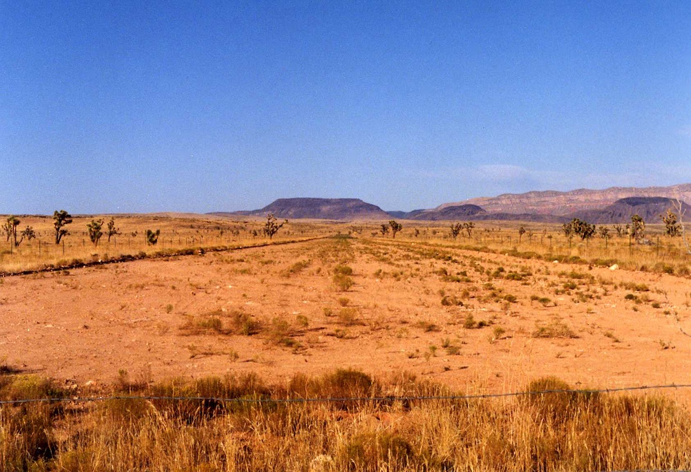
Our
first night's camp site was next to a remote BLM landing strip
complete with a barbed wire fence to prevent the cattle and
burros from being on the strip when a landing is attempted.
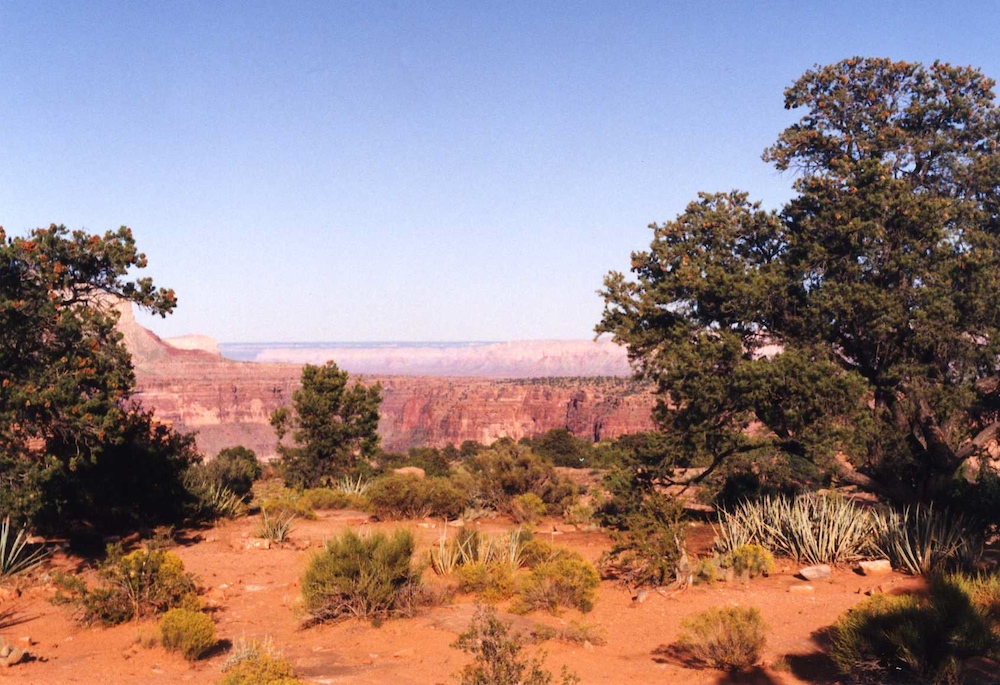
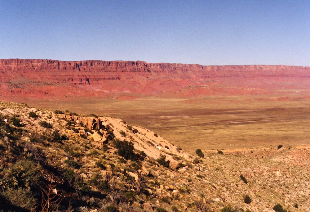
From our
camp, we had a great view of the cliffs in the distance.
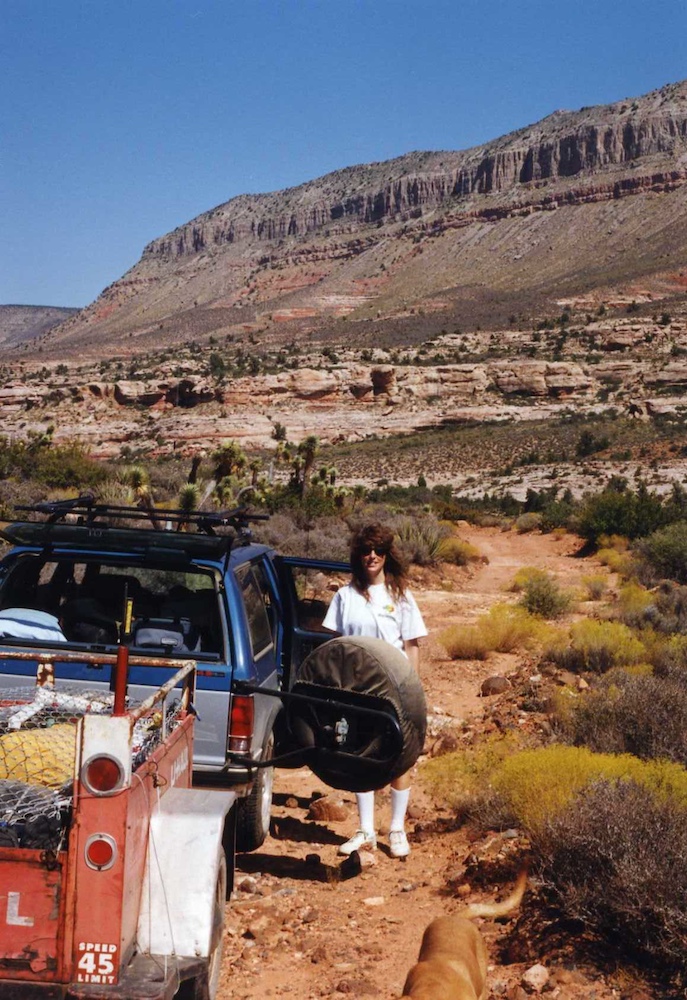
To
provide sufficient room for Bogart (the dog) and our stuff, we
rented a U-Haul trailer (without a spare) and got some chain
link fence to serve as the security guard. We did however
bring a High Lift jack that I bought Kathleen as a Christmas
present. A real girly gift.
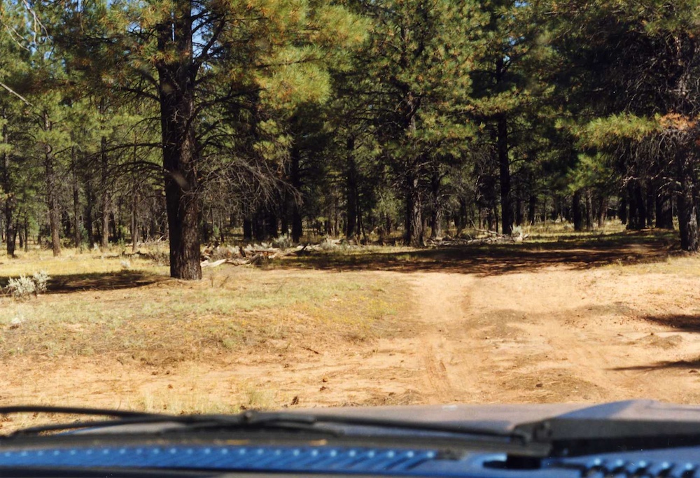
As the
elevation increased we passed through a region of pine
trees. In the shadows we spotted a flock of wild turkeys.
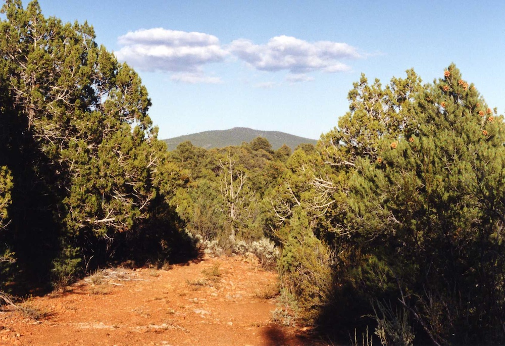
We
descended the other side of the ridge into the Pinyon and
Juniper trees.
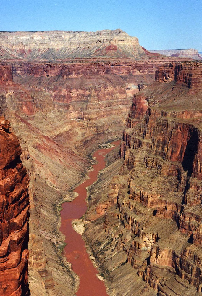
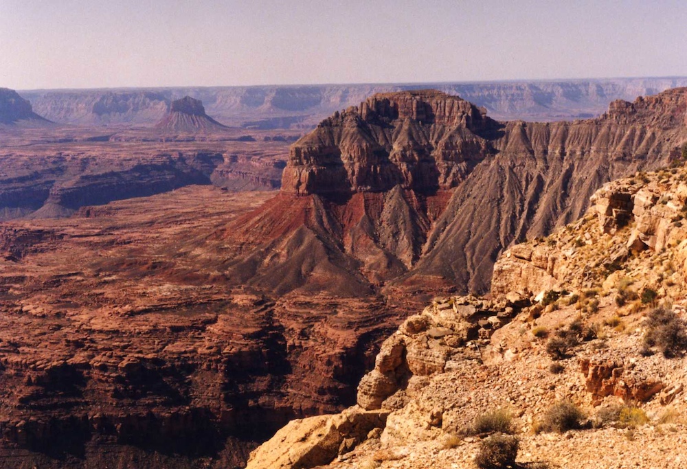
Our
objective was Toroweap Point on the north rim of the Grand
Canyon. We camped next to the edge and then got out to see
the view.
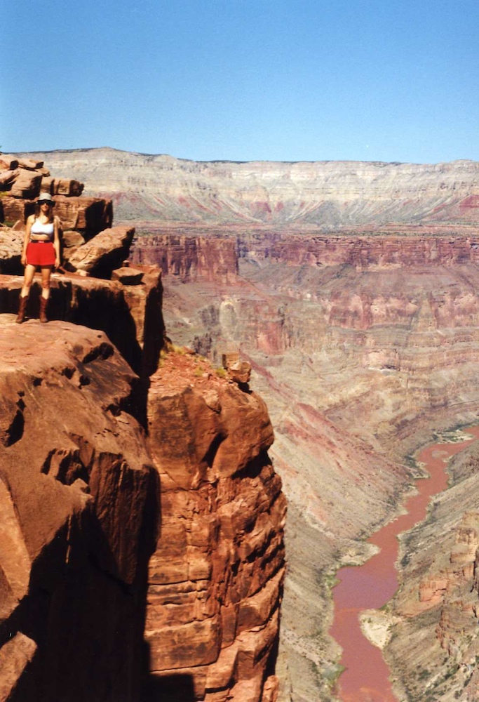
Kathleen
stands at the lip of the cliff at Toroweap Point.
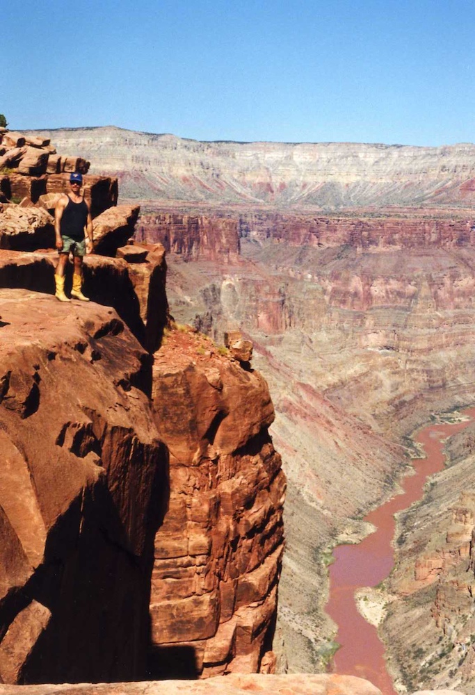
It is a
really long way to the bottom, perhaps 2,000 feet.
The view
out the rear of our camp site was good. Outstanding in
fact.
The
cliff at Toroweap is profound and it is a long way to the river
below.
The
river cut through a combination of volcanic and sandstone
structures.
This was
the first time either of us had been to Toroweap. The view
was stunning.
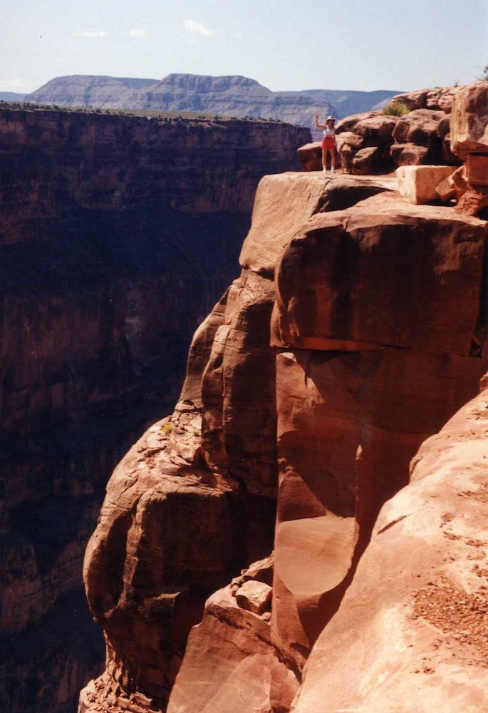
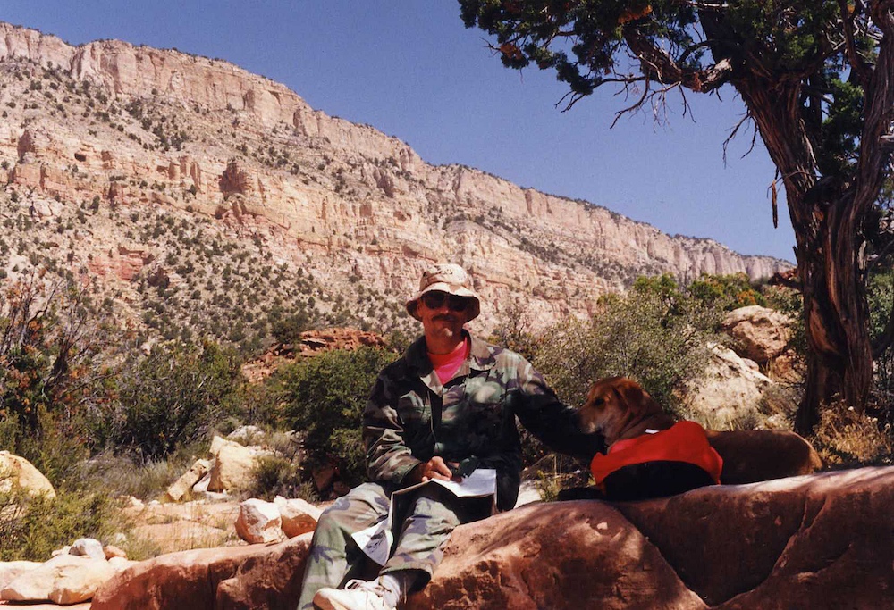
The dog
would go nowhere near the cliff so I had to take a photo of
Kathleen by herself.
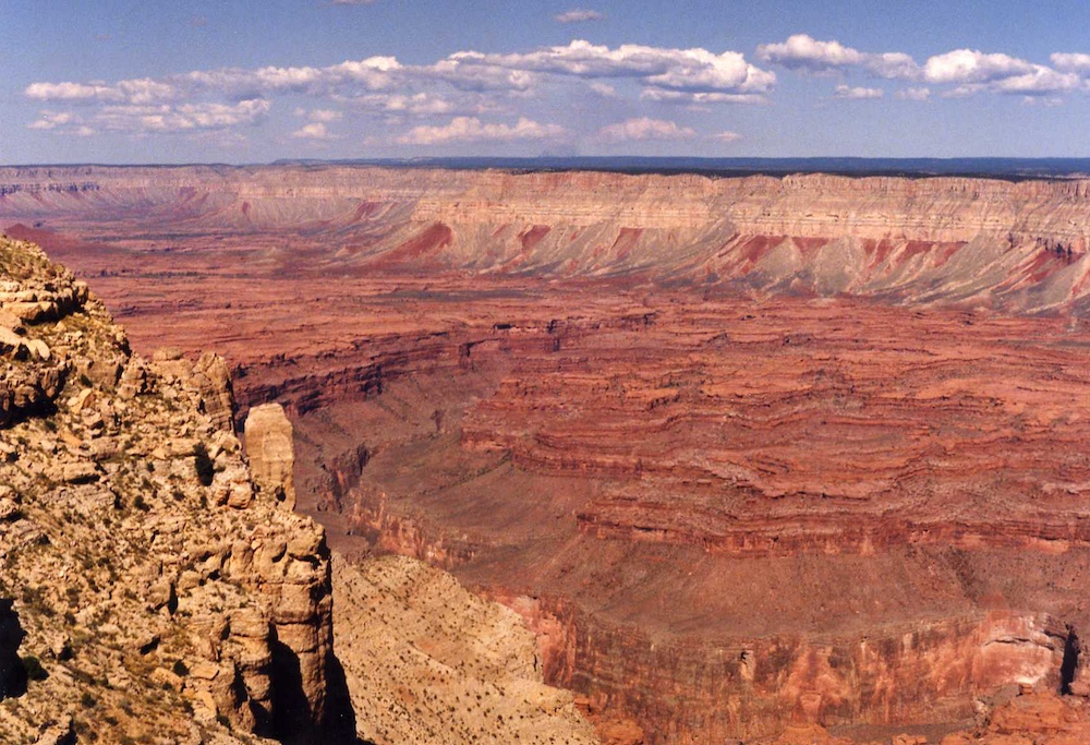
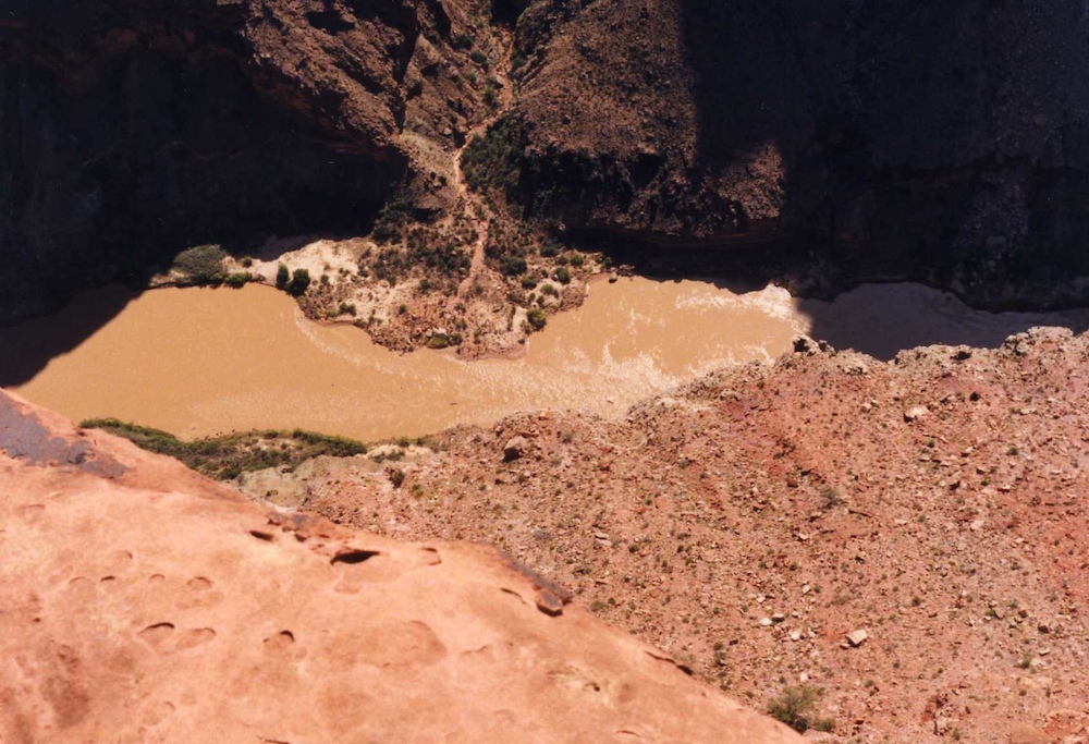
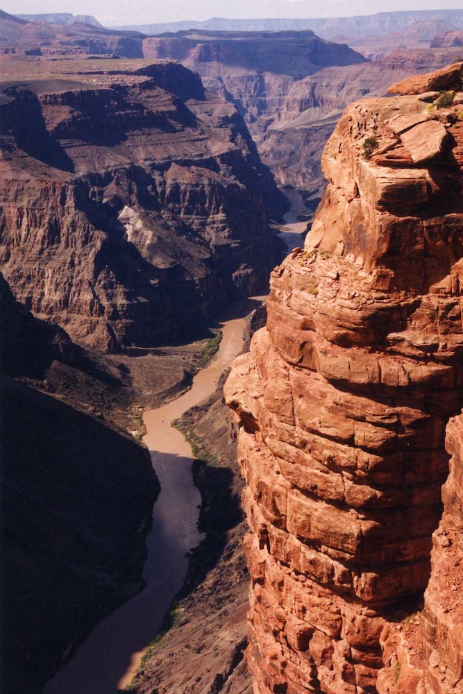
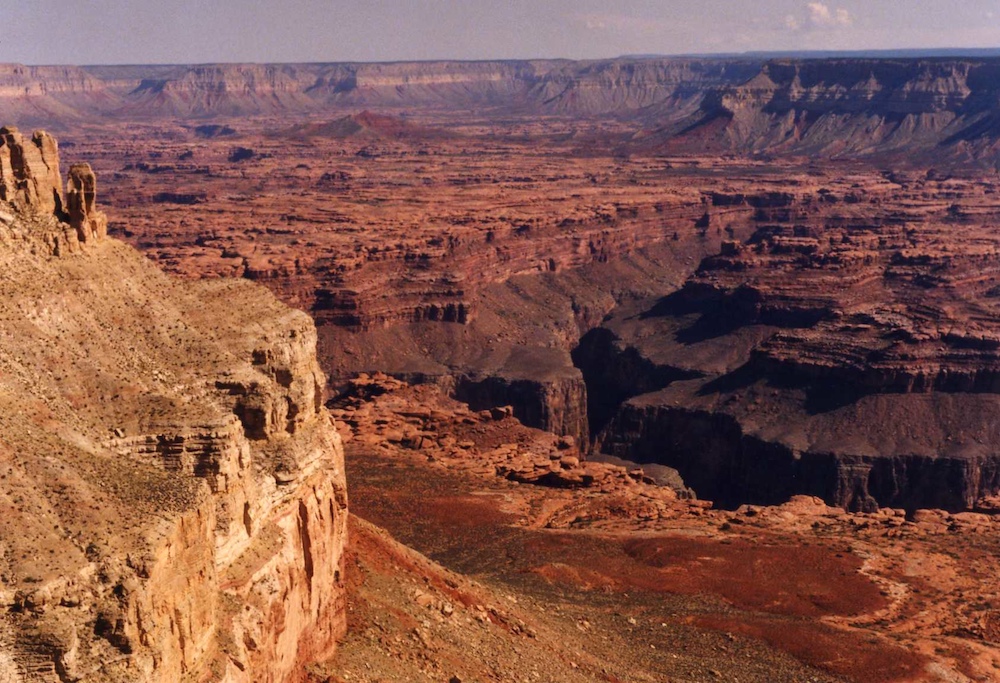
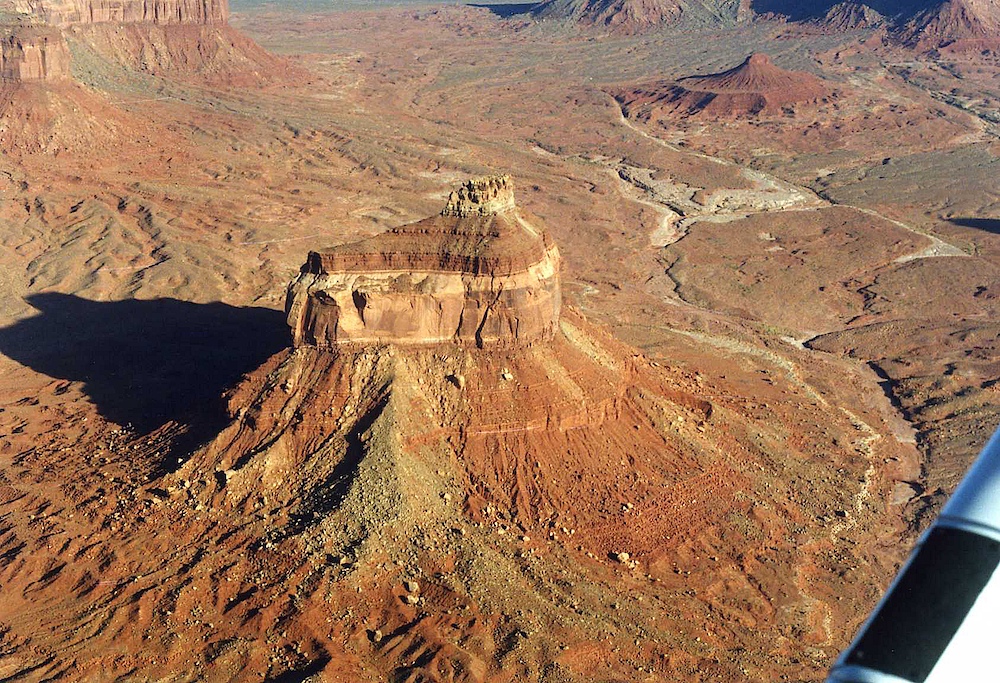
From Toroweap, we traveled via the dirt road network to Kanab Point overlooking the confluence of Kanab Creek with the main Colorado River. Look closely on the horizon and you can see the smoke from a forest fire that was burning in the Kaibab region. The valley in the photo above is the Kanab Creek Canyon. The dark red colors on the opposite cliff are uranium rich areas. Indeed there were a number of mines in the area.
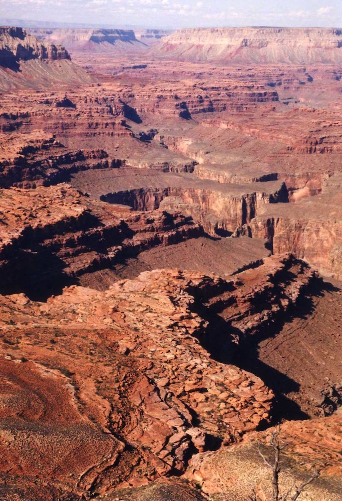
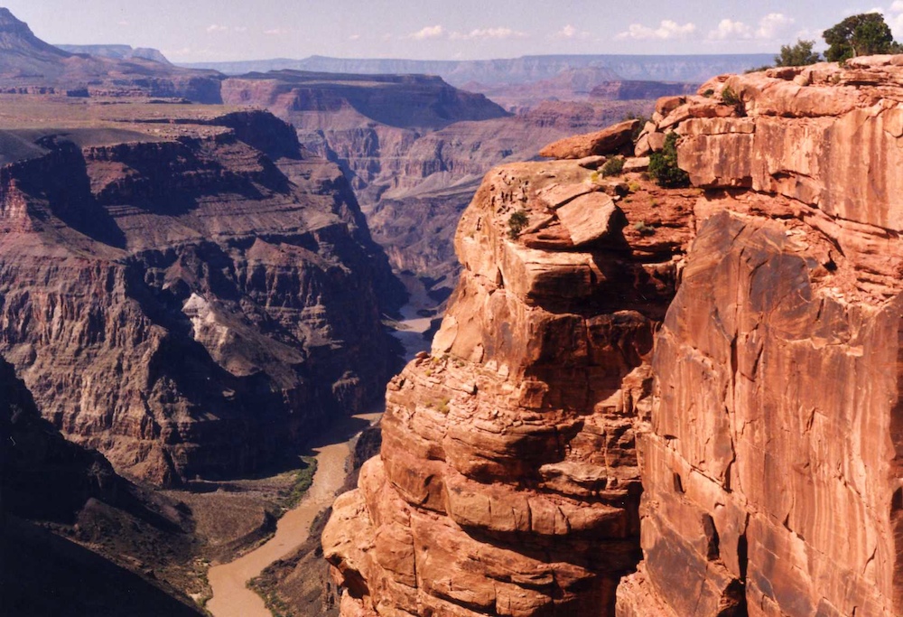
Looking
generally to the south toward the Colorado.
I sat on
the cliff edge with my feet hanging over and there were small
birds that buzzed me. As they swooped by, I could hear the
wooshing of their wings through the air. The main canyon
of Kanab Creek is visible in the photo above.
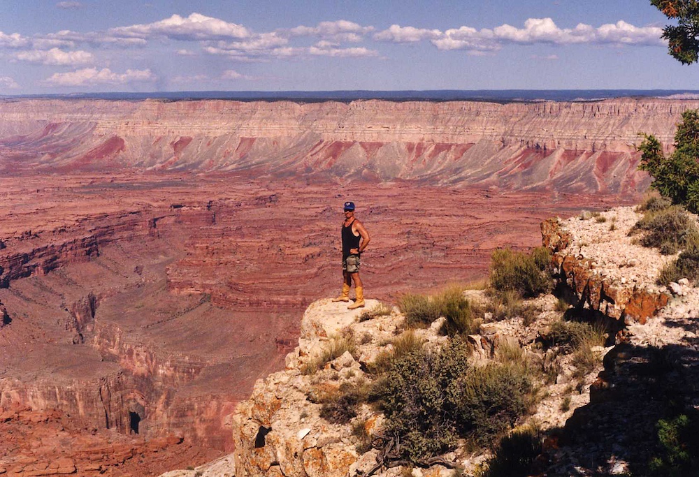
Kanab
Point is a cool place, but close to nothing. It is a long
trip to get there.
The
sweeping views were impressive.
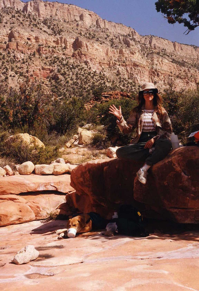
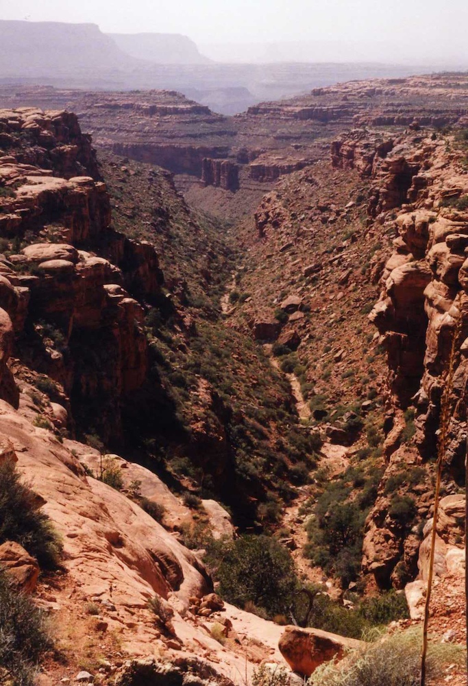
From
Kanab Point we went to Indian Camp on the north rim. Our
plan was to hike into the canyon about half way to the
river. The planned descent was about 3,000 vertical feet
and we were taking the dog. It was hot, but we brought
plenty of water for the three of us. Note he is drinking
from the cup laying down. We decided to turn around at
Deer Creek and our decision was based on the amount of time it
took us to get there. I assumed that going out would be
twice as slow as the descent. This seemed like a sound
assumption, but the reality was the trail was so steep that we
just crept down the grade as we slipped step after step.
Our time to get back to the rim was less than 1/2 my estimate,
which was better than the other alternative.
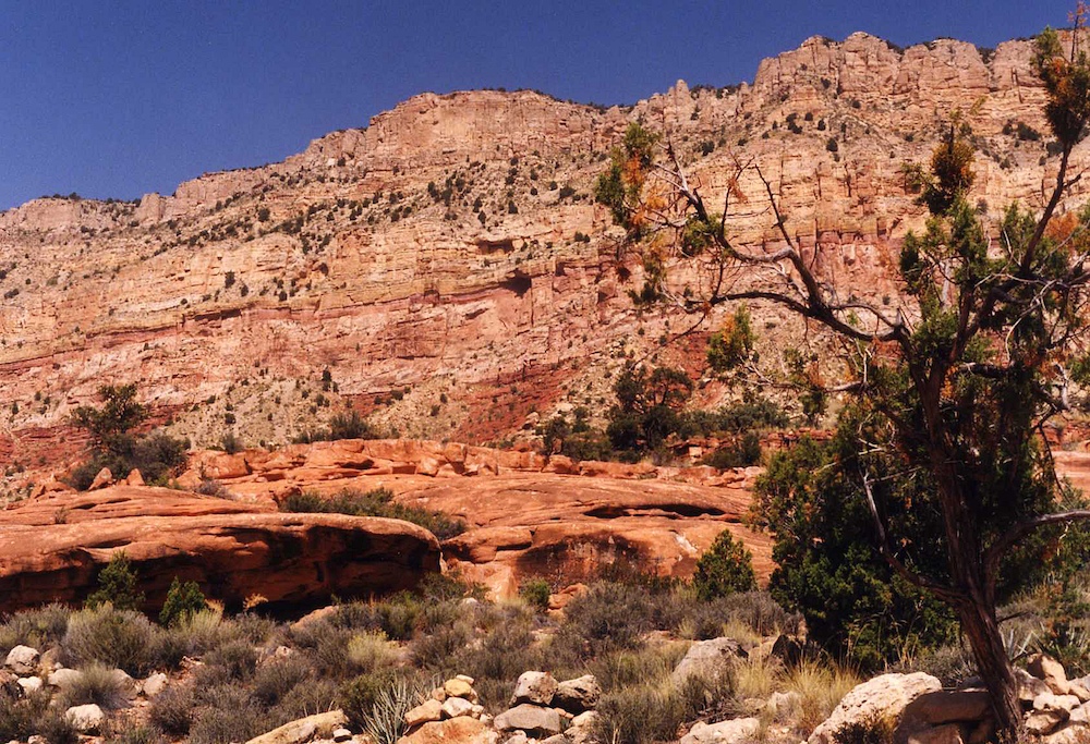
The view
of the north canyon face from Deer Creek was most impressive.
We did
not have a GPS for this trip, so we determined our location the
old fashioned way: with a lensatic compass, multiple bearings
and a map.
The view
into Deer Creek was impressive too; we still had a substantial
vertical distance to get to the river. The walls of Deer
Creek canyon are very steep.
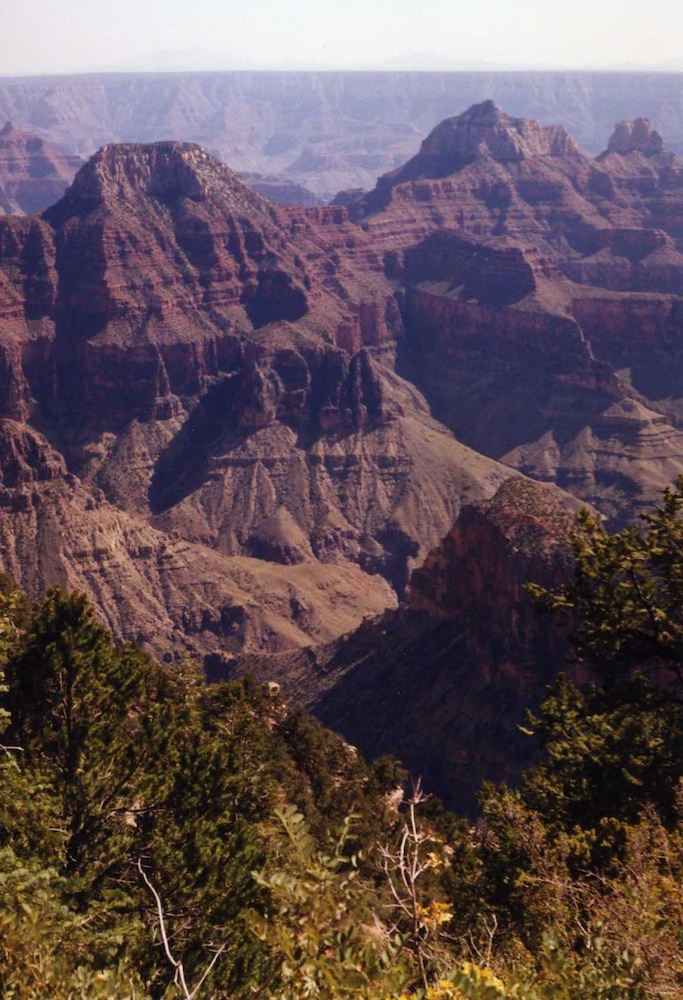
We
turned around at Deer Creek and headed back the way we came up
the very steep, loose trail.
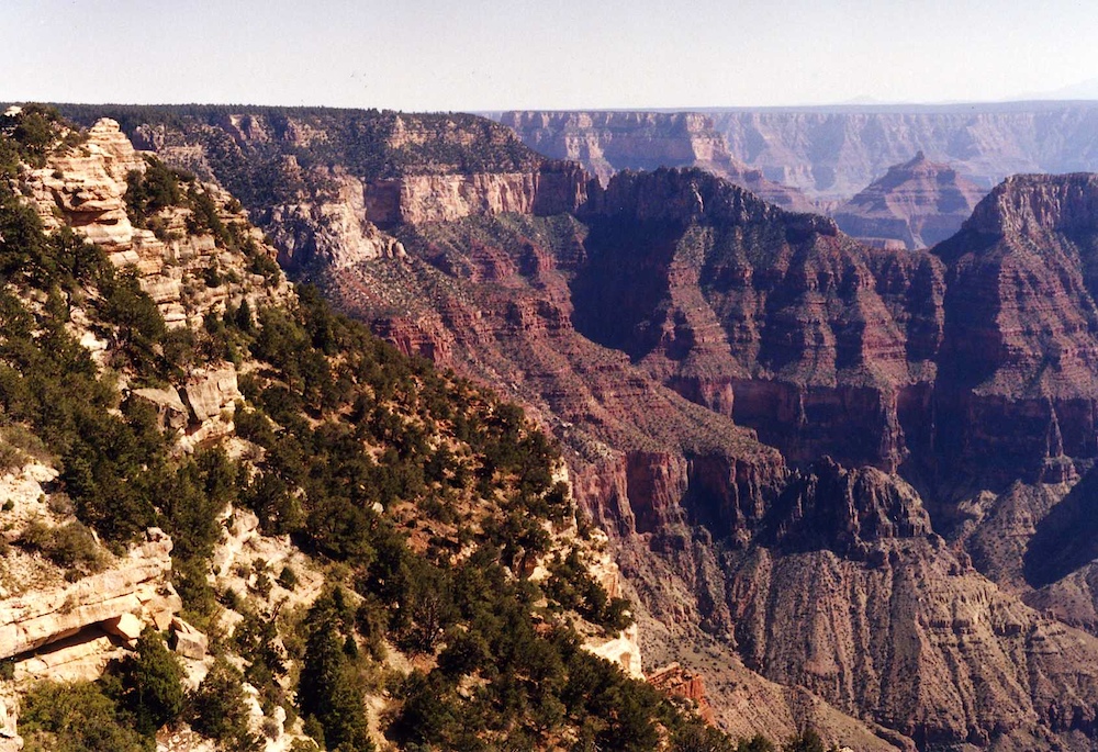
I got
this shot of the canyon wall near the top of the trail. We
took electrolyte pills on the trail and although we were tired,
we were not shot. The dog drank more water than we did and
he WAS shot. He went right into the tent and crashed.
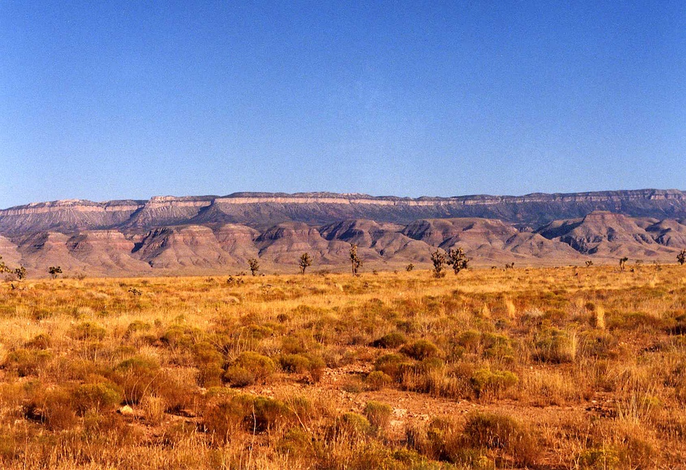
Next
morning we broke camp and headed along US 89 toward Page,
AZ. Above are the Vermillion Cliffs that are visible
before the road descends off the Kaibab Monocline.
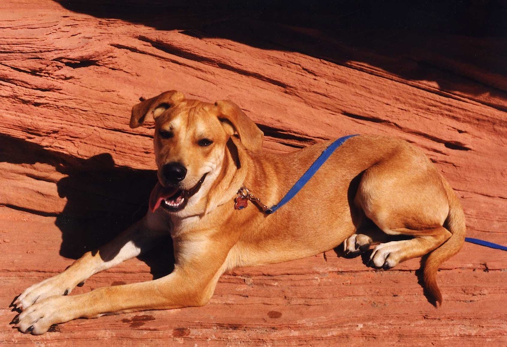
Near
Page, I got this shot of Bogart. He was a great companion,
but you could not leave him alone as he would tear things
up. He did our kitchen several times. Not cool and
that behavior ultimately resulted in his demise. After we
bought our house, he started working on the plumbing of our spa
when I was at work, and that was unacceptable. After 18
months with he was delivered back to the pound. That, of
course, would do nothing to improve his separation anxiety, but
both Kathleen and I had jobs so there was no choice. Our
neighbors were complaining about the whining he was doing during
our absences. Sad outcome.
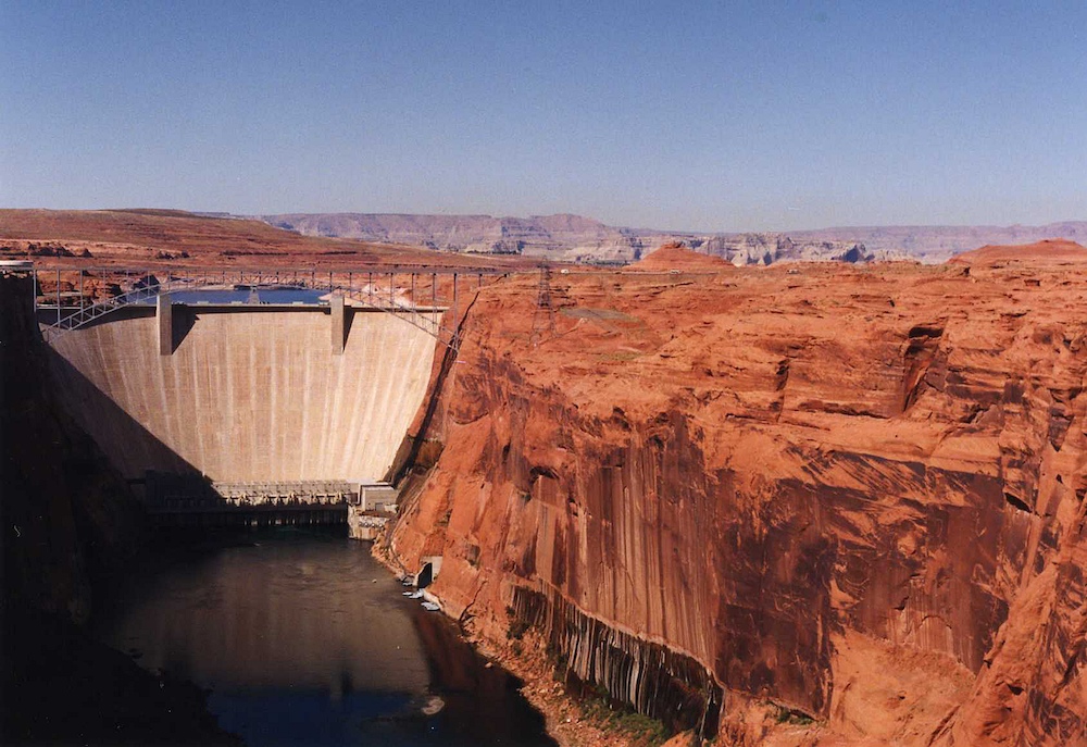
Glen
Canyon dam at Page, AZ.
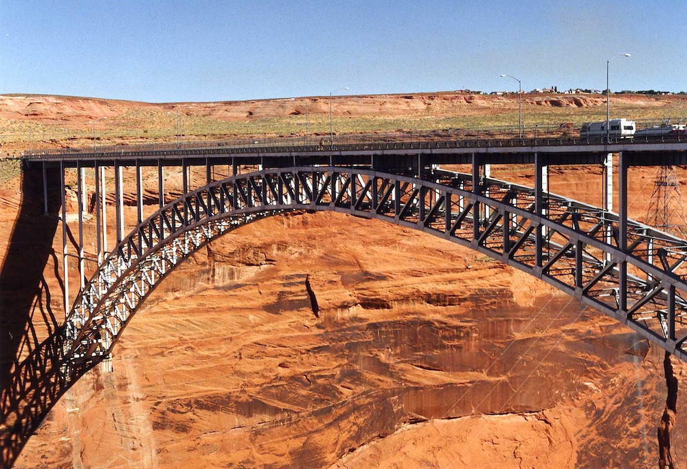
The
bridge over the Colorado River on US 89.
In Page
we rented a small plane to give us an airborne tour of the
area. We were running short on time and had to return to
San Diego, so a 2 hour plane flight could cover several day's
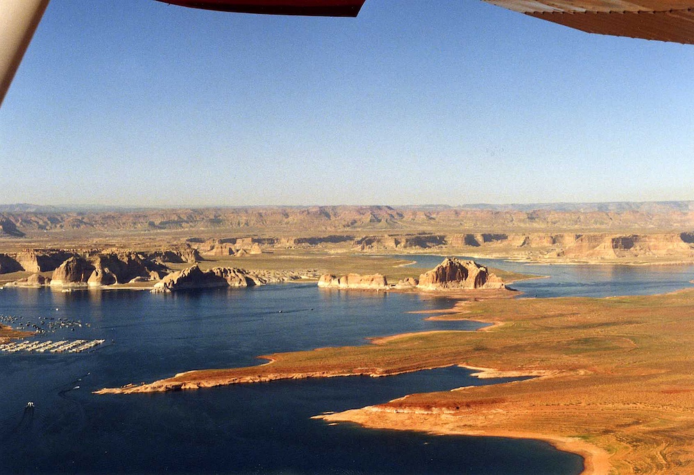
worth of driving in terms of sight seeing. Above is
Wahweap Bay on Lake Powell.
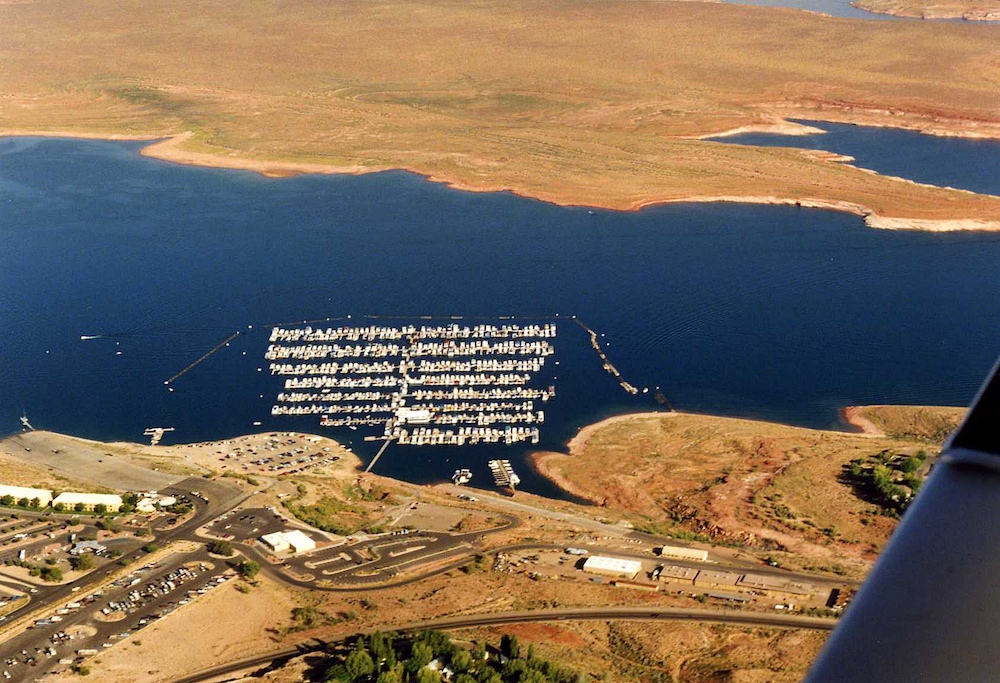
Wahweap
has a big marina for house boats and pleasure craft.
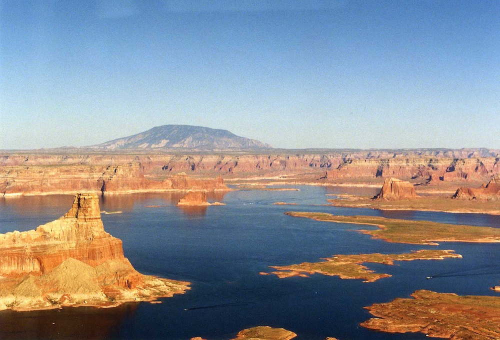
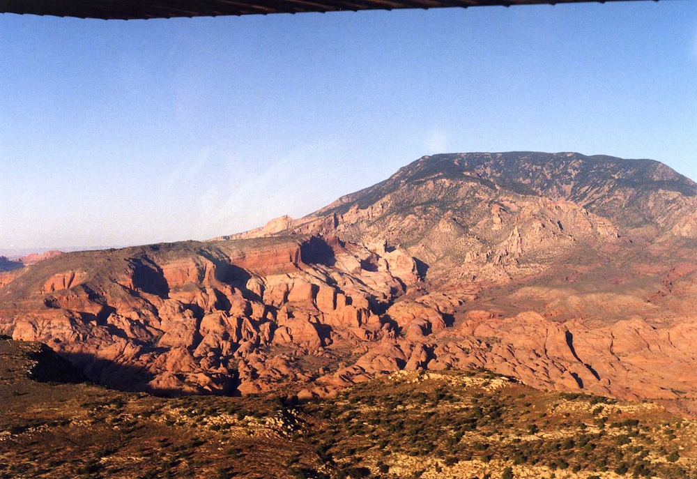
Gunsight
Butte (left) and Navajo Mountain on the horizon. Navajo
Mountain is over 10,000 feet.
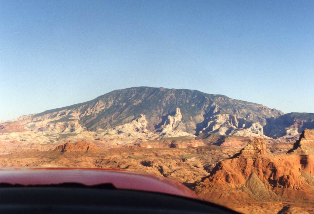
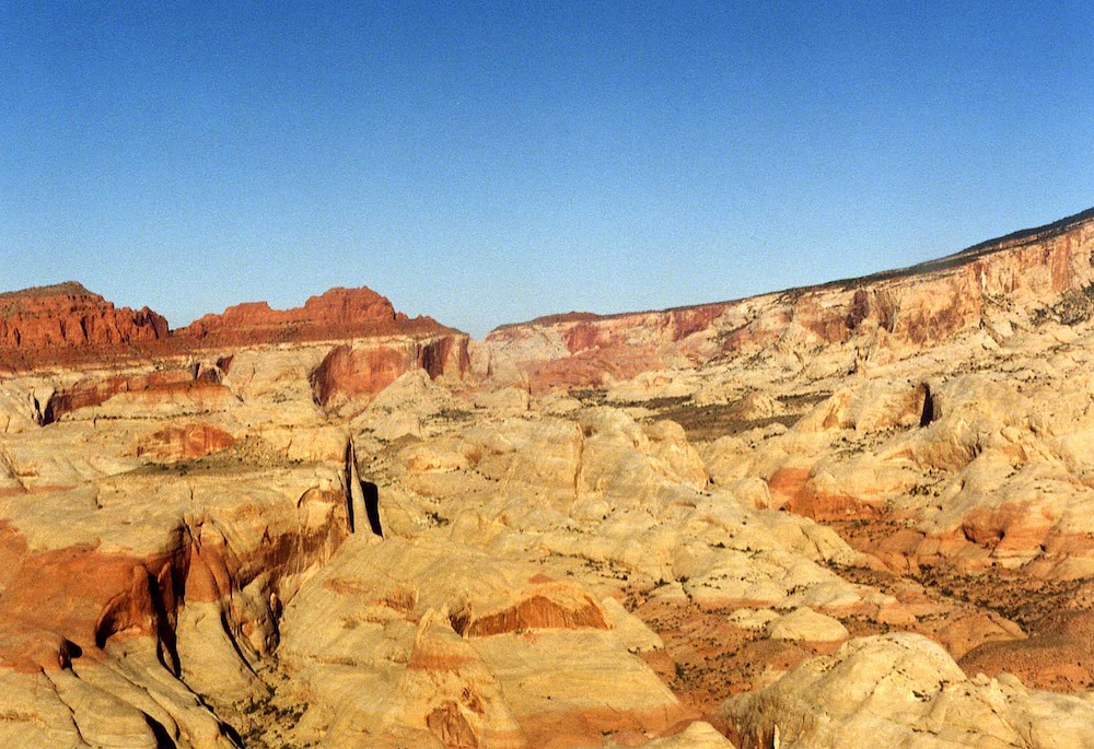
The
flanks of Navajo Mountain had huge outcroppings of sandstone
that were exposed by the volcanic uplift.
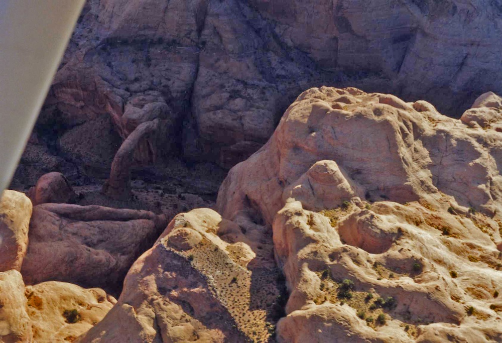
We flew
over Rainbow Bridge, which is visible next to the trailing edge
of the wing.
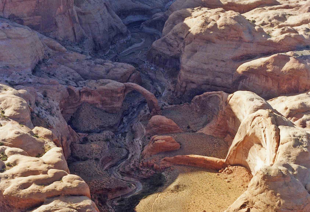
Another
view of Rainbow Bridge.
The
canyon system that hosts Rainbow Bridge has plenty of incredible
structures. The increased slope of the land due to the
Navajo mountain uplift caused the rain to carve narrow, steep
canyons through the sandstone.
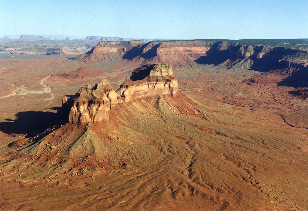
We flew
on to Monument Valley.
A number of the
structures in Monument Valley were massive.
Another
view of the flank of Navajo Mountain.
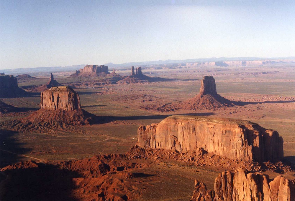
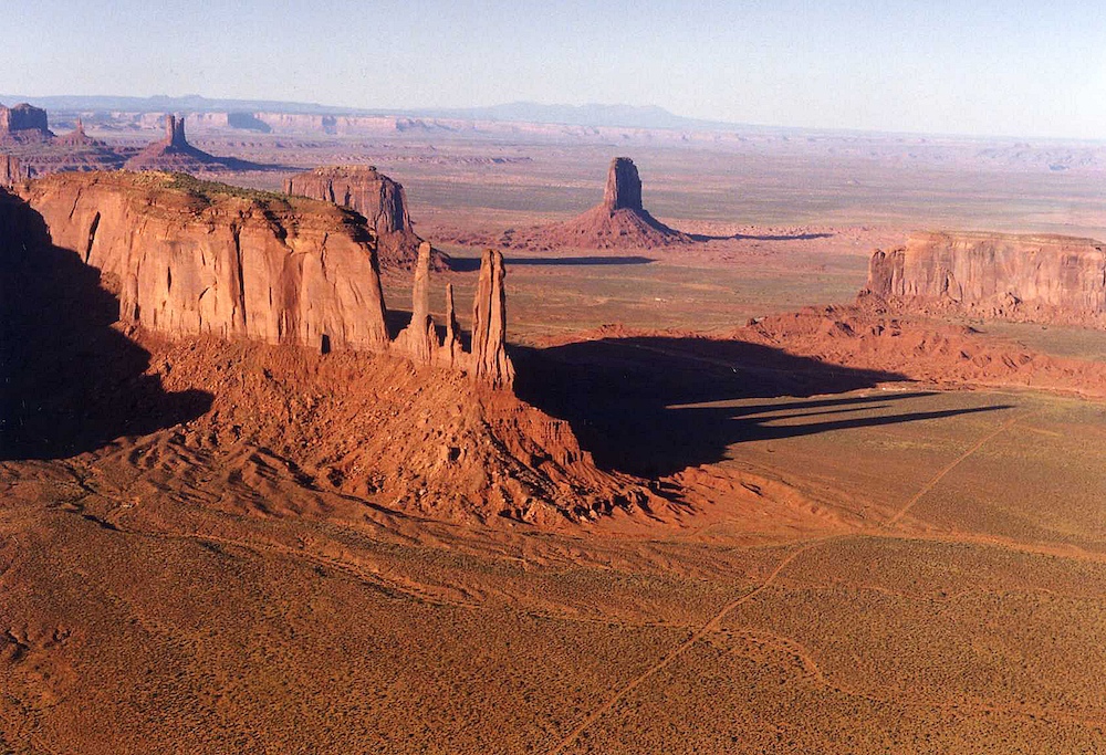
Monument
Valley.
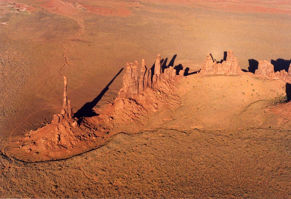
The
Totem Pole and Yeh Bichii Rocks in Monument Valley.
A
parting shot of Monument Valley with Navajo Mountain in the
background.
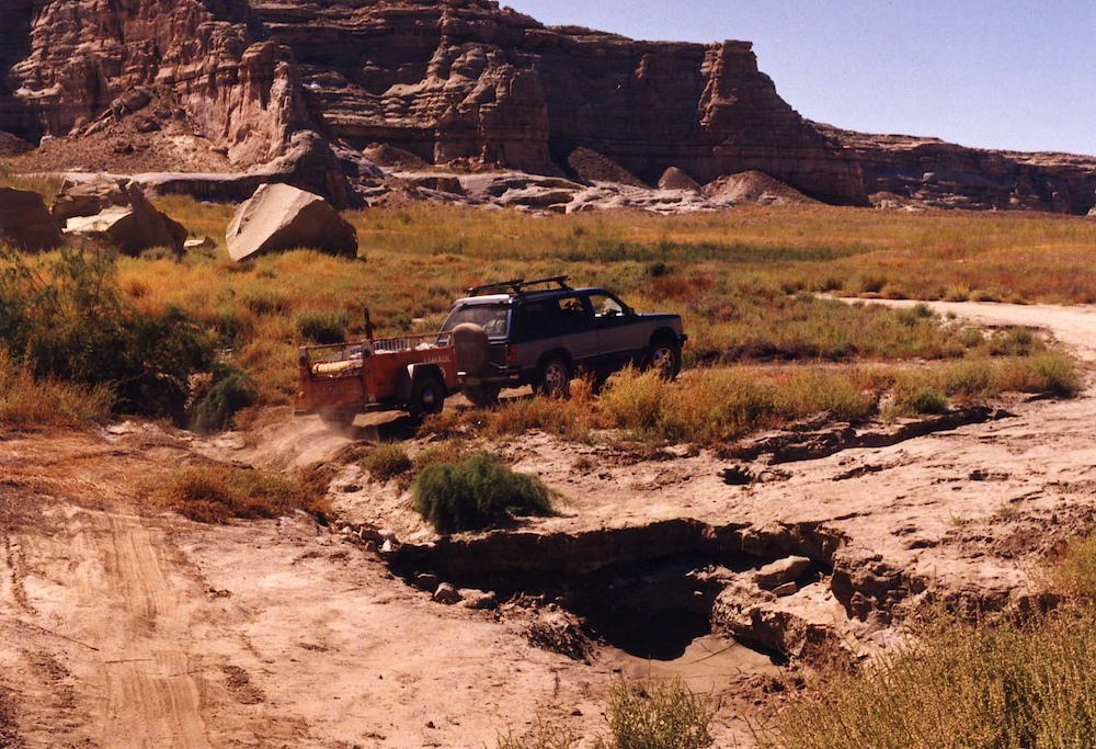
We left
Page and headed out to camp along the banks of Warm Creek on the
north side of Lake Powell. Recent rains had hosed the road
forcing us to use the four wheel drive capability in crossing
this ditch.
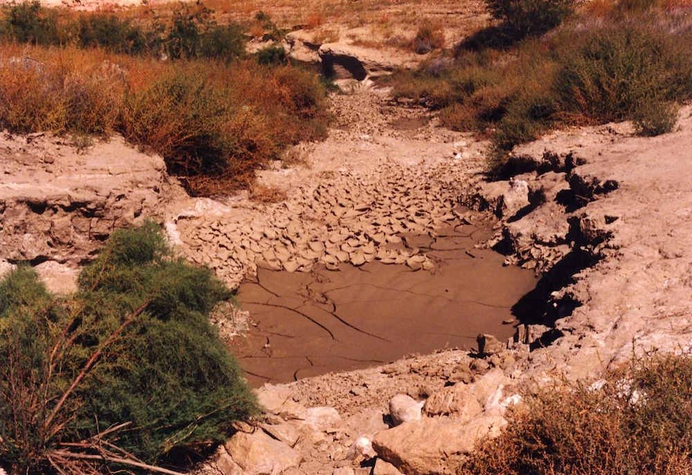
The road
was eaten by the water leaving a steep arroyo in its
place. That is nasty clay mud there and we would have been
stuck for sure.
This
was a great trip. Kathleen had fun, the dog had fun and
nobody got hurt.
Copyright Bill Caid, 2013