199709
During the period around Labor Day in 1997, Kathleen and I decided to do a set of trips in the Four Corners area of the southwest. The plan was to take the Unimog and the jet ski and head to the Grand Canyon and Lake Powell. Then, since we were in "the area", we also went to Moab, UT to see what was there. First, we would do an organized white water raft trip down the main Colorado river through the Grand Canyon and then on the way out, we we would put the ski in Lake Powell and cruise around a bit. From there, we would head to Moab. It seemed like a solid plan and for the most part things went well. But, despite my many trips to the area over the years, I still misestimated time and distance. Or perhaps it was distance and time, but the essence is that things always take longer than you think. And map distances are not the same as travel distances. We did hit most of the objectives that we planed, but in general, we did not get to do them for the duration that we wanted. Such are vacations, I think.
When we finished with the white water raft trip, we took the mog and the jet ski and headed to Bullfrog marina on Lake Powell. Along the way, we passed Natural Bridges National Monument. This area, administerd by the National Park Service, has some great natural bridges. See this link to the NPS pages on the area. To complete the experience, we would also go to Rainbow Bridge on Lake Powell. Rainbow is only accessable via water. Most folks come on the tour boat from Page, AZ. We decided to travel on the jet ski from Bullfrog. This was an interesting plan, but the trip proved much more arduous than we had anticipated.
The photos below are scans of chemical photos of what we saw. These were taken with a Nikon N90 camera using generic Kodak print film. Enjoy.
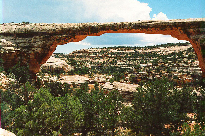
This is the biggest bridge in Natural Bridges Park -- Owachomo Bridge. This beast is big. So big that there are photos of old timers on the top of the bridge with a two horse wagon. The bridge was discovered by a gold prospector Cass Hite in 1893, but the local indians had known of these bridges for thousands of years. For whatever reason, most likely time, I only took photos of Owachomo Bridge, which is the largest of the many bridges in the park.
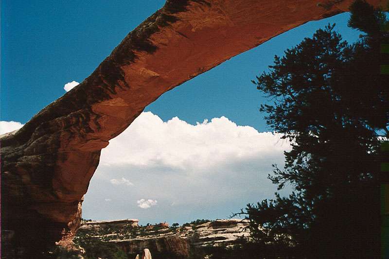
Another view of the bridge. This fellow is many hundreds of feet long. Note the storm clouds brewing in the distance. These would come into play later in the trip.
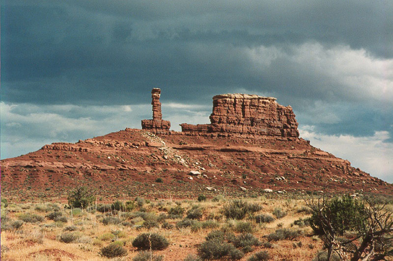
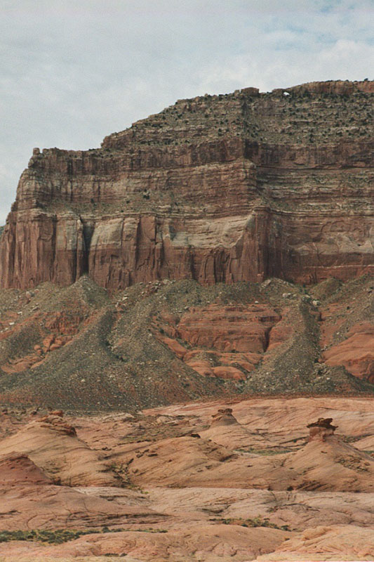
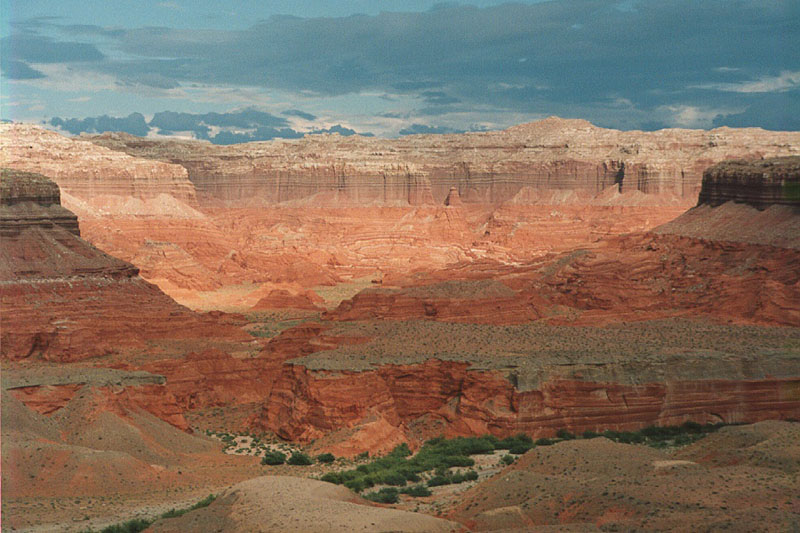
We went to the Hite Marina area at Lake Powell and decided to stash the ski and do some camping. The plan was to head into the southern area of Canyonlands Park and camp there for a few days. But, the road conditions and the travel speeds that it allowed cut the trip short. We were willing and had sufficient supplies of diesel, food and beer, but in the end the clock ruled the trip and we were forced to miss some of our objectives. On the way into the back country from Hite, we passed this rock formation. The locals call this "Sewing Machine Rock" because of the needle looking formation on the left. Note the storm clouds on the horizon.
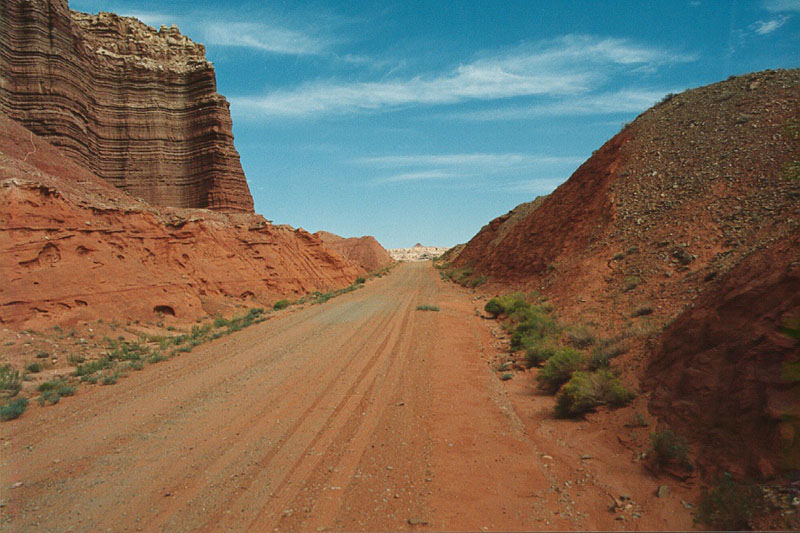
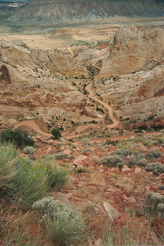
This photo more clearly shows the geography of the area. The trail is on the "low" mesa with high mesa structures punctuating the landscape. As we got further into the boondocks the weather got worse. I became fearful of a lightning strike on the truck. The mog has several radios and a tall antennas on the roof. Stated differently, we were the highest thing around and we were metal. While we probably would have survived the strike if we were in the truck, I was convinced that the electronics in the truck, including the starter and the battery, would have been fried. The consequence, of course, was that we would be stranded and have to walk out. That plan was flawed -- the distances were too great and you could not carry sufficient water to achieve the mission. We had traveled for many hours on the trail and had not passed another vehicle. Nor were there fresh vehicle tracks visible on the trail. In the end, caution prevailed and we found a sheltered camp in an alcove of one of the mesas where we would be protected from both lightning and a possible flash flood.
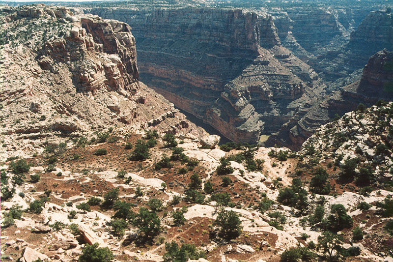
Our camp was close to the rim of the main canyon. Note the foot path below. And, if you look carefully, you can actually see the Colorado River itself.
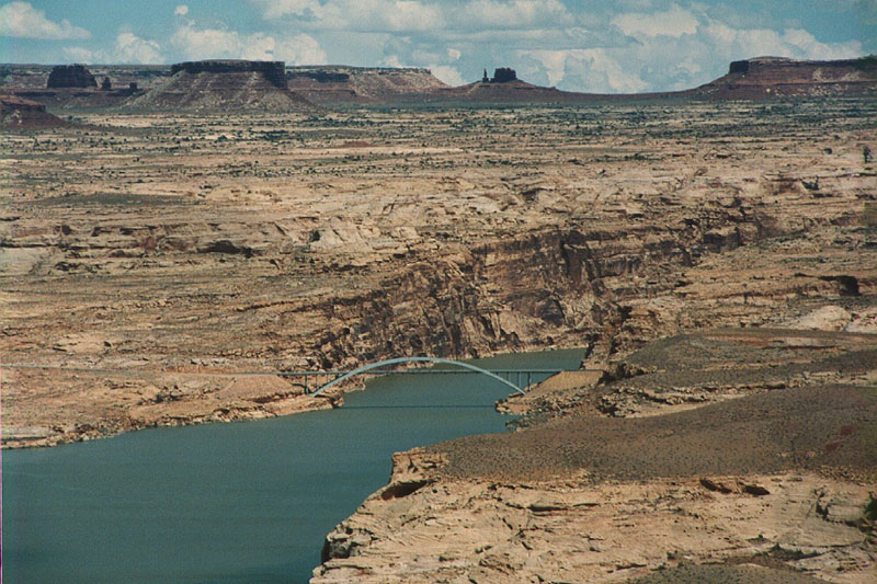
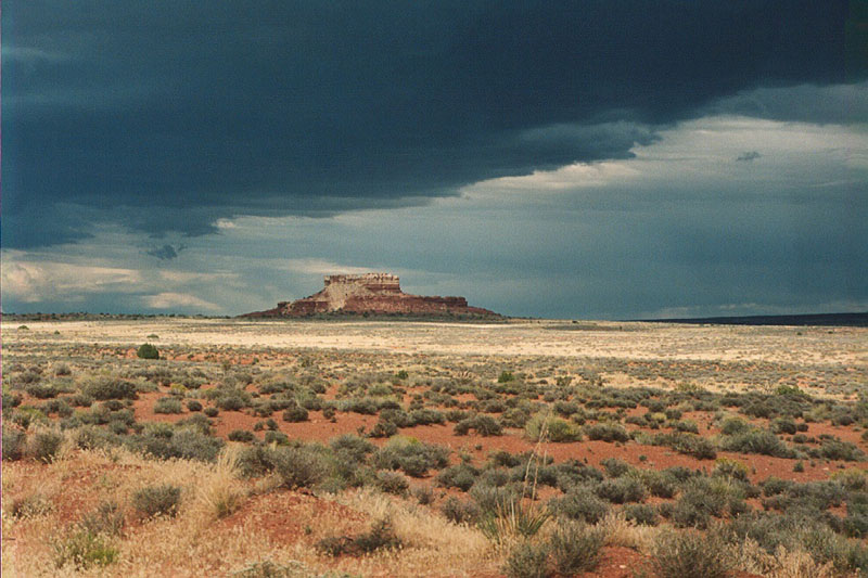
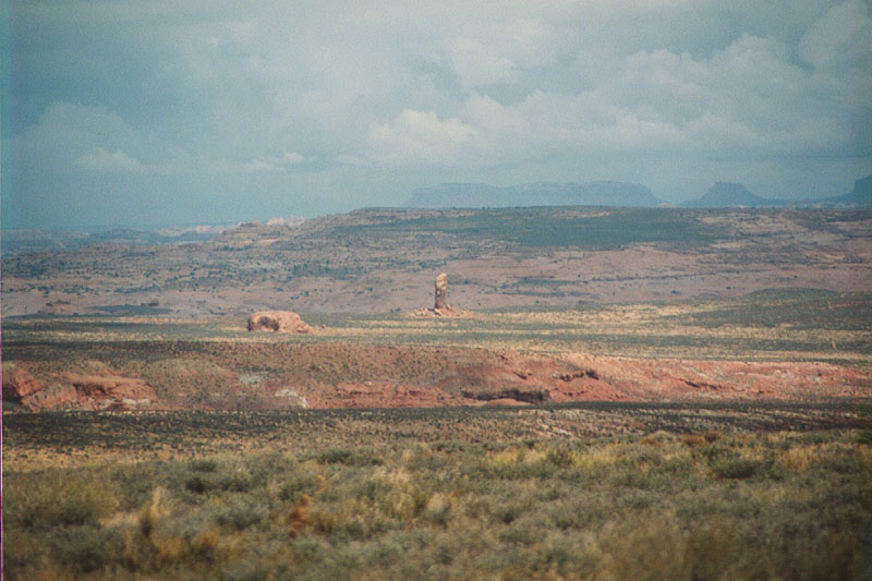
After spending the night camping we retuned to the Hite area to get the ski and then head over to Bullfrog Marina. This view shows the bridge over Glen Canyon near Hite Marina. In the distance, you can see the Sewing Machine.
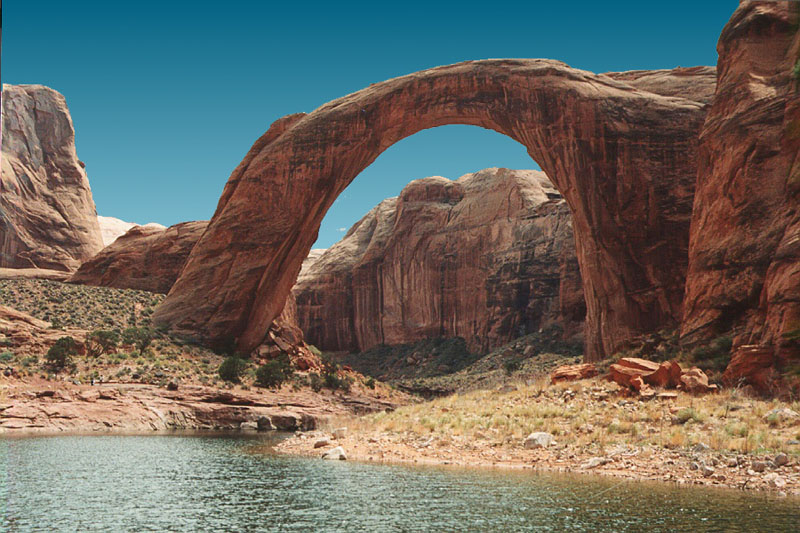
A good view of Rainbow Bridge. We took our jet ski with a hydro-trailer from Bullfrog to Rainbow Bridge. This was a very long trip; longer that we wanted as we were on the water for about 6 hours. The water was rough and it was slow going, not the fast, fun trip that we had expected. One aspect of Lake Powell is that when wakes are generated, they reflect off the rock walls and generate significant chop. These waves made the trip slow and rough requiring us to stand "in the saddle" nearly the entire way. Because of the extended distance, we were in danger of not having sufficient fuel. We used the hydro-trailer to haul the extra gas, chairs, beer cooler (which was not used due to the cold and overcast). We brought chairs, but there was no horizontal area to sit. Nearly the entire distance from Bullfrog to Rainbow Bridge is cliffs. When Glen Canyon Dam was brought on line, the initial "full" level of the lake was higher than the base of Rainbow Bridge, potentiall endangering the structural integrity of the bridge. So, despite the need for the water and power that comes with water, cooler heads prevailed and the full-level was lowered to protect this most unique (and sacred) landmark.
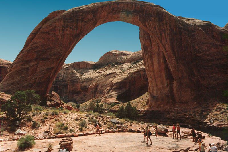
This view shows the massive size of Rainbow Bridge. The person in the center is me and I am standing quite a ways back from the bridge itself. The bridge is sacred to both the Hopis and Navajos, so the path under the bridge is restricted and folks are told to stay in the viewing area.
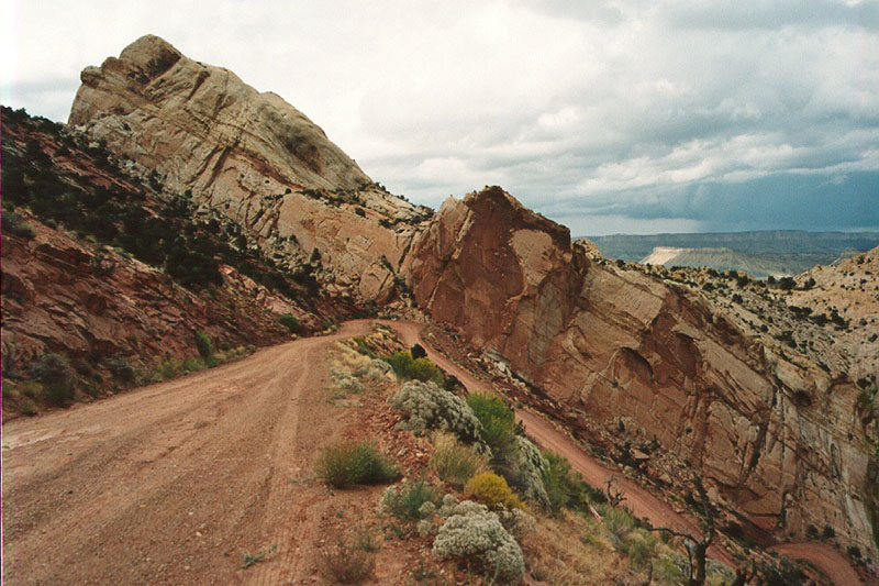
The dirt road north out of Bullfrog. We were on our way to camp one night at Hole in the Rock and the only way to get there from Bullfrog is to cross Bullfrog Creek (just a trickle when we crossed), then go north up Waterpocket Fold to the Muley Twist Trail. Then ascend the face of the Fold and then come south again to Hole in the Rock. The story of Hole in the Rock is very interesting. See this NPS link on the site. Any Google search will bring up information on the Mormon's epic adventure to descend the cliffs on the north side of the Colorado River with their wagons and cattle. Quite a story.
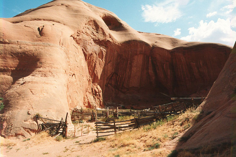
We stumbled upon this set of corrals near the road to Hole in the Rock. They were built into an alcove in the sandstone cliffs. A true relic of the old west. No telling how long this area has been used as a corral, but the steel gate suggests that at least that part was upgraded recently.
The camper is used by the cowboys that ride on this range. Imagine waking up and having that cliff as your view as the sun comes over the eastern horizon. The corral in the previous shot is just past the far right of this photo.
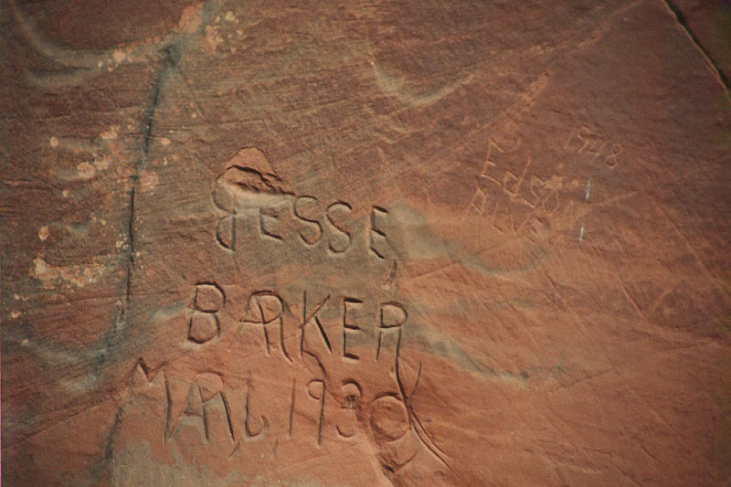
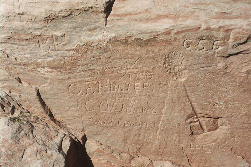
Literacy was not a strong point back in 1930. Today, we would refer to these scratchings as graffiti. 100 years from now, graffiti would be transformed to "of historic significance".
 .
.
Today, we have taggers. Back then, I am not sure what it would have been called. But, note the date of 1896 in the rock. Also note the path of the drill steel and the point of explosion of their blasting charge. I am guessing that in the Mormon records somewhere are the names of each individual that was on the Hole in the Rock expedition, including C.O. Quigley and O. E. Hunter.
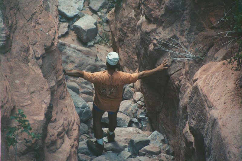
The canyon is narrow. My outstretched arms are touching both sides of the slot. The debris on the bottom was the result of the party's blasting efforts.
The canyon is narrow, steep and nasty. Remember, the Mormons took covered wagons and cattle down this canyon. You can see the rim rock country on the south side of the river in the distance.
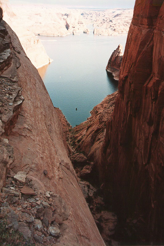
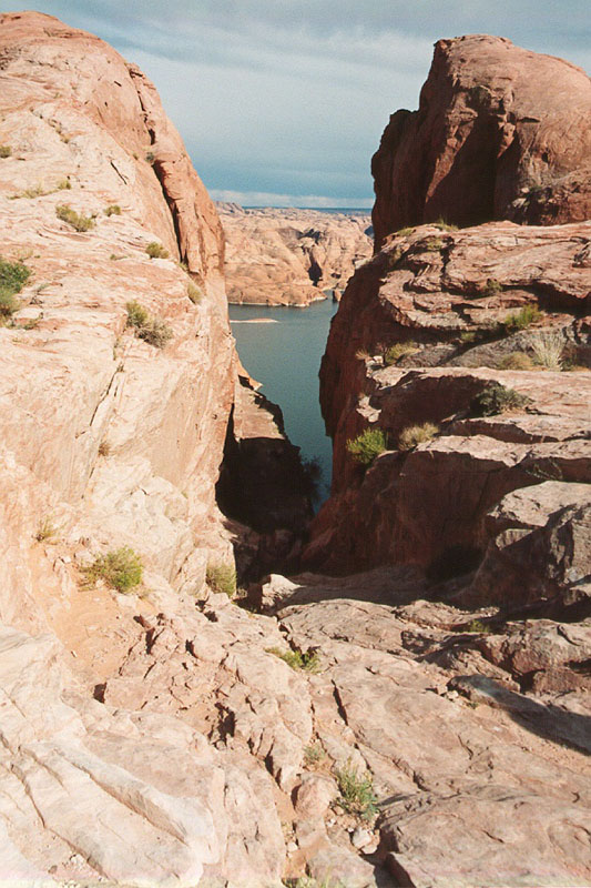
A view down Hole in the Rock Canyon to Lake Powell. Note the bouy in the lake.
Note the window in the rock on the ridge line. This is visible from near Hole in the Rock.
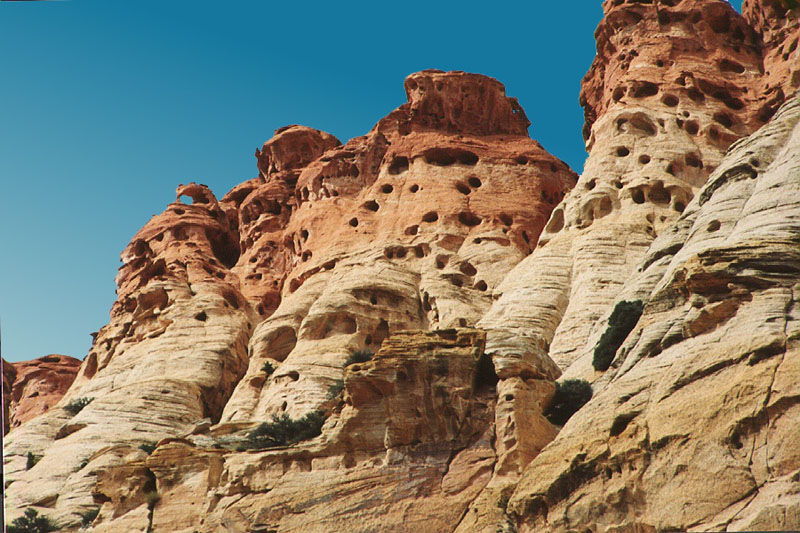
Chimney Rock as seen from the Hole in the Rock trail.
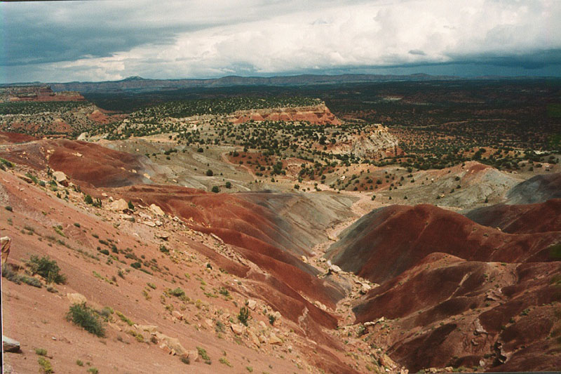
Awesome colors in the landscape. The photo does not do it justice. This is called, appropriately enough, Kodachrome Overlook.
Wind and rain have carved these mini-caverns in the cliff walls visible from the Muley Twist Trail.
The top of the Muley Twist Trail in Waterpocket Fold.
Look steep? It is just as steep as it seems and with clay on the roadbed, a bitch to ascend when wet. Note the angle of the rock bedding.
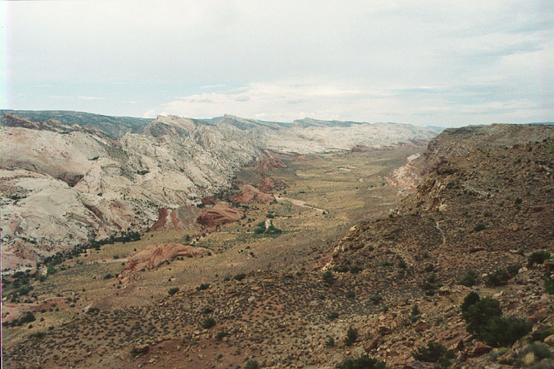
A view down Waterpocket Fold looking north.
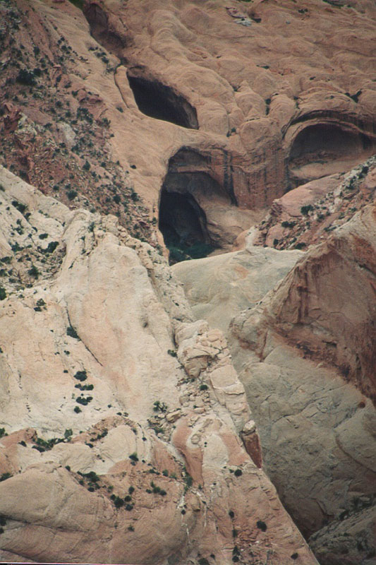
A view of some of the natural catchments from a viewpoint on the Muley Twist Trail. Note the arches and alcoves.
This was a particularly nice view. But, notice the clouds on the eastern horizon. These clouds produced rain and a flash flood in that canyon (Bullfrog Creek). Turns out we had to cross that very canyon to get back to Bullfrog Marina where we left our jet ski (and where our hotel was for the night was). More below.
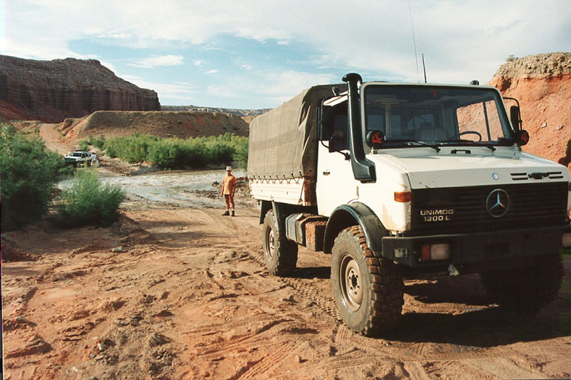
While I am always wary of rain in the desert, this was totally unexpected. We got to the crossing and the fellows on the other side of the creek were wading in fast water up to their knees. They claimed that they did not know how deep the center of the stream was, but it was at least knee-deep. But, they did state that it was rising. So, armed with that fact and not wanting to spend the night, we put the mog into low gear and headed across the water. Turns out that the water was a "bit" deeper. Note the limit of the bow wave on the fender of the mog. I guessed the water at about a meter depth, possibly a bit more. Glad we had the mog. I asked the others if they wanted me to tow them across, but they declined. That was a good decision on their part as the muddy water would have surely entered their cab getting the carpet wet and nasty. On fellow on the Bullfrog side was going to pull his boat on a trailer across the water, but when he saw how deep the water came on the mog, he returned the way he came. That was a smart move on his part, because we were guessing that the boat would have floated and the current would have pulled the boat, trailer and truck downriver right into Lake Powell (5 miles away). That would have been very, very bad.
 .
.
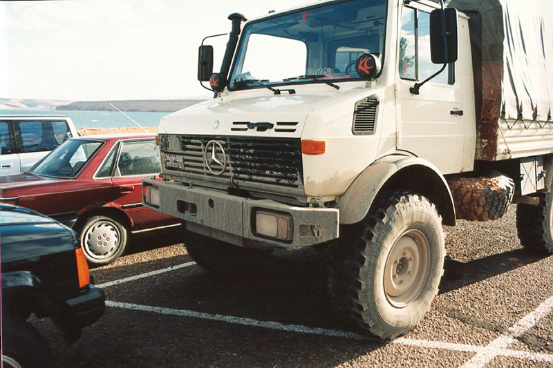
The mud dried like concrete. Here, we are waiting for the ferry to carry us from Bullfrog marina across Lake Powell to Hall's Crossing. From there, we took the "normal" highway back to San Diego, but it took 2 full days of travel.
This was an excellent trip. While a long trip in the Unimog, the nature of the awesome scenery made the distance tolerable. I would do this trip again and may in the near future. But, this time I will not be fooled by the distances involved and the time required to traverse the distance. From San Diego, this is a full week trip if treated as a forced march, but 2 or 3 weeks would be much more relaxed.