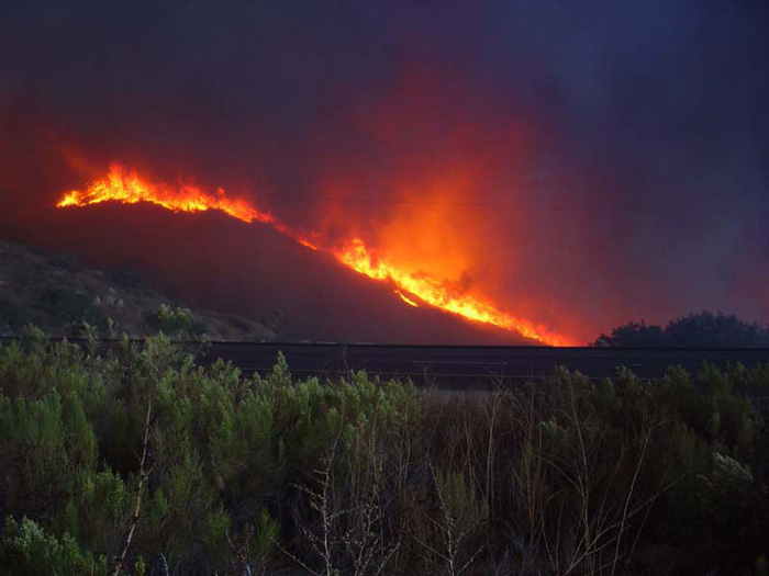
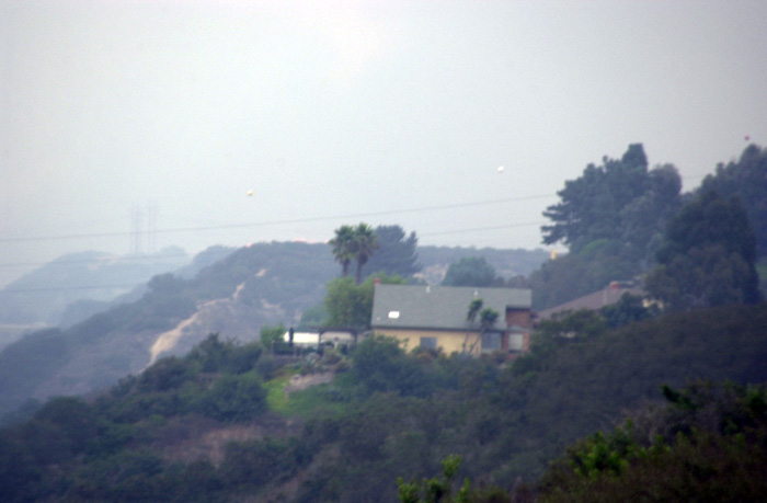
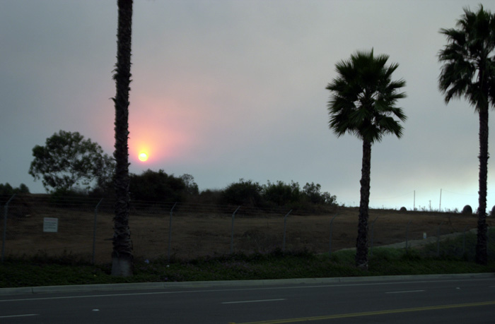
Alpine area, 3 p.m., Oct 26 Photo courtesy of Andy Menshek Fire Information Officer
On Saturdy, October 25th, we held my 50th birthday party at my house on Jamestown Road. It was the usual binge partying with folks staying util 0300 or so. We slept well, in somewhat of a drunken stupor. The next morning, we were awoken at 7am to the smell of strong smoke. Given that we live on a canyon, with brush close to the house, we were clearly concerned. Once we got outside, it was worse than anything I could have imagined. Hungover and tired, we tried to consider what to do next. The fire had started the previous evening and with strong Santa Ana winds, was moving from the east toward the ocean. We were not sure where the fire was until our friend Kai called us with the news. We immediately turned on the TV to get the scoop. It was not good. The winds were dry and strong and the fire was far, far from being under control.
The photos below were taken by me on the morning of the fire and the next day.
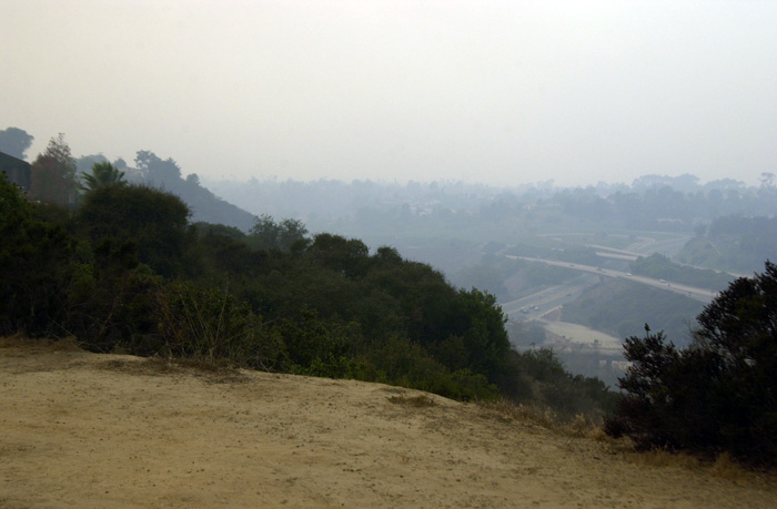
This shot is taken from my backyard looking south. Note the dark sky. This was around 7am, 10-26-2003
After assessing the situation and watching the TV, we decided that we would pack our stuff in the mog..
The air quality was very bad. Acrid smoke and heavy ash. This is my car in the driveway.
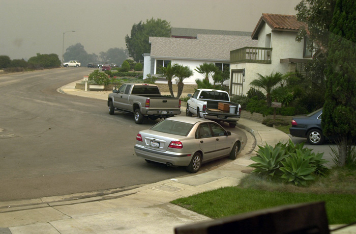
View from the driveway looking east. Note that the neighbors are packing. Sadly, (or gladly depending on your perspective) Clark Martin next door was in Europe. His daughters had to move the valuables and their cars.
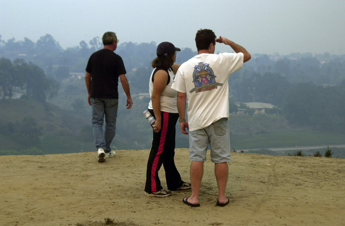
The neighbors are starting to panic. Here, those close to the canyon rim do canyon drive-bys checking on the fire's progress down San Clemente canyon next to my house.
Note the neighbor covering their mouth from the smoke.
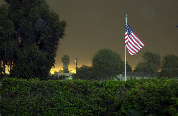
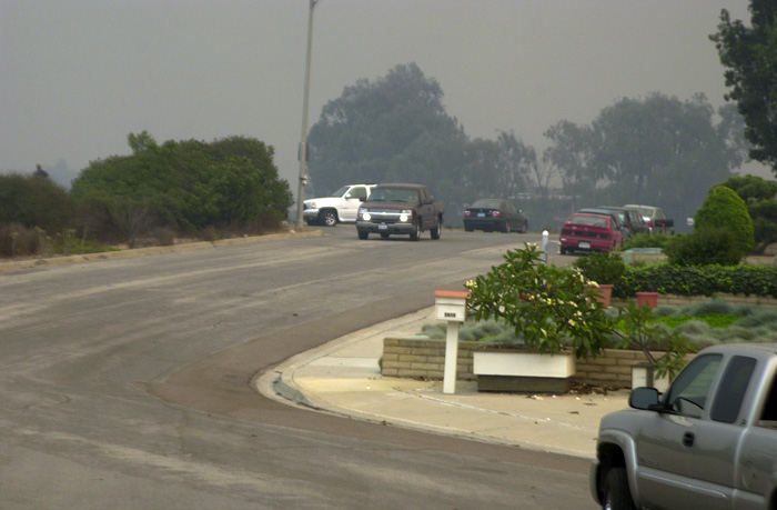
We moved the cars to Kai's house. Note the dark sky from the ash and smoke. It was dark enough that everybody had their lights on.
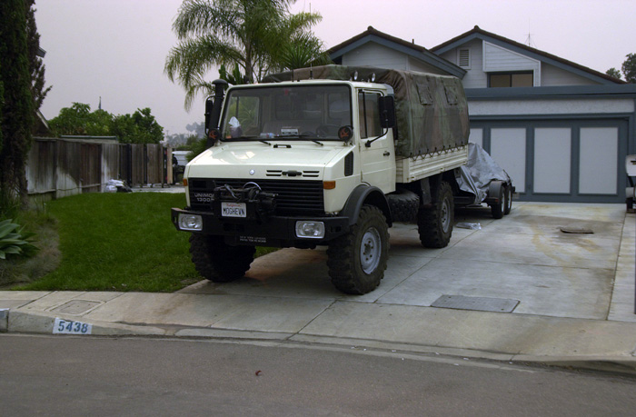
The mog is packed, the cars are moved. We are waiting for the fire to cross I-805.
A view from the cul-de-sac in front of the house looking to northwest.
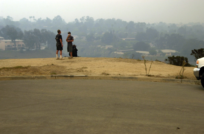
Concerned neighbors watching for the crossing of the freeway.
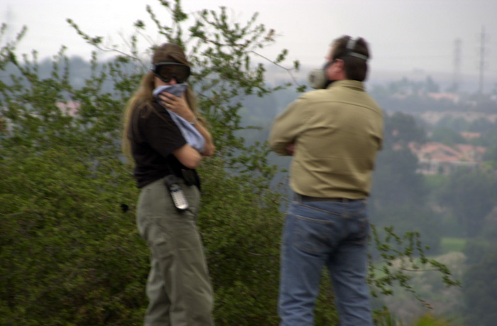
Kathleen and Kai shield their faces from the smoke.
The fire is approaching, it is getting smokier and darker. It was hard to breath.
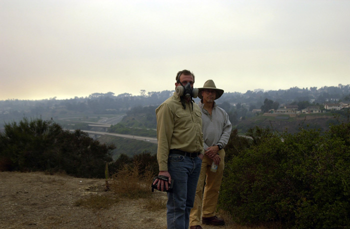
Kai Serrano on left, Bill Caid on right.
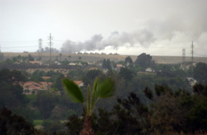
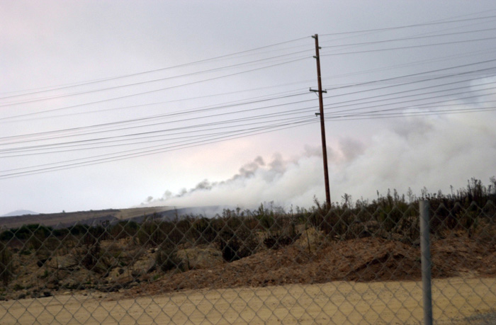
The fire has progressed to the Miramar air base.
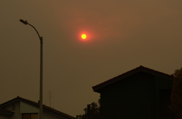
The smoke is blocking the sun. From in front of my house.
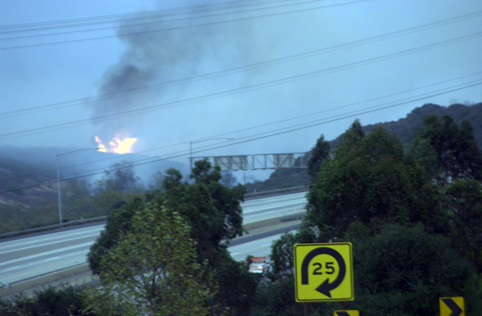
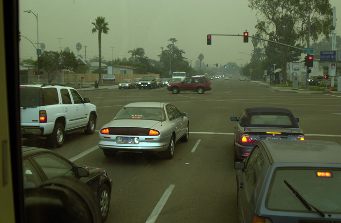
The fire is now visible from I-805. Not good.
North of hwy 52, east of I-805.
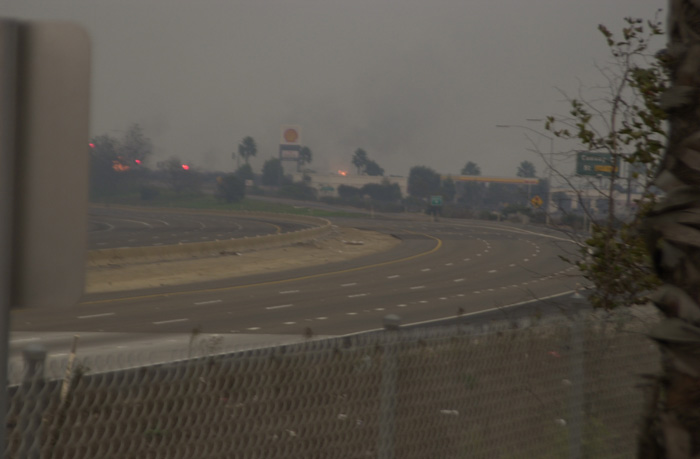
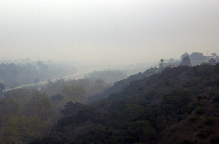
View from Kearney Mesa. Note fire over buildings.
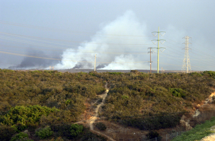
Near the Miramar treatment plant.
Looking west from Hwy 52.
Looking north from Kearney Mesa
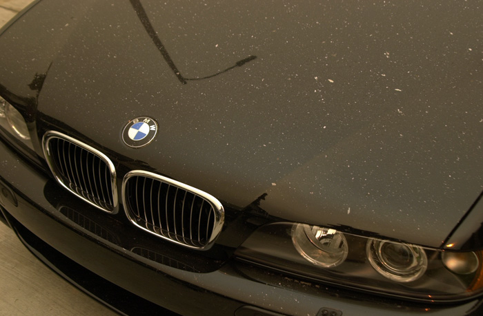
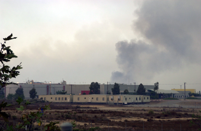
This is the next morning. Air quality is still very bad.
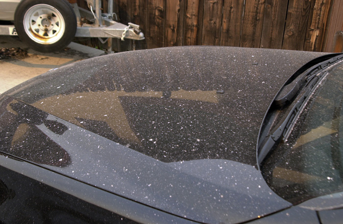
Ash fall on my car in the driveway on Monday 10-27-2003.
The fire was huge news in San Diego. Nearly every person was effected in some way, if none other than an inconvenience. Many, many homes were lost, whole subdivisions in fact. And there were injuries and deaths. The scope of the damage was extreme as the excerpt from the news bulletin below shows. The link to the full story is below. The cause? A lost hunter who built a signal fire in tinder-dry brush and high winds. Doh! Hundreds of millions of dollars of damage. He was taken into custody, but how can he make up for his stupidity?
-------------------------------------------------------------------------------------------------------------------------------------------------
For other fire information in the region, check http://www.fs.fed.us/r1/lolo/
Incident Name : CEDAR FIRE UNIFIED COMMAND
Location: South San Diego County
Size : 280,293 acres Cause: Human Caused
Damage: 2,232 Homes Destroyed; 22 Commercial, 566 Outbuildings
Injuries: 13 Civilian Fatalities; 1 Fire Fighter Fatality; 91 injuries
Current Problems/Threats/Action : Hot spots, flying embers and hazards such as snags present concern for firefighter and public safety. Action Plan: Secure line and mop up perimeter. Mop up 300 feet around all structures.
Percent Contained : 99% Expected Containment: 11/03/03, 1800 Hours
Percent Controlled: 0% Expected Full Control: 11/16/03 1800 Hours
Current Weather: Wind speed W 20 mph. Temperature 37 degrees. Relative humidity 100%
Predicted Weather: Wind variable W-NW 6-14 mph. Temperature 46-66 degrees. Relative humidity 35-100%.
RESOURCES ASSIGNED as of 0700 hrs:
Engines: 242 Fire Crews: 37 Helicopters: 32
Dozers: 42 Water Tenders: 30
Overhead Personnel: 422 Total Personnel: 2,120
Link to the full government press release on the fire
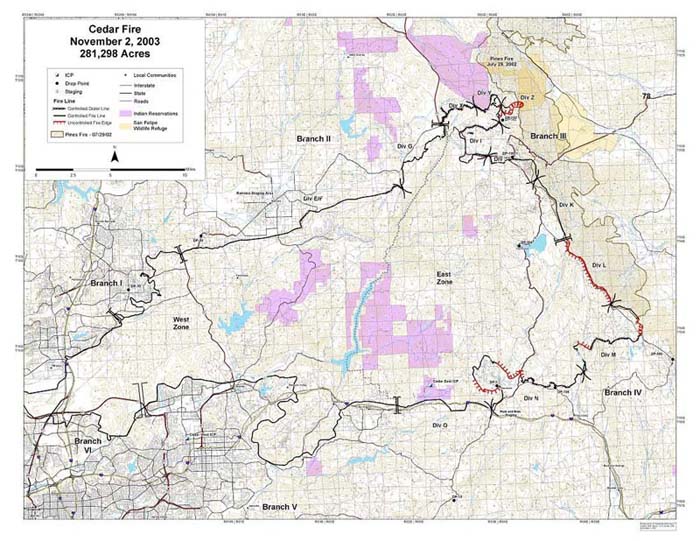
These two maps below tell the story. The scope of this fire was well beyond any of the fires that have been experienced in San Diego.
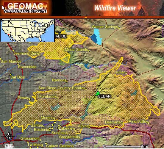
The official fire map as offered in government briefings.
The photo below is from the official site for the Cedar Fire . There are a number of photo galleries there, it makes for morbid reading.
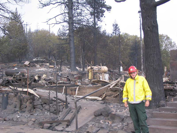
Burned house. Taken by D.L. Wilkerson, Forest Service, Oklahoma
As of the date of this writing, 3-25-2004, there was little doubt about the cause of the fire. But, the government, being such as it is, took it's own sweet time in stating the obvious. Below is the text from the San Diego Union Tribune dated 3-24-2004.
------------------------------------------------------------------------------------------------------------------------------------------------
By Gregory Alan Gross
UNION-TRIBUNE UNION-TRIBUNE STAFF WRITER
March 24, 2004
For the first time, investigators looking into last October's deadly Cedar fire have officially pointed to a lost hunter as the man responsible for starting the blaze. A report prepared for the U.S. Forest Service that was commissioned to detail firefighting strategies states "the fire was started by a lost hunter as a means of being found."
The document was prepared by the Marin County Fire Department's mapping and analysis unit and was presented last week to a blue-ribbon state panel investigating the Southern California firestorms.
Despite the report, the investigation into the cause of the Cedar fire remains open, according to the U.S. Attorney's Office, which has jurisdiction over the case because the fire started on federal land.
"The investigation is continuing," said a spokeswoman for U.S. Attorney Carol Lam. The spokeswoman declined further comment.
Although he is not named in the new document, the hunter has been identified as Sergio Martinez of West Covina, a city about 25 miles east of downtown Los Angeles.
Martinez, 33, was rescued by a sheriff's helicopter crew near the fire's point of origin, in the Cleveland National Forest near Cedar Creek, four miles southwest of Pine Hills.
The genesis of the Cedar fire is one of the many topics examined by the governor's Blue-Ribbon Fire Commission. The commission's draft report notes the sheriff's helicopter crew saw the Cedar fire in its initial stages while conducting an aerial search for the hunter, but does not zero in on Martinez as the the source of the blaze.
The Forest Service report was presented to the commission at the last in its series of Southern California hearings in Los Angeles last week. The commission's final report on the fires is due in two weeks.
Personal contact info: bcaid "at" san "dot" rr "dot" com Read the email address and form it yourself. Link not included due to spam email address harvesters.
All photos and narrative text Copyright (c) Bill Caid 1977 to 2004
All rights reserved.