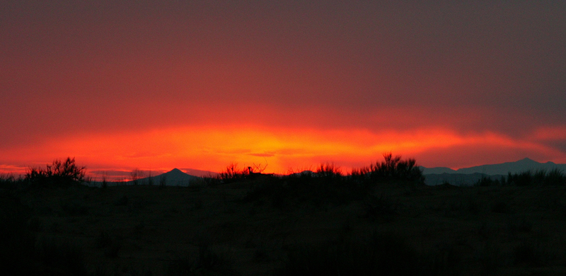
Trip Report: January 20-23, 2005
Quick link to start of daily log and photos Day 1: 20-1-2005 Crossing Border to Tacos Duros
After our late 2004 trip to the Altar desert (which caused so much carnage), we heard of the Confluence Project which can be seen at www.confluence.org
To quote the Confluence.Org website, the concept behind the project:
The goal of the project is to visit each of the latitude and longitude integer degree intersections in the world, and to take pictures at each location. The pictures and stories will then be posted here (at www.confluence.org).
After the completion of the last Altar trip, we saw on another visitor's site that they were attempting to get to the confluence at 32N114W by the mid-February timeframe. While there is no remuneration for being the first to visit a confluence, we would have to make do with the fame and glory that would result from being the first to visit this coordinate. There were a number of documented failures to reach this location due to the difficulty of the trip, the general logistics and the soft sand.
The planned trip involved getting the four Unimogs across the Mexican border at Mexicali, Baja California Norte (BCN) then head south toward San Filipe. Once we were out of the Mexicali area, we turned to the east and followed BCN 4 toward El Gulfo de Santa Clara. We planned to travel east on a dirt road to get close to the dunes and the starting point for our attack on the confluence. The planned trip duration was 4 days, so we did not bring a tremendous amount of supplies. Likewise, since we did not have quads, we did not have to bring quad equipment (helmets, gas, etc) thereby easing the logistics and amount of cargo.
The general plan was to get to the El Gulfo area via paved roads, then head east on one of the graded dirt roads that the Mexcan government "maintains". Once we were within traversal distance of the dunes, we would leave the road and head across the tundra to the dunes and proceed notherly until we hit the plane wreck. From there, we would proceed east to the confluence. Assuming that the terrain would allow, we would attempt to reach the confluence before dark on the second day and camp there. The following day, we would head to the northwest through the Sierra El Rosario and camp near the flanks of these rugged mountains. On the last day, we would traverse the remaining dune fields and head back to the boarder crossing at San Luis del Colorado.
Like any trip to a foreign country, substantial pre-planning was required. To do such a trip required detailed knowledge of what conditions were expected as well as research on issues beyond just road conditions. To prepare for this trip, we utilized experience gained from previous trips, tide charts, satellite photos, Mexican maps as well as other intelligence gathered from the local four wheel clubs. But, unlike the previous trips, we organized and executed within 3 weeks of learning of the objective. Not bad considering the number of working adults that had to adjust their schedules to meet the objective.
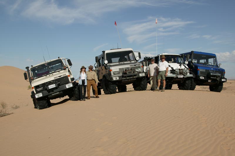
To insure the success of a major expedition in a foreign country, it is absolutely essential that the proper team of vehicles and operators was assembled. Of key importance was vehicle reliability. The size of the Altar dunes basically precludes the ability to tow a truck as dead weight. While theoretically possible, the time required to complete the winching make recovery a practical impossibility. Therefore, special attention was given to mechanical preparations prior to the trip. And, in general, this paid off in a relatively trouble-free trip. This trip, unlike any other in the past, was totally free of tire issues. I am proud to say that there was not even one de-bead or flat among the 4 vehicles. Several of us did get stuck however, but resolving being stuck is easier than reseating a tire. I am guessing that the reason that we had less issues is that the sand was harder due to moisture from recent rains allowing operation at higher tire pressure, thereby reducing the likelihood of a de-beading.
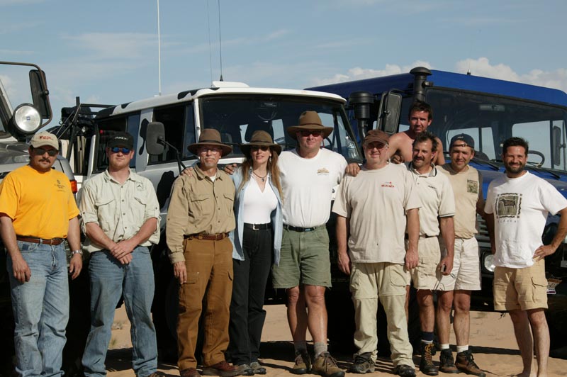
Left to right are: Shane Pritchard (Colorado), Rob Pickering (Colorado), Bill Caid (San Diego), Kathleen Jones (San Diego), Mike Bennett (Fresno), Dan Johnson (Indiana), Kai Serrano (San Diego), Jose Aizcorbe (Celaya, Mexico), Roberto Espinoza (Celaya, Mexico), Alvaro Nieto (Celaya, Mexico). Missing from the photo is Frank Nesselhuf who is taking the photograph.
All drivers had substantial experience in hard-core off-roading. All except Espinoza had completed the Rubicon and the hardest trails in Moab. Additionally, Caid, Serrano, Pickering, Johnson, Bennett and Espinoza had previously successfully done the high dunes of the Altar Desert in 2004 and lived to tell about it. However, the balance of the group were "Altar Virgins".
In Figure 1, San Diego bay is just below the top edge on the left. The large lake is the Salton Sea. Farmed areas are shown in red. The road in Mexico that parallels the border can be seen. Refer to the map below for reference.

Figure 1. Satellite Photo of Baja and Northwest Sonora, Mexico.
In Figure 2, the large dunes are evident and can be seen as forming a set that roughly parallel the coast to the south. The destination was El Gulfo de Santa Clara, and this is due east of the end of the largest "gray colored" island at the mouth of the Colorado River.
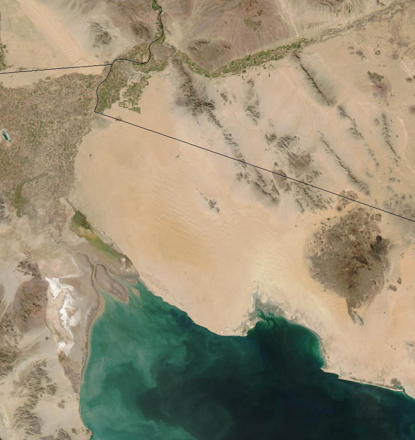
Figure 2. Zoom Photograph of Area of Interest.

Figure 3. ZoomPhoto of the Altar Desert with
Ozi Explorer overlay of waypoints on satellite photo .
El Gulfo is a very small town; this is primarily a fishing village, but does cater to tourists, particularly Gringos around Thanksgiving, Christmas and New Years. There is a Pemex station, and it probably has gas. I say probably, because in Mexico, if the fuel truck does not show up for what ever reason, then there will be no gas or diesel. There is a store and ice is available along with plenty of fresh fish, shrimp, clams and sometimes other shellfish. Water is in short supply, but can be purchased at the town OXXO store. There are several RV parks in town and several "hotels". The quotes are used here since one of the selling features of the hotel is that it has indoor plumbing.
The locals make their living fishing, and good seafood is available at all times. The best restaurant in El Gulfo is the El Delfin and has excellent food although modest accommodations (they did, however, have hot water in the washroom).
Firearms are prohibited in Mexico. Handguns, in particular, are frowned upon. If you are caught with one in your possession, you will go directly to jail. There is a very high likelihood that you will be unable to "buy" your way out of the situation no matter how much money you have with you, so this situation is better avoided. While lack of a firearm in the wilderness will place you at somewhat of a disadvantage should trouble arise, the penalty for possession is so harsh that it is not worth the risk. The proposed area of operations is known to be used by drug smugglers. However, the open desert crossing is not the preferred route, so the chance of encountering anyone is nil. But, the Mexican Army does patrol both the north end and the sea-side of the desert and if they stop you, they will most likely do a thorough search of the vehicle. They pose no threat to honest Gringos that do not break the laws of their country.