Trip Report: May 28, 2005
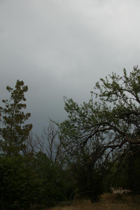
The Santa Catalina Mountains are the dominant feature of the Tucson skyline. Rising over 9500 feet, the mountain is tall enough to influence the local weather. The figures below shows maps of the area and a photo of the south face of a small portion of the Catalina range. These are steep mountains with rugged terrain and big cliffs. The mountain is roughly triangular with one of the flat sides facing Tucson. Oracle is at the north apex of the triangle.
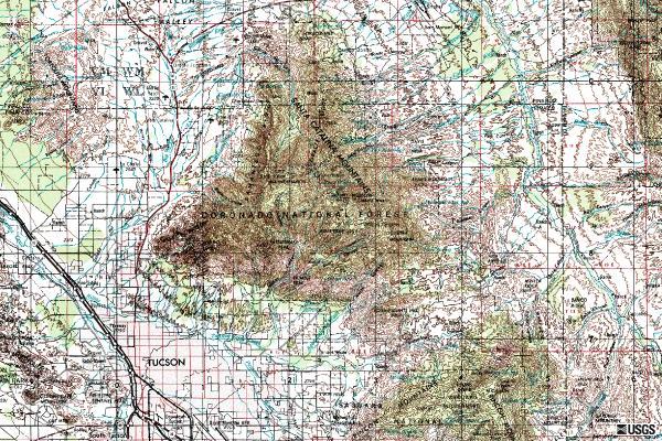
Map showing the triangular shape of the Catalina Mountains. Oracle is at the 12:00 position on the mountain and the Madrugada ranch is at the 1:00 position on the northeast flank of the mountain.
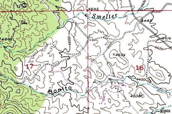
The Madrugada Ranch is the set of blue squares in section 16 to the 10:00 from elevation 4508. Bonito Creek is labeled at lower center of the map.
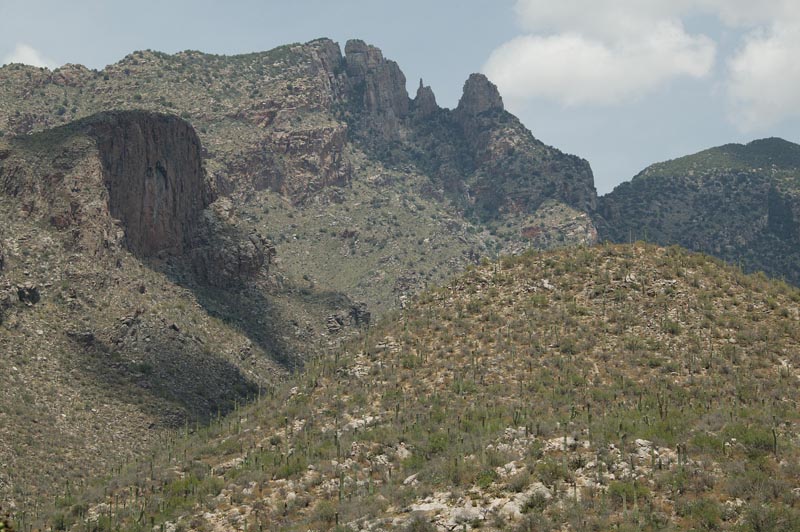
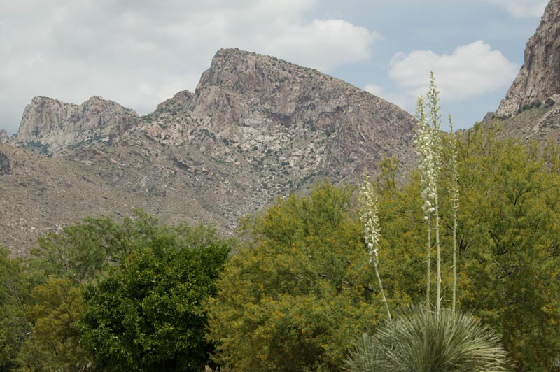
The terrain of the Catalina mountains. Finger Rock in the western Santa Catalina range. Note the rugged, steep terrain and large cliffs.
The real event started in July of 2003. At that time the so-called Aspen fire was raging in the Catalina Mountains. Due to the draught conditions, the fire spread far and wide and took many weeks to fully control. One thing that fires do very well is to clear old brush. While needed in the general life cycle of these desert mountains, there is a deadly side effect. When the predictable monsoon rains come to the area in the late summer, great flash floods are produced because of the terrain's inability to retain rain water.
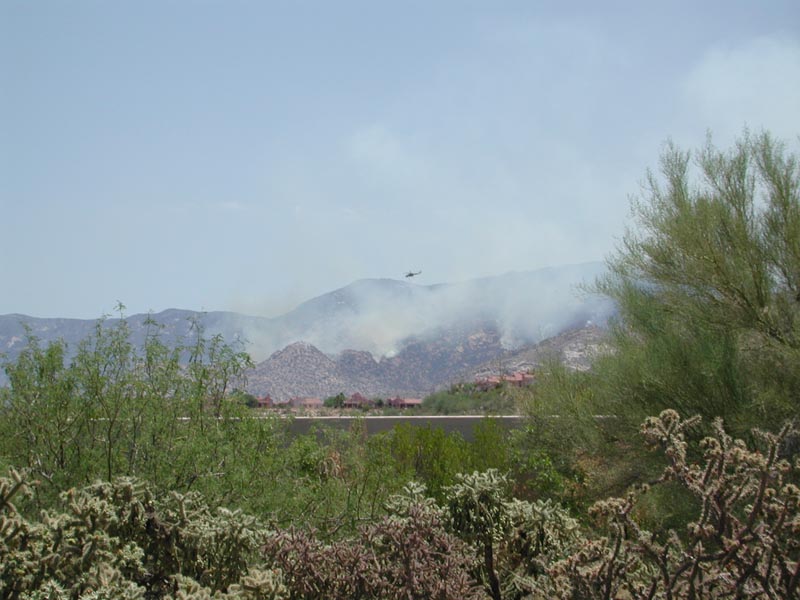
Fire fighting helicopter drops water on northern flank of the Aspen fire. July, 2003
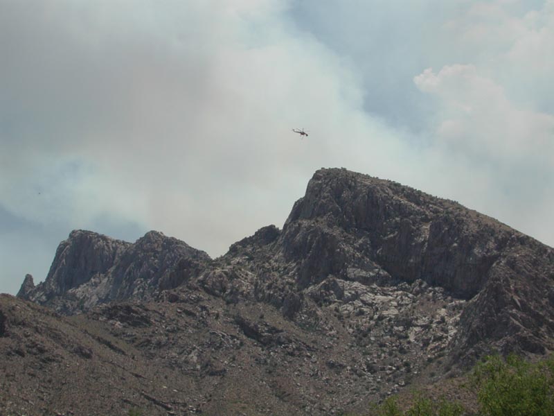
Helicopter returns to watering station after a drop. Pusch Ridge, Santa Catalina Mountains.
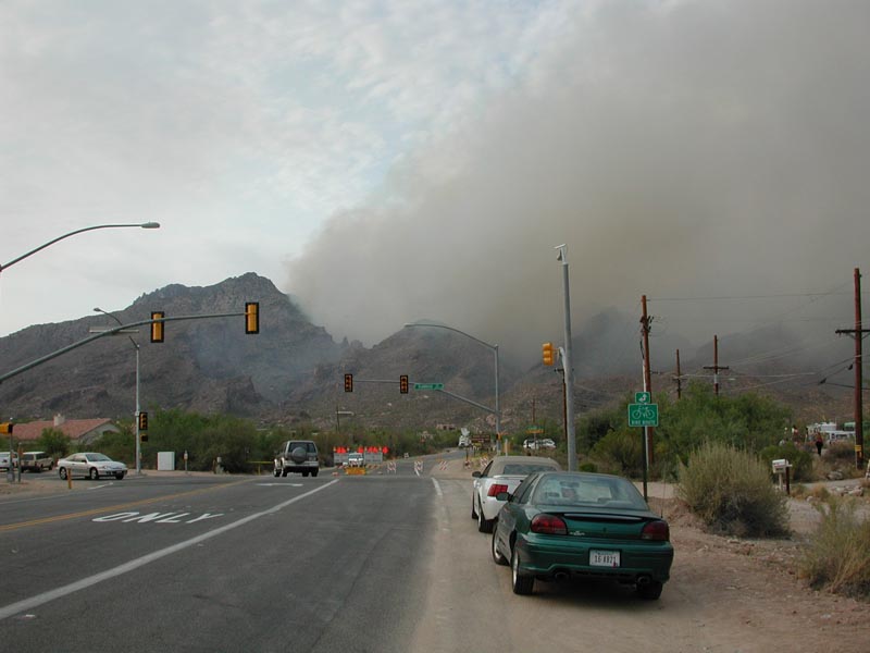
View of the south flank of the fire as seen from Skyline and Sabino Canyon roads. Sabino Canyon is on fire!
It only took one month from the end of the fire to the first disaster. Near Oracle, the USFS had set a big backfire on Apache Peak to protect the houses and ranches on the northeast flank of the mountain.
This backfire set the stage for a major flash flood that swept a man from his house to his death in the swirling, turbid waters. In the process, it damaged the house of my friend Dr. Sandee Mattson.
The Tucson Weekly story by Renee Downing in November, 2003 tells the detailed story of the floods, death and subsequent tribulations that Sandee would face after the fire and flood. See that story here. A brief extract follows:
Hydrologists from the National Weather Service and the U.S. Geological Survey put the peak flow through the canyon that afternoon at 2,000 cubic feet per second. For comparison, the typical flow in Sabino Canyon is about 10 cfs, and its floodpeak so far this year is 4,000 cfs. But Bonito Canyon is a gully compared to Sabino--roughly what Sabino is to the Grand Canyon.
Coming around the bend, the water careened into Jim Huntington's house and the bluff behind it. Watermarks on the walls showed that it engulfed the house to a depth of 5 to 6 feet, which means that the racing water was 10 to 12 feet deep, as measured from the old bottom of the channel. (The washbed is now about three feet higher than before mid-August.) It smashed in the windows and front door, ripping open one of the wood-framed house's downstream corners, carrying away furniture and books and leaving behind three feet of mud. Outside, it stripped everything movable from Huntington's yard, including his Toyota 4-Runner, which it carried 100 yards before ramming it into the side of the next house downstream.
Huntington's grotesquely battered body was found three-quarters of a mile down the canyon later that night.
Yuck. Sandee came to San Diego and showed me a video of the damage to her ranch, the Madrugada. But, she did not have any video of the flood as she was not home at the time.
The predictable floods and unexpected death brough the predictable Government studies and investigations. Results of government study on the Aspen fire and the subsequent runoff volumes that resulted from the rains can be found on http://newweb.wrh.noaa.gov/wrh/05TAs/ta0501.pdf This document covers more than the event on Campo Bonito Creek and has charts, graphs, maps and links to other technical reports. An excerpt on Campo Bonito follows:
On August 14, 2003, a rainfall event and resultant flash flood occured on the upper Campo Bonito Watershed. The upstream site drains a 1.5 square mile watershed, has a mean basin elevation of 5,600 feet, and contains 43% high severity and 38% moderate severity burn. The peak discharge was estimated, my the USGS using the slope area method at 1,900 cfs (+/-20%). This estimate equates to a 100-year pre-burn flood. This amounts to a post-burn runoff 2.5 times greater than runoff during pre-burn conditions.
The short story from the analysis is that the runoff had been 2.5 TIMES greater than runoff during pre-burn conditions. Needless to say, any planning that may have been put into bridge sizes, stream capacities and flood planes would be rendered null and void by the laws of physics and the tremendous mass of fast moving water. As a personal interest calculation, I estimated the mass of water moving past any point on this creek to be 118, 560 pounds of water per second. Just using the concept of mass transfer, this was an awesome force to be reconed with.
Kathleen and I visited Oracle on May 28th to see Dr. Sandee Mattson at her Madrugada Ranch. As we left Tucson for Oracle, we could see the thunderstorms brewing in the distance. The objective of the visit was social as Sandee has been a personal friend for more than 30 years.
Thunderheads brew over Pusch Ridge, north of Tucson.
As we crested the hill at Oracle, we saw dark thunderclouds south down the San Pedro valley. There was much thunder and lightning as we rolled into the Madrugada. There was no rain as of yet, but it was clear that it would rain soon. We could smell it in the air. The air in the Sonoran desert has a very particular smell when wet.
Southern sky is full of clouds pregnant with rain coming north up the San Pedro valley as seen from the Madrugada Ranch.
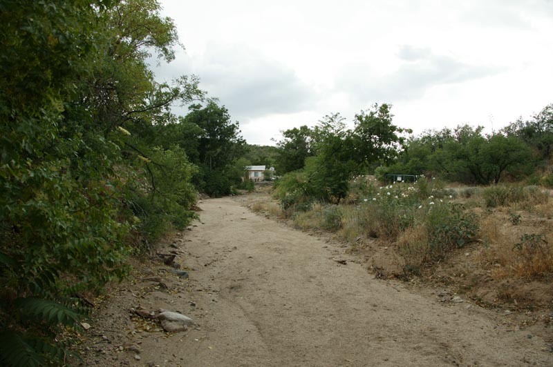
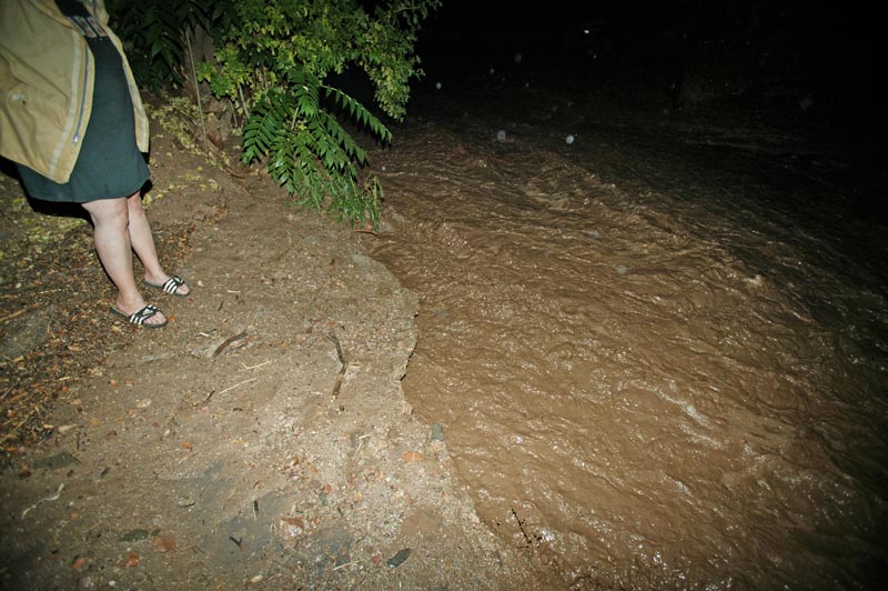
Bonito Creek, looking upstream from the stream crossing for the ranch. Note house in the distance. This is where the flood took Dr. Huntington out of his bed and down the creek to his death. Also note the grade on the riverbed.
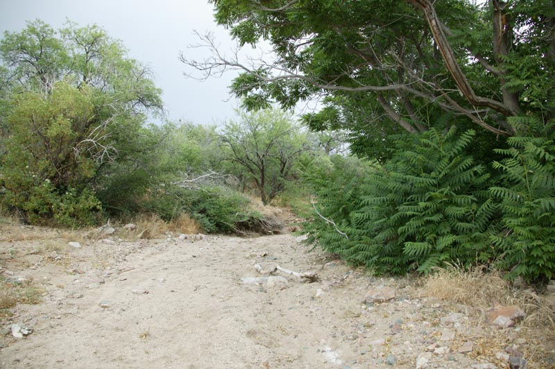
Bonito Creek, looking downstream from the stream crossing. Note trees along bank.
After shooting a few photos, we went inside the ranch house to visit and have cocktails. While we were drinking and talking, the rain started. At first, it was not too strong, but intensified over time. Soon, we were all actively concerned. So concerned, in fact, that Sandee moved our rental car across the creek to the opposite side so we could get out if we had too. After moving the car, we went back to socializing.

Kathleen enjoys a Mudslide cocktail. Very appropriate name in retrospect given the circumstances.
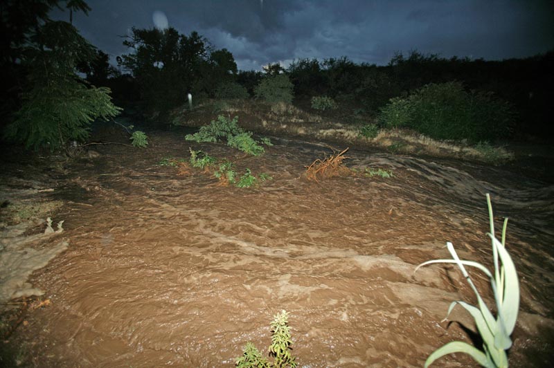
Kathleen, Sandee and I chatted and drank. It was clear that as the rain progressed, Sandee was getting more and more restless. Having suffered the death of her neighbor and substantial damage to her place back in 2003, she was very wary. Meanwhile, we lit the bbq and prepared to cook some chicken. As the chicken was done ,we served up the food. The rain continued to intensify as we ate. Finally, Sandee requested that we help her test the flood alarm. After the events of 2003, she had the alarm company install a water alarm that would notify he when the water in the wash reached a certain level so she and her daughters would have time to evacuate if needed. She left the house and poured water in the sensor. To our collective relief, the alarm sounded as it was supposed to. We returned to eating our chicken and salad. Within another minute after the test, the alarm went off again. I assumed that the system had not been fully reset. We stood to look at the wash out the front window and to our dismay, it was running. Strong. Within seconds, the second stage alert alarm sounded. Something closely akin to panic overtook all of us. I grabbed my camera and ran outside. It was raining pretty hard. I ran to the creek and took the shot below. The waters were surging, strong and cold, the color of chocolate milk. The water was heavy with suspended mud and debris.
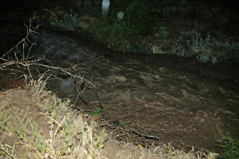
Alarm has sounded inside the house. We came out to investigate and found this. Within 30 seconds of the alarm going off, the second stage alarm indicating a flash flood was also piercing the night. This was around 8pm.
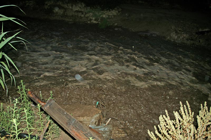
The water was rising rapidly, seemingly an inch every few seconds.
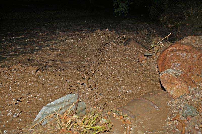
Within a few seconds, it had spanned the entire canyon floor. Note the boil of mud in the upper left corner of the photo.
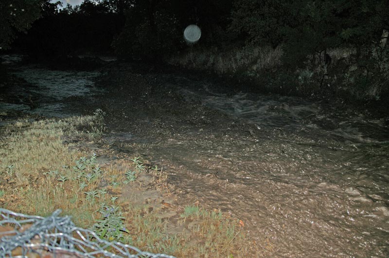
Suddenly, we heard a loud cracking noise followed by the big tree in the upper left corner was torn apart and pulled into the torrent. Note the branches in the creek.
Still rising rapidly, more of the tree is torn loose of its roots. The branches are scraping the banks like a scrub brush, pulling in more debris as the clot passes. Note the boil in the center of the photo.
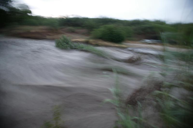
I tried to capture the chunks of tree as it went by but the flash in the camera failed. Note that even though it is blurred, that the size of the flow has greatly increased. Now that the water was rapidly rising, we were all very scared and looking for a place to run.
The creek was moving so much debris that it was like a saw. There were fence posts, tree limbs, whole trees, big chunks of concrete pipe and big boulders. As we stood on the bank, the boulders clacked as they were moved down stream by the nearly 200,000 pounds per second of water that was passing us. We watched as big chunks of river bank were sawed away by the fast rushing water, disappearing into the deepening darkness. The noise of the water was substantial. There was a vibration induced by the movement of the sheer mass of water moving past us. Plus, the sloshing of the water and the grinding of the debris in the water.There was so much debris in the water it was like a soup. It was clear that if you fell into the water, you would be crushed by the debris, stabbed on tree branches and the drown in the cold, turbid waters.
After awhile, the height of the water seemed to stabalize, then slowly it started to recede. We were all on edge. Kathleen was shivering. At first, she thought it was from the cold rain, but later realized it was from fear. The water continued to run strong for a couple of hours.
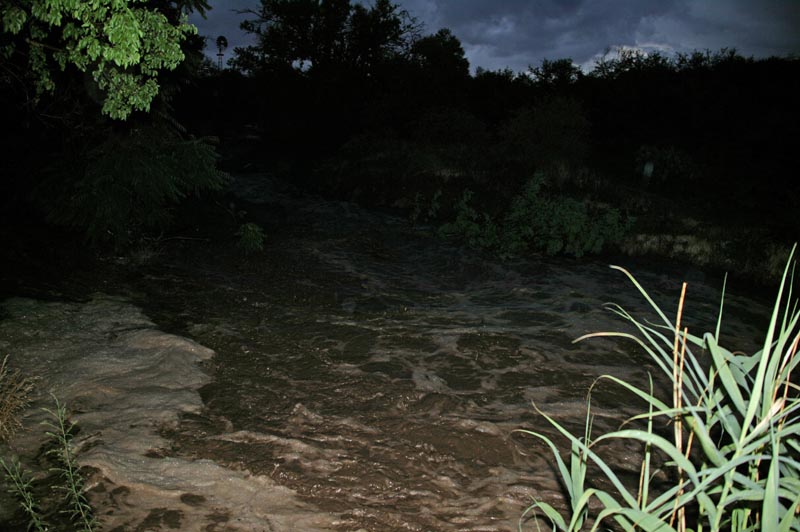
Here, the water pounds the rocks on the revetment that was built after the second flood in 2003. Note the boil in the foreground.
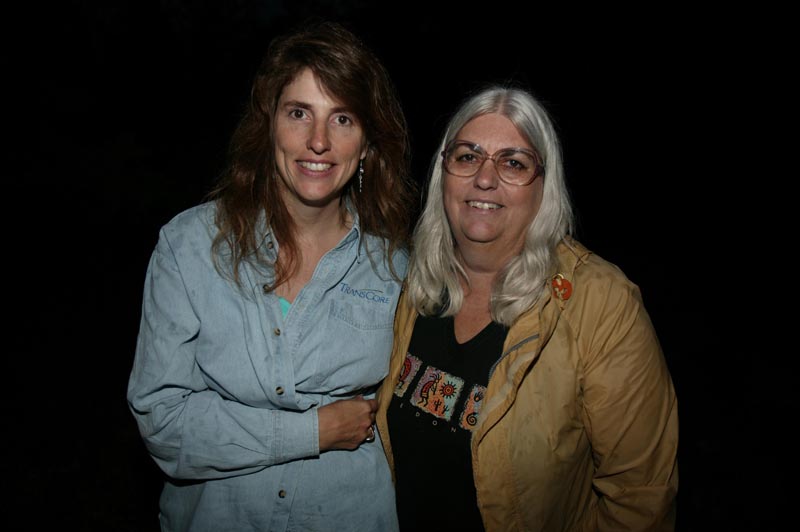
The girls gave me a forced smile as the waters start to recede.
Even as the waters dropped 4 feet below their max level, there was still plenty of water in the wash.
It took several hours before the water fully receded. By midnight, the wash was free of running water. We decided to leave while the leaving was good.
The water alarm system served it's purpose, warning us with what would have likely been sufficient time to get out the back door and up the hill before the house was swept away. Fortunately, the water level never reached that magnitude.
I have seen flash floods in the past, but never been so close to one. The power of moving water is tremendous, something to be both feared and respected. Sandee was lucky that the rain had not been too big, but still it was a scary event.
Never attempt to cross a flooded wash either on foot or in a vehicle. Usually, people that get into the water die. Some never to be found among the brush and debris in the river.