Trip Report: 20070810
We spend the night at the Denali River Cabins. The accommodations were basic in the most general sense. Sadly, despite the proximity to the Nenana River, we also had proximity to the main highway and therefore had to listen to truck traffic all night. Other than that minor annoyance, things were fine. The food was good and there was plenty of it. Next morning, we decided to get a plane flight around Mt. Denali that would land on one of the many glaciers on the mountain. We were very lucky in that we got the last 2 seats available and the weather was very, very clear. The pilot told us that many days, the flights are grounded due to poor visibility. But, we did not suffer that fate. We culled hundreds of excellent photos to this set that "spans the space" of the flight. The views were spectacular, almost beyond words.
The photos below are what we saw.
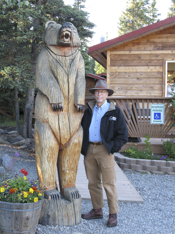
Lots of grizzly bear statues in the area. This hand-carved statue was outside the office area of the Denali River Cabins where we stayed.
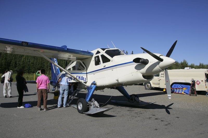
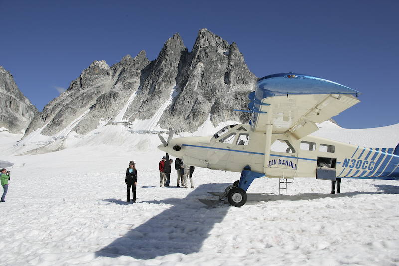
Preparing to board our glacier sight seeing flight.
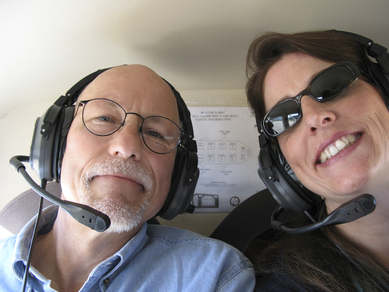
Interested sight seers.
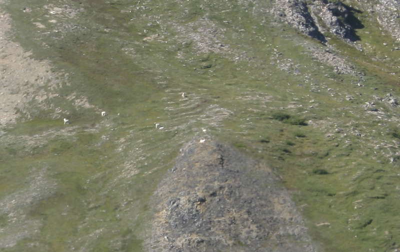
The pilot spotted these Dall sheep on the ridge below us.
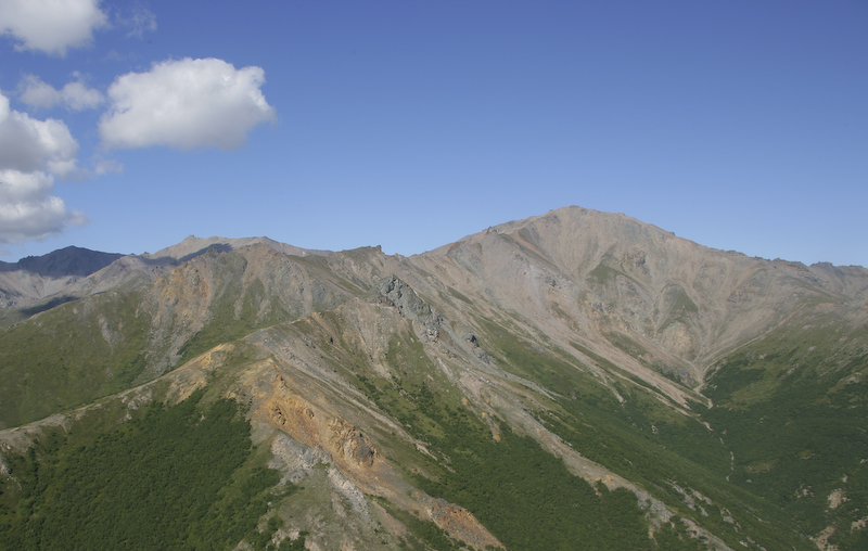
The mountains close to the airstrip were heavily mineralized as evidenced by the colors in the rocks.
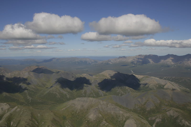
The broken clouds provided interesting shadows on the mountains. Visible in the distance is the road to a distant range station that is 95 miles away over a dirt road.
Our first views of the glaciers on the flanks of Denali. Note the separation cracks around the upper perimeter of the glacier. These are formed as the glacier flows downhill.

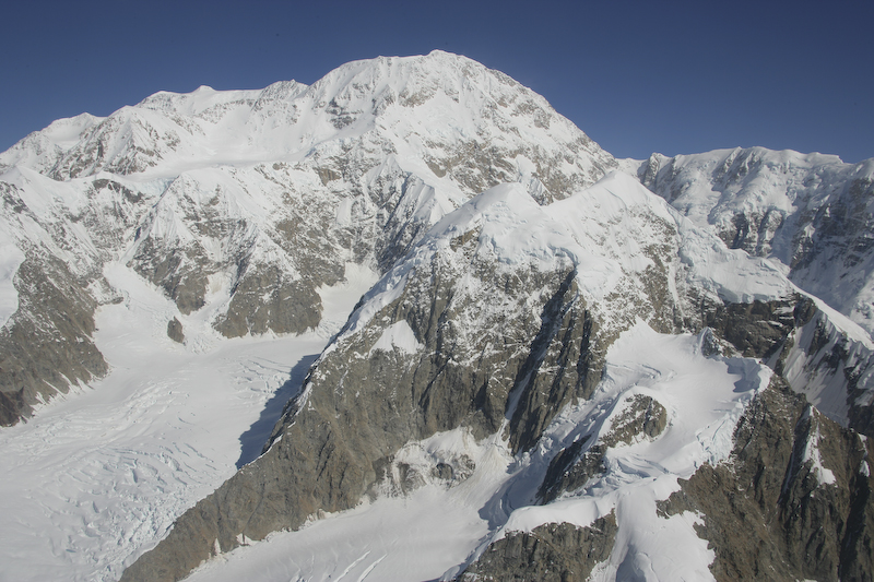
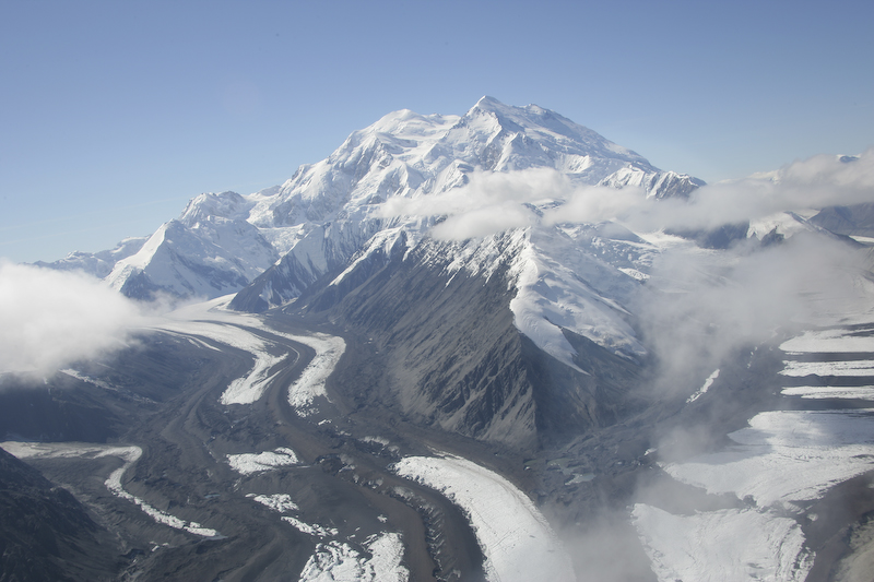
A clear view of Denali. At this point, the mountain is still 60 miles away.
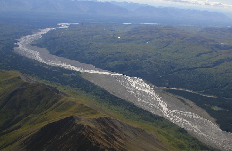
The classic braided river pattern of a glacial valley. The reflected sunlight highlights the braiding of the stream.
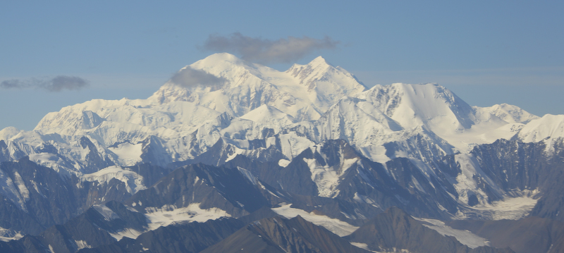
Denali is getting closer, now about 50 miles.
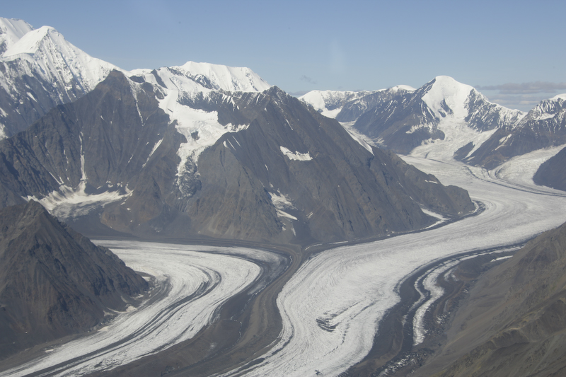
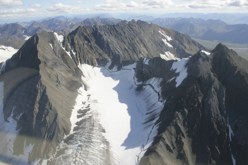
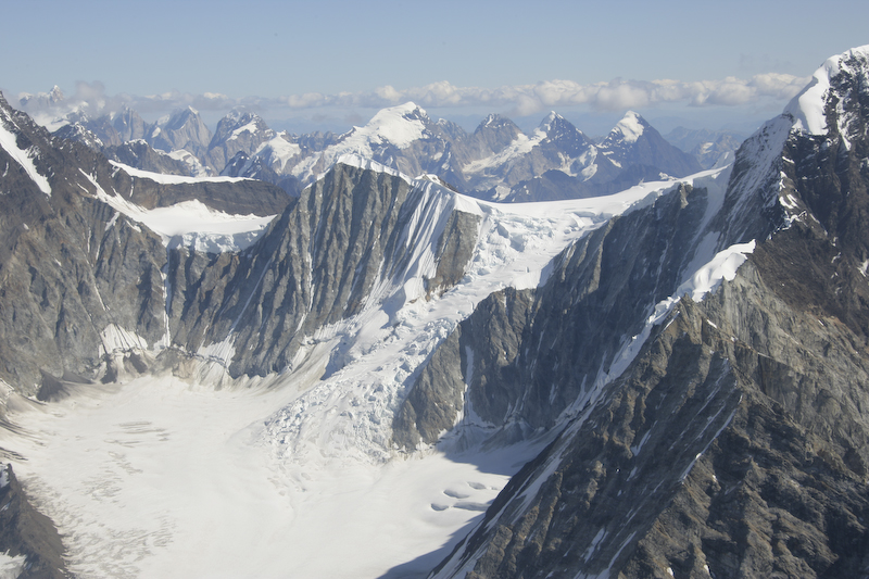
Intersecting glaciers. These glaciers mix and the lateral moraines then become medial moraines and carry a big load of material downhill.
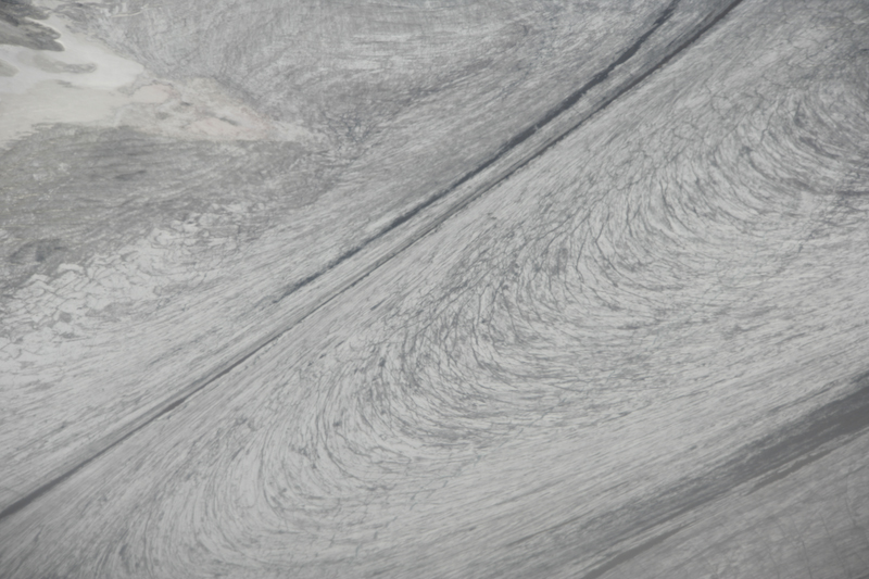
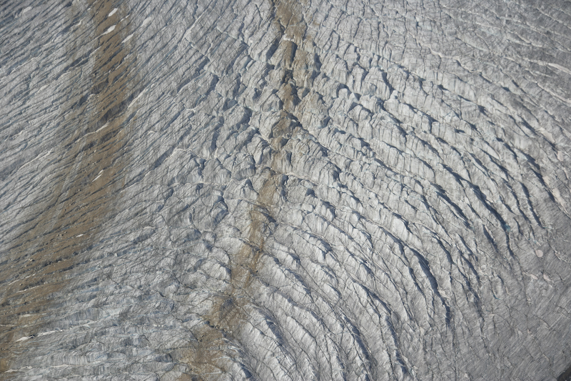
The flow patterns of the glacier are easily visible in this shot. Due to friction, the center of the glacier flows faster than the edges resulting in these curved crevasses.
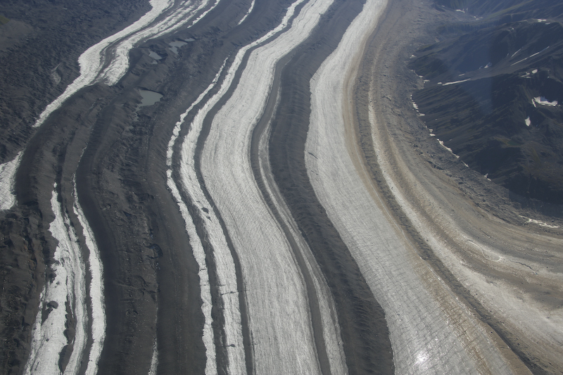
Nice banding of material in this glacier.
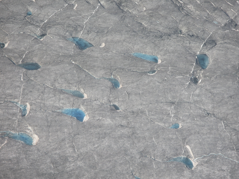
Pools of glacial melt water have a baby blue color.
Intersecting crevasses create interesting patterns in the surface of the glacier. These are hundreds of feet tall.
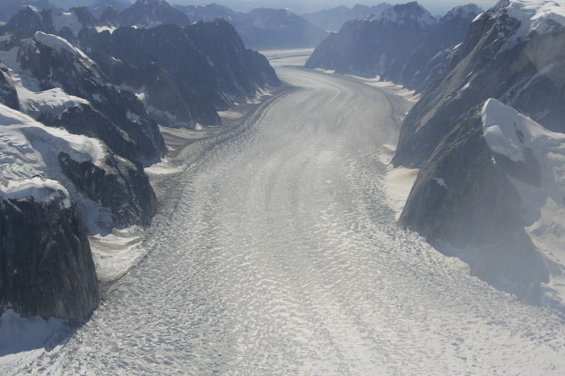
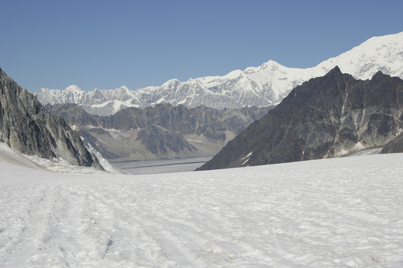
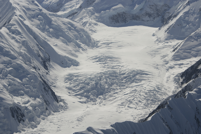
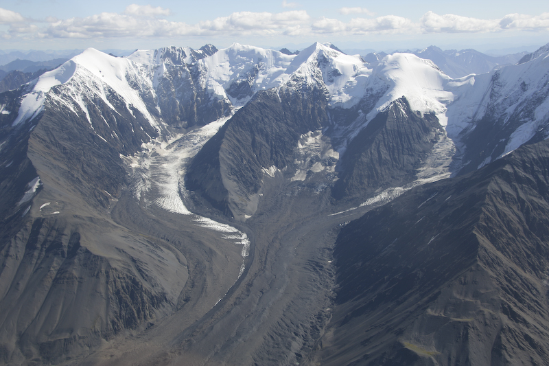
There were many huge glaciers on the flanks of the mountain.
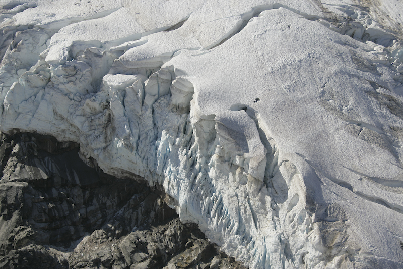
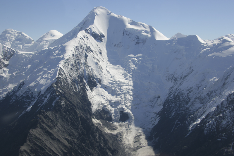
The exposed sides of the glacier are an ice fall waiting to happen.
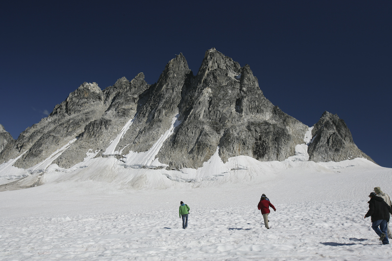
Once we completed our landing on the glacier, we got a chance to get out and look around. The surface of the snow was very cupped from the heat of the sun. Our landing was at an altitude of 1668 meters above sea level. The Healy airstrip was at 480 meters.
This shot was taken with my wide angle lens with a polarizer, which results in the deep blue colors.
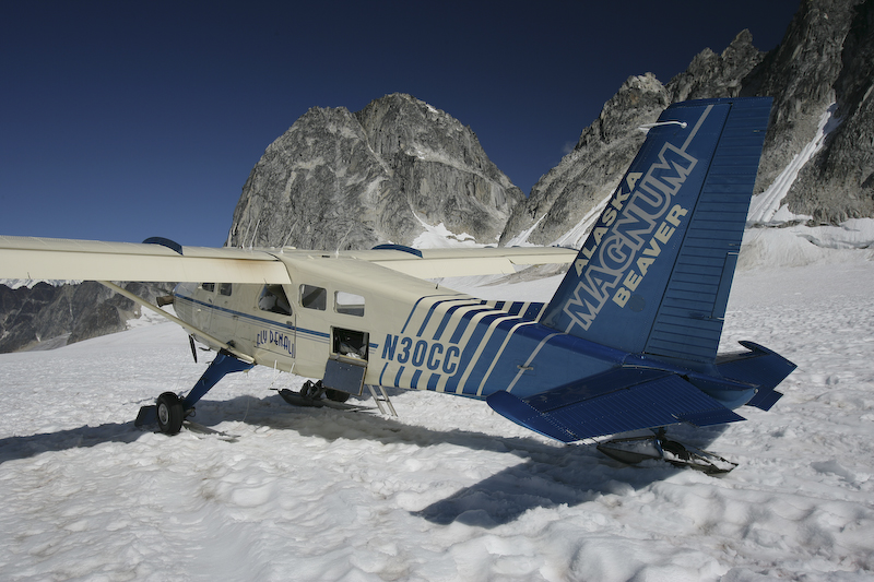
Our ride pointed down the slope of the glacier, poised for takeoff.
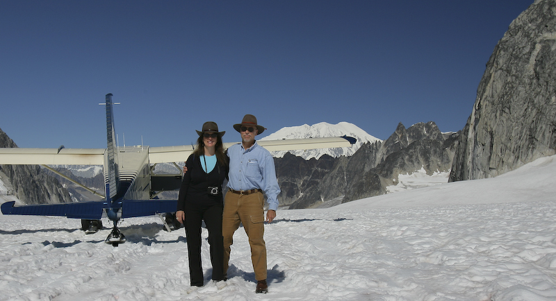
Happy sight seers.
This is the runway. We took off pointed directly down the glacier, using the slope to assist us in building airspeed.
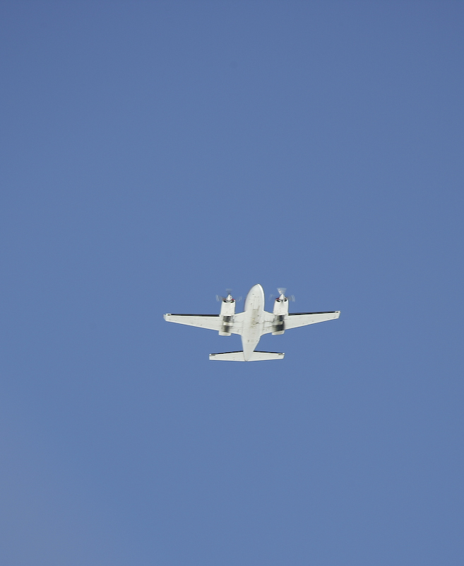
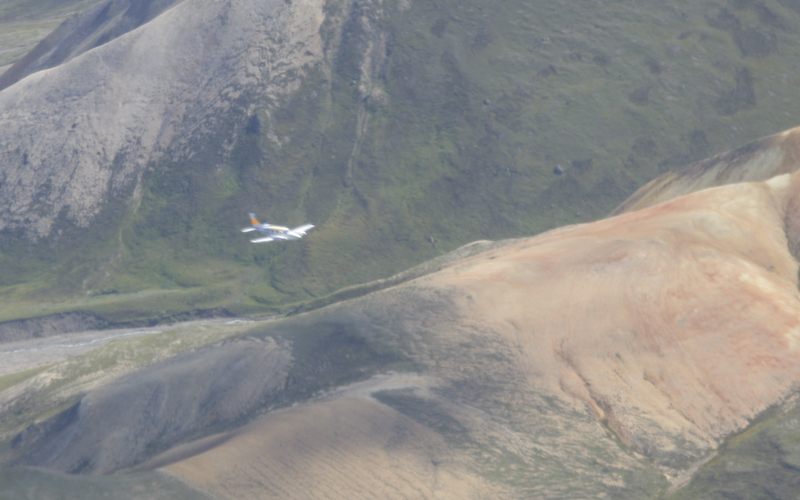
We had an overflight from another sightseeing flight.
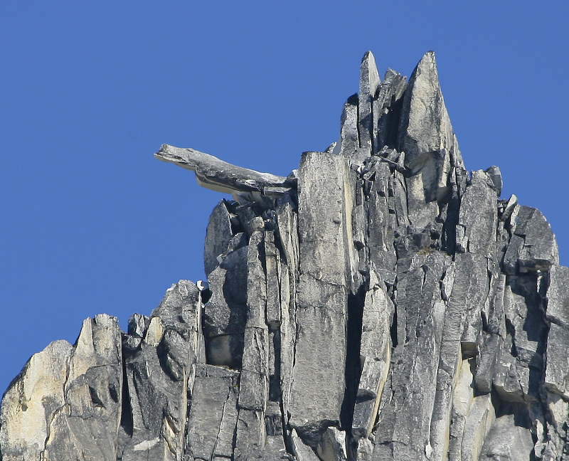
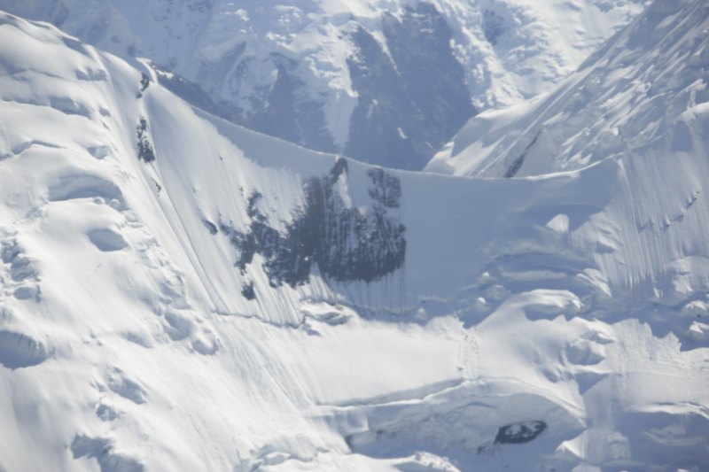
This large rock flake was poised to tumble. Indeed, while on the glacier, we could hear both the ice cracking and rocks falling.
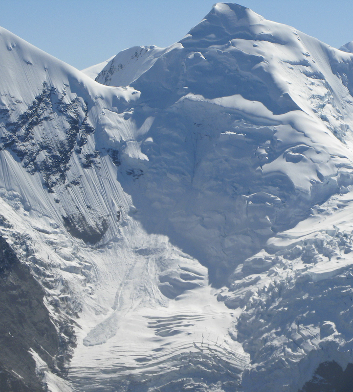
More groovy glaciers.
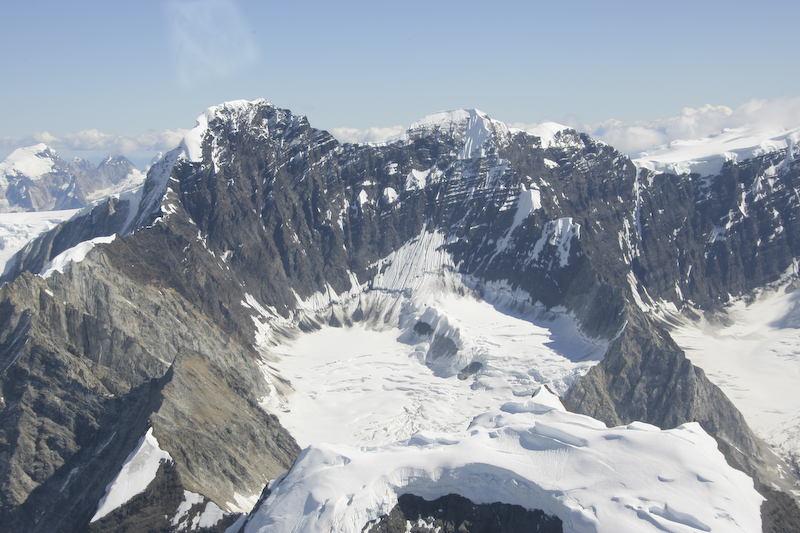
The upper peaks north of Denali had big basins that were filled with captive snow.
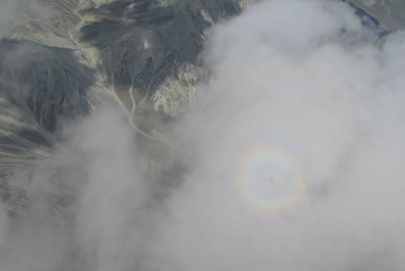
Kathleen captured this interesting circular rainbow with the shadow of our plane in the center. This was due to the action of the sunlight on the water vapor in the clouds.
Kathleen also caught this avalance in progress! Look at the lower left of the photo. Awesome.
An interesting ice flow. Very cool.
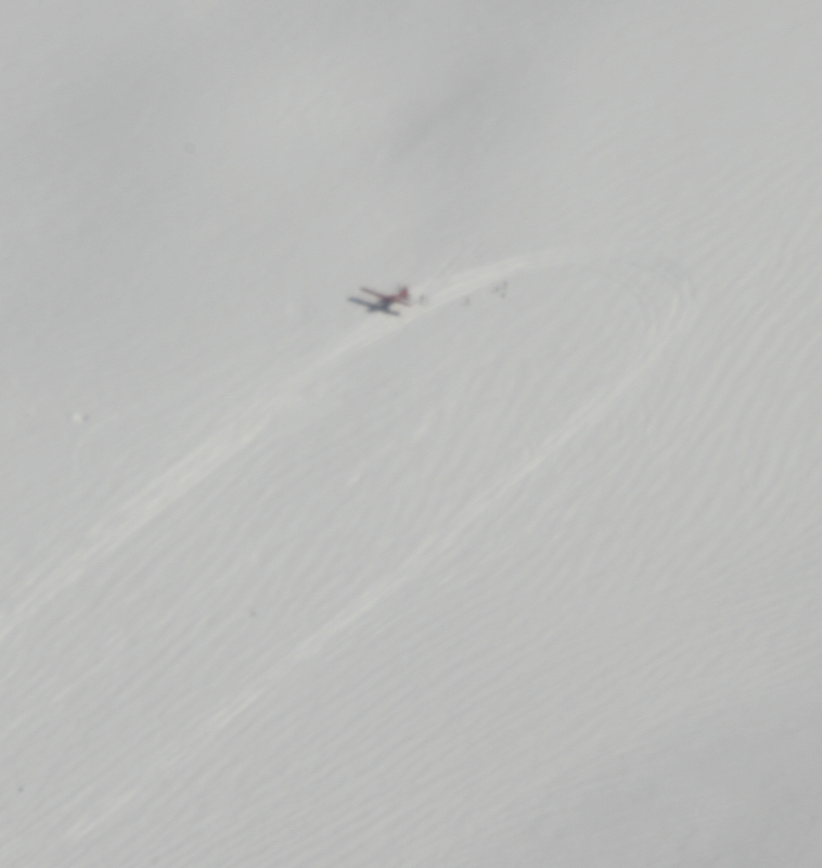
A shot of the supply plane on the glacier. This landing zone is the staging area for the climb up Denali.
Denali from the north.
A steep cornice.
Deep crevasses in this ice flow.
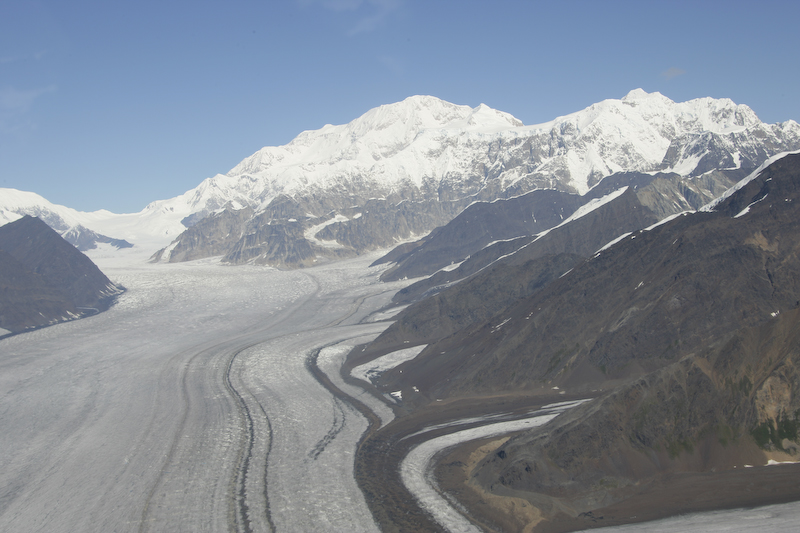
Another shot of Denali and one of the many glaciers on its flanks.
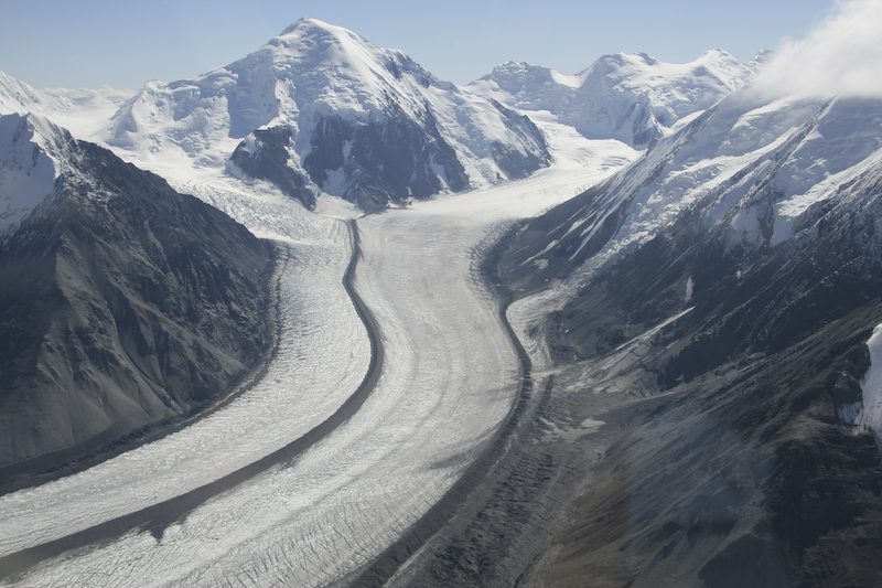
A big glacier with a well defined medial moraine.
Some of the sister peaks were big and steep.
This glacier is covered with dirt and gravel hiding the ice.
Oncoming traffic several thousand feet below us. We were cruising at 2050 meters altitude according to the altimeter in my watch.
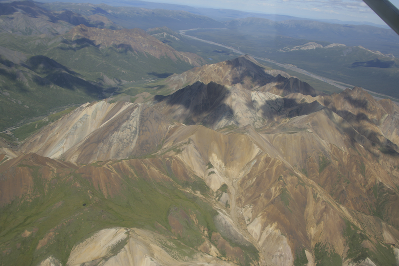
Cathedral Mountains to the west of Denali had great colors due to mineralization.
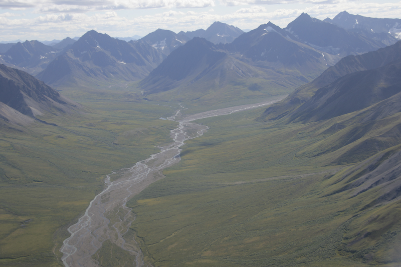
The lower valley areas all had the classical glacial braided stream structures.
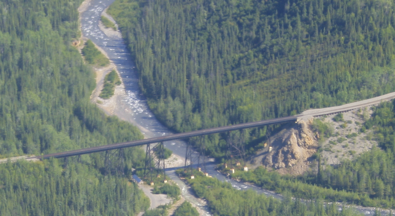
The train bridge over the Nenana River just south of Healy.
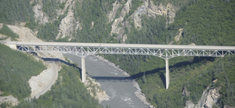
The highway bridge was newer, and just as awesome.
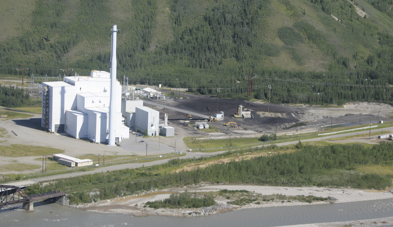
This coal fired power plant was visible on final approach to the Healy airstrip. There is a local coal mine and the pilot told us that the bulk of the coal is sold to Korea and is delivered to the port via the Alaska Railroad.
This was an awesome experience. While the flight was expensive at $300 a seat, there is really no substitute. The distances are just too large to allow hiking for equivalent views. Even the climbers are transported by plane before their ascent. If you are in the area, I strongly suggest taking this tour.
Back to the Road Trip Home Page