Trip Report: 20070922
We spent a great night at the Albuquerque Inn in "old town". We had a great dinner and prepared for the next day's travels. The plan was to leave Albuquerque and head north on US Highway 550 (aka "the Aztec Highway") to Durango, Colorado. Along the way, we were going to divert over to Chaco Canyon. While Chaco was generally on the way, the side route would take us over 40 miles of dirt road. The trip was worth it as Chaco has some great ruins and interesting sights. Once we finished at Chaco, we traversed the dirt road again and headed north to Durango.
The photos below are what we saw.
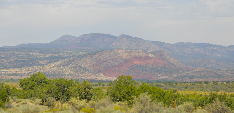
This is a view of one of the many uplifts that we saw on the highway from Albuquerque to Chaco. Note the bedding in the rock and the vivid red colors of the sandstone.
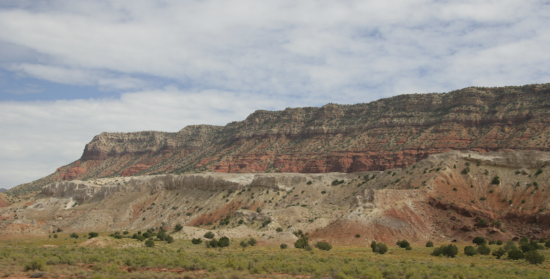
The cliffs along the highway were spectacular. Here, you can see the red cliffs with white cap rock and a durable white sandstone below the red layers.
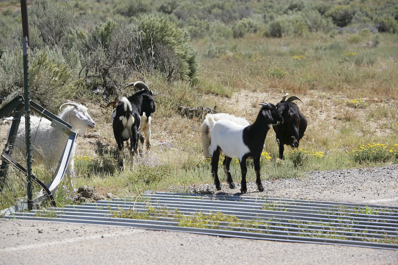
As we took the turnoff from the main highway to the road to Chaco, we spotted the goats grazing on the road side. The cattle guard keeps them on the correct side of the fence.
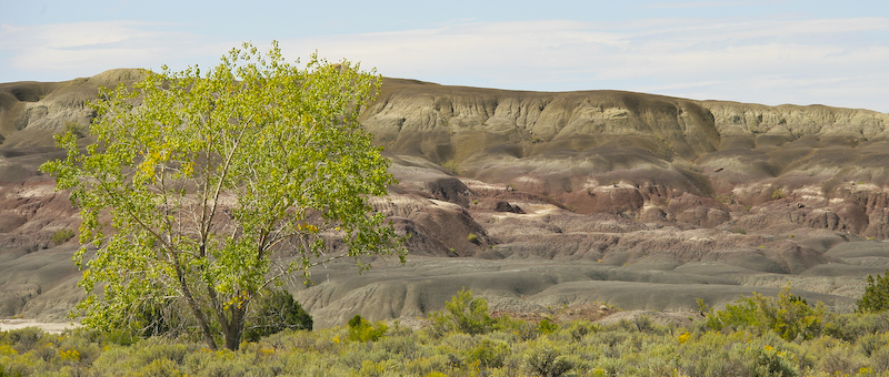
The hills near the main highway were gray and barren. Nearly devoid of any vegetation, these badlands generate huge runoffs in even light rains resulting in flash floods.

We passed this Chacoan structure on the outskirts of the park.
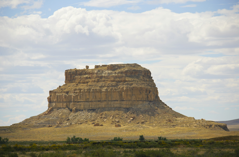
One of the prominent mesas visible from the Chaco visitor center.
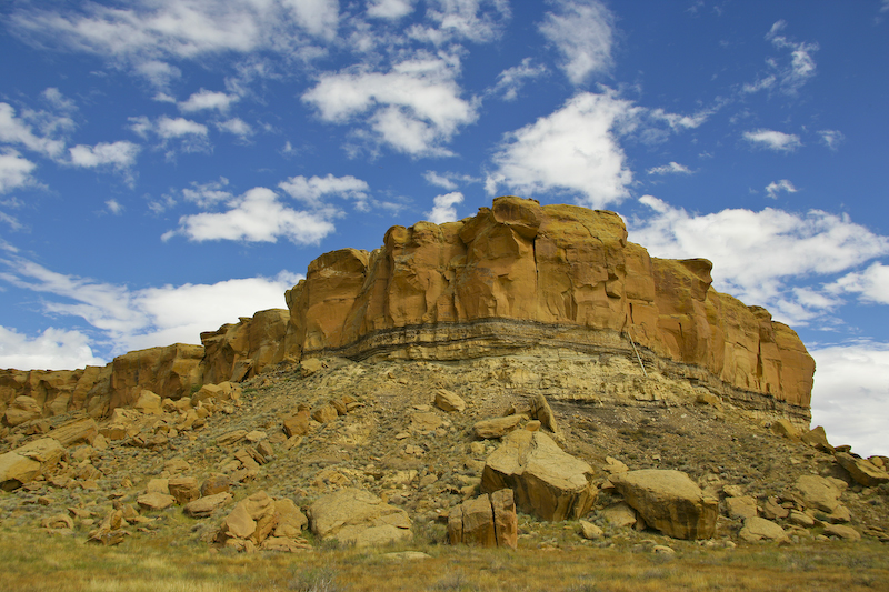
The mesa next to the visitor center is quite scenic. While not clearly visible to most visitors, the utilities for the center come in from the top of the mesa. Note the pipe descending the face of the mesa. I am guessing that it has electrical cables rather than water as there is water present in the bottom of the wash.
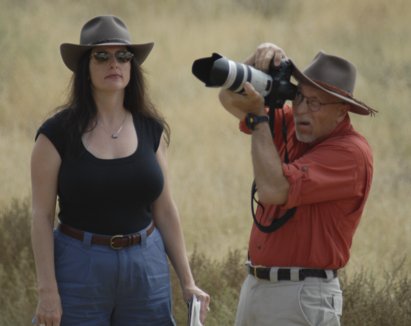
I was working hard for these photos with Kathleen supporting me. Here, I was shooting petroglyphs on the far mesa.
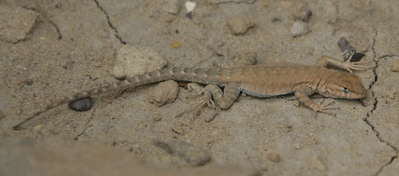
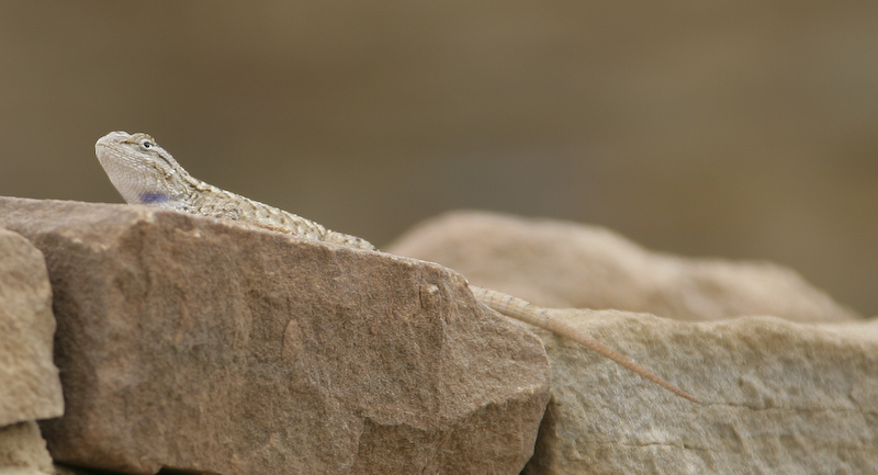
The place was alive with lizards. These came in several species, but I am not sure what kind this one is. When he saw us, he flattened into the rock.
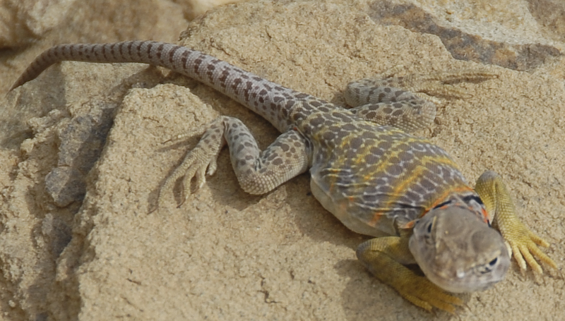
This lizard is different that the others, as he has bright yellow stripes and is much bigger. This may be a kind of chuckawalla.
The first ruin, Una Vida, was quite substantial. Note that the stones were very tightly packed next to one another.
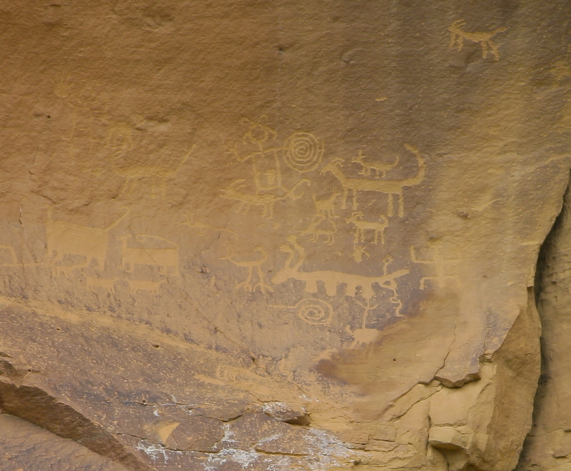
There were some nice petroglyphs way up on the cliff from the base of the ruins. This shot was taken at 300mm and cropped.
Note the windows and the window sills. The round holes in the wall were for timbers that supported the roof that has long since collapsed.
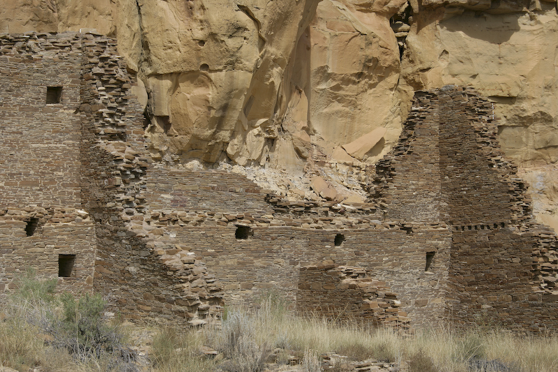
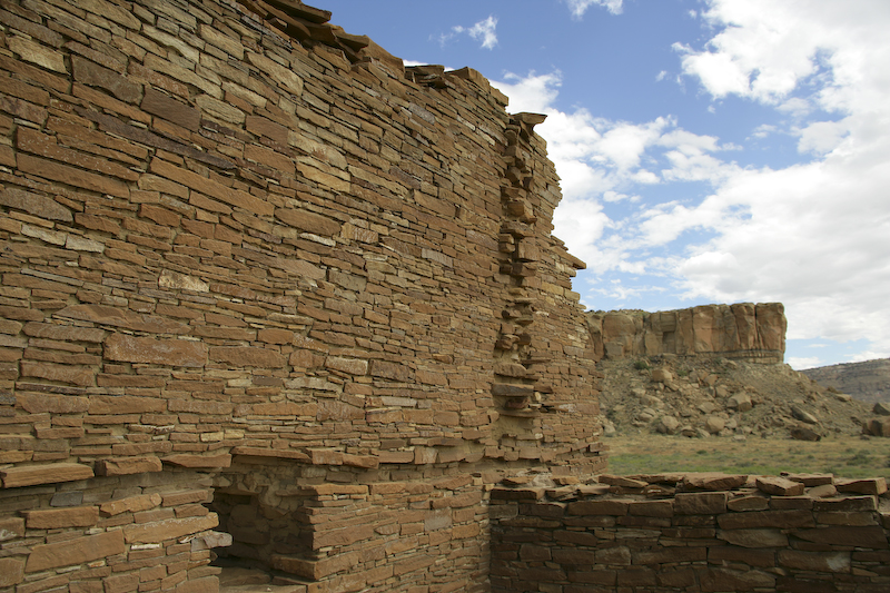
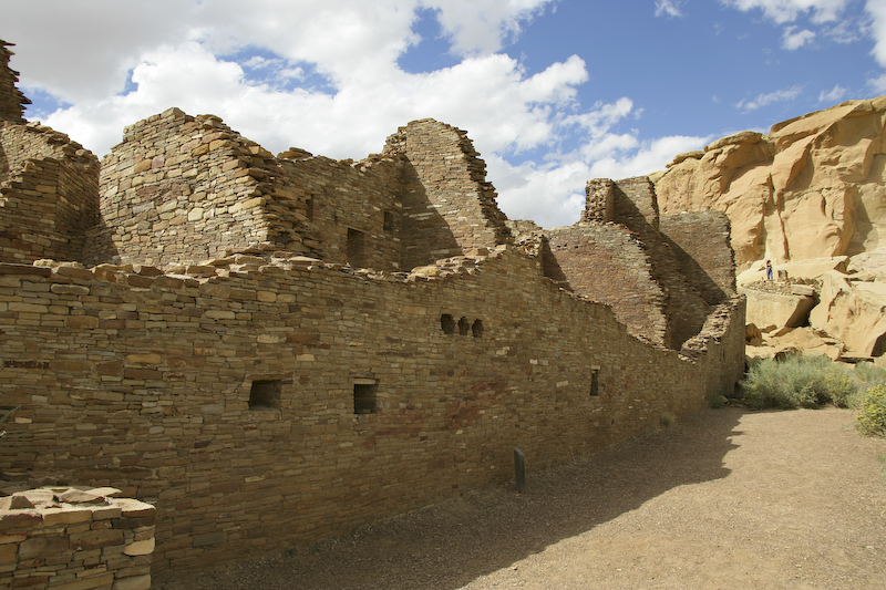
We moved on to the next set of ruins that were farther down the canyon from the visitor's center. These ruins were extensive and had both big walls and large kivas. This set of ruins is called Chetro Ketl.
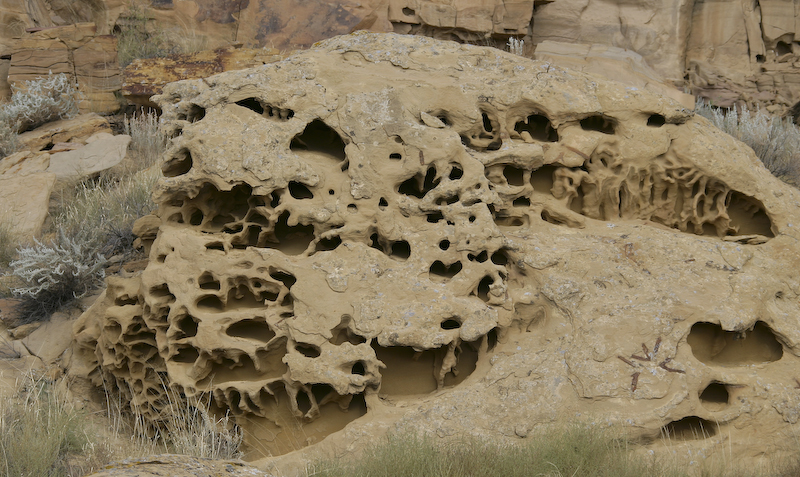
On the path to the ruins, I spotted these very cool wind caves.
Some of the many kivas at Chetro Ketl.
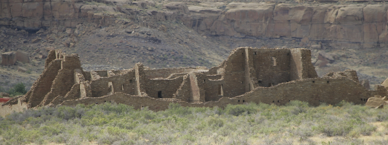
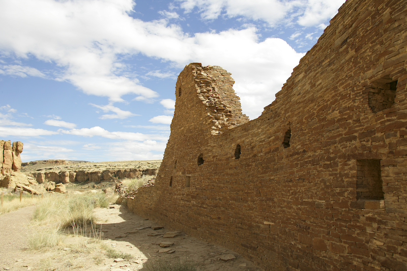
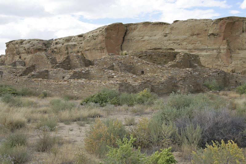
The largest ruin in Chaco is Pueblo Bonito. This view is taken from quite a distance but belies the scope of the ruin. This set of structures is huge.
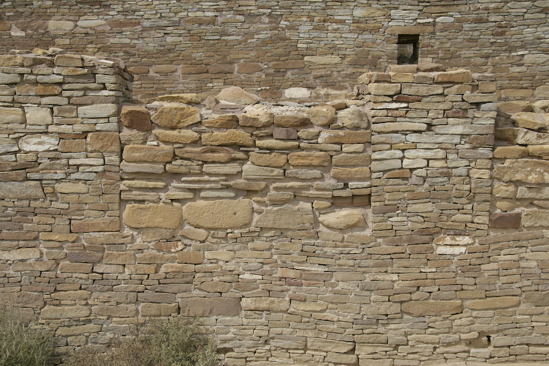
The masonry technique at Chaco underwent several generations. This represents the later style; note how the stones are closely fitted together.
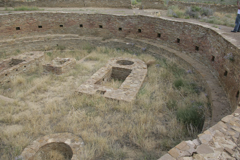
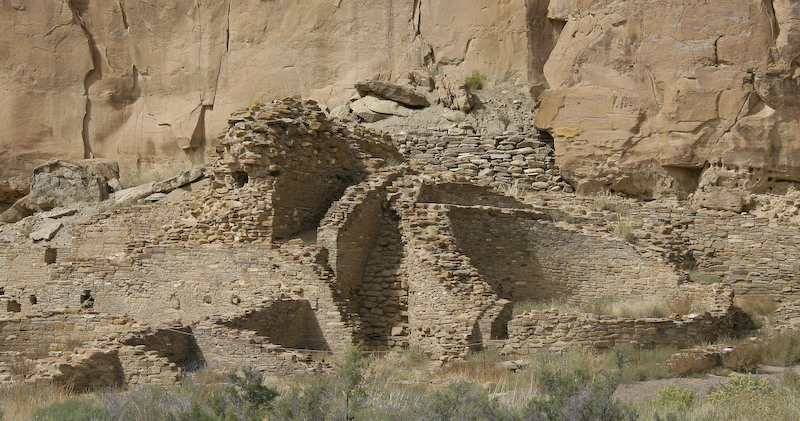
One of the largest kivas at Pueblo Bonito.
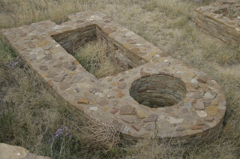
A detailed view of part of the kiva.
More of Pueblo Bonito.
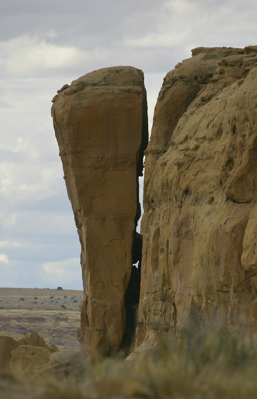
There was a large flake of rock that was separating from the cliff above Pueblo Bonito. While this may not actually fall in my lifetime, there was a flake that fell in 1941 and nearly crushed the biggest part of Pueblo Bonito.
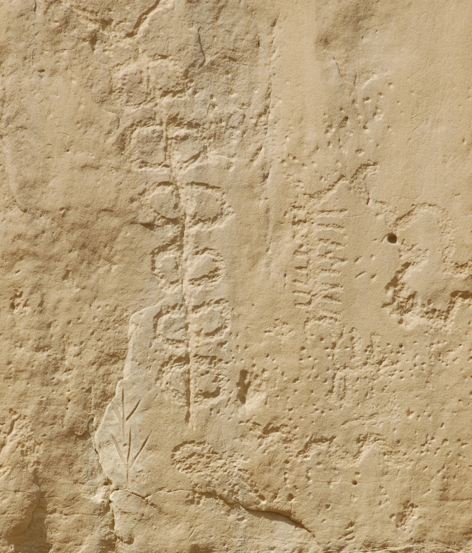
Along the cliff face, there were many petroglyphs. Note the straight line carvings on the left side. These are likely recent defacement of these petroglyphs.
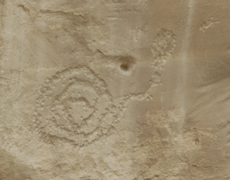
All of the petroglyphs in the Pueblo Bonito area were of the "pecking" variety where a sharp rock was used to chip the design into the cliff face.
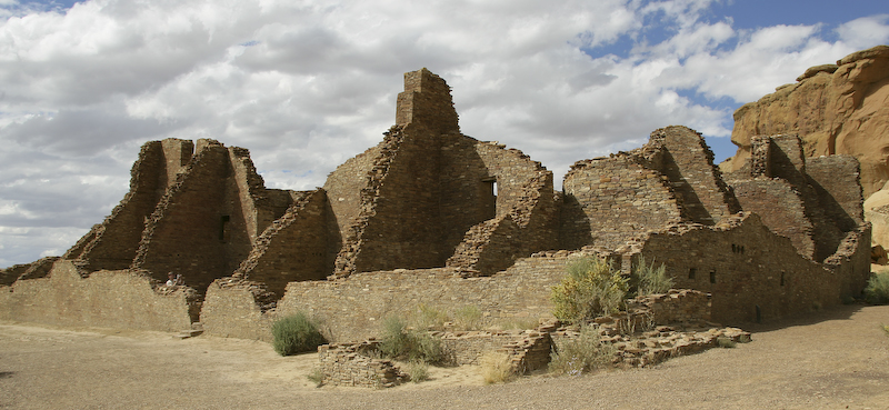
The main ruins at Pueblo Bonito are very impressive.
The walls in Bonito were in good shape as a result of restoration efforts.
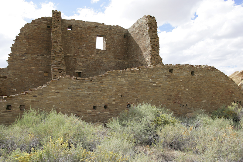
The walls were many stories high.
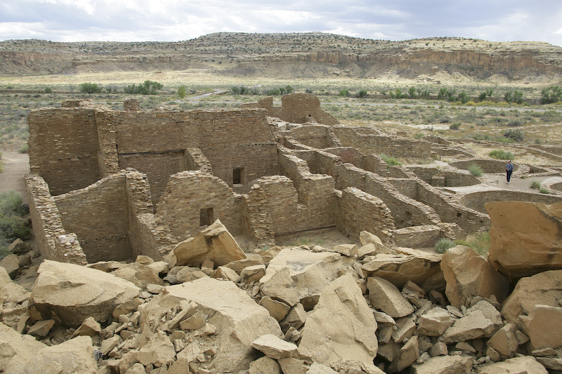
The debris in the foreground resulted from the collapse of the cliff in 1941. The fall nearly destroyed the entire ruin.
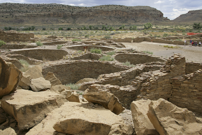
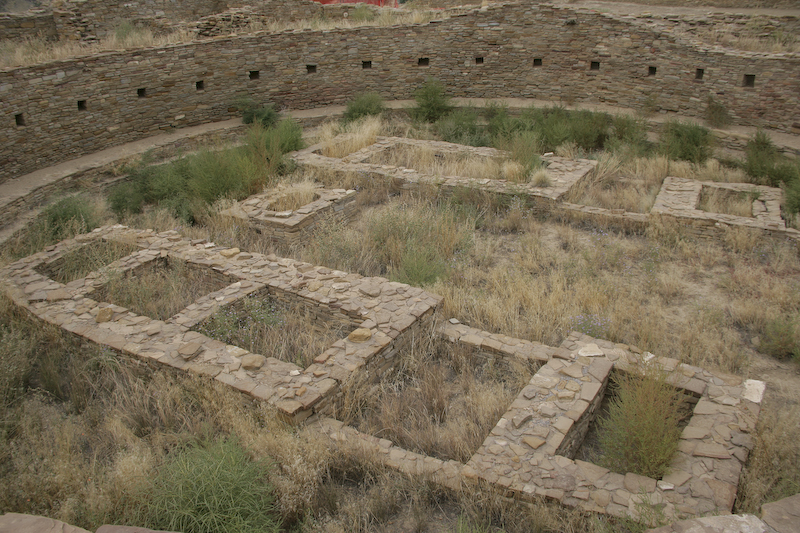
Pueblo Bonito has many open kivas which were used for religious ceremonies.
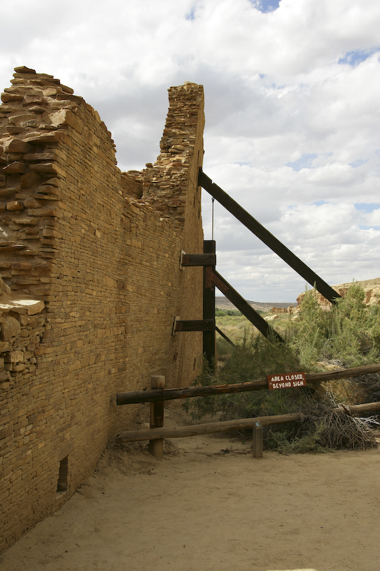
Several of the higher walls at Pueblo Bonito were in danger of collapse, so the NPS has shored them up to prevent further decay.
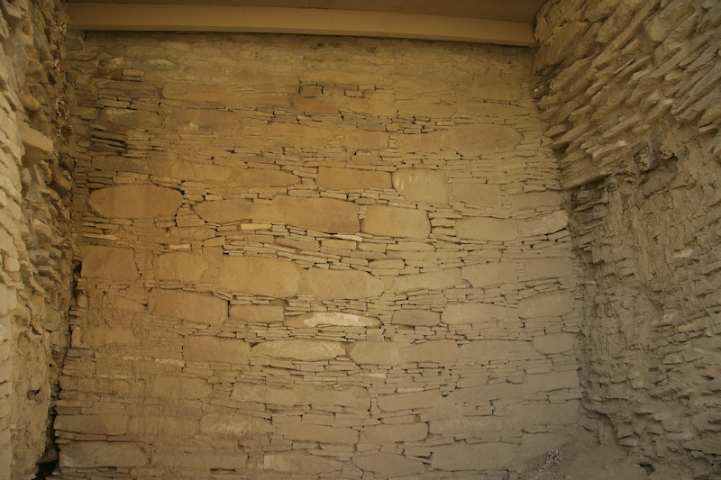
Note the intricate brick work. There are interlaced large and small stones in the walls.
The largest kivas at Pueblo Bonito were very impressive.
More of the local residents. This fellow was not afraid of us at all.
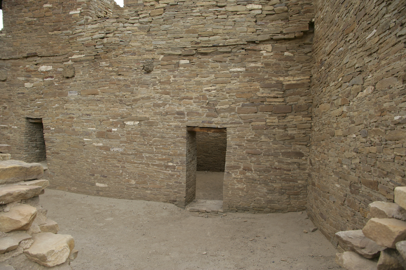
The walls and structures at Pueblo Bonito had intricate brick work that feature flat walls and vertical doorways.
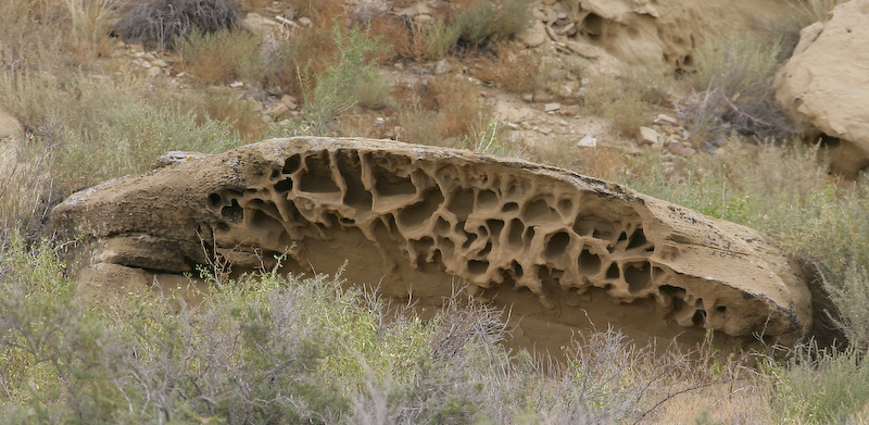
More intricate wind caves.
Despite being very out of the way, Chaco Canyon was well worth the trip. If I were to go again, I would allocate time to go to Pueblo Pintado as well.
Durango and Silverton Narrow Gauge Railroad
Back to the Road Trip Home Page