Trip Report: 20070927
I had heard about the Great Sand Dunes that were outside of Alamosa many years ago but never had a chance to go there. Since we were already in Alamosa, a visit to the park was a must. They were really awesome. After seeing the high dunes of the Altar I could really appreciate the dunes themselves.
The photos below are what we saw.
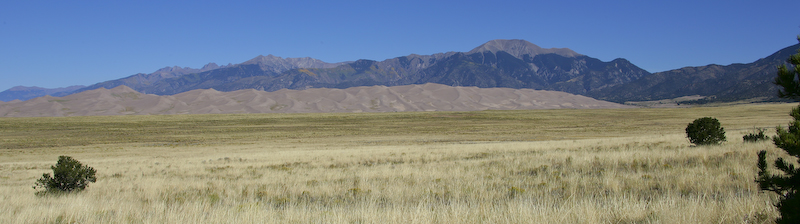
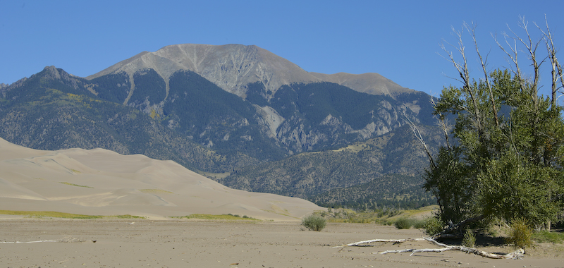
Our first view of the dunes was from south. In the background is the 14,000 foot Kit Carson Peak that is part of the Sangre de Christo range to the east of Alamosa.
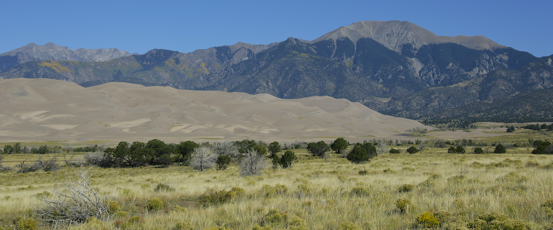
From the visitor's center, the dunes were clearer. The peaks in the background are a bit smaller that Kit Carson and are about 13,000 feet.
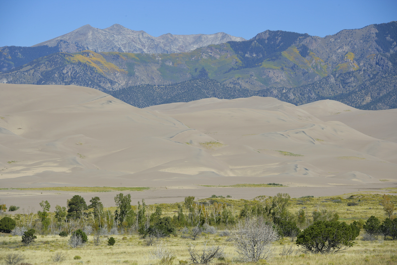
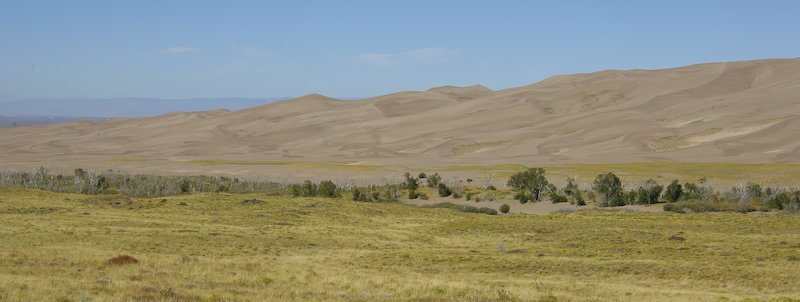
The fall colors of aspens high on the Sangre de Christo are visible over the sand dunes.
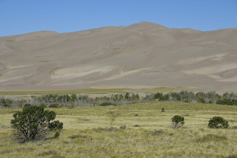
Grasslands are visible at the foot of the dunes.
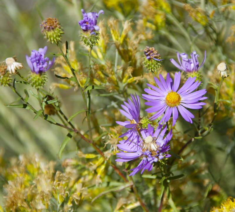
Despite it being well into fall, there were still small flowers blooming.
A view of the northern end of the Great Sand Dunes.
The peak in the distance is over 13,000 feet. The elevation of the foot of the dunes is just under 8,000 feet.
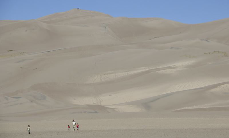
This photo gives a sense of scale of the dunes. Note the people in the foreground. Also note the small spots on the top of the dunes -- these are also people. The dunes are about 700 feet high.
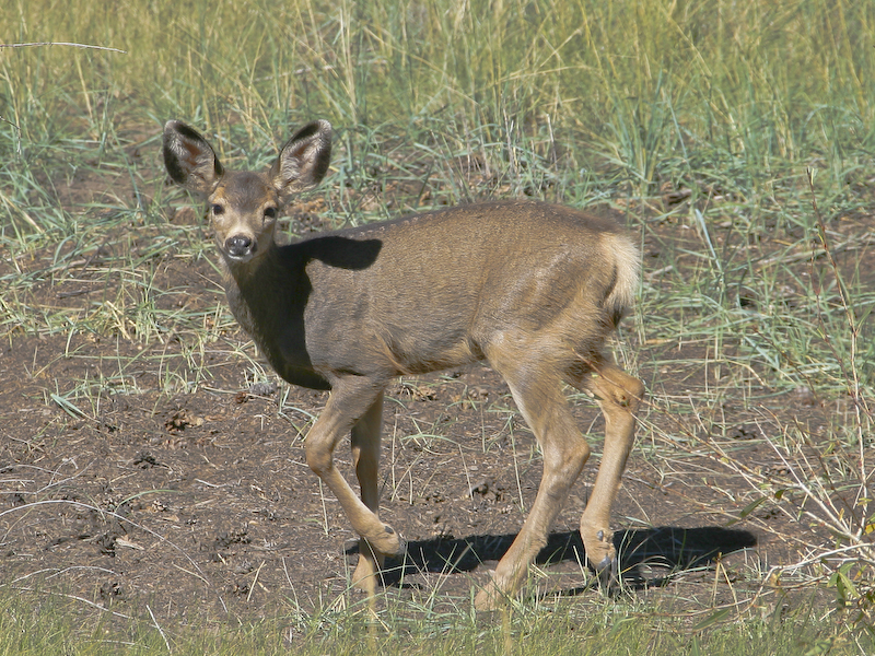
We passed this mule dear doe on the way out of the park. She was in no hurry and was actually part of a herd of 3 deer.
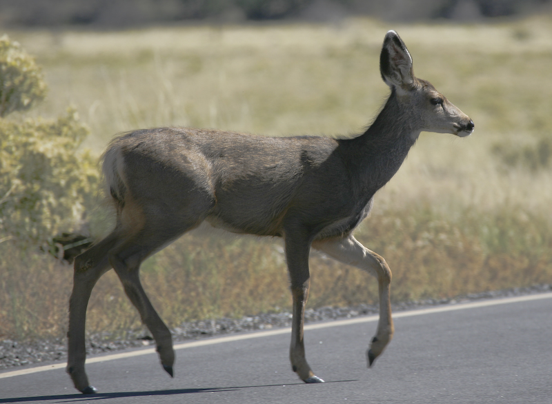
This doe is in pretty good shape, but the other 2 were pretty skinny and had ribs showing through.
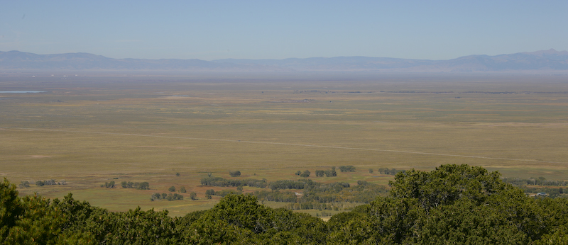
A view of the great expanse of the San Luis Valley to the west of the Great Sand Dunes. Visible in the distance are the San Juan Mountains.
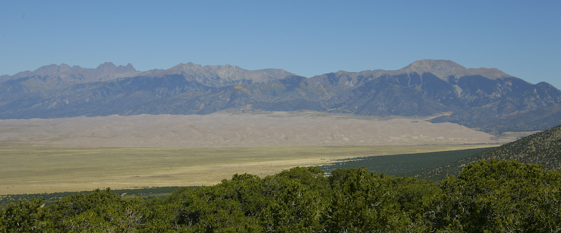
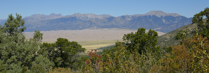
Since it was close by, we decided to check out Zapata Falls on the west flanks of Blanca Peak (14,000 feet). En route to the falls, we got a great view of the sand dunes from about 8500 feet elevation. Kit Carson Peak, also over 14,000 feet is on the left of the photo.
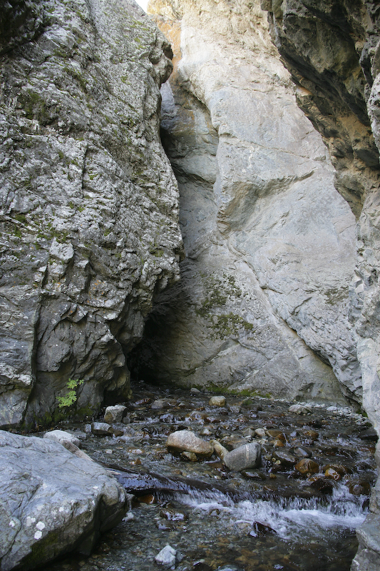
We had to hike in about 1/2 a mile to get to the falls. But, to actually see the falls, you had to be prepared to get both wet and cold. You have to hike through the water and I was not willing to do that. So, this is the best that I could do given the circumstances. The falls are only about 30 yards upstream through the crevice.
A parting shot of the sand dunes and the north end of the Sangre de Christo range on our way down from Zapata Falls. When we finished at Zapata, we headed over Wolf Creek Pass and on to Pagosa Springs.
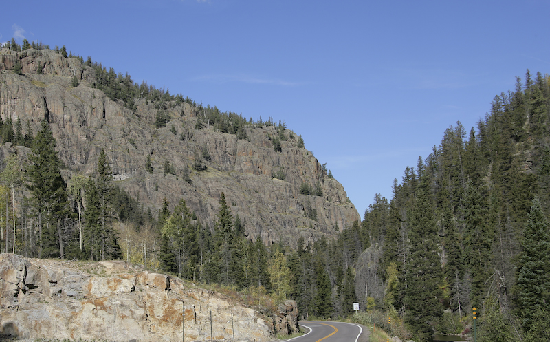
Nice cliffs with the Rio Grande river on the right just to the east of Wolf Creek Pass.
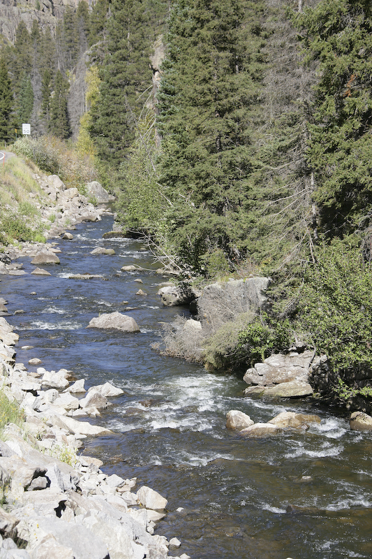
The mighty Rio Grande before it becomes mighty. This is just downslope from Wolf Creek Pass and on the Atlantic side of the continental divide.
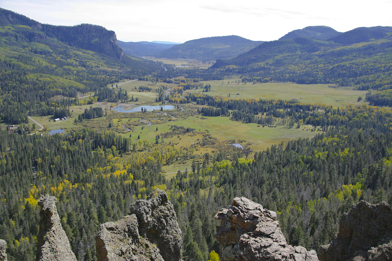
On the western downslope side of Wolf Creek, we stopped at an overlook point and got this great view of the valley below to the south west.
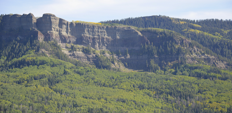
Cliffs to the southeast as visible from the overlook point.
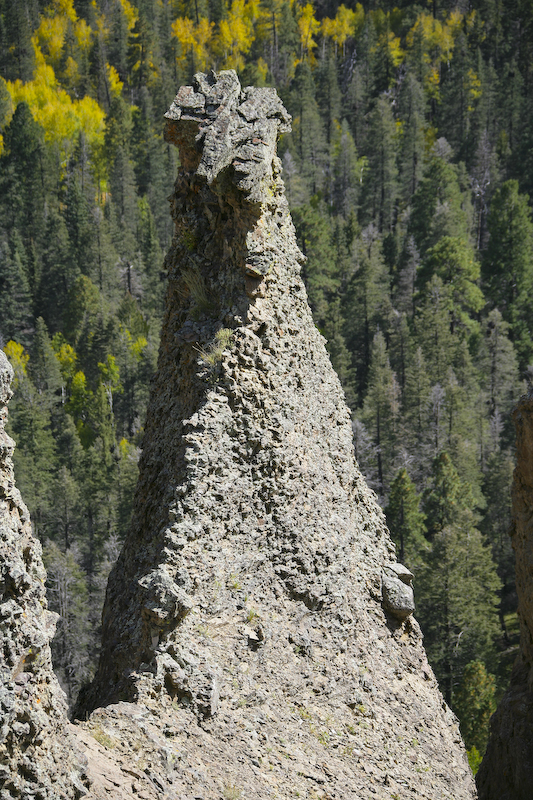
These hoodoos were visible from the overlook point.
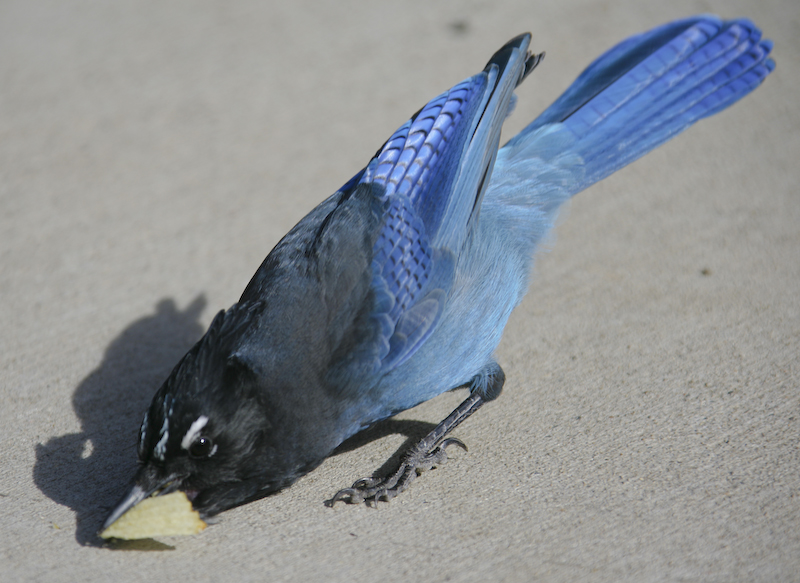
One sure way to attract animals in with junk food. This blue jay seems to like the Ruffles. Nice bright colors, but boy was he fast. I was lucky to get this shot and only got it because the camera is fast.
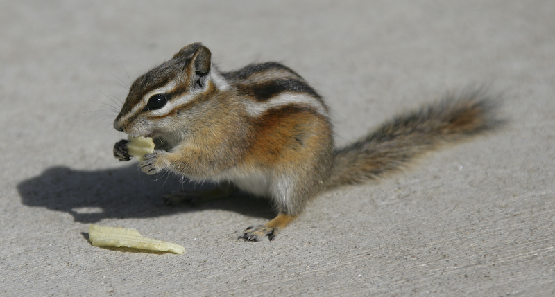
This fellow was chowing down on the chips. He loaded up his cheek pouches and then came back for more. But, he held still long enough to get a clear shot.
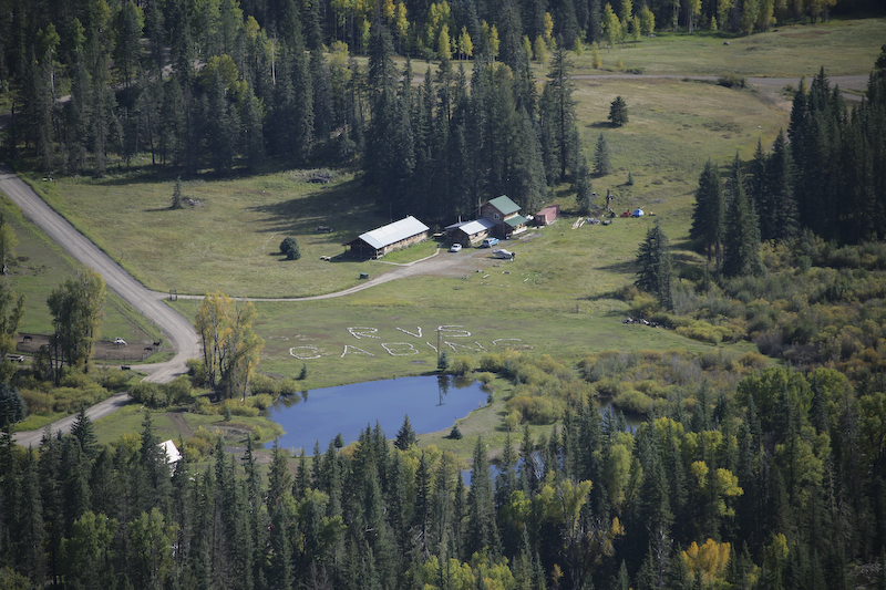
We were looking over the valley from the overlook point on the downslope of Wolf Creek Pass and saw this sign. Clearly, the owner knew folks would be looking as the signage is only visible from the overlook.
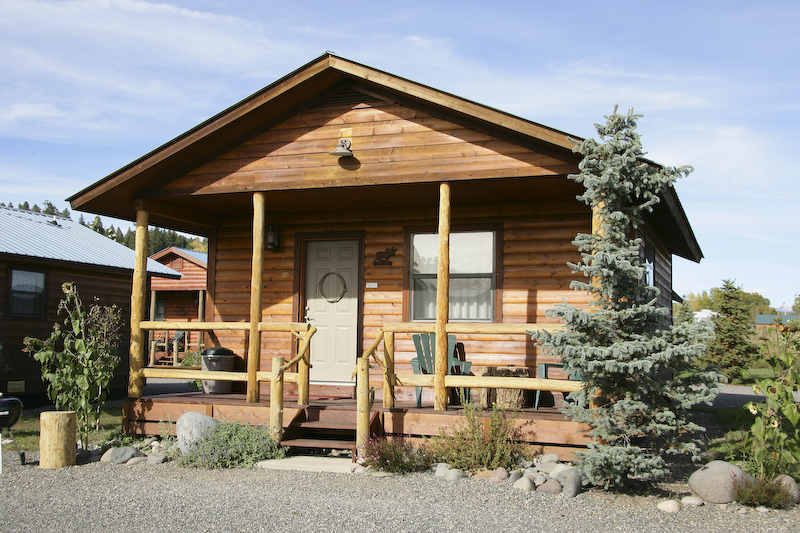
These were the Fireside Cabins that we rented that were on the banks of the San Juan river.
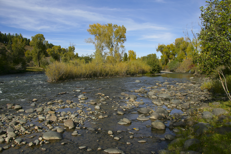
This is the headwaters of the San Juan river on the upstream side of Pagosa Springs.
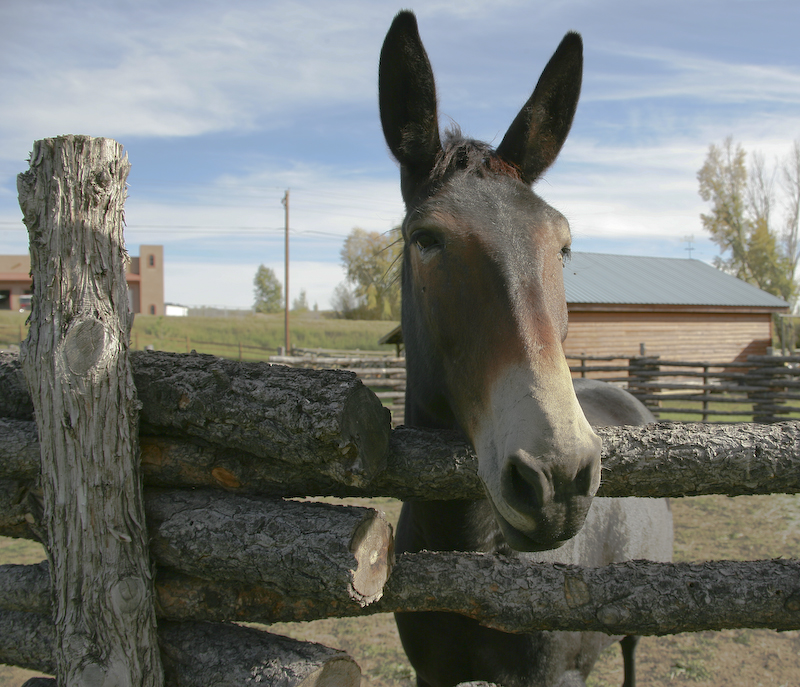
This pack mule was jones'n for some attention. He must have known that I was a horse person and came right over to me.
This was a cool drive. The Great Sand Dunes were awesome and well worth a visit. And, the drive over Wolf Creek Pass was very enjoyable (given that there was no snow). Tomorrow, we would head south to Chama, NM and a ride on the Cumbres and Toltec steam train.
Chama and the Cumbres and Toltec Railroad
Back to the Road Trip Home Page