Patrick Kennedy and his wife Jamie offered up their driveway for us to stay the night in Los Alamos so we gladly accepted. The four of us went to dinner at a restaurant in Espanola that had regional foods and it was great. The next morning we did some museum sightseeing in Los Alamos and then headed south out of the Jemez mountains toward Cochiti Pueblo and Tent Rocks. We spent the night at Cochiti Lake and then headed back north into the Jemez and over to Fenton State Park. From Fenton, we went to the small town of El Rito and camped in the National Forest. The photos below are what we saw.
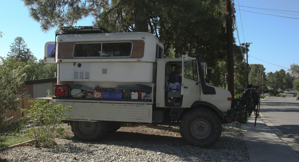
The driveway at Patrick's was just the ticket. The night was warm and we had plenty of moonlight to make things enjoyable.
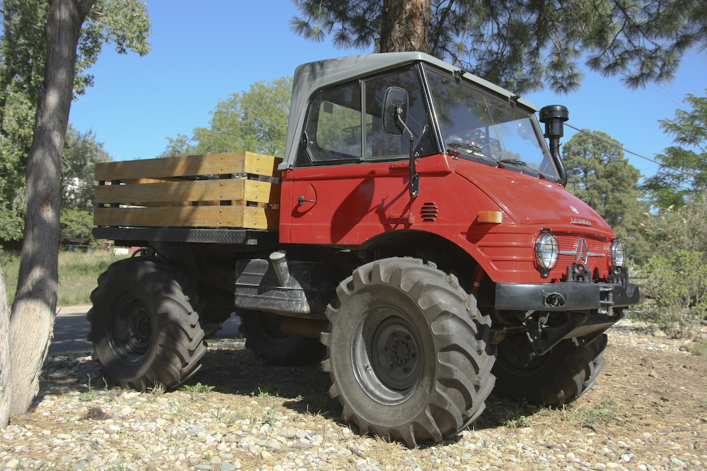
Patrick has a Case 406 that he has totally reworked including replacement of the cab and top.
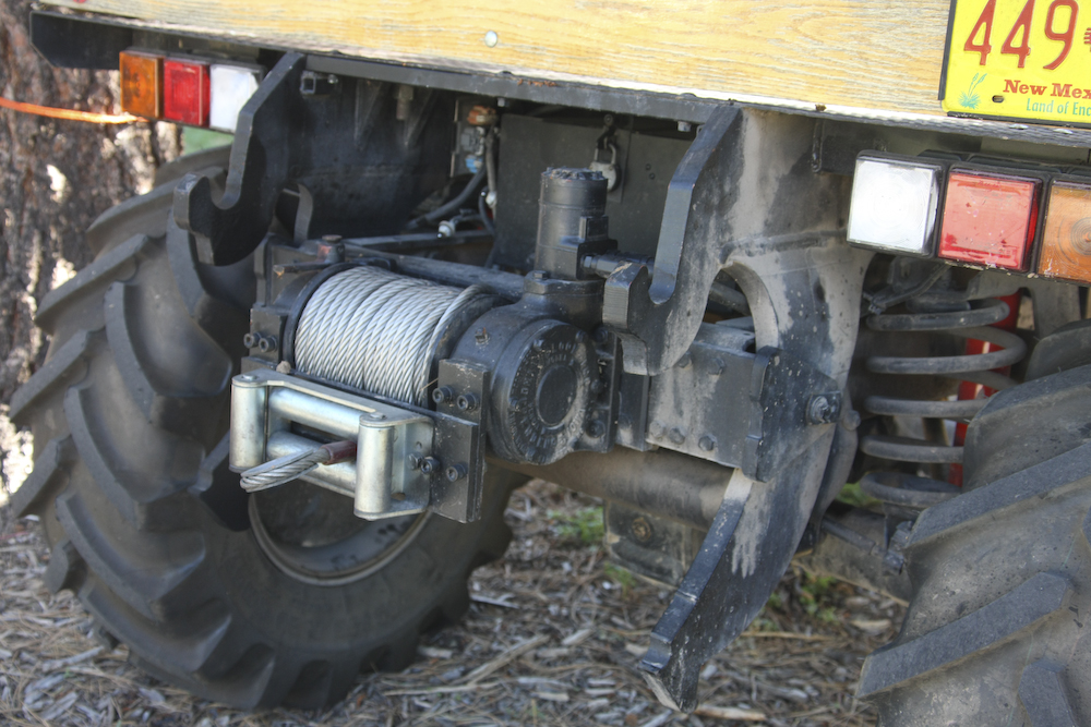
He added this winch but the large members are part of the Case original equipment.
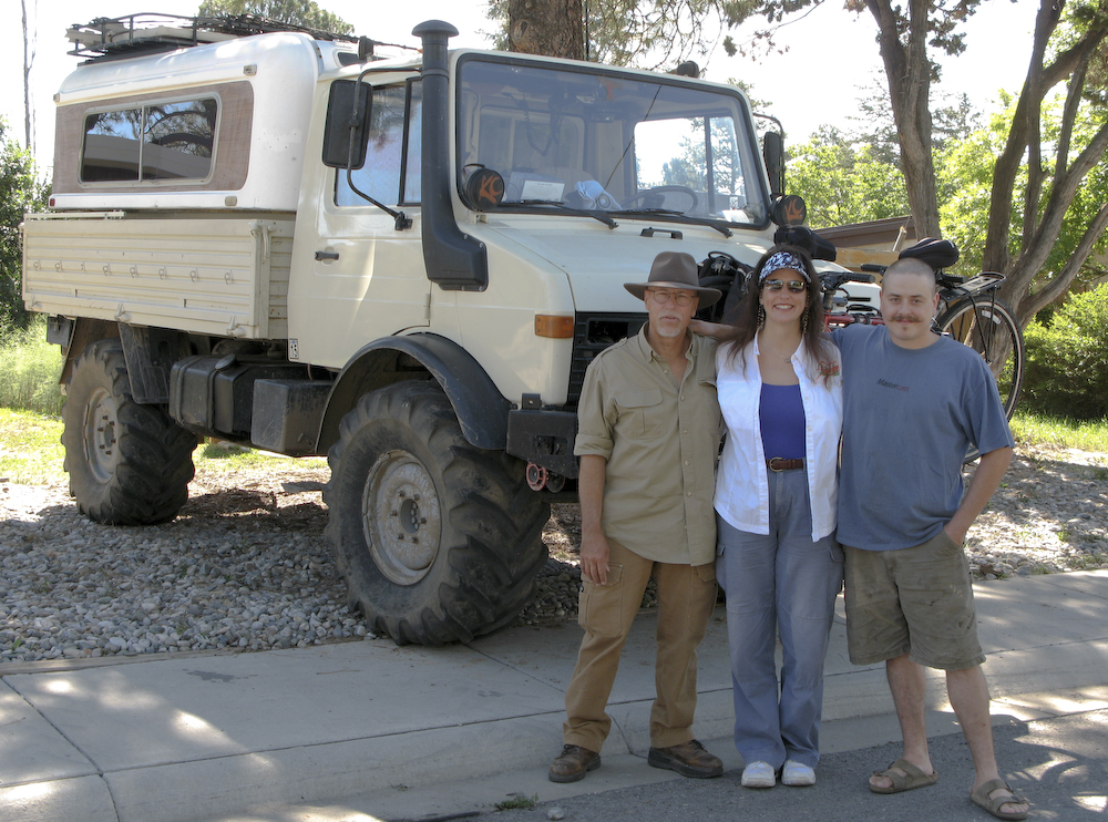
A shot of Bill, Kathleen and our host Patrick Kennedy taken by his wife Jamie. Once we finished at the Kennedy's, we headed to the Bradbury Science Museum in Los Alamos to learn about the history of the atomic bomb.
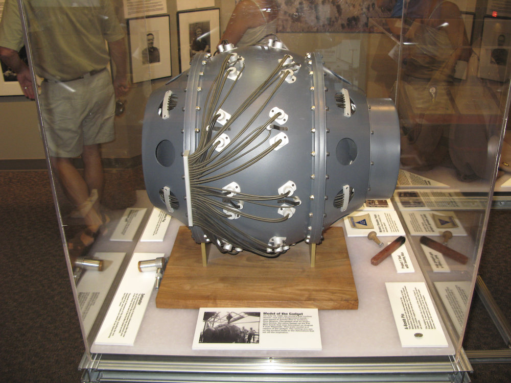
The Bradbury Museum is very nice and has many displays and multi-media presentations about Los Alamos and the history of the Manhattan Project. Above is a small scale model of the Trinity device that started it all.
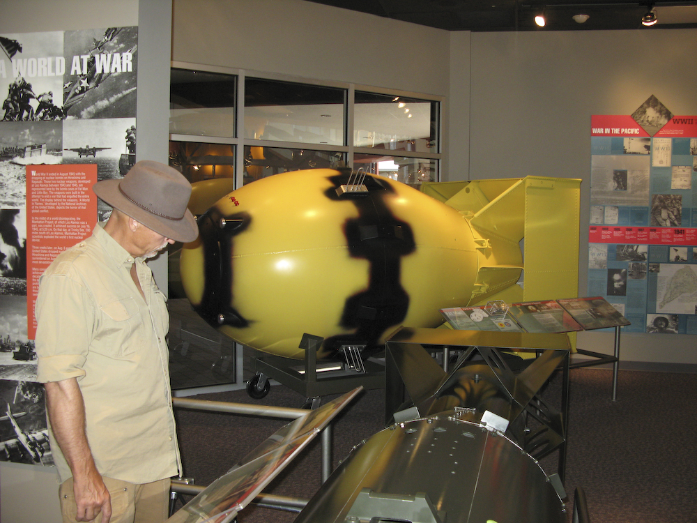
I am checking out the display with a full-scale model of the "Fat Man" device in the background.
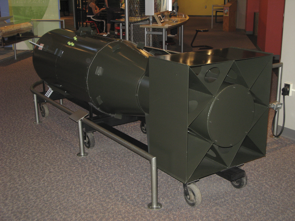
A scale model of the "Little Boy" device. Amazing to think that such a small device could cause so much destruction.
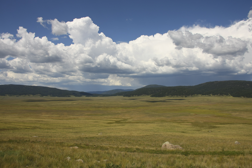
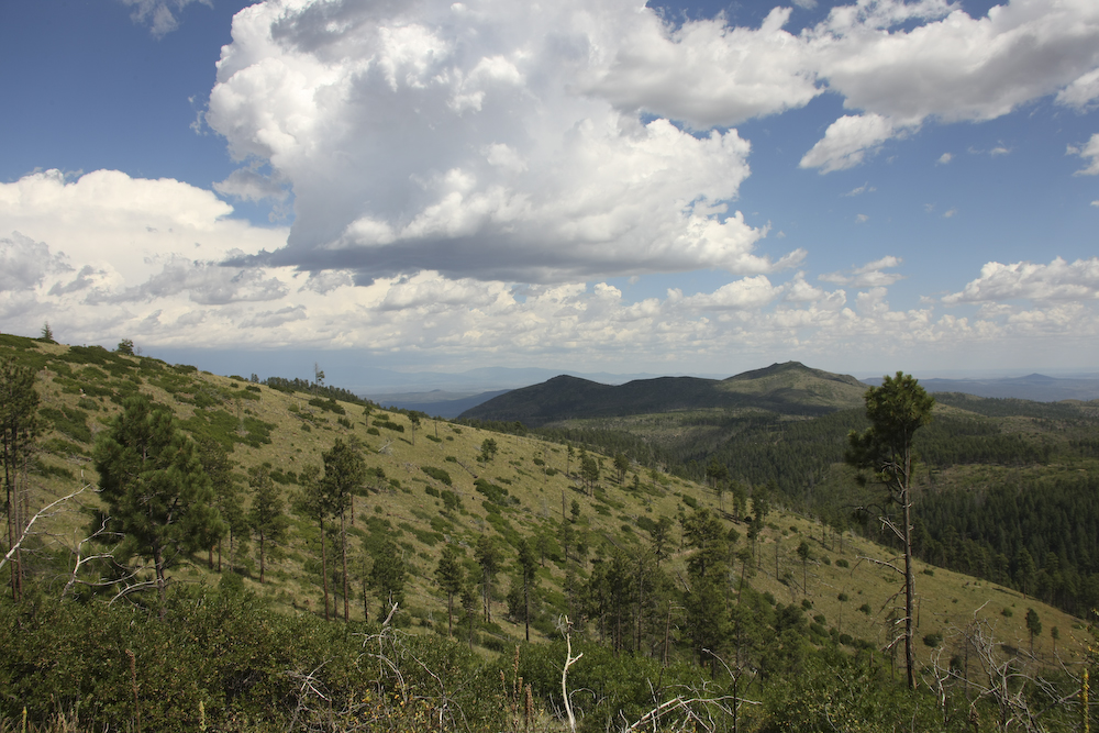
At Patrick's suggestion, we headed west from Los Alamos to the Valles Caldera National Preserve. This is the remnants of an old volcanic caldera that has turned into an awesome grazing area that supports a large herd of elk and many deer. Additionally, since it was part of an old Spanish land grant, they still run cattle in this area.
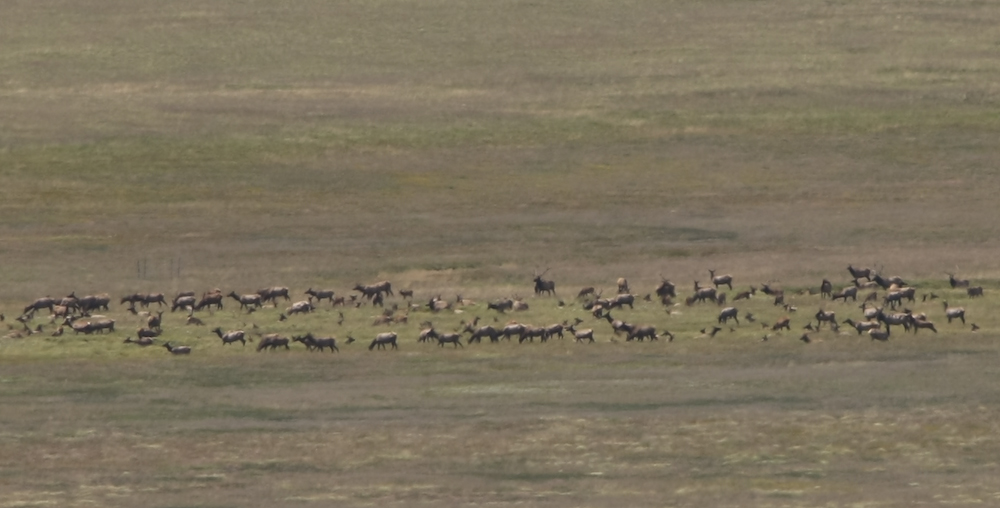
On the day we were there, there was a large herd of elk barely visible from the road. Above is a crop of a 300mm zoom. Note the large bull in the center of the photo. Usually, when I say "Gee, that is a big rack" I get slapped, but not this time.
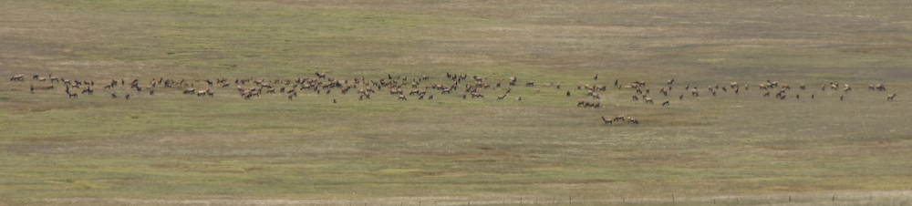
The scope of the herd is visible above.
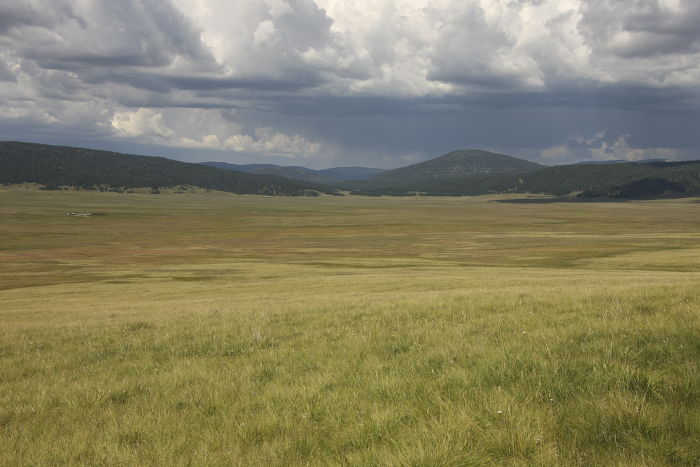
The storm clouds were brewing over the Jemez, so we decided to roll on.
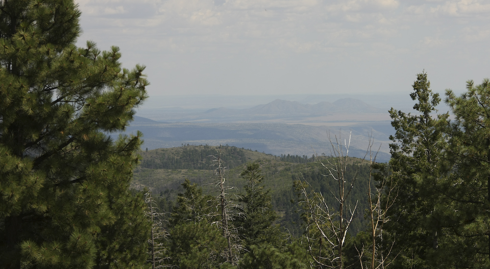
From Valles, we headed south on a Forest Road toward Cochiti. This was 30+ miles of easy dirt and had many great views of the nearby mountains and the Rio Grande Valley to the south.
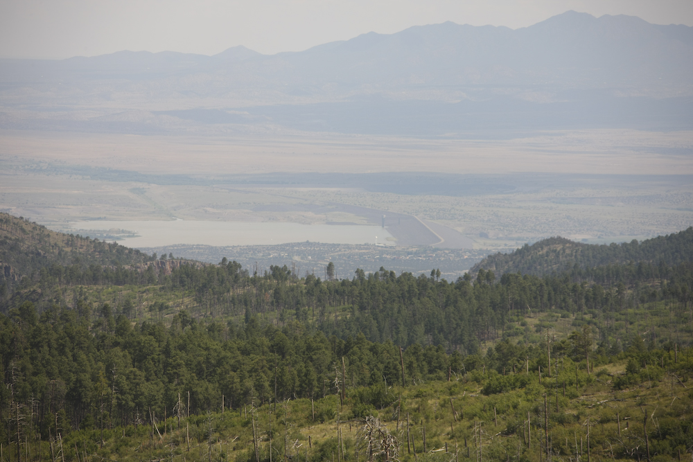
Further on, we hit a viewpoint that allowed us to see through the thick trees. Above is a view of Cochiti Lake on the Rio Grande as seen from high on the ridge. This is an earth-fill dam.
To the east, you could see the effects of the large fire that happened about 7 years ago.
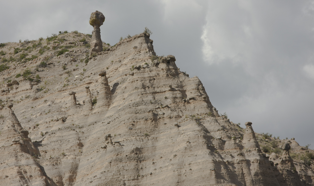
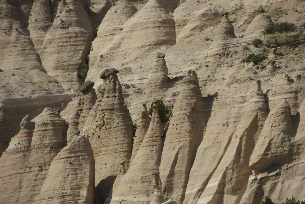
Our objective was Tent Rocks which is just to the west of Cochiti. These are hoodoos that are caused by hard caprock over a softer strata.
While not as impressive as the hoodoos in Bryce Canyon, they were still very cool.
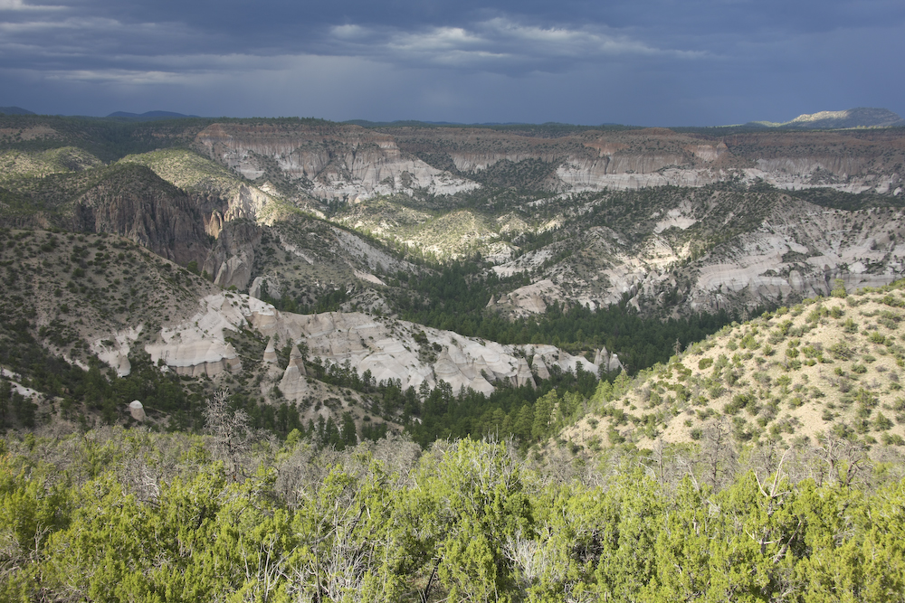
From the main area at Tent Rocks, we took the dirt road to the Veteran's Memorial overlook. The south flanks of the Jemez were highlighted by the broken sunlight.
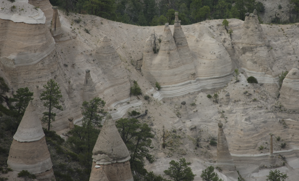
Note the thin hoodoo in the lower right of the photo.
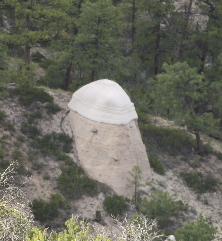
The differing hardness of the various strata produced interesting formation shapes.
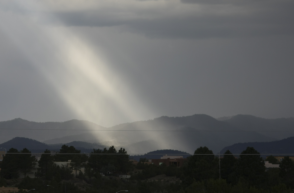
We were going to head back north into the Jemez to spend the night, but the weather was closing in on us. So, we decided to stay at Cochiti Lake. Just after we landed and set up, the skies opened up and it rained like hell for about an hour. After the storm broke, the sun peaked through the clouds briefly before raining some more.
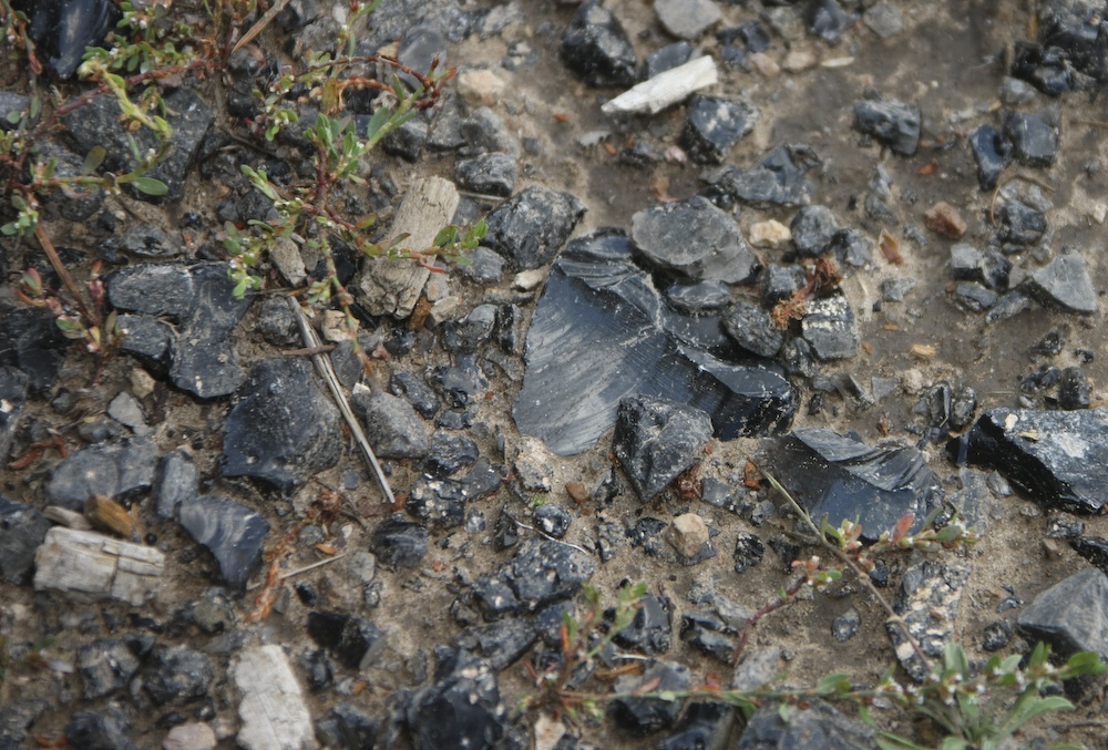
Next morning, we packed and headed back north into the Jemez. Along the way, we stopped for lunch and while we were stopped, I happened to glance down. The ground was covered in dark nuggets. At first I assumed it was charcoal from the burn some years earlier, but upon closer inspection it turned out it was obsidian from the Valles Caldera. The ground was covered in it.
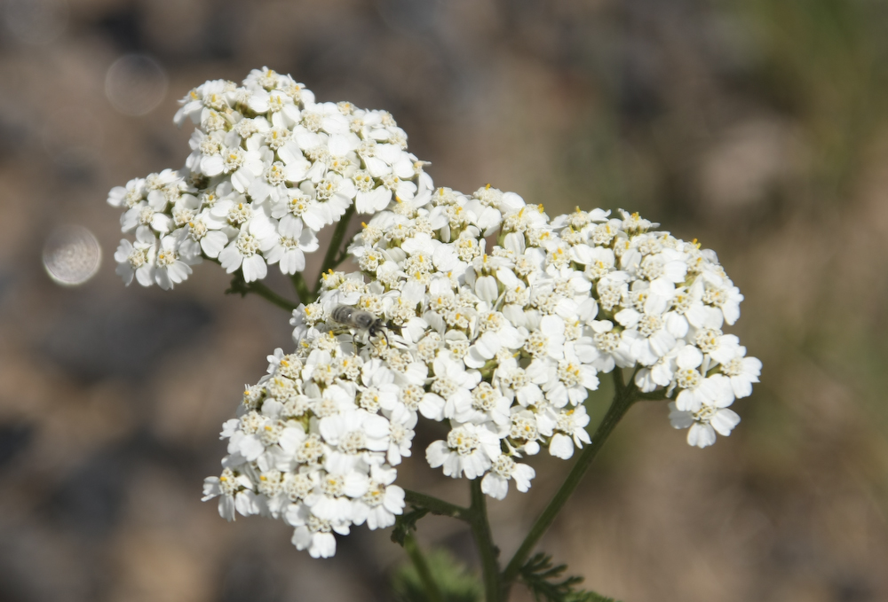
There were nice white flowers in bloom on the high mesas.
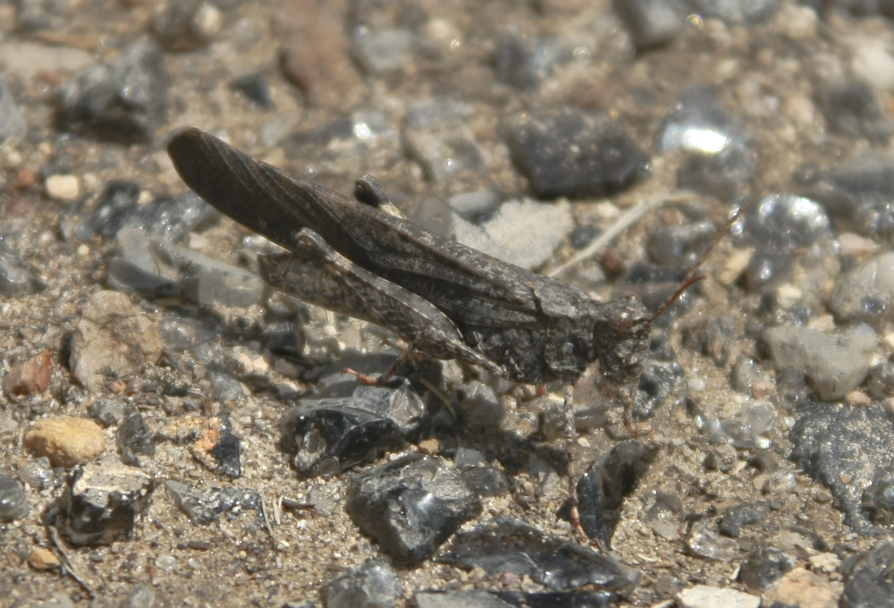
A spotted this grasshopper while we were eating lunch. The remarkable thing is how well he blends in with the background, including the patterns in the rocks.
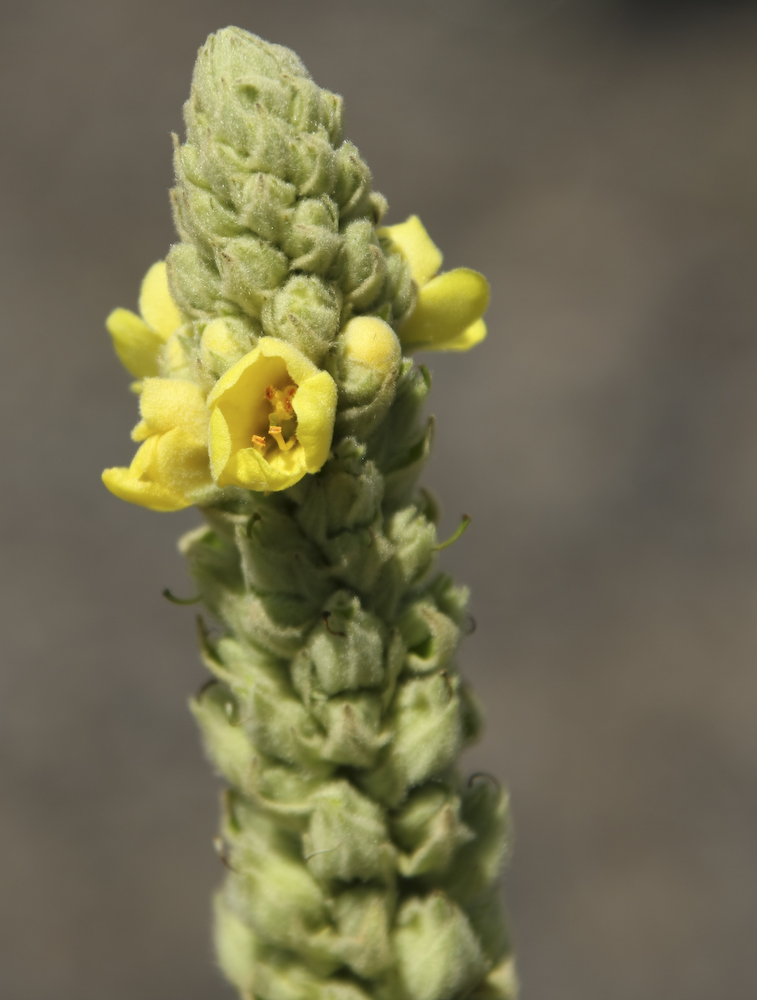
This plant, whose name I do not know, was deemed an "invasive species" as it was imported by man. It has become pervasive throughout the high country.
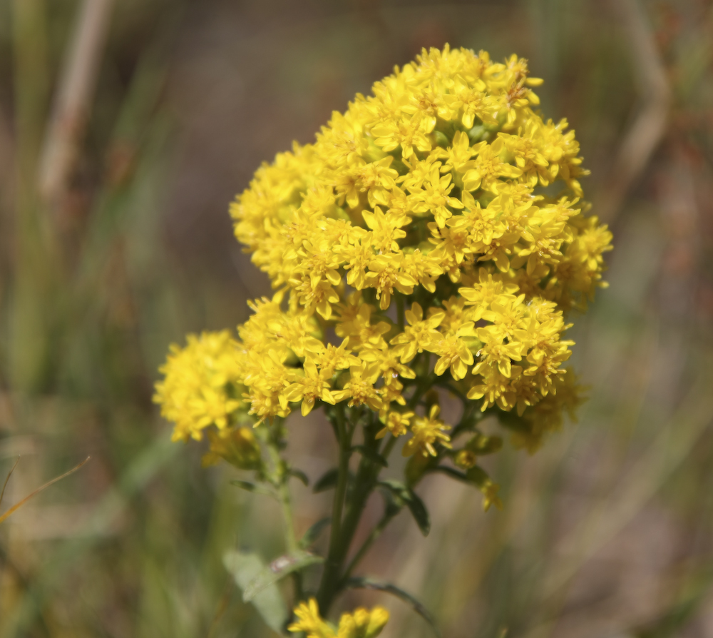
The yellow flowers were pervasive as well.
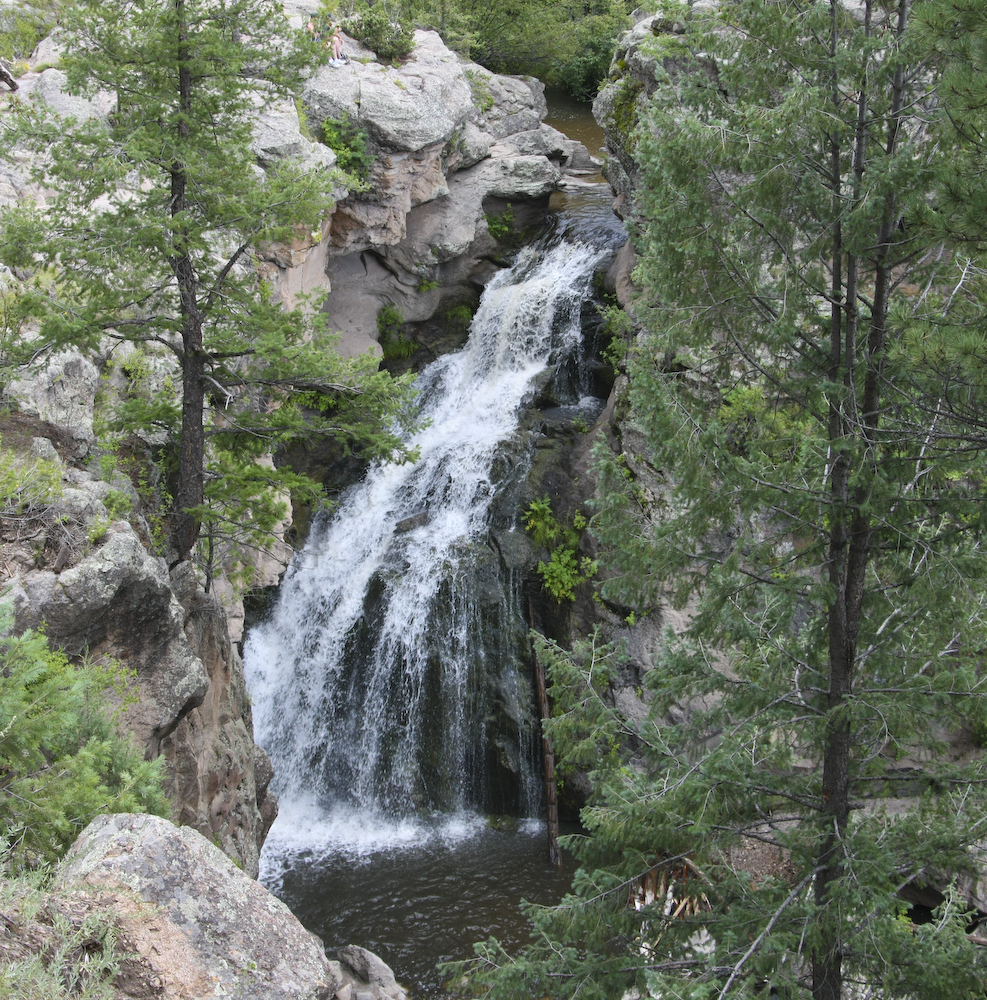
Once back into the high country of the Jemez range, we headed to Jemez Falls. The river is not large by eastern standards, but out west where water is scarce, anything that has persistent water is called a river.
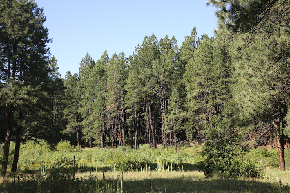
From Jemez Falls, we went to Fenton State Park in the high country. The place was not crowded and we got a nice spot next to this small meadow. Not surprisingly, it rained hard that night putting the chingas to our plans for an outside BBQ.
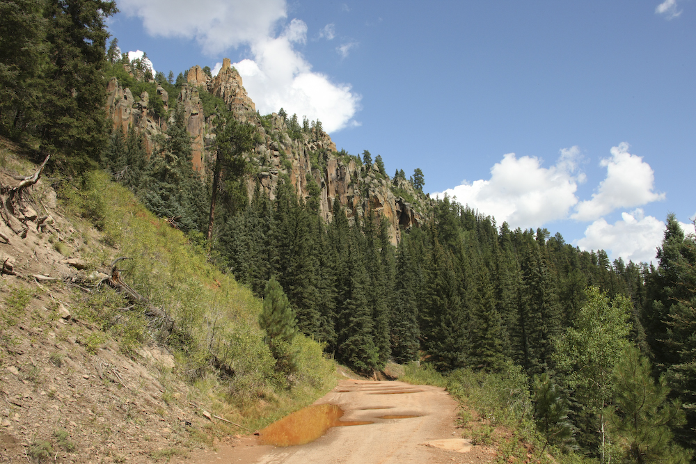
Next morning, the skies were more clear, but still partly cloudy. We broke camp at Fenton and decided to check out San Antonio Hot Springs. The road into the springs was quite rutted and required us to air down for comfortable travel. In the photo above, you can see the basalt cliffs along the road that were the result of the Valles Caldera event.
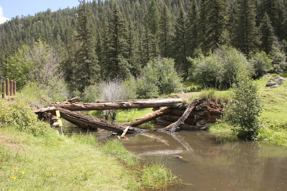
After quite a while, we finally got to the hot springs area. The springs are right next to a medium sized creek. The bridge that crosses the creek had collapsed some time ago, so we looked for another route across.
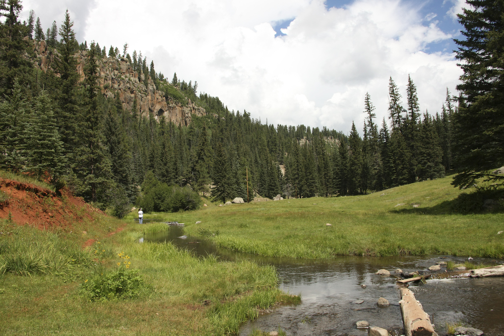
Next to the creek was a nice meadow. In the distance, you can see Kathleen checking out the sights.
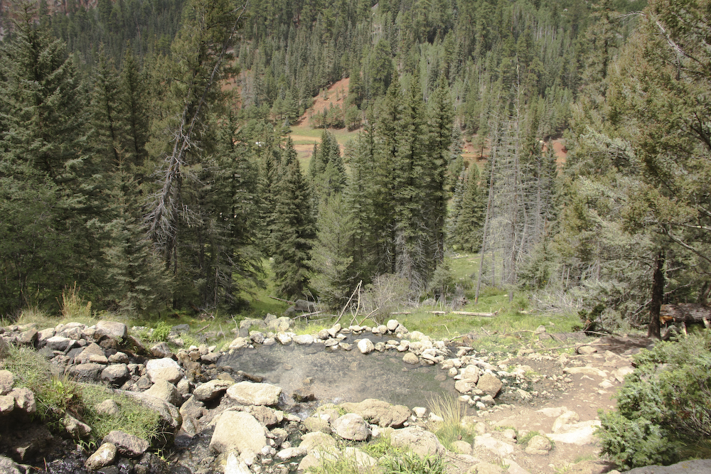
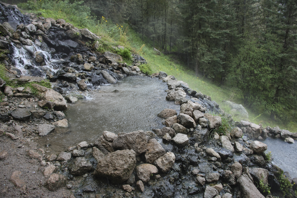
The hot springs were quite a ways up the side of the cliff, so we were both winded and sweaty when we got there. The water was about 105 degrees according to the bodies in the pool, so we stripped and joined them. It was wonderful.
In our infinite wisdom, we did not bring towels with us so we had to "air dry". Normally, that would have been a great solution, but the weather turned against us just as we got out. We scrambled to put on our clothes before they were soaked, only to have them be soaked after we put them on. We hiked back to the mog, and about half way down realized that we had left the windows to the truck down. Doh!! The good news was that the wind was not blowing strong and therefore the inside did not get very wet.
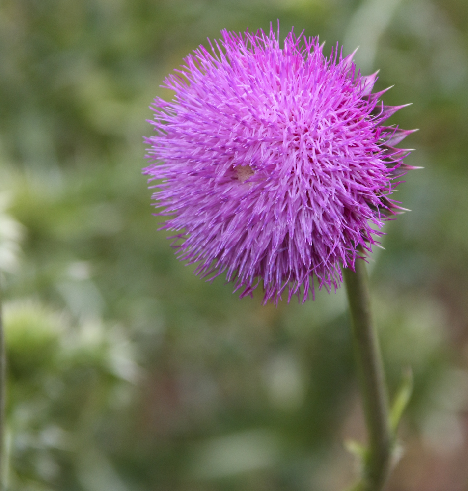
This thistle was near our parking spot and looked pretty good. From the Jemez, we headed back through Los Alamos and then north to a place called El Rito. We spotted it on the map and despite not knowing what was there, we decided to check it out.
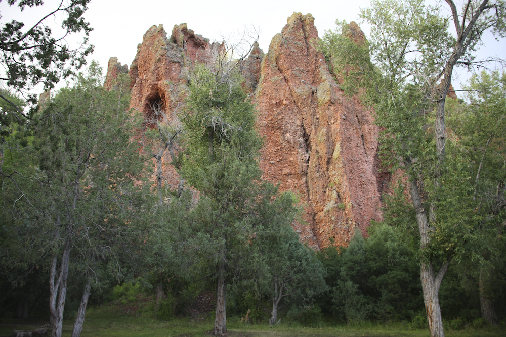
El Rito campsite was deserted so we had the place to ourselves. Our site was right next to a strong flowing stream and had a great view of these cliffs. Again, it rained about sundown, but our dinner plans called for cooking inside so it did not matter. After the rain quit we had a fire and then crashed for the night.
Next morning, we broke camp and headed to Taos, NM. We had reservations at a place that we discovered on our last trip to this area, a bed and breakfast called "Casa Benavides". And, as a final treat, we also had reservations at the only four-star restaurant in Taos, "Joseph's Tables".
| Previous Adventure | ||
Photos and Text Copyright Bill Caid 2008, all rights reserved.
For your enjoyment only, not for commercial use.