This segment of photos covers a number of days travel as we worked our way south from the Lava Flows near Terrace, BC to Vancouver, BC. We followed the highway, for the most part, but did a substantial off road excursion of perhaps 250 km that took us past Big Bar and into Lillooet, BC. From there, we followed the highway into Vancouver, BC Canada.
The photos below are what we saw.
We decided to head over to Prince Rupert (PR) on the Pacific Coast and the drive there was very scenic and went through some very large mountains between Terrace and PR.
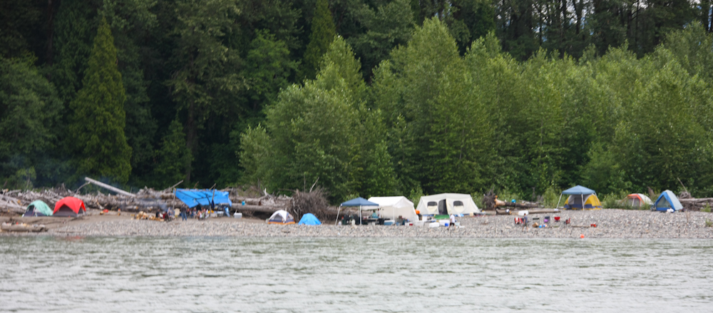
The fishing season was in full swing and just west of Terrace, we spotted huge numbers of fishermen camped on the river banks attempting to catch fish.
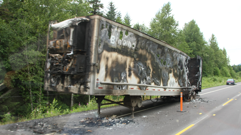
PR was a nice place and we stayed in a motel to shower and do laundry. We ate at the local sushi bar and it was excellent. They had all manner of fresh fish and the sushi chef was very happy to see us. It seems that the locals were not really sushi-literate and he rarely made any of the exotic dishes we requested. He was happy to provide. It was a bit pricey, but I felt that I got my money's worth. From PR, we headed back to Terrace (because that was the only path) and we passed this rig on the side of the road. He was blocking traffic, but there was no way around it until the heavy wreckers and trailer could be brought in to remove the carcass.
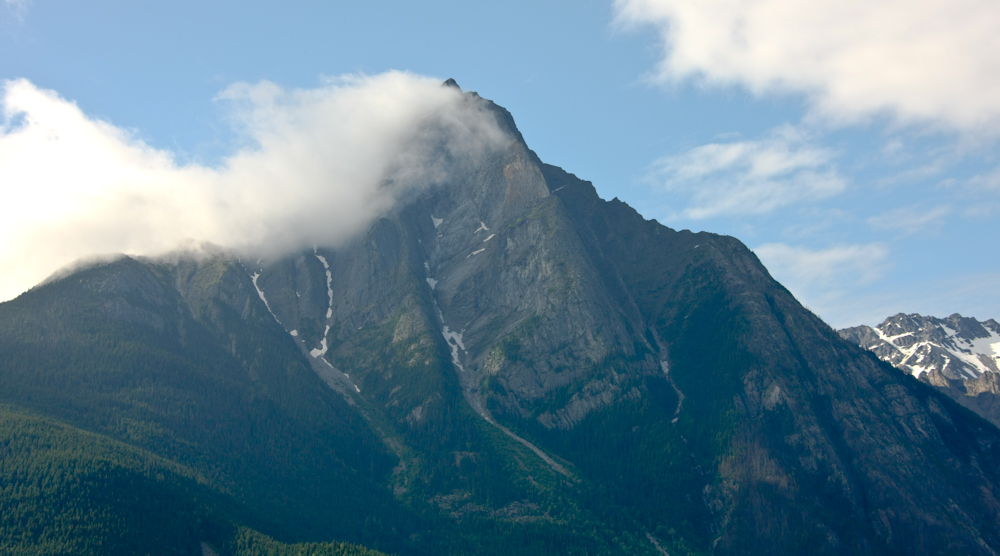
On our way south, we passed nice peaks that were high enough to generate their own weather.
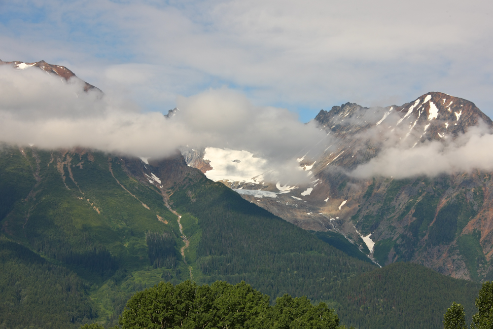
One nice portion of the highway provided great views of the nearby mountains. The mountains above are just north of Smithers, BC.
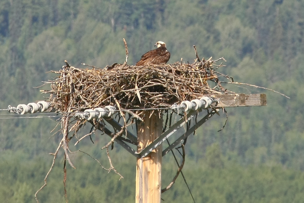
While out of the truck taking the previous photo, I noticed an osprey nest on a nearby power pole. These fellows hunt fish and build nests with small logs.
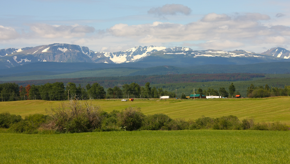
Further south, we were treated to nice rolling hills that were covered in hay.
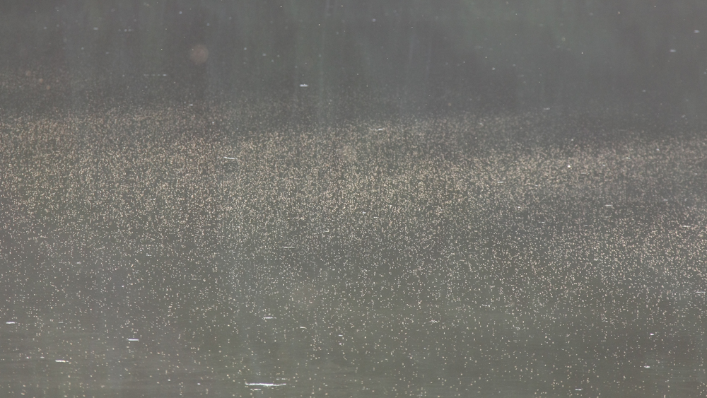
We continued south almost to Prince George and decided upon a road-side camp site. The site was next to a small lake and was about 1/2 km away. Kathleen spotted it so we decided to take it. After setting up the camper, I took the photo above. These white dots are a massive swarm of mosquitoes over the lake next to our camp site!! Except for this "minor inconvenience", it was a nice place.
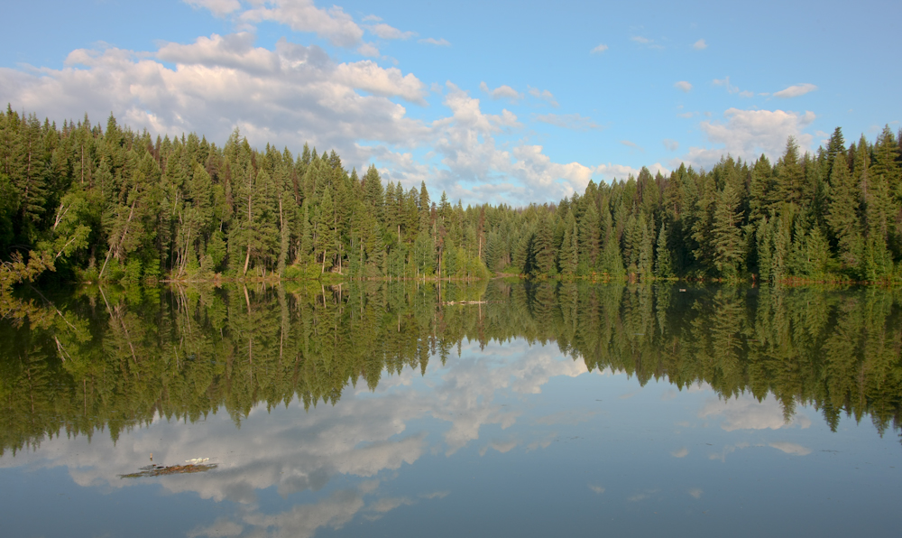
Next morning, the lake was calm and provided a near-mirror surface for the clouds in the distance. We broke camp and headed south through Prince George and Hwy 97.
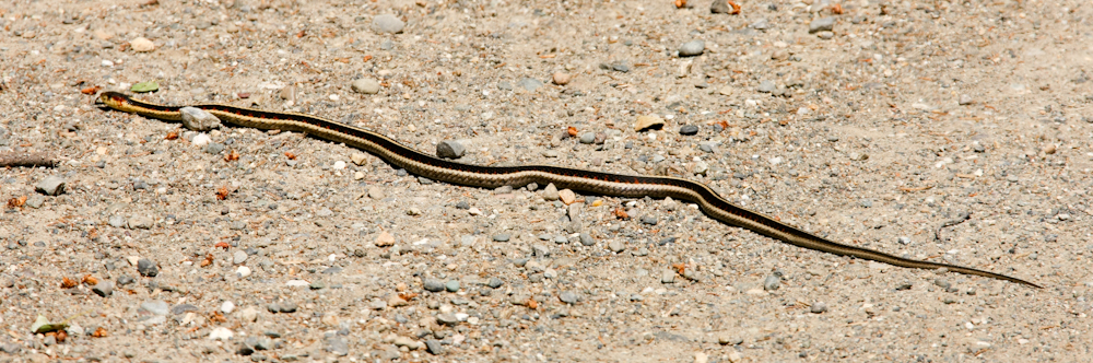
While seeing a small snake is not a big deal, we had not seen any reptiles for several months. The intense cold combined with the perma-frost is not suitable habitats for these critters. So, seeing a snake indicated that we were getting back into "warm country".
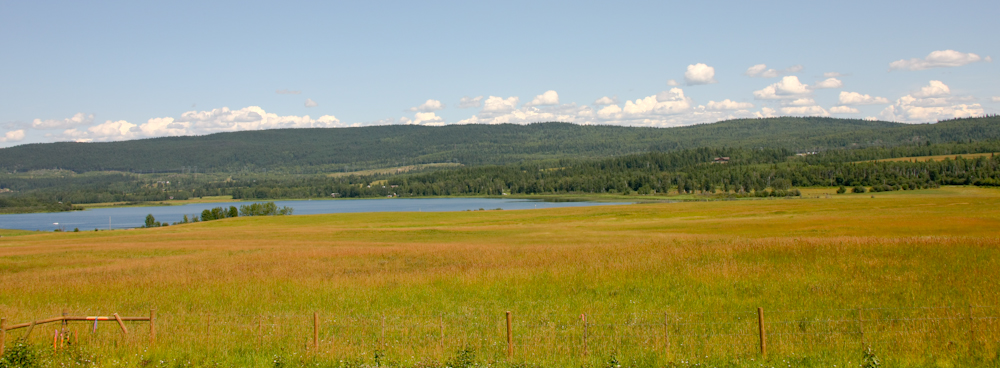
More nice rolling hills and hay fields.
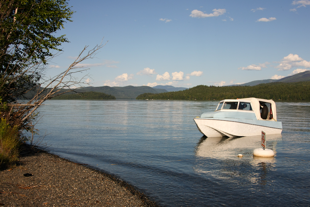
We camped in the Provincial Park at Horsefly Lake. The place was packed and because we got there late in the day, we got the very last site in the regular camping area. This was good news since the we would have had to backtrack many, many miles to find another suitable camping spot. Above is a view of one of the boats on the lake. We debated going swimming until the camp host came by and mentioned something about "swimmer's itch". When I asked for more details, she mumbled something about a duck-borne skin parasite. Enough said; we did not swim.
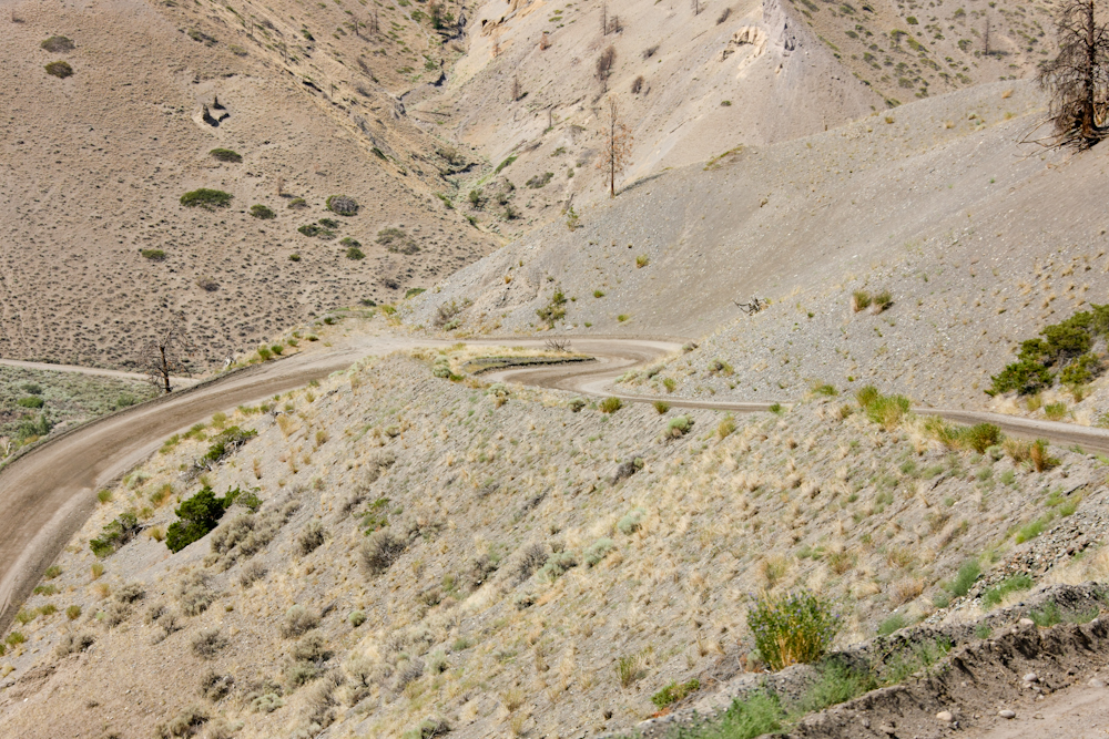
We traveled south and spent the night at a place called Big Bar Lake. The locals said that there were no parasites in this lake, so we did go swimming. Next morning after a nice night, complete with DVD and popcorn, we headed down the dirt track to Big Bar ferry. The path was perhaps 75 km from the camp site and descended some really, really steep grades. So steep, in fact, that despite gearing down to 3rd gear (out of 8) we managed to boil out some brake fluid from the reservoir. There was no failure, just a big mess. When I get back to San Diego, I will be installing an exhaust brake, for sure. The view above gives a sense of the steepness of the road. It was like this for many, many kilometers as it made the descent from 1100 meters to about 300 meters of elevation at the ferry.
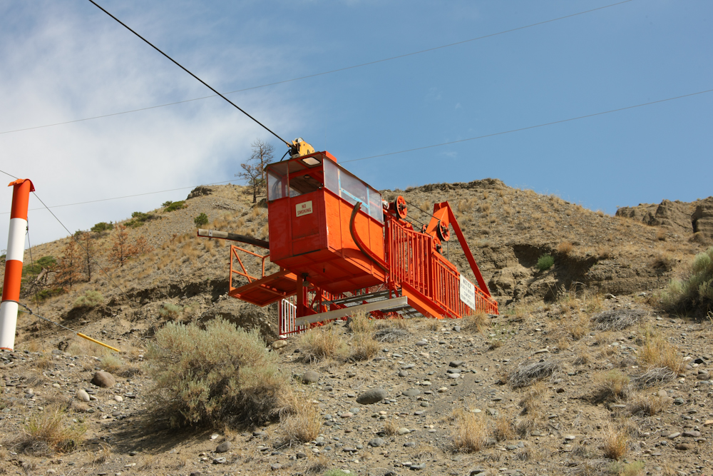
Big Bar ferry crosses the Fraser River. This river is big and Big Bar is the only crossing for hundreds of kilometers, so despite its remoteness, it is important to the local ranchers and must remain functional all year. In winter, the river becomes ice choked and the conventional vehicle ferry is not feasible. When that happens, they resort to use of a passenger-only high-line across the river. The ranchers must leave a vehicle on either side of the river.
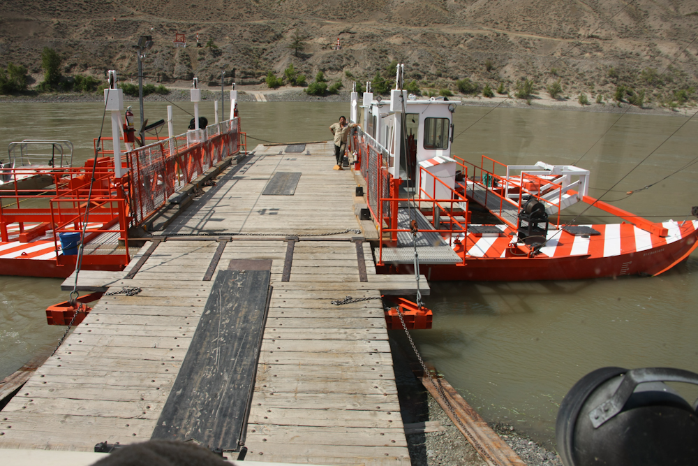
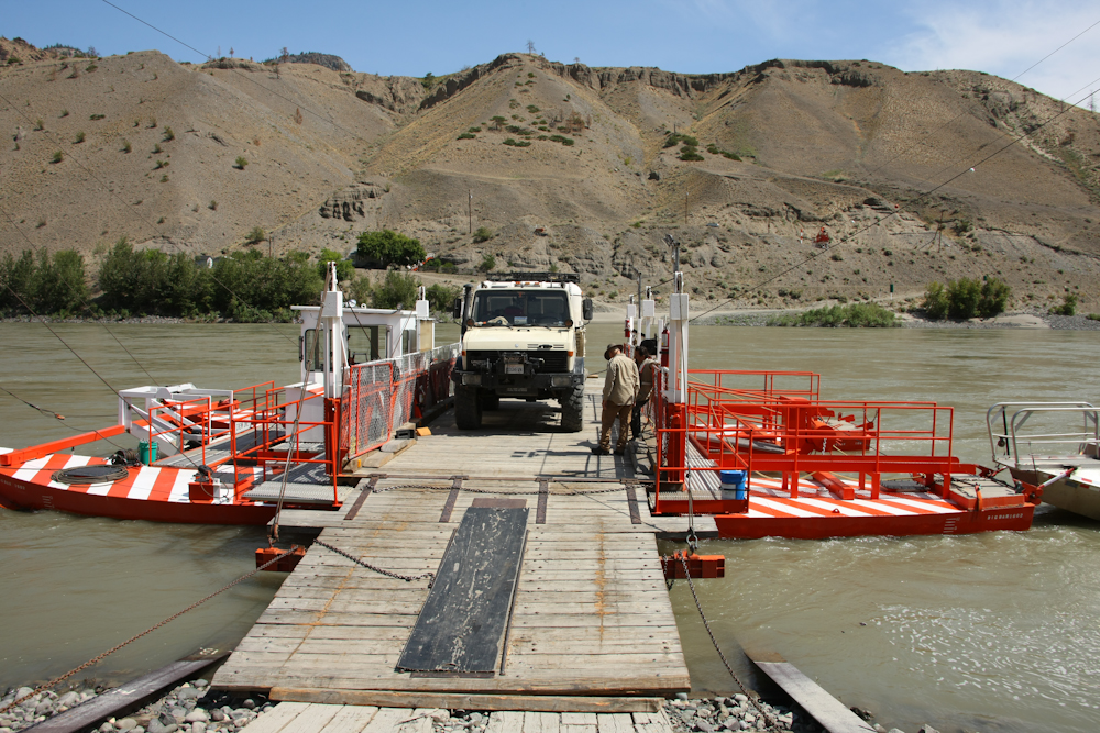
The Big Bar ferry is really in the boondocks. When I spoke to the operator, he stated that we were the first passengers for the day and it was nearly noon. Big Bar is what is called a "reaction ferry" that uses the direction of the keel of the ferry relative to the current to provide the motive force. A very cool idea in that it is totally passive and does not require a motor. Above, we descend the loading ramp to the ferry.
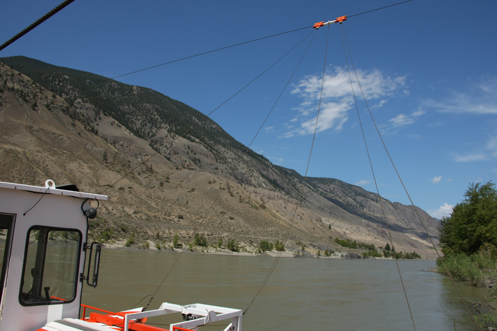
The "runner" and control lines for adjusting the angle of the bow can be seen in the photo above. The pilot turns a large wheel that adjusts the relative left-right tension of the lines and we were off like a shot. The river current was about 12 mph at the time of our crossing and is about 16 mph during the spring runoff. The Fraser is a big, fast and powerful river.
We docked on the far side and prepared to unload.
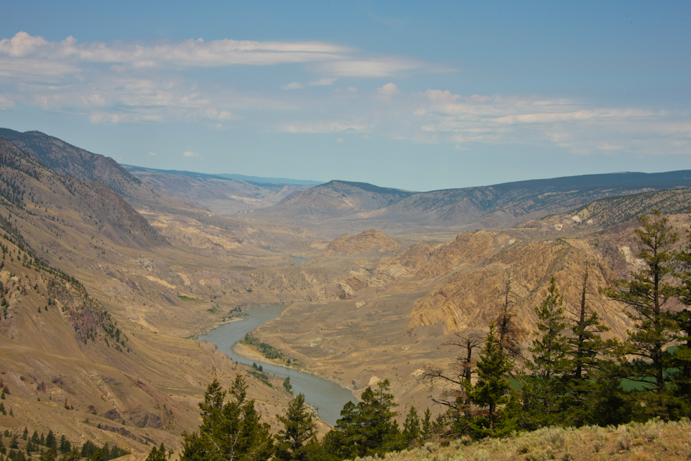
The trip up the mountain from the Big Bar ferry was narrow, steep and scary. But, from the top we got this awesome view of the Fraser River valley.
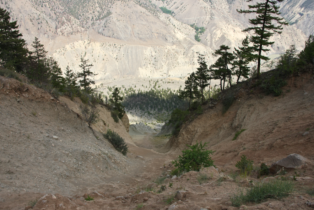
Continuing south on the dirt toward Lillooet, we passed this big slide area. This area had taken out a big chunk of the road and seemed to slide in both winter and summer. Snow in the winter, and dirt in the summer. The chute went down for several thousand feet, almost to the river below. The site was at 1100 meters and the river at perhaps 250.
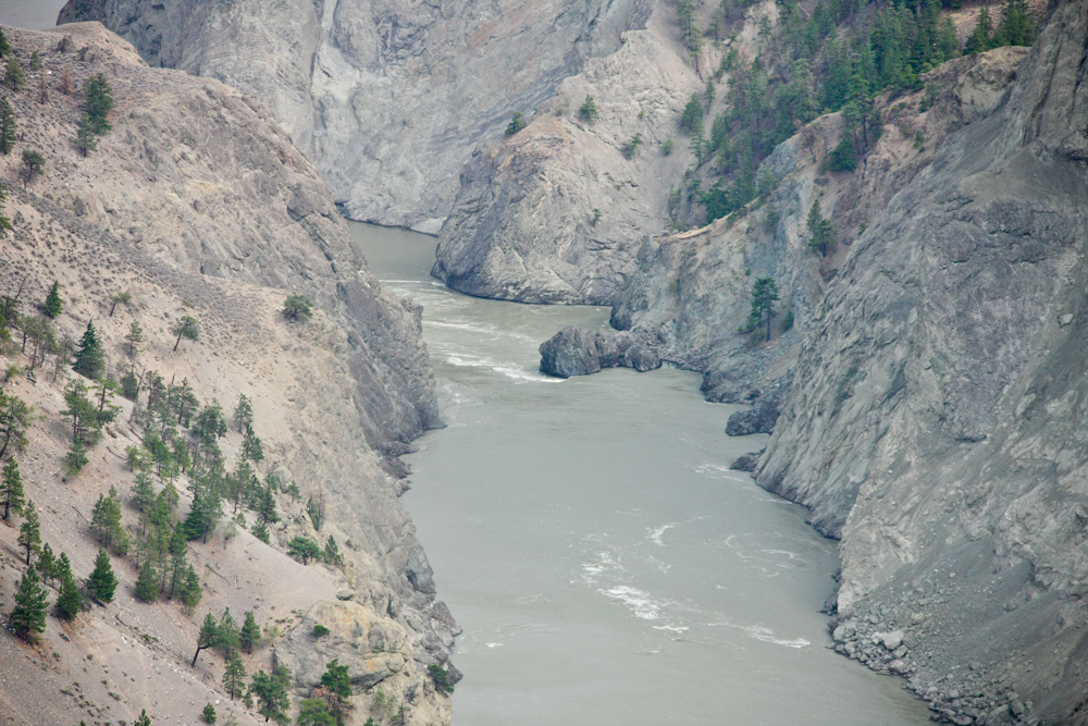
Narrows in the Fraser river generated powerful hydraulic action.
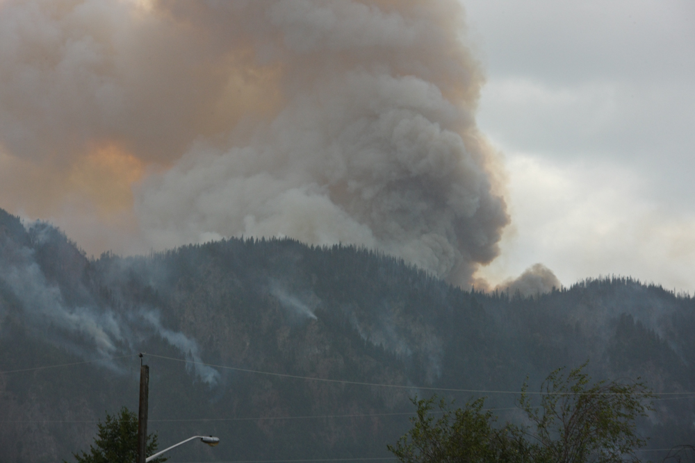
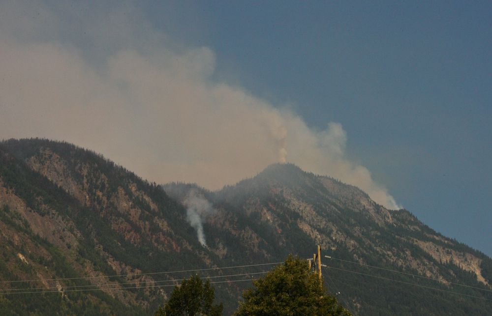
We had heard from the ferry pilot that there were fires in the Lillooet area. When we arrived in town, the whole place was ablaze. We attempted to get a motel room, but all were booked with fire crews. As an afterthought, we asked about RV sites and found one next to the Fraser River with awesome views of the fire.
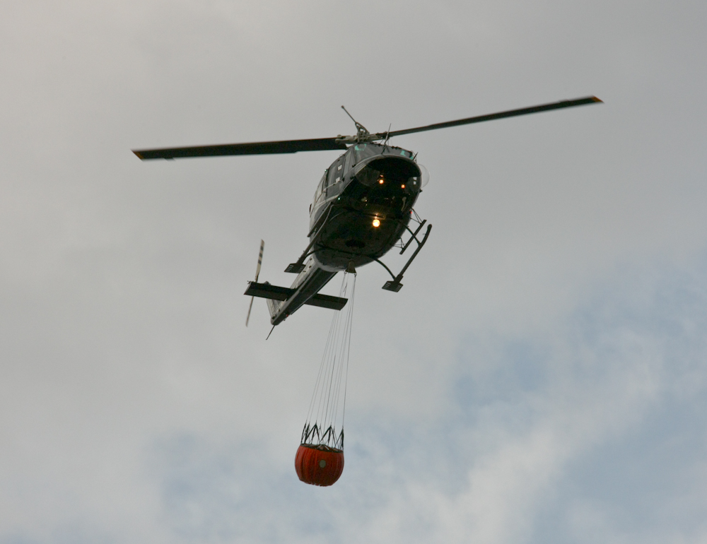
The terrain was super-steep and the only viable method of attacking the fire was using helicopters and large water buckets. There was a squadron of copters on the task and they ran sortie after sortie attacking the fire. They dip the bucket in a local lake to take on water then head up the mountain to dump their load.
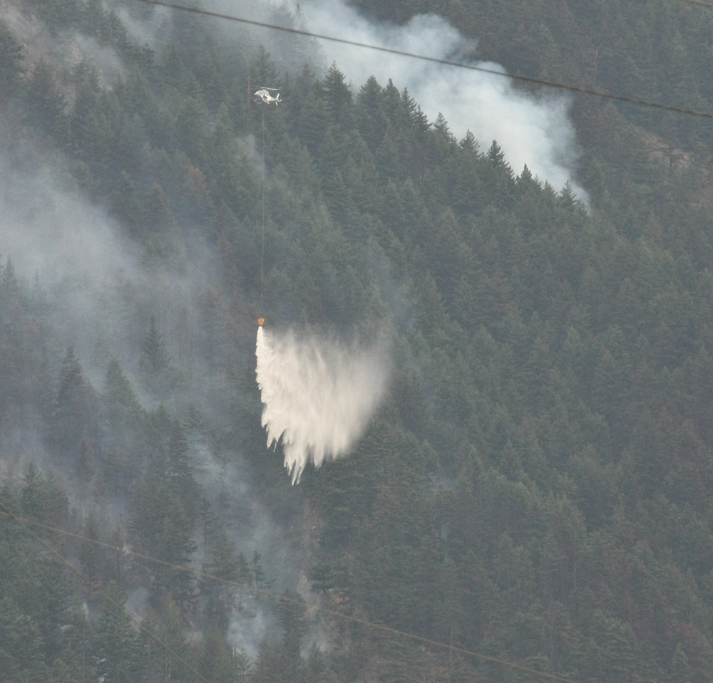
The choppers made run after run doing precision drops of water on hot spots.
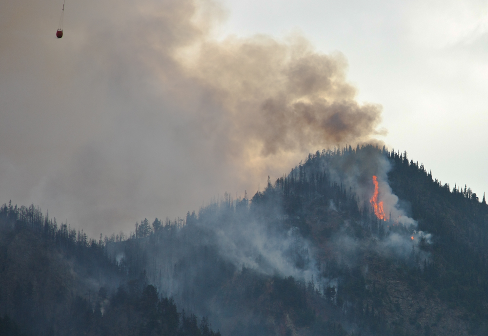
Flare-ups were happening all the time and the trees were literally exploding as the sap caught fire. The crews quit at nightfall, but resumed their attack the following morning.
Next morning, things were better, but there was much work to be done. We packed and left Lillooet and headed toward Vancouver via Whistler.
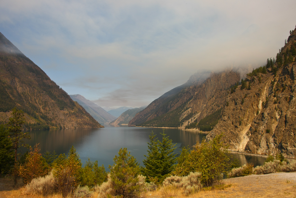
Coming out of Lillooet, we got a nice view of one of the local lakes that is run by BC Hydro. Note the smoke in the air.
There were plenty of road-side pull-outs on our path and the trees were nice. Buggy, but nice.
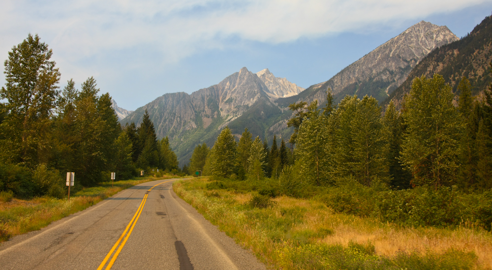
Closer to Pemberton, we got nice views of the mountains in the distance.
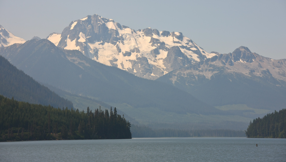
A lake near the summit was dominated by glacier covered peaks to the west.
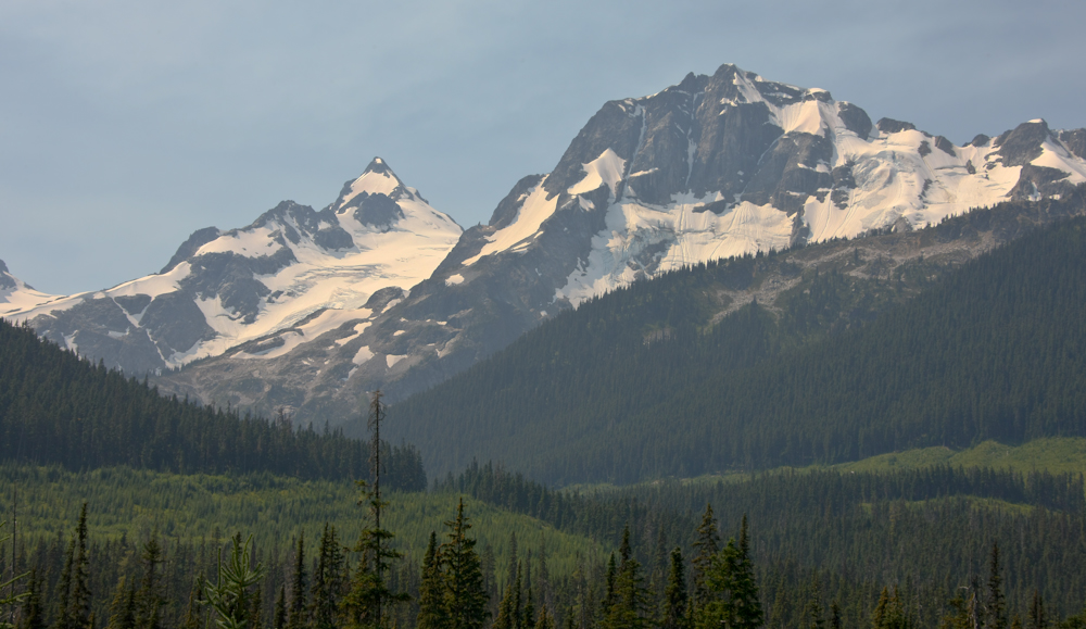
Despite being mid-July, there was plenty of snow left on the peaks.
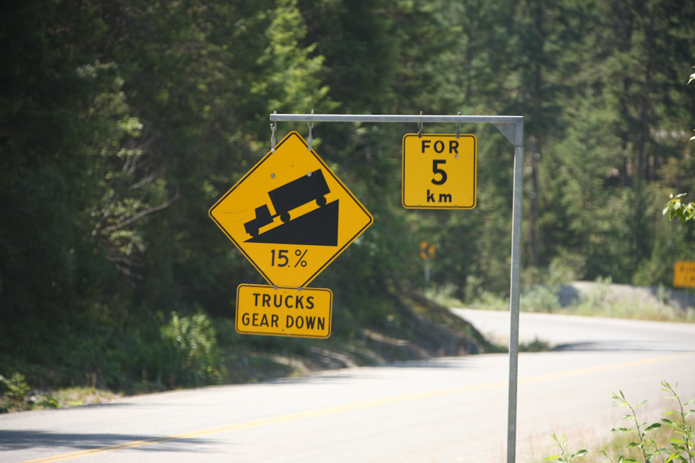
Ah, the bane of my existence. There were many steep grades and with the memory of the boiling brake fluid fresh in my mind, we headed down the hills in 3rd gear.
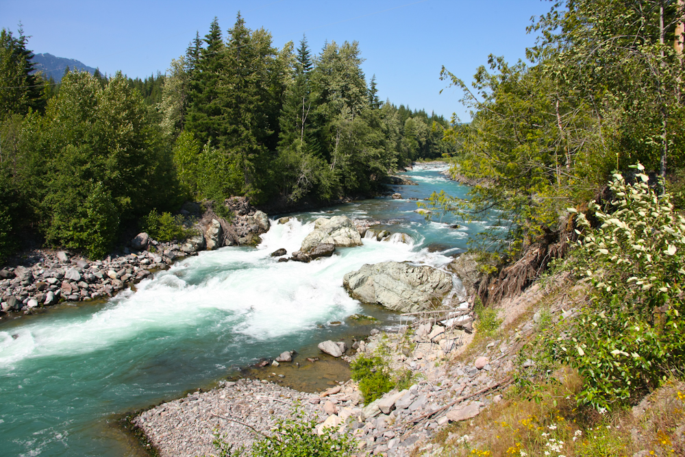
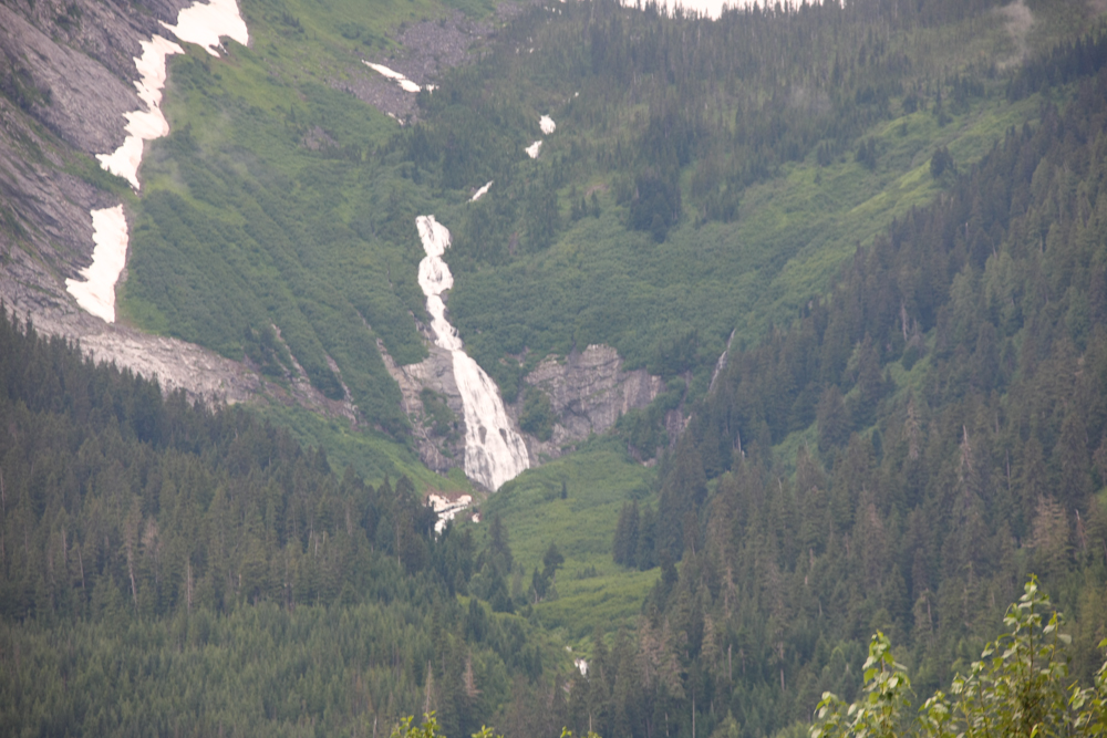
We stopped in Whistler for lunch and the place was a zoo. Finding parking was hard, but we finally succeeded. As we headed further toward Vancouver, we spotted this small waterfall by the side of the road.
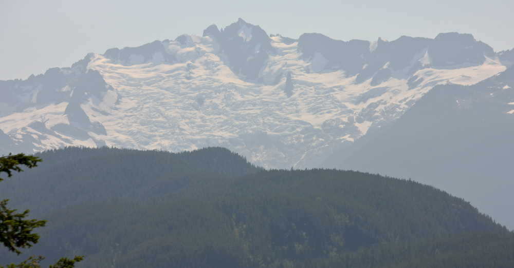
The final summit outside of Squamish provided our last glacier views on this segment of our trip.
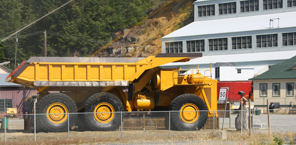
Outside of Squamish, I spotted this large ore hauler at a mining museum.
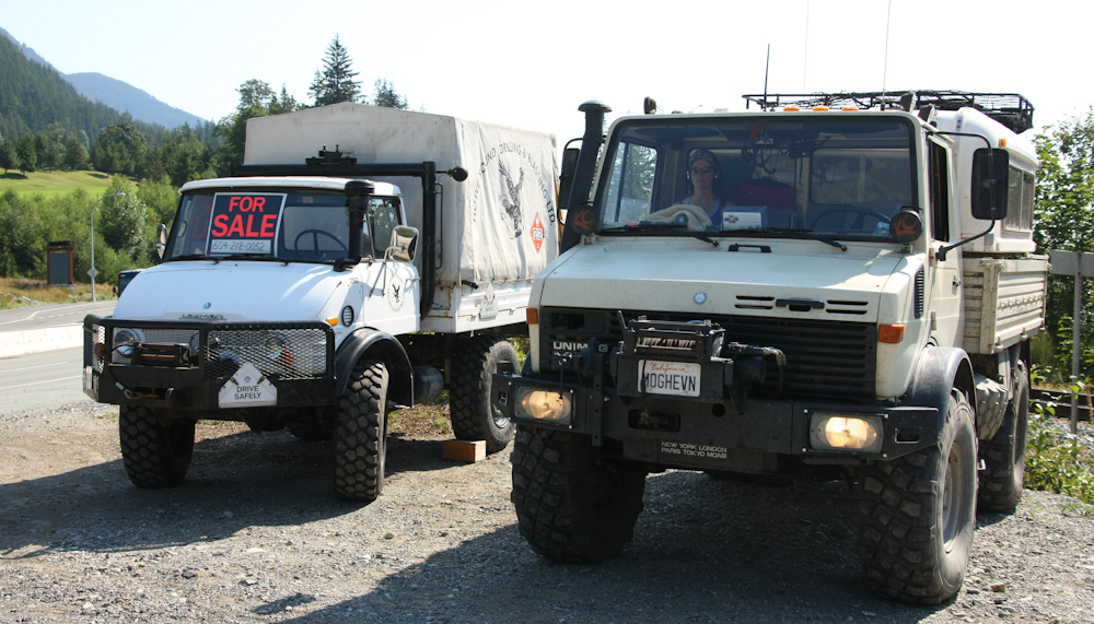
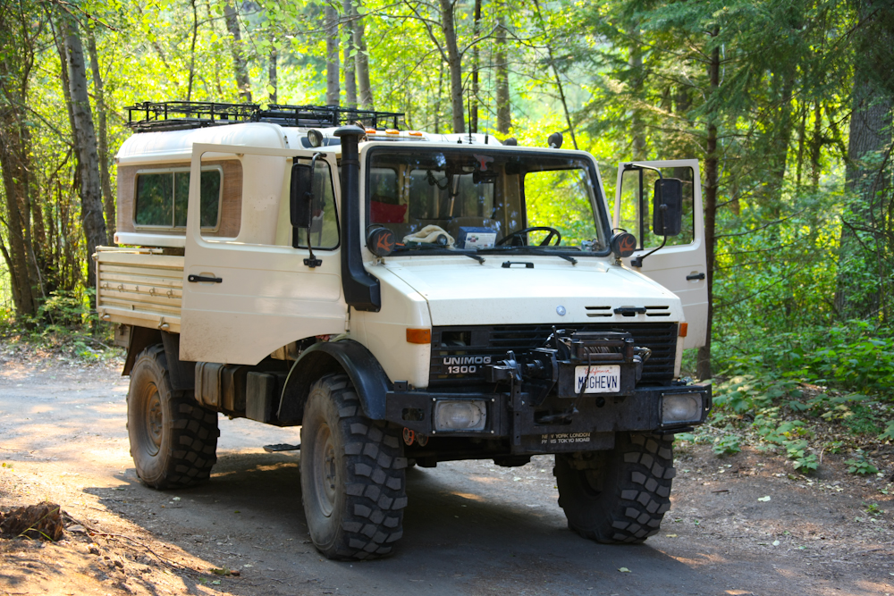
No trip is complete without seeing another Unimog. This one was for sale at Fuzzy Creek.
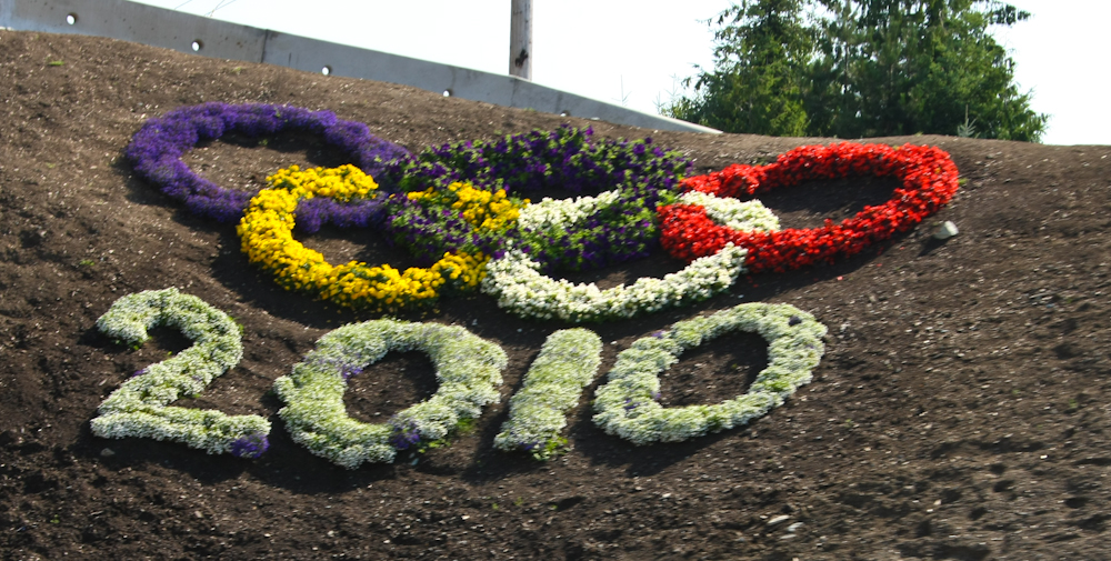
Vancouver is hosting the 2010 Olympics and there were signs everywhere. Many roads were being improved in anticipation of the event and we suffered many delays due to the construction.
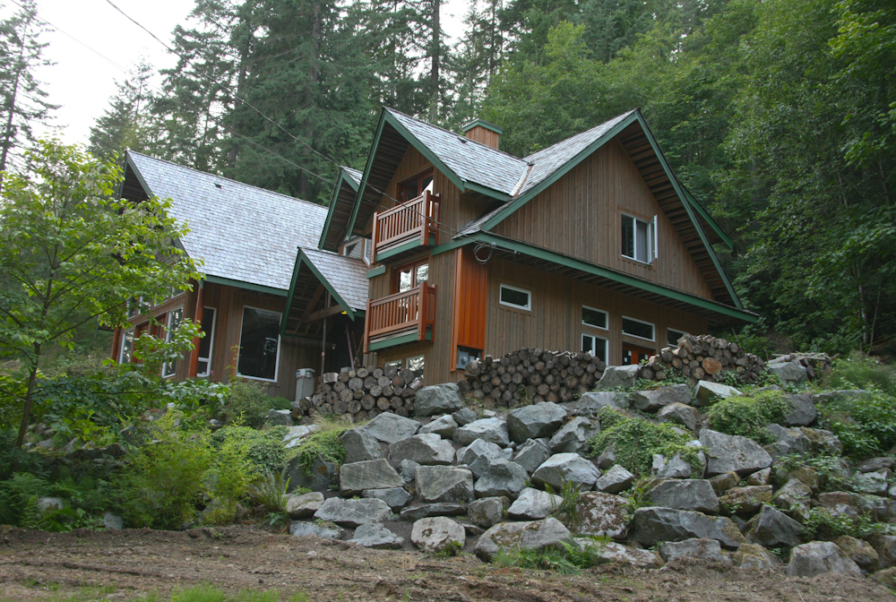
I was in touch with the Vancouver unimog contingent and they set me up with a place to spend the night. We stayed with Jon and Lenka at their place on Indian Arm. It was an awesome house in a spectacular location. Thank you Jon for taking total strangers into your home.
This was a long segment, but there were some great things to see. The trip from Whistler to Vancouver was particularly nice as was the area around Lilliooet. Tomorrow, we would meet with the Vancouver Moggers and have a BBQ at one of the member's homes.
| Previous Adventure | ||
| Trip Home Page |
Photos and Text Copyright Bill Caid 2009, all rights reserved.
For your enjoyment only, not for commercial use.