Lubec, ME is the easternmost
point in the CONUS. Our objective was to see what was there and
then head into the Baxter State Park and have a look around. From
there, we would head to the southwest and visit Mt. Washington in New
Hampshire.
The photos below are what we saw.
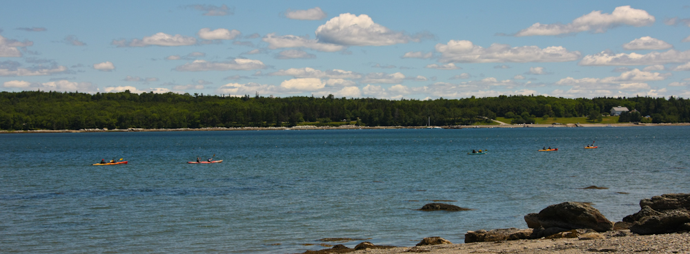
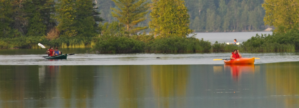
Along the coast route, we saw
plenty of kayakers out in the bays.
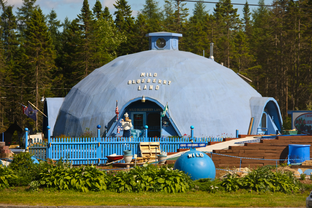
One of the odder buildings we saw
on the route. We did not stop; I can only guess that this is the
Blueberry Museum or something like that.
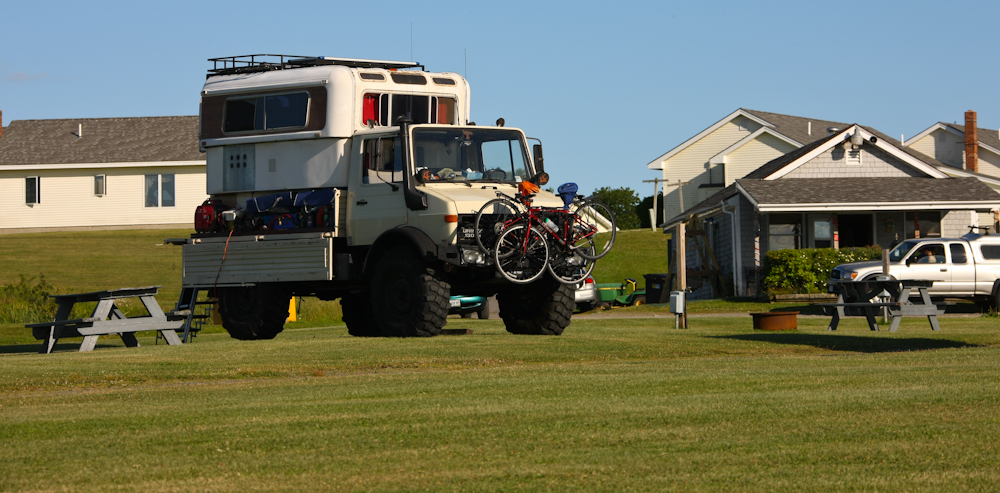
Our campsite in Lubec was nice
with broad lawns and a nice view of the water.
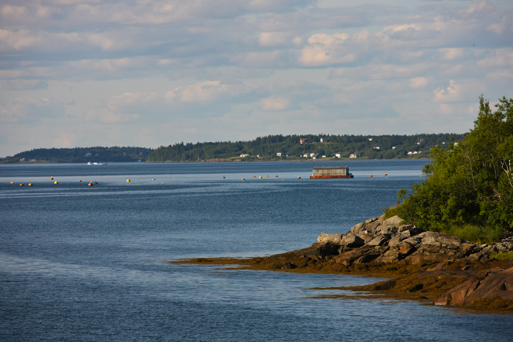
From our camp, we had a clear view
of the bay.
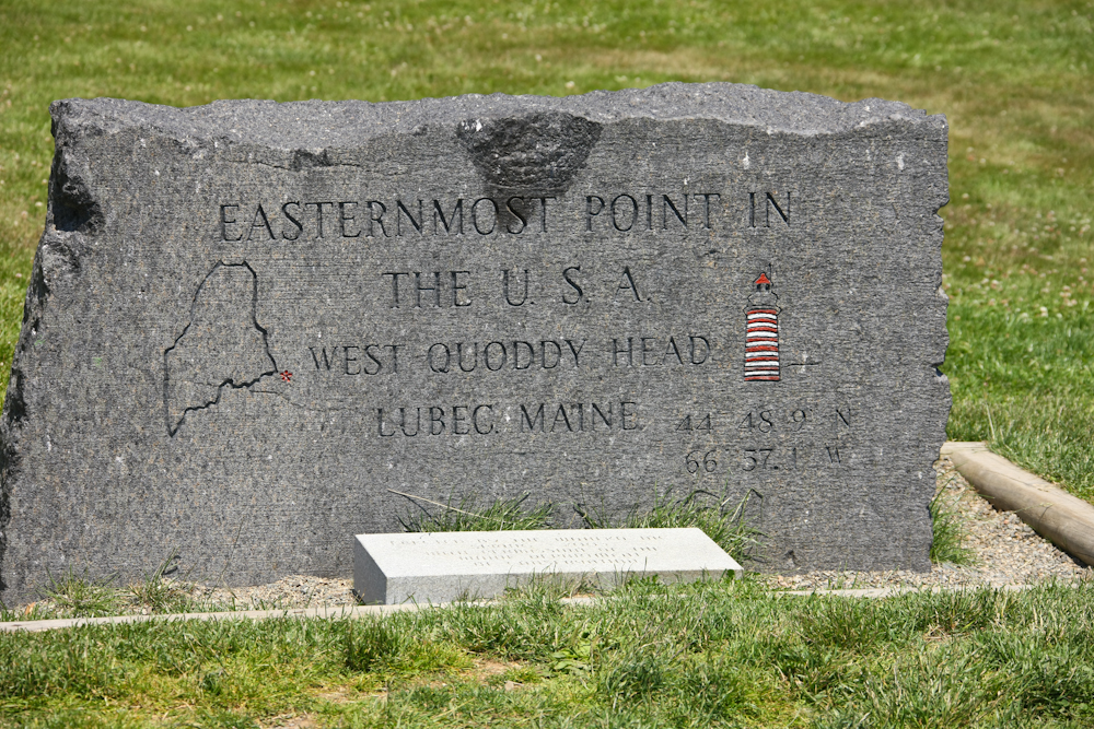
Once we finished in Lubec, we
headed out to the easternmost point, West Quoddy Head. The day
was generally clear, but quite hot.
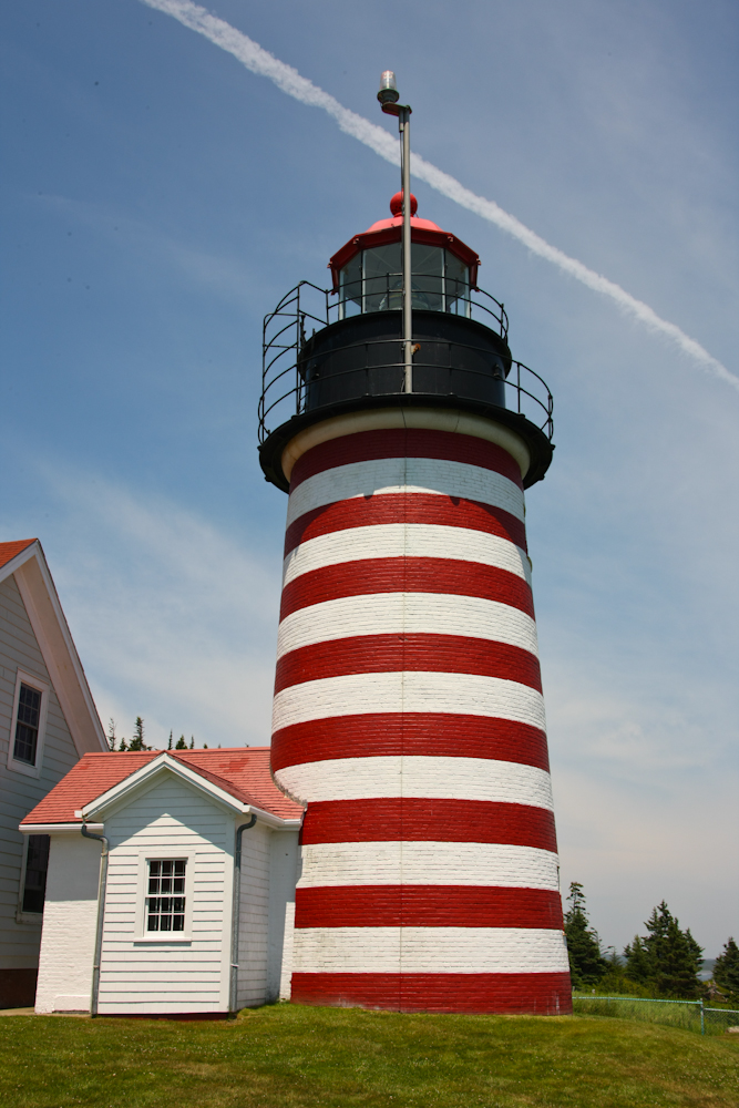
The lighthouse at West Quoddy Head was still in operation; there is both a lighthouse and a fog horn at the station. We were told that the lighthouse is a clone of the one on Point Loma in San Diego. What a coincidence.
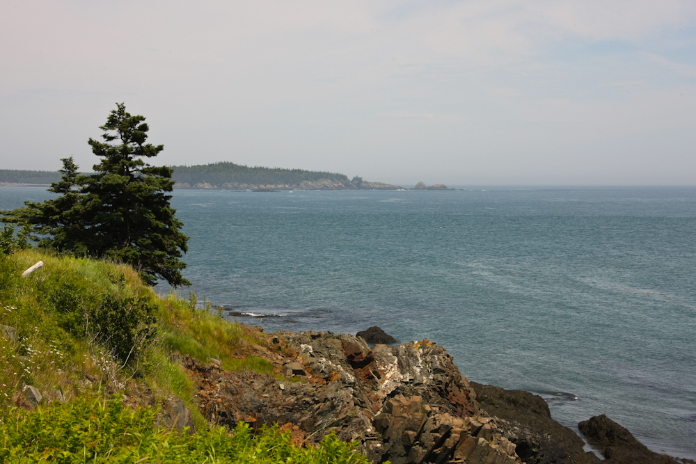
The view from Quoddy was
spectacular. There are many rocky outcrops along the coast and
the fog can make travel treacherous.
From Quoddy, we headed north along
the coast. We were going to see the fireworks at Eastport, but
the place was full. We could not find any place to camp and the
town was in the middle of it's annual Fourth of July parade, so we just
continued further north. We stayed at some nondescript campground
that was filled with folks that were celebrating. Next morning,
we continued north toward Baxter State Park. We could not reach
the park in the daylight, so we holed up at a site close to the eastern
boundary: Shin Pond. The place was nice and virtually
deserted. There was only one other rig in a place with 50
sites. Above, you can see some of the folks out in their canoes
on Shin Pond. The camp was great, but very buggy. Next
morning, we broke camp and headed to Baxter State Park. We
stopped along the road to tighten a strap and a fellow stopped to ogle
the mog and chat. He advised us that we would not be able to
enter the park because we were TOO BIG -- too wide, too tall and too
long. He spoke with conviction as his Fuso 4x4 truck had been
refused and it was clearly smaller that ours. We had rather
expected this due to some of the signs that had been posted lower on
the mountain, but we were willing to risk the refusal on the outside
chance that the might let us pass. But, now armed with local
information from someone with nothing to gain, we turned around and
headed back the way we came. This small event would constitute
the northern terminus of our trip as all of our future travels would be
taking us south and west.
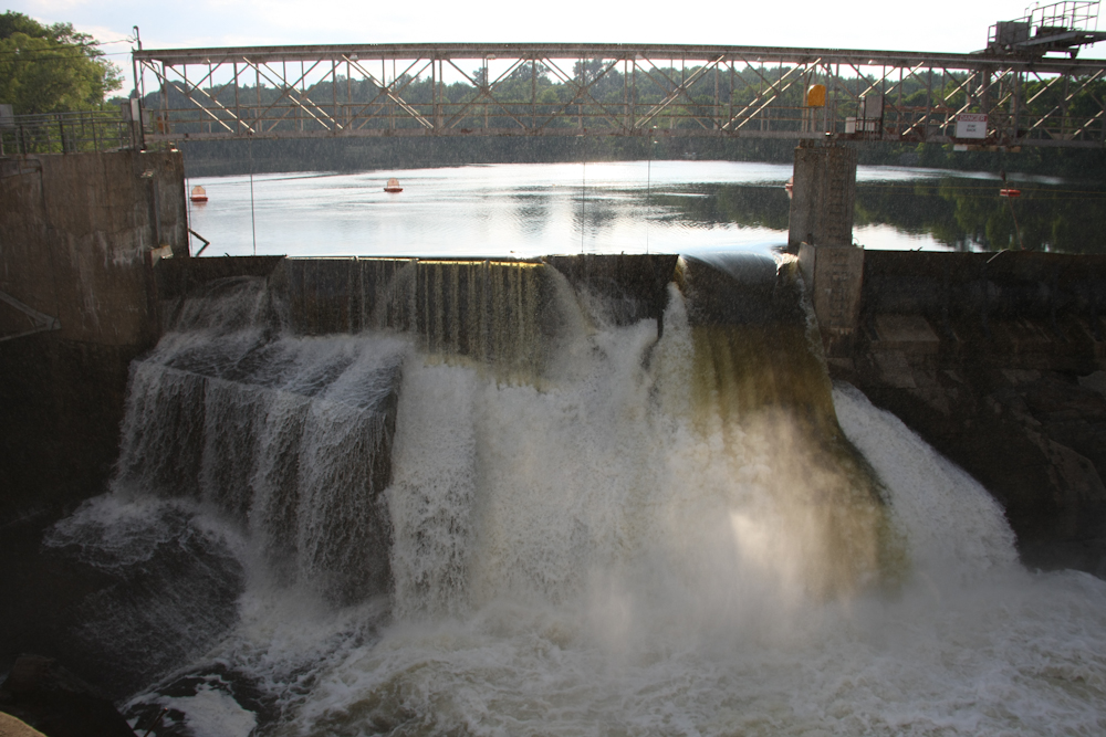
Our path took us past a big dam in
Skowhegan, ME. We had a close view of the spilway. When we
finished at the dam, we headed west toword Farmington to find a
campsite for the night. We settled on a place called the Troll Valley
Resort. The only troll we saw was behind the desk at the check in
counter.
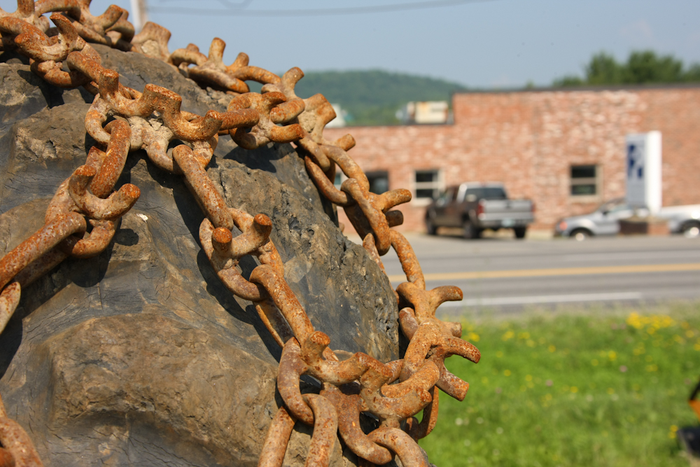
Along the way, I saw this
skidder in a used equipment lot. Like most skidders used in
logging, it has chains on the tires. But, I never got a good look
at the chains until now. These appear to be home made, but with
the big spikes, I am sure that they are effective.
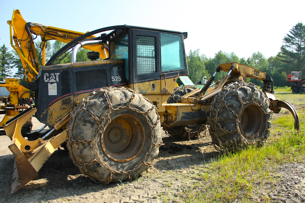
Skidders are the ultimate off road
machine. The claw on the back is used to grab and tow logs to the
loading site.
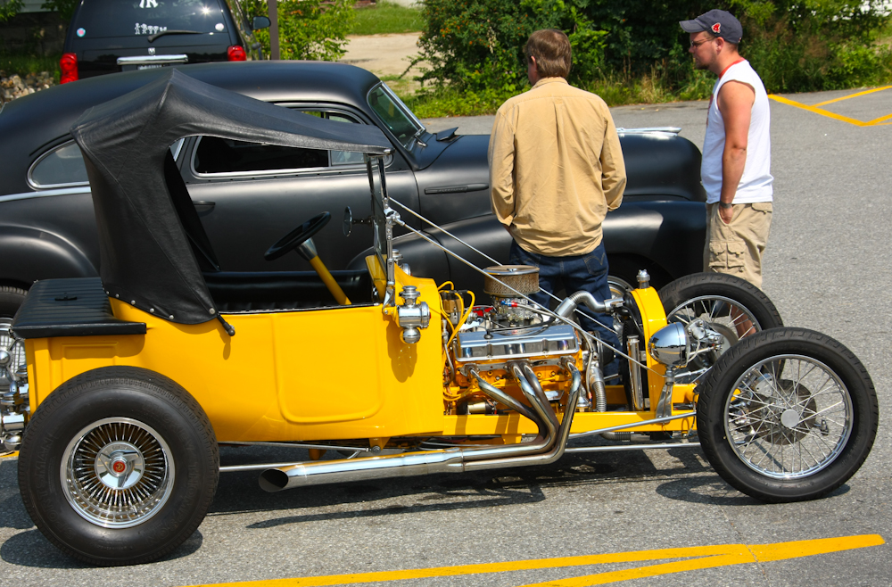
We left Farmington and headed west
toward Mt. Washington. Along the way, in Mexico, we spotted this
nicely done custom hot rod. We passed a bunch more oncoming on
the road, so we guessed that they were having a meet in Mexico.
Oddly, we never found a Mexica restauant in Mexico, ME.
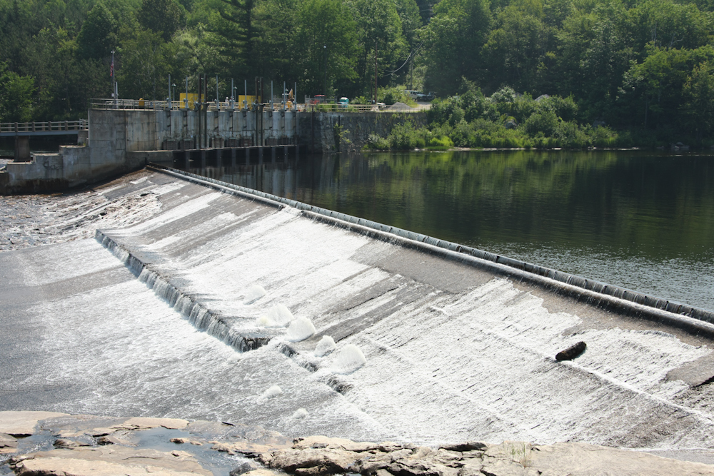
The dam in Rumford, ME
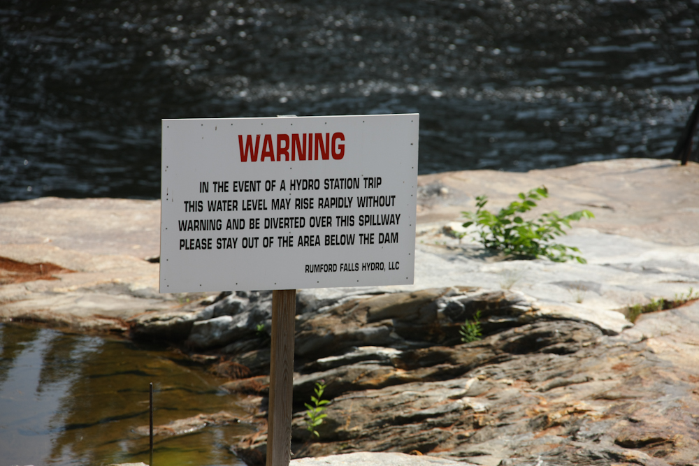
The outflow area of the dam had
this sign that seemed a bit scary.
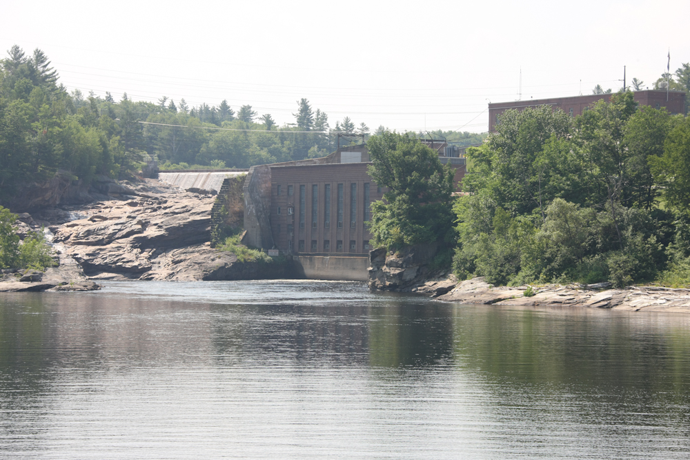
The powerhouse looked eighteenth
century, but I never confirmed the age. The water level of the
reservoir was just below the top of the powerhouse. In fact, you
can see the spillway on the left.
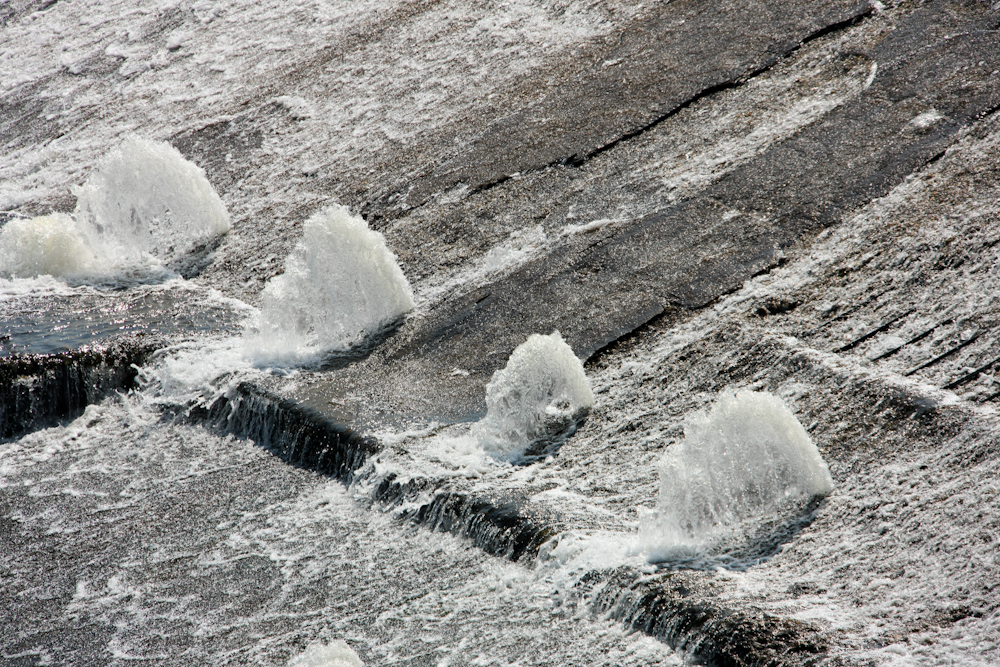
The bottom of the spillway area
had these mini-geysers due to water pressure form seepage behind the
concrete.
We traveled west to Mt.
Washington. We had lunch at a nearby town and found out that you
can drive to the top of the mountain. We tried, but they turned
us away at the toll gate. Again too big. So, as a fall
back, we drove around to the west side of the mountain and took the cog
railway to the top. The railway was pricey at about $65 a
seat. But, there are very few of these in the U.S. so we decided
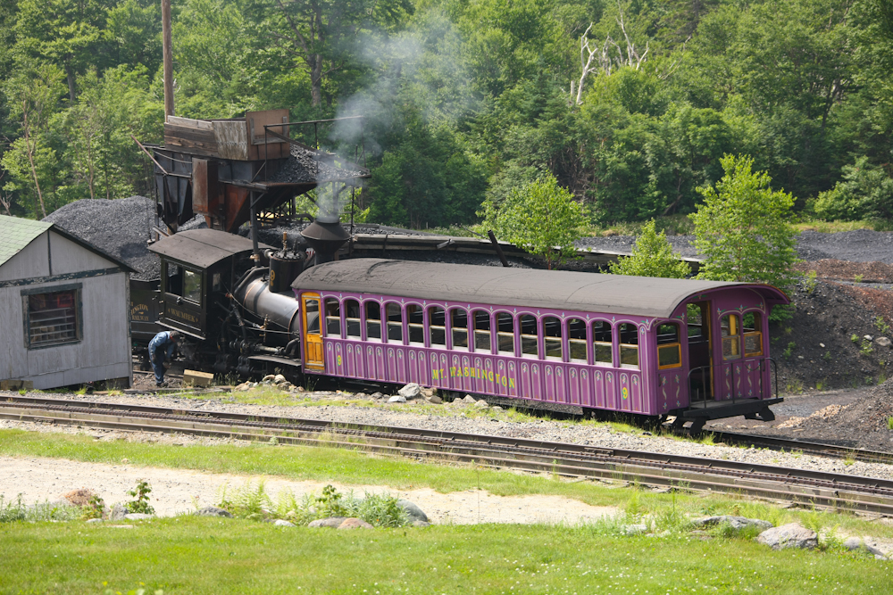
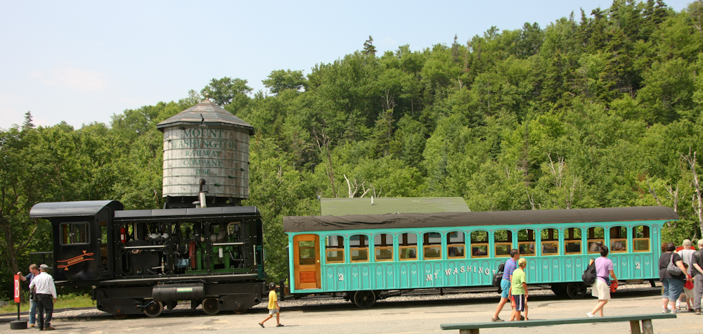
to do it anyway. Above is a shot of one of the engines used on
this route. This steamer can be ridden, but for an extra fee and
it only travels once a day. Since it was late in the day, we
opted for the next train.
This was the original engine
employed on the Mt. Washington Railroad.
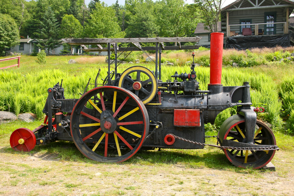
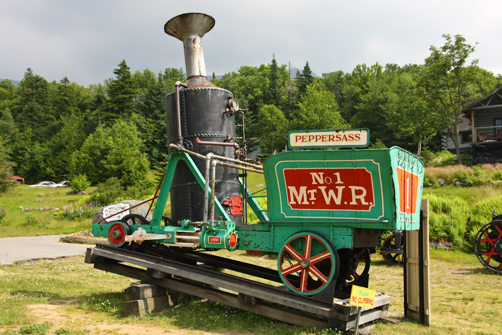
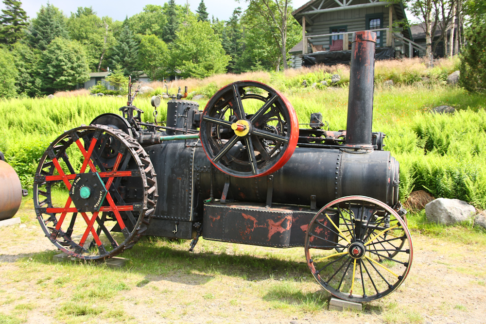
They had some other interesting
steam powered equipment there on display at the base station.
This looks like a steam roller used for road construction.
This is a steam tractor.
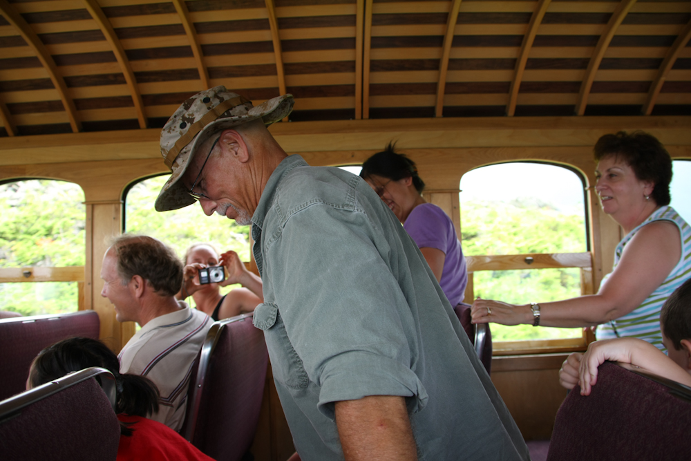
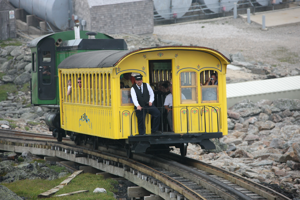
Our ride to the top of Mount
Washington.
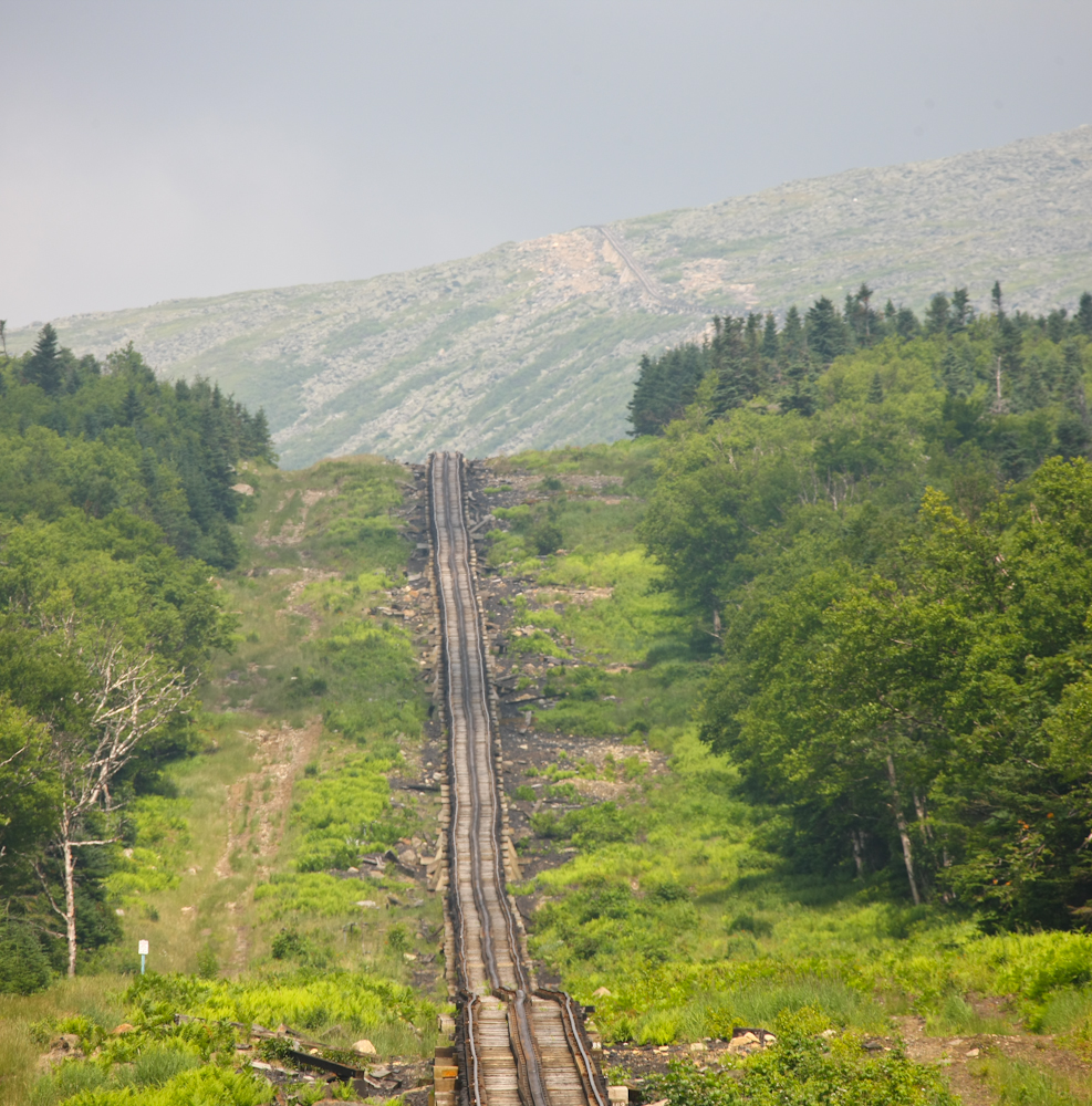
The track to the top is very
steep. The operators claim that they have the steepest section of
track for a cog railroad after Pike's Peak. The track has
shifted somewhat resulting in an interesting ride. The cog system
is visible as the center "rail", but it is really like a bicycle chain
laid out flat. At the top of the photo, you can see the last
pitch that takes the train to the mountain station.
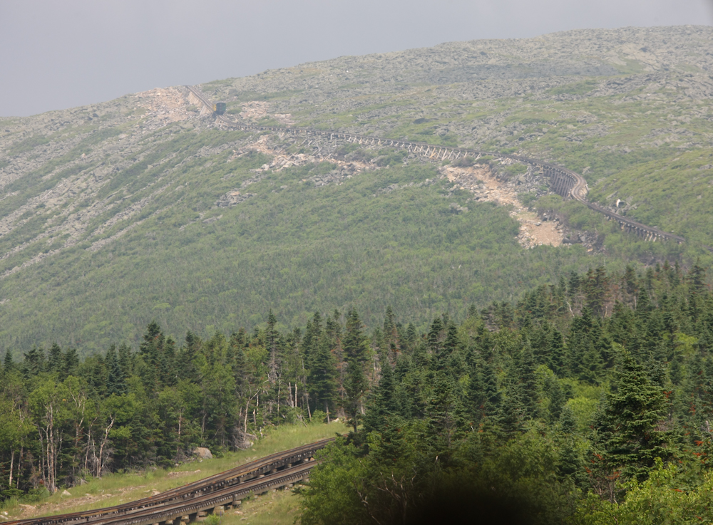
I spotted the downhill train
coming at us near the top of the upper pitch.
Except for the steam engine, all
the motors in service are diesel hydraulic. The actual cog motor
is a hydraulic circuit so it can be "locked" if required.
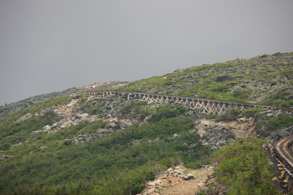
Much of the track was on the side
of the mountain. It was rather scary.
At the steepest part of the track,
I stood in the isle. I was not holding on, so I was vertical.
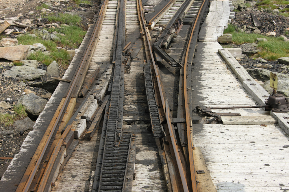
The switching mechanism for the
track is quite complex due to the cog rail. This switch is the
last manual switch on this track system.
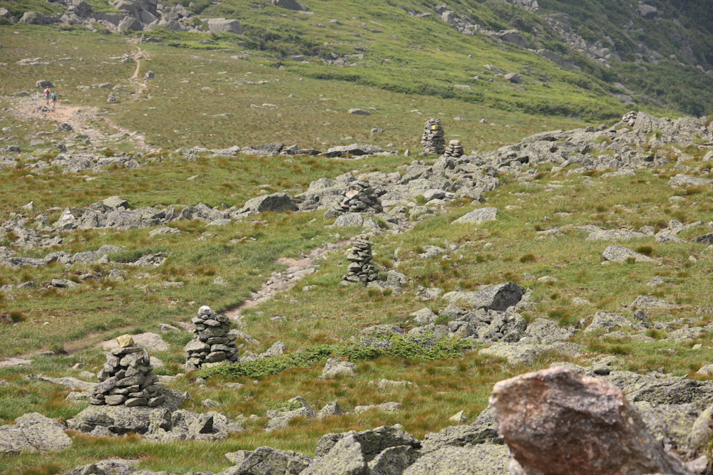
Near the top of the run, we could
see rock cairns associated with the Appalachia Trail. The stacked
rocks are "guideposts" for the trail that are invaluable in the fog.
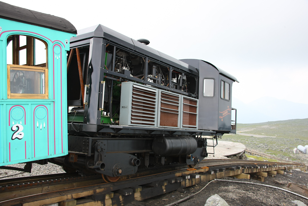
We finally reached the mountain
station. The modesty panels on the side of the motor were off due
to some problem. The boxes on the side of the engine are
hydraulic fluid coolers.
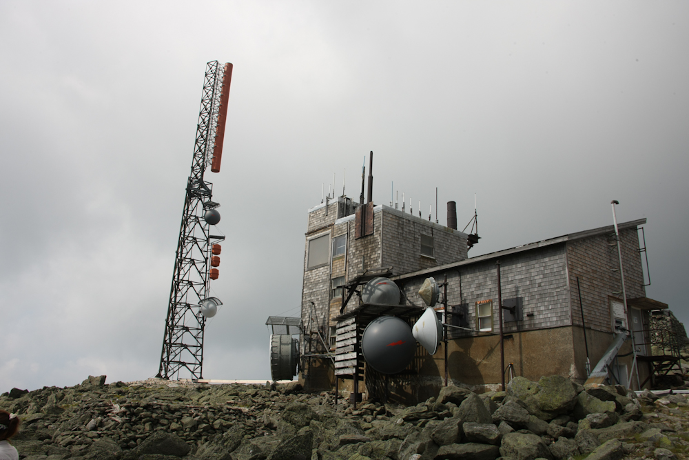
Mt. Washington is the tallest
mountain in the area, and therefore hosts a variety of communication
equipment.
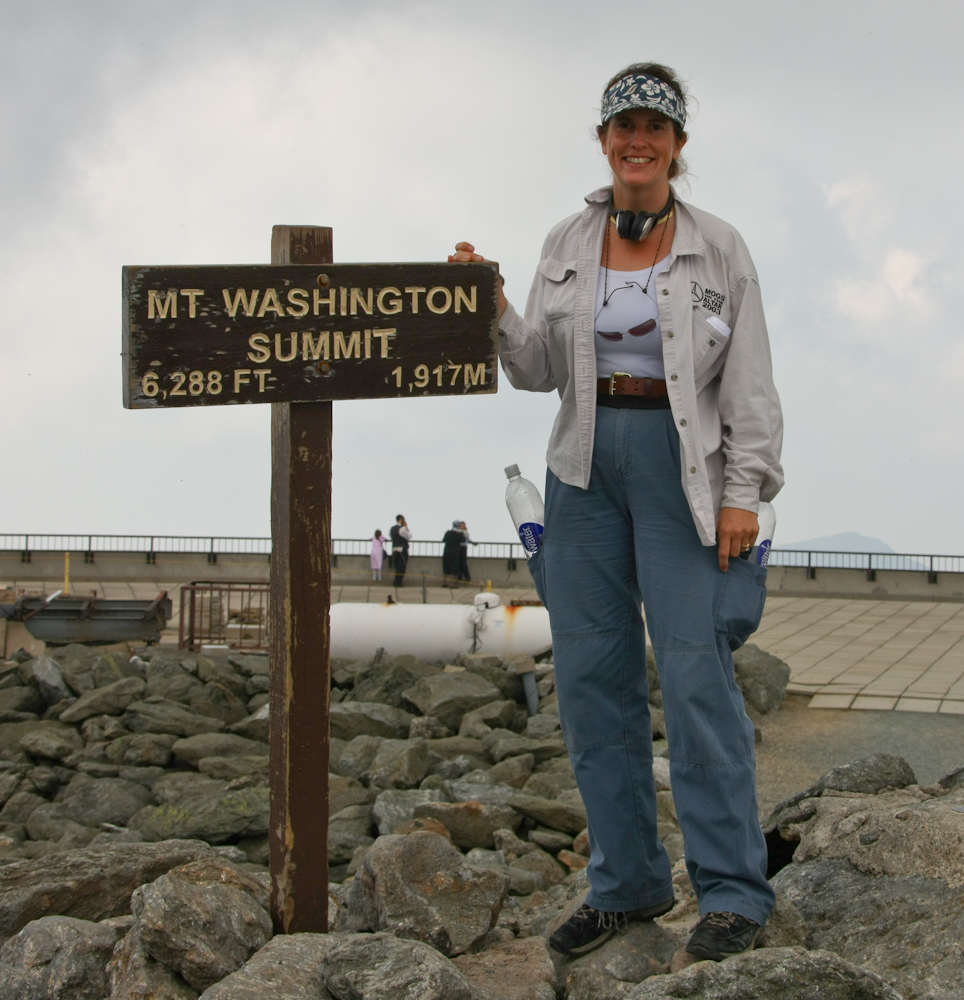
Kathleen poses by
the summit sign. There were tons of deer flies in the area while
this photo was taken.
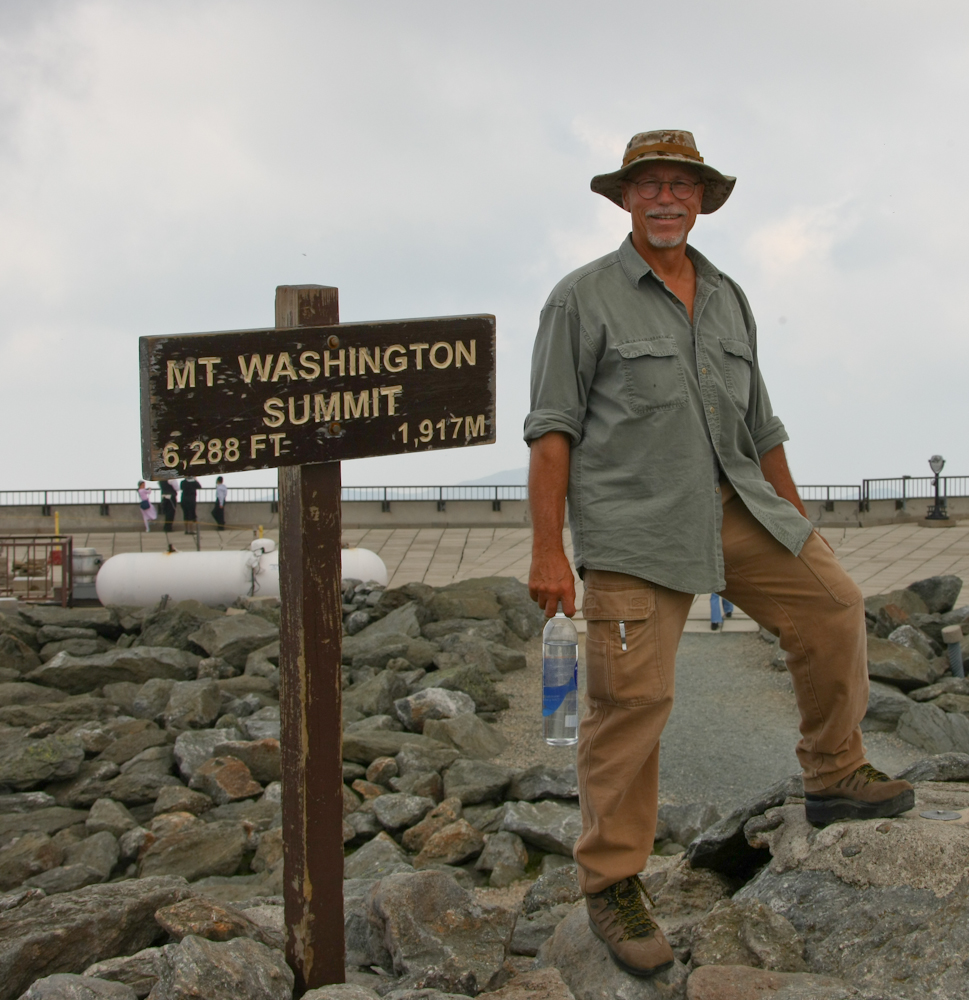
The view from the top was limited
by the fog and clouds in the distance. Mt. Washington is famous
for foul weather; 231 MPH wind gusts have been recorded on the summit.
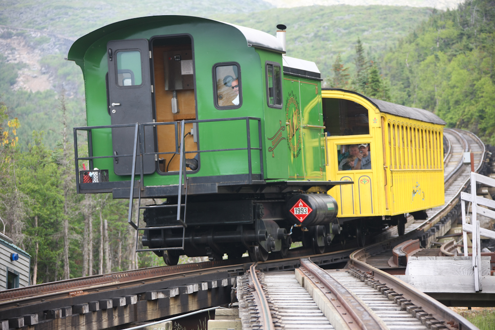
Another train pulls into the
mountain station.
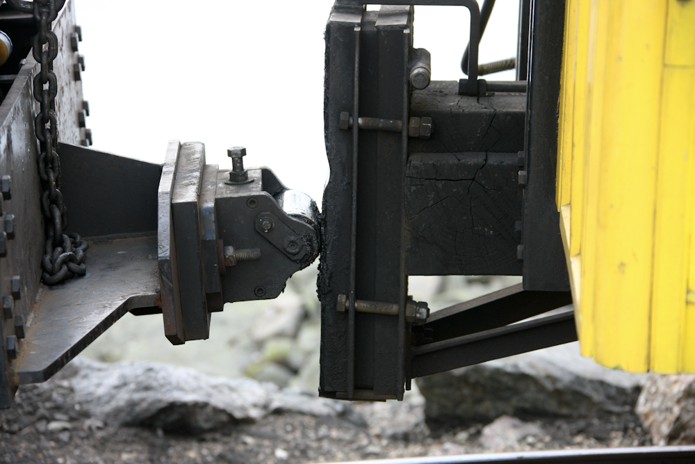
I was expecting a standard hitch
between the engine and passenger car. This hitch is designed for
uphill use only and allows the angles of the cars to vary as hills and
bumps are encountered in the track bed. But, this design requires
that there be a brakeman on duty in the passenger car during
descents. The passenger car has cogs as well, but these are used
as part of the braking, should that be required.
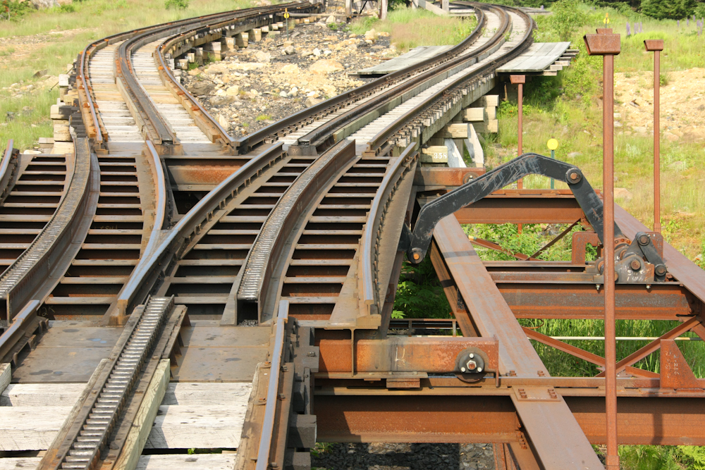
One of the new, hydraulic
switches. These switches are fully automatic.
This was a nice segment of our trip. Mount
Washington was quite interesting, and we were lucky that the weather
was kind.
| Previous Adventure | ||
| Trip Home Page |
Photos and Text
Copyright Bill Caid 2010, all rights reserved.
For your enjoyment only, not for commercial use.