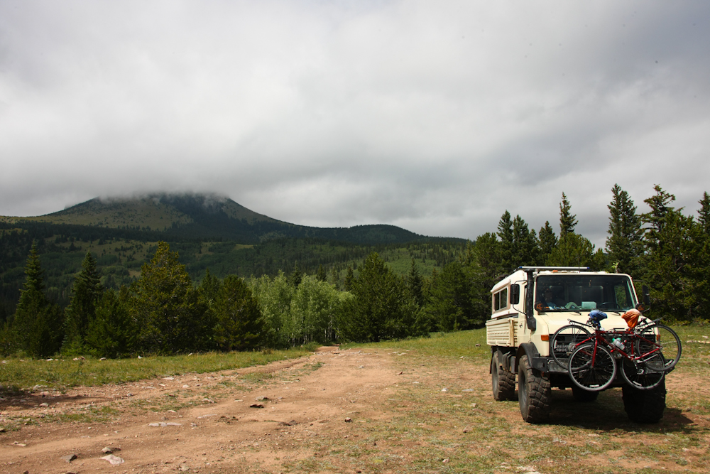
The
photos
below show the truck and the planned cabin.
Once
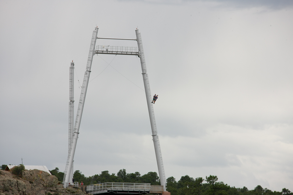
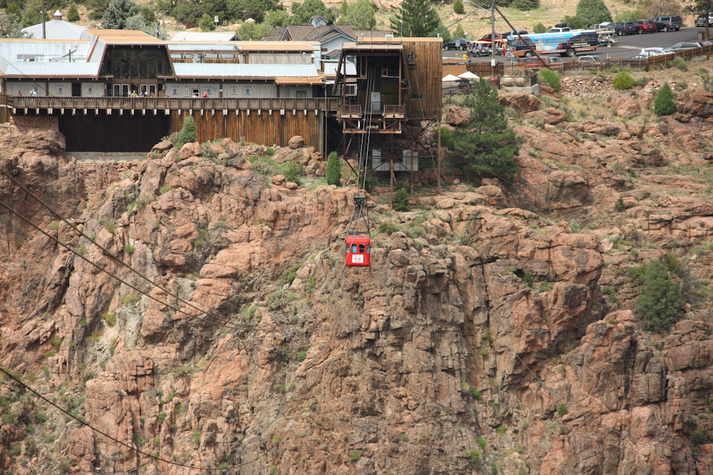
we arrived at Royal Gorge (RG) we spotted this pendulum ride where
daring souls would pay to have themselves be terrified by swinging over
the canyon of the Arkansas river. While the photo above looks
reasonably tame, check out the photo below and you will see what the
participants saw during their ride.
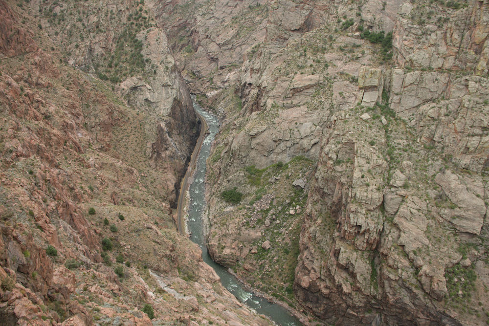
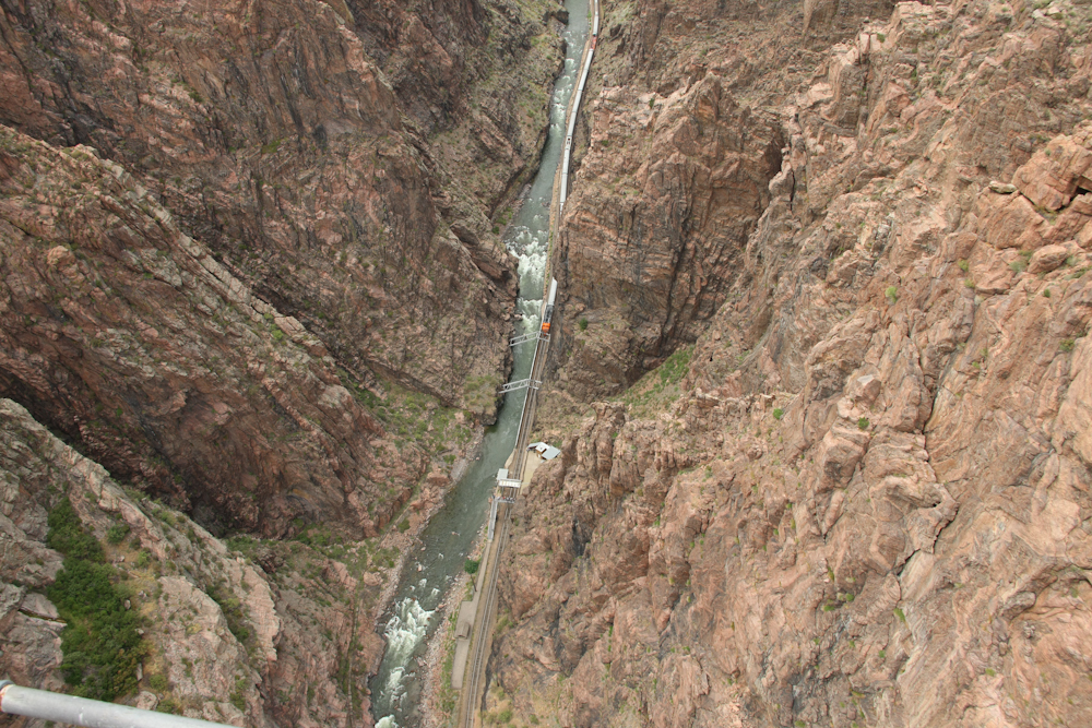
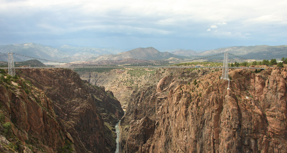
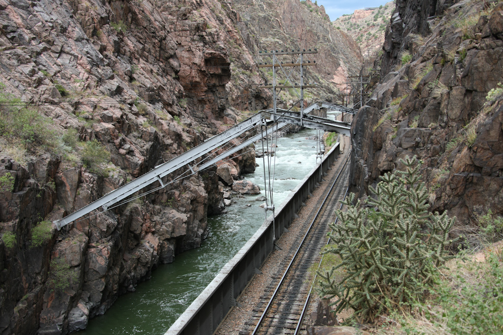
The
look down into the Arkansas River canyon was daunting. The line
to the left of the river is a full-size train track (as opposed to
narrow gauge). That line was part of the Denver & Rio Grande
route. The river is a LONG way down from the lip of the canyon.
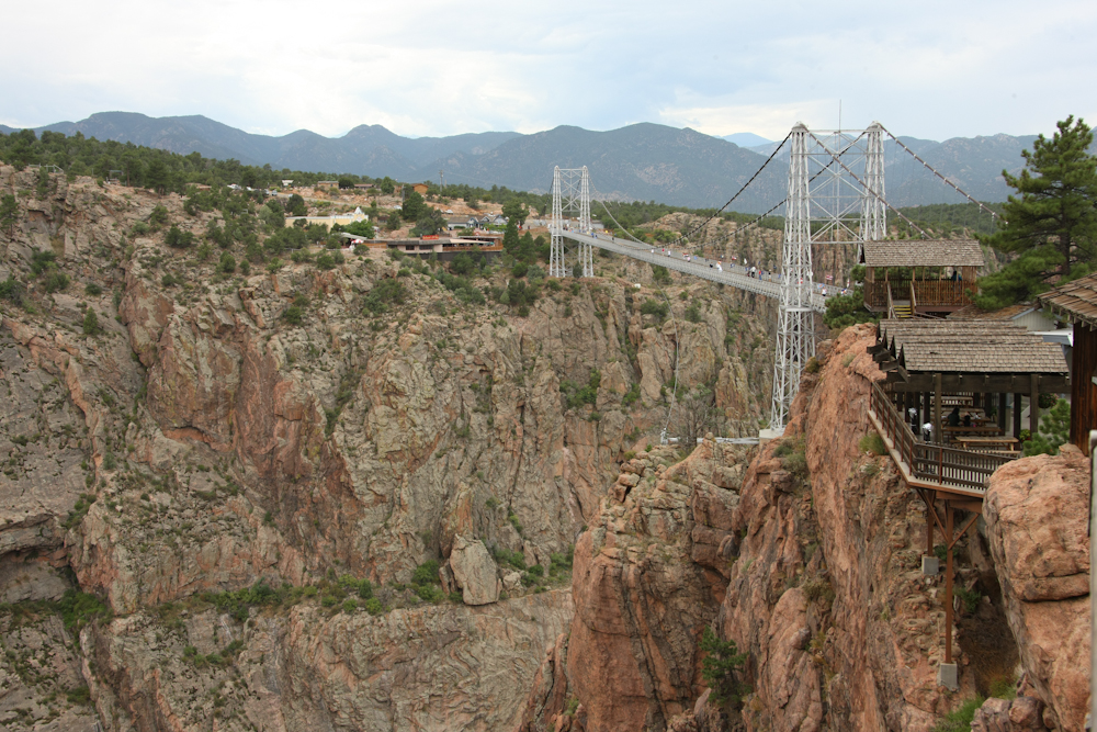
The
bridge was constructed in the 30s and near as I can tell, solely as a
tourist attraction. Impressive nonetheless.
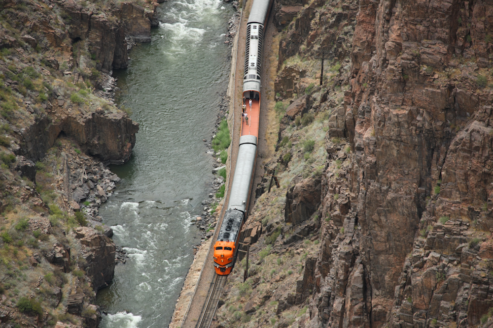
We
walked over the bridge and during our hike a tourist train passed our
position in the canyon below. Some of the cars had open tops that
allowed the riders to see the top of the canyon. The train
stopped at the foot of the inclined railroad that runs up the cliff
wall.
Interestingly,
portions of the railroad track were literally hung from the canyon
walls. Note the cantilevered supports for one of the bridges
where the far end of the bridge goes to the opposite side of the canyon.
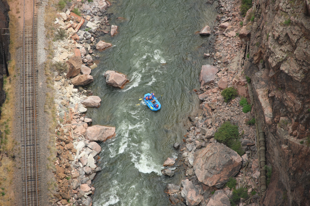
From
our viewpoint on the bridge, we spotted rafters that were running the
river. Note the railroad tracks at the left of the photo and on
the right are the remains of a since-abandoned wooden aqueduct that was
built to supply Canon City.
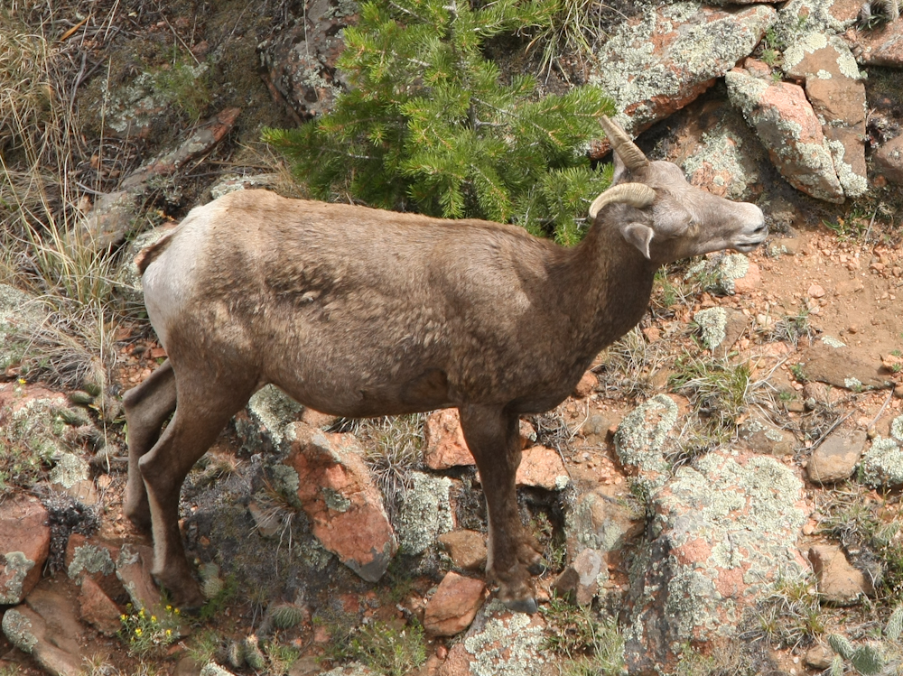
From
the bridge, we also spotted some Rocky Mountain sheep grazing on the
grasses below.
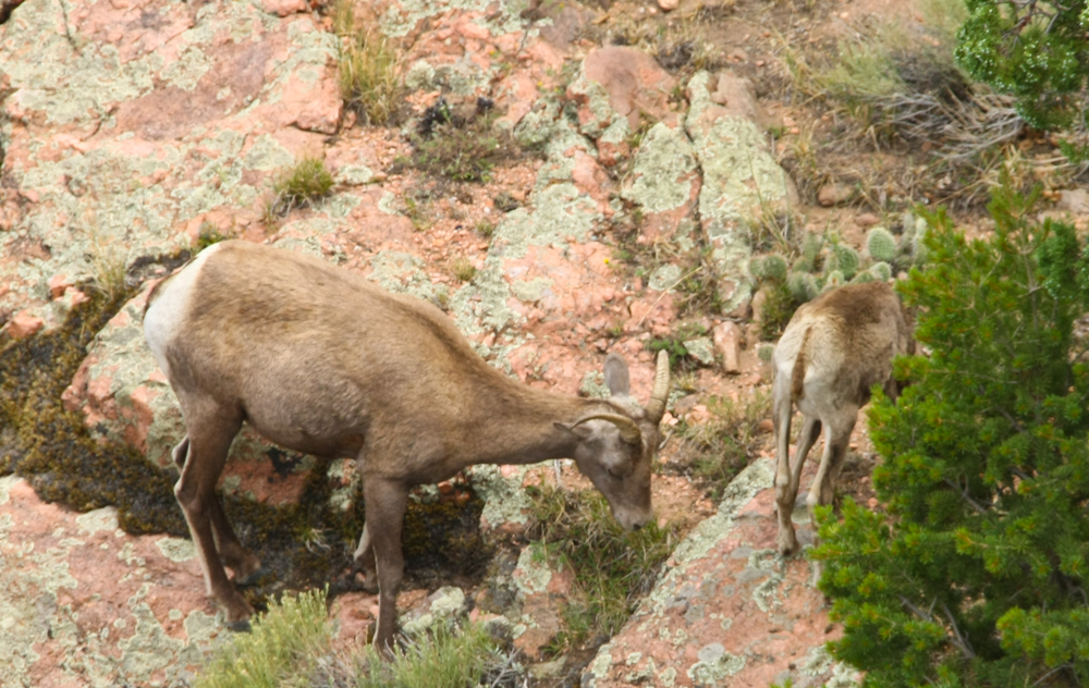
We
saw 3 sheep in total, one had a kid.
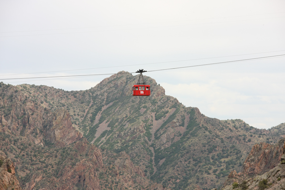
In
addition to the bridge and the inclined railroad, a tramway crosses the
gorge.
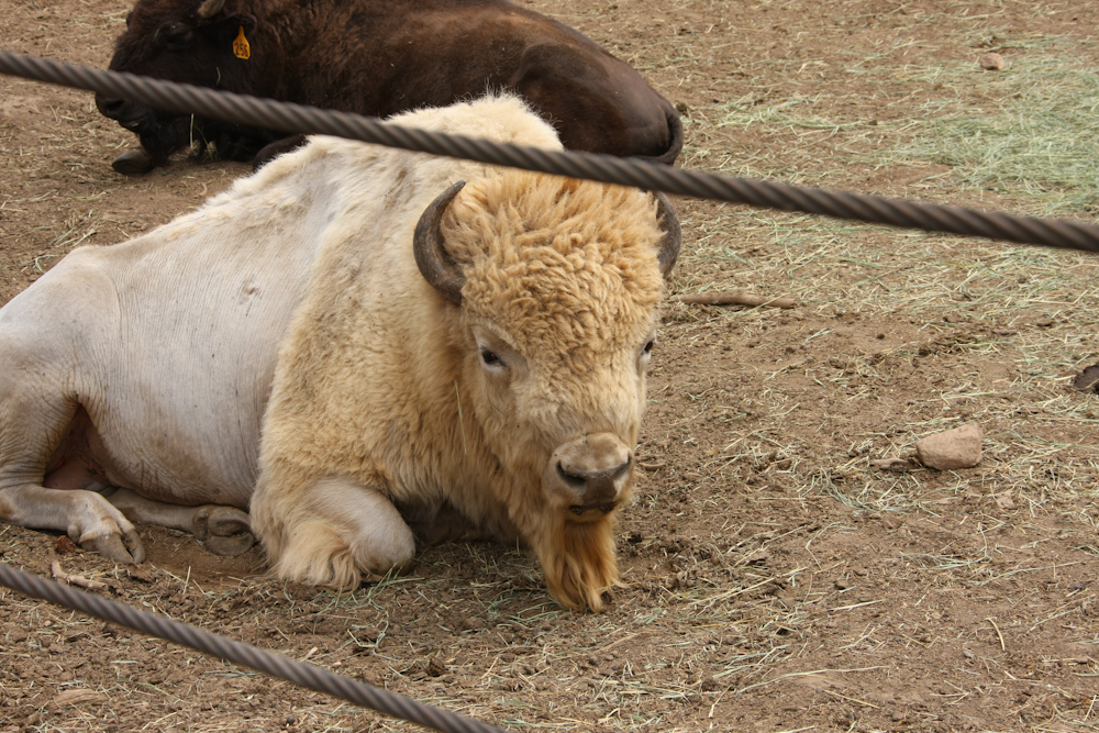
On
the far side of the canyon, the park has a small zoo that had buffaloes
and elk. I thought that the white buffalo was rather novel.
I have never seen one of these before.
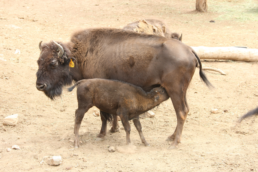
There
were several buffalo calves in the herd and this one was fully engaged
in having lunch. We watched him "snout punch" his mother
repeatedly to encourage her to produce more milk.
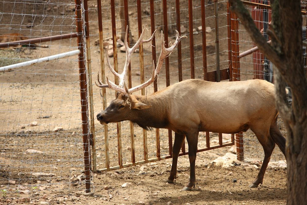
There
were a number of elk in the enclosures. This one has a very nice
rack.
Rather
than walk back across the bridge, we elected to ride the tram.
Above, the sole tram car crosses the canyon to pick us up.
I
chose a position at the front of the tram and therefore got a good view
of the bridge and the canyon below.
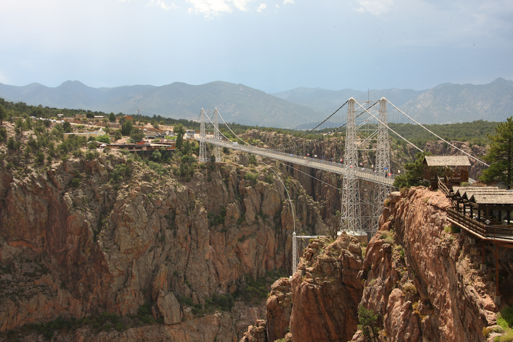
As
we docked at the tram station, I got a final shot of the bridge.
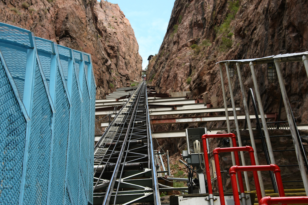
From
the tram, we decided to take the inclined railroad down to the canyon
floor. As we disembarked, I got this shot of the railroad as it
comes down a small side canyon to the floor of the gorge. The
supports for the railroad span the width of the side canyon and in
several places the big beams had been damaged due to falling
rocks. The angle of the railroad is 45% (100% grade) and steep
angle requires that the passengers stand in cages (the blue metal at
the left of the photo above). I assume that the cages are there
to prevent folks from falling out during the ride as well as to protect
them from falling rocks.
At
the bottom of the canyon, we got a better view of the supports for the
train trestle.
From
the bottom of the gorge, we took the railroad to the rim of the canyon
and then moved on to our next camp site. We headed south, then
west from Canon City and we remote camped at the crest of a
ridge. A storm had overtaken us and it rained most of the night.
We
headed south and then west again to the eastern slopes of the Sangre de
Christo range. I had heard on an earlier trip that there were
several trails that passed over the range and into the Great Sand Dunes
National Monument so we tried to find it. The first path we found
on our GPS device and it showed a trail that transected the
range. On the trail, we encountered some locals on quads that
told us that the trail was blocked at the crest of the range.
Strike one.
We
traveled south and found signage for another possible route over the
mountains, so we took the trail.
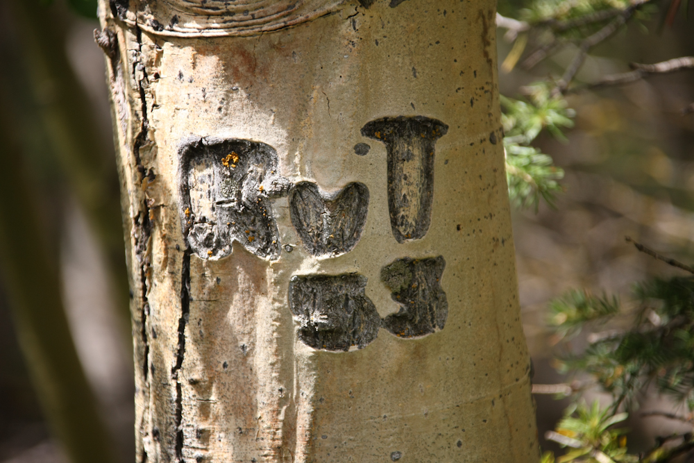
The
trail was narrow and there were many tree branches that covered the
path. The branches did a great job of polishing the top of the
camper and tearing off the remaining limit lights. Along the way,
I spotted this aspen tree with some initials carved into it and dated
1953.
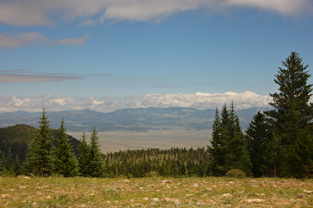
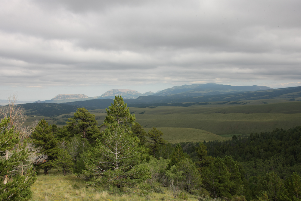
Strike
two. The trail was blocked as well, but there was a nice
camp site at the crest that provided stunning views of the valley
floor to the east.
Music
Pass is to the left of the cloud-covered peak. We took a few
photos and took another stab at polishing our camper top.
From
the Music Pass trail, we traveled south to try the next trail over the
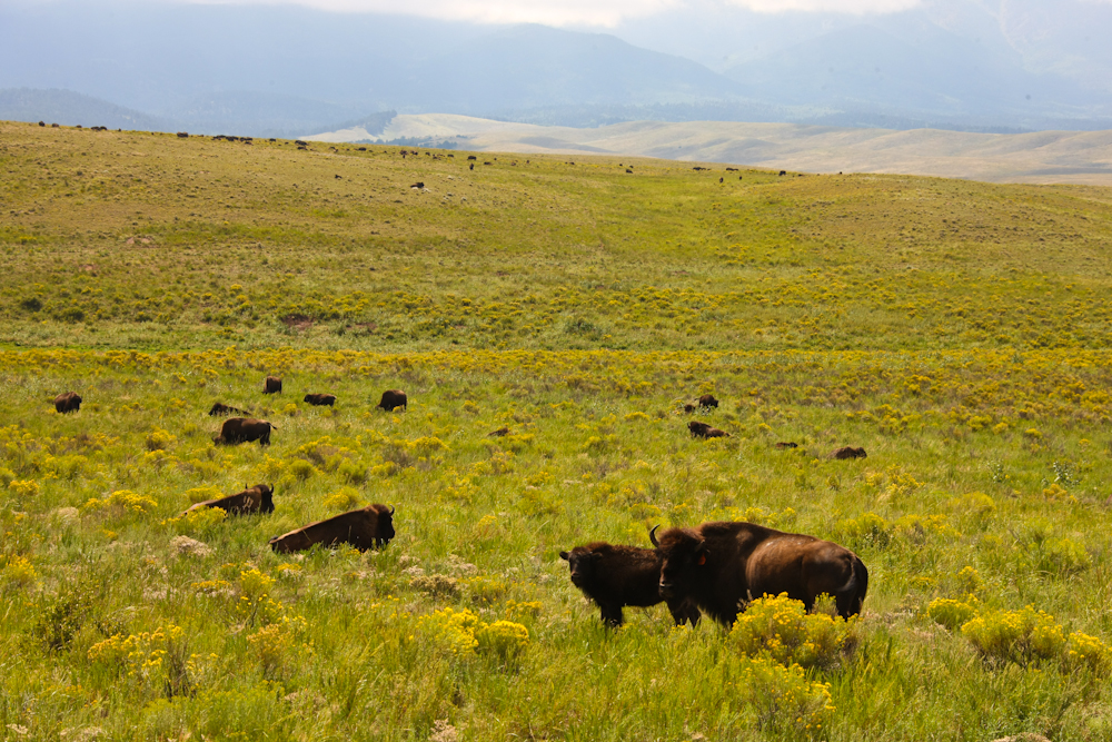
Sangre de Christo range. Along the way, we passed a sizable
buffalo herd next to the road.
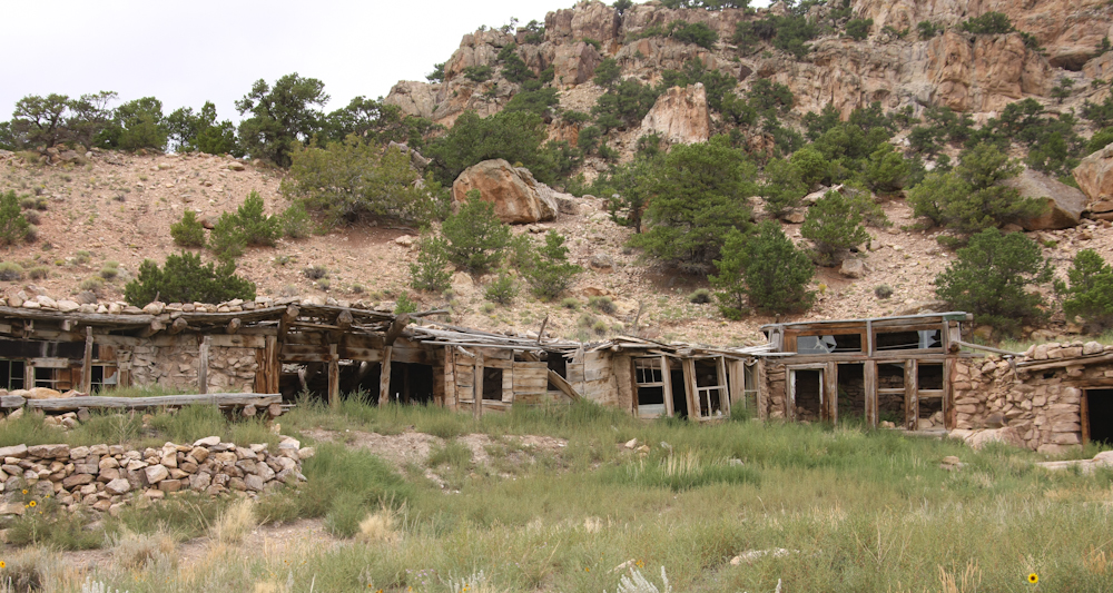
On
our last, and final, attempt to cross the Sangre range, we passed these
interesting abandoned structures. I am sure that these buildings
have a story to tell.
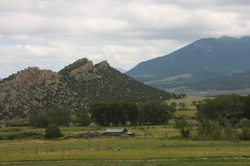
Our
path took us past an interesting hog back structure on the
eastern flanks of the Sangre de Christo range.
The
trail was blocked at the crest of the range. But, this trail DID
go to the Sand Dunes and the dunes were only 4 miles away from the
blockage. Strike three. We retreated and did the southern
highway route to cross the range into Alamosa, CO
| Previous Adventure | ||
Photos
and Text Copyright Bill Caid 2010, all rights reserved.
For your enjoyment only, not for commercial use.