We
were "done" with Niagara Falls and headed out the next morning at
Warp 2 heading south. Our initial destination was Rickett's
Glen State Park in PA, but we were not able to make the entire
distance in one day. So, we found another state park along
the way and hit Rickett's the following day.
The photos below are what we saw.
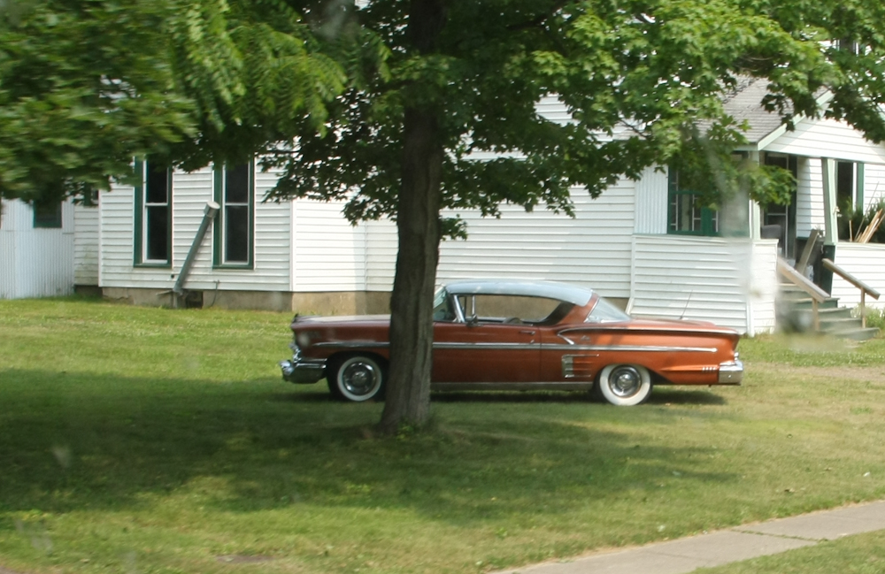
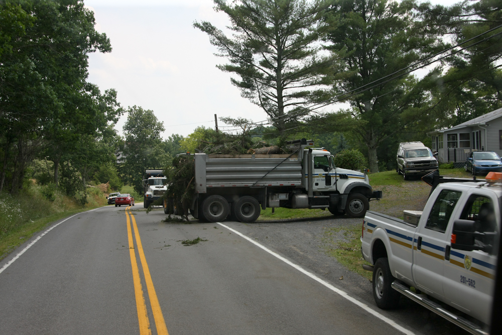
Sometimes
in our travels we see interesting vehicles. While not a
super photo (shot through a dirty windshield while in motion), it
clearly shows a nice restoration of a mid-fifties coupe.
We
traveled quite a ways and were ready for a stop. Our first
attempt was an RV park that we found by the road. The
preliminary inspection drew a resounding "NO" vote from both of us
so we motored on. About 5 miles down the road, we saw a sign
for a PA state park so we went to check it out. The place
was more than acceptable and we got, according to the rangers, the
best site in the park.
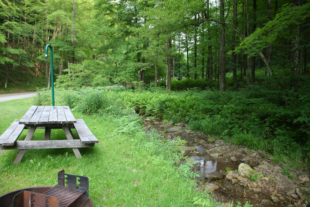
We
were right next to a small stream and had full 30 amp service
allowing us to utilize the air conditioning.
From
the state park we got to Rickett's Glen only to find that the camp
site was full. We went further down the road to a nice RV
park. That section of road required that we descend an 18%
grade which required us to be in 3rd gear (out of 5) and use the
exhaust brake full-time during the descent. We spent the
night at the RV park and it was HOT. Gladly, they had both
wireless and full electrical. Next morning, we discovered
that there had been a large storm that had struck most of the
northeast. We were not impacted (for now) so we broke camp
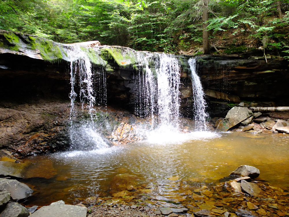
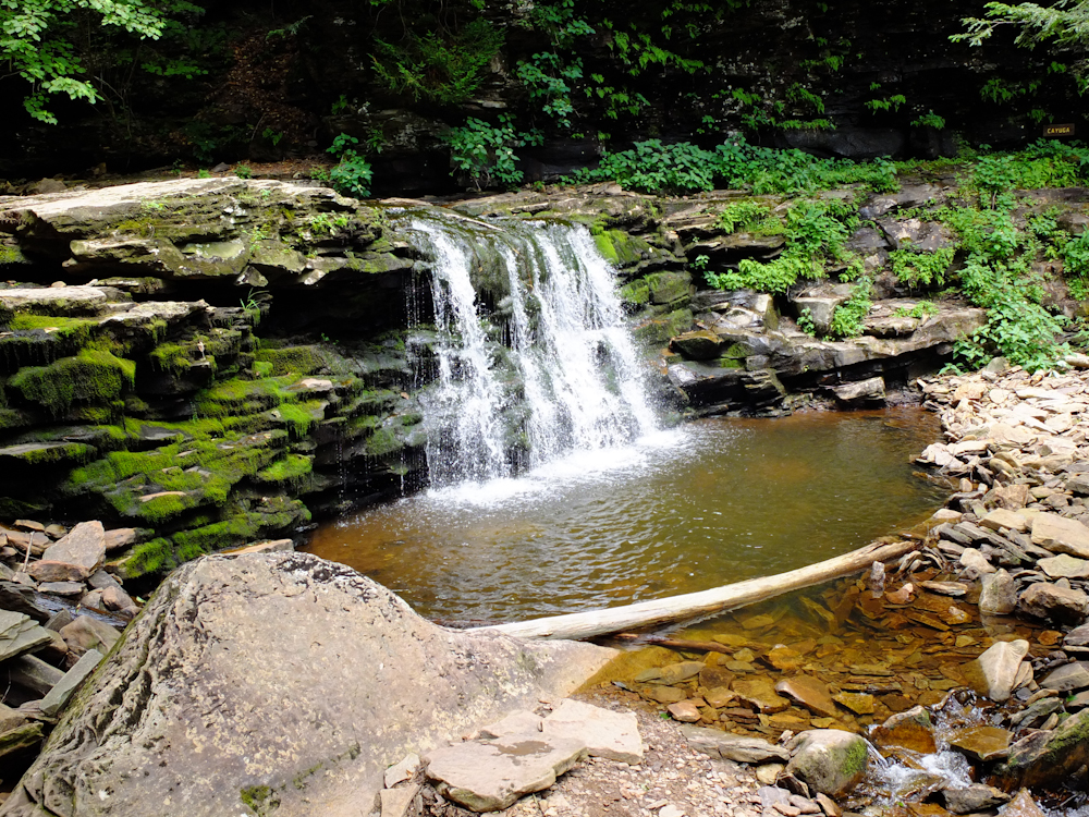
and headed back up the 18% grade to Rickett's Glen to do some
hiking. Our objective was to see some of the 22 waterfalls
that are in the park. Above is the first waterfall we
encountered on the trail.
Because
of our arrival time and the trail distances, we took the most
direct route to the biggest falls in the park. This 3 mile
trail was reasonably steep and required careful attention to
footing to prevent falling. Along the way we passed a number
of smaller falls. We also passed a number of hikers that
were struggling with the steepness of the trail. Most of
these hikers needed to do some preparation for this kind of hike
as we will see below.
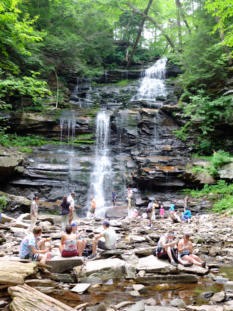
This
in Ganoga Falls, the largest in the park at about 97 feet.
It is a popular place and there were many other folks there.
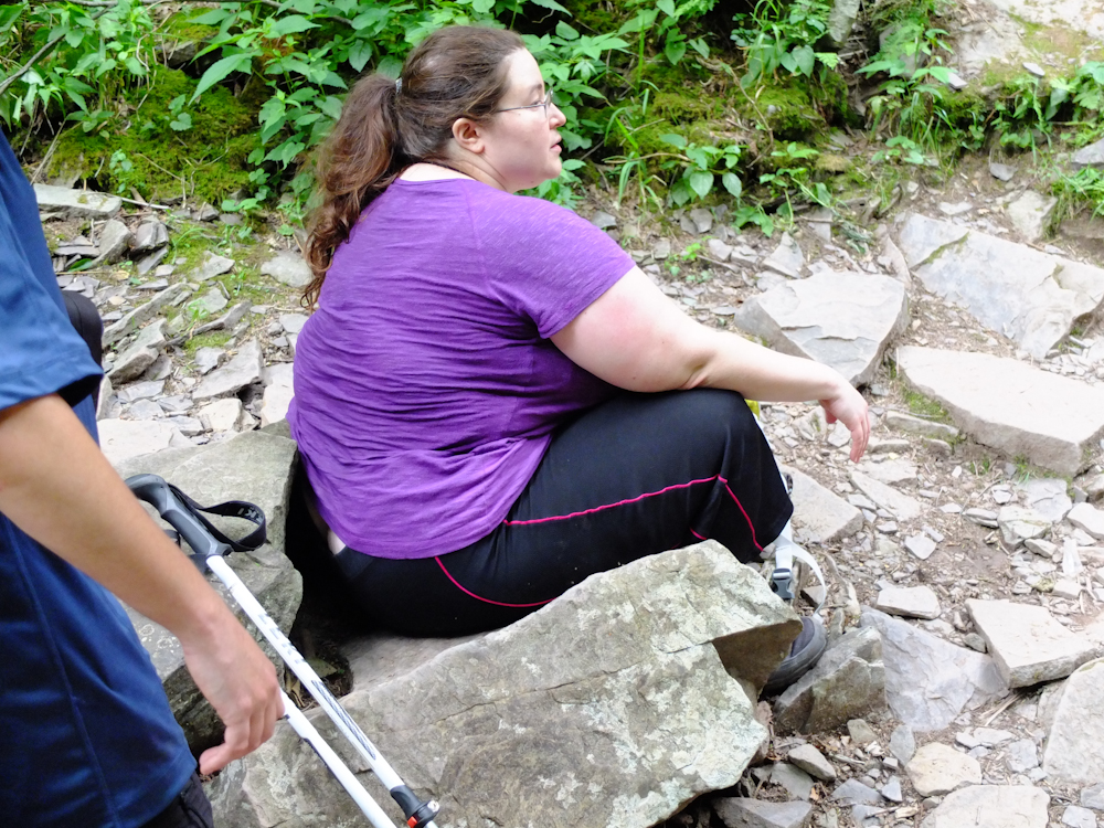
This
specimen is representative of most of the struggling hikers.
Some of the hikers were barefoot which makes no sense to me.
We
left Rickett's Glen and headed southwest toward West
Virginia. We found another state park along the way and
discovered that Jed had beat us to the park. Note this fine
work of engineering. You cannot see in the smaller photo
included in this web page, but the brace used a screwdriver stuck
in the ground.
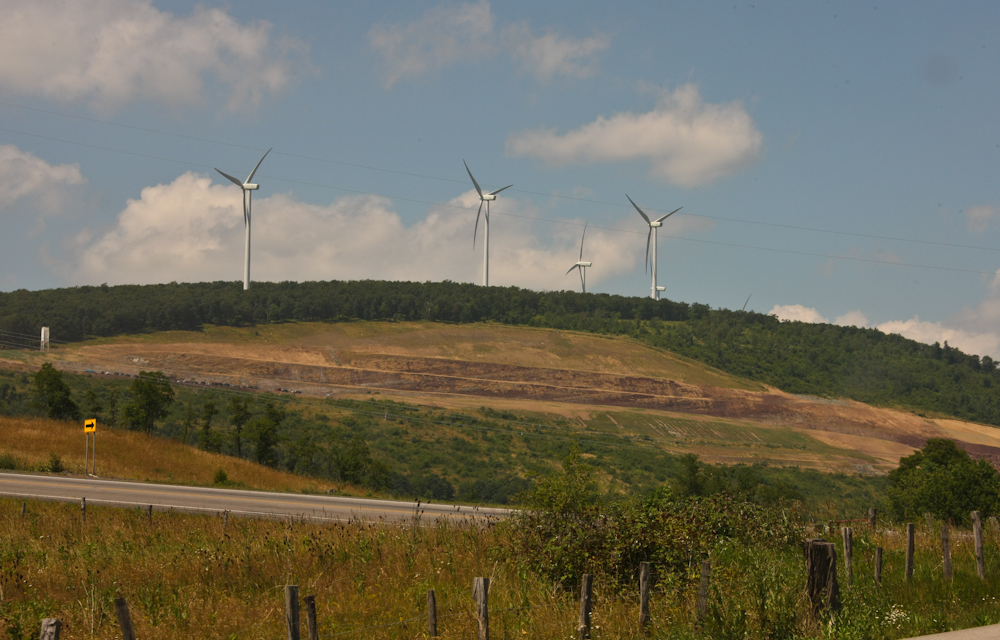
We
crossed the border into West Virginia and then into the highlands
near Mt. Storm. The grade up to Mt. Storm was quite steep
requiring 3rd gear. Near the crest we spotted these
windmills on the ridge above us. I assumed the large cut in
the mountain side was part of a coal mine, but we found out that
it was part of a large interstate highway construction
project. In the canyon, below Mt. Storm, we passed the
"bridge to nowhere" and did not recognize it for what it was.
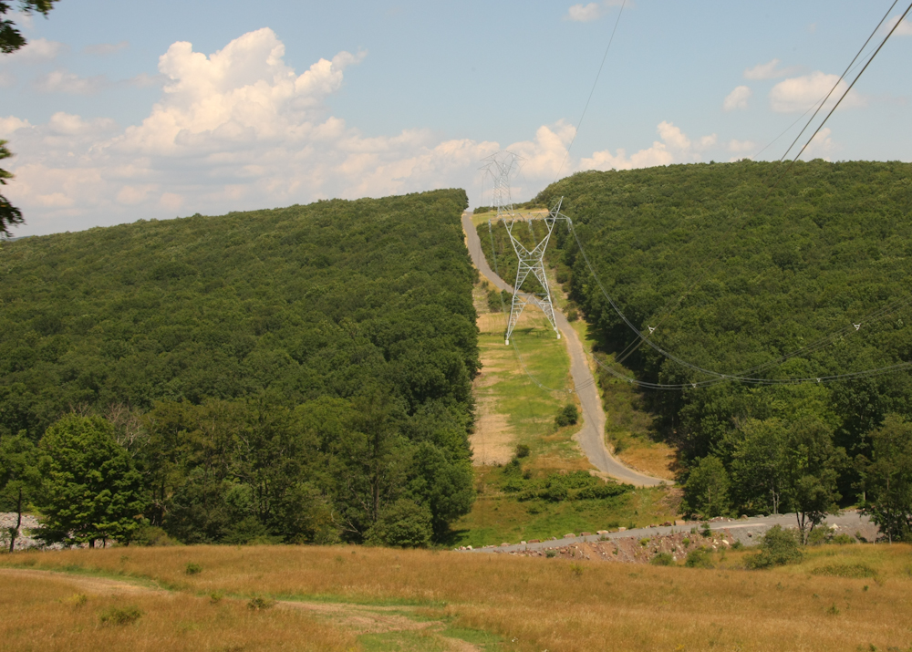
From
the crest of Mt. Storm, we could see that there was a large
electric transmission line. I assumed it was to take power
from the windmills to market, but was wrong.
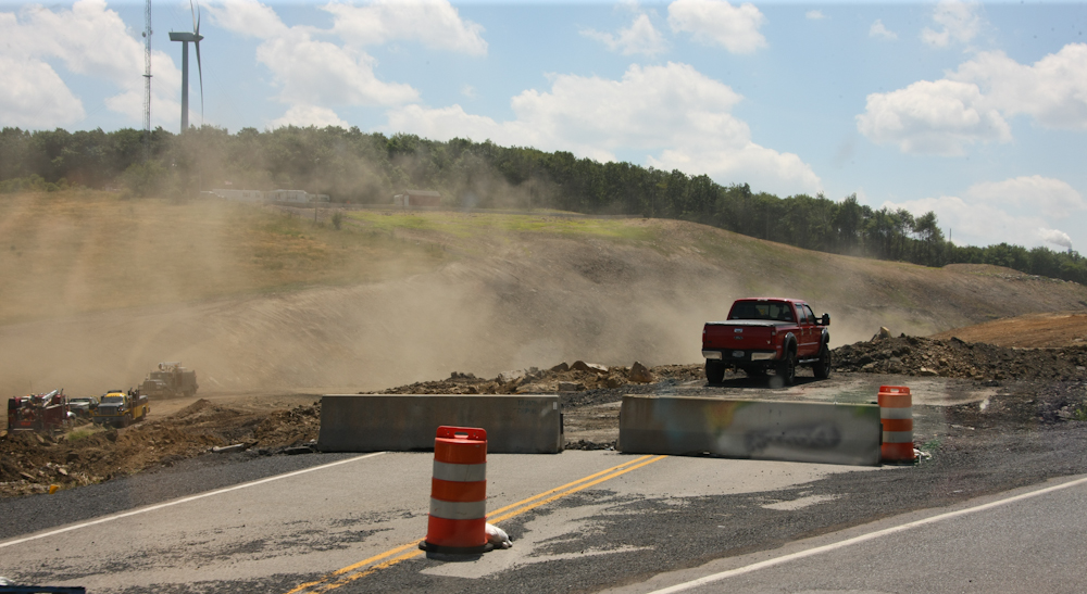
The
highway construction project was substantial and they had
excavated a huge cut in the ridge to meet the grade restrictions
for the highway.
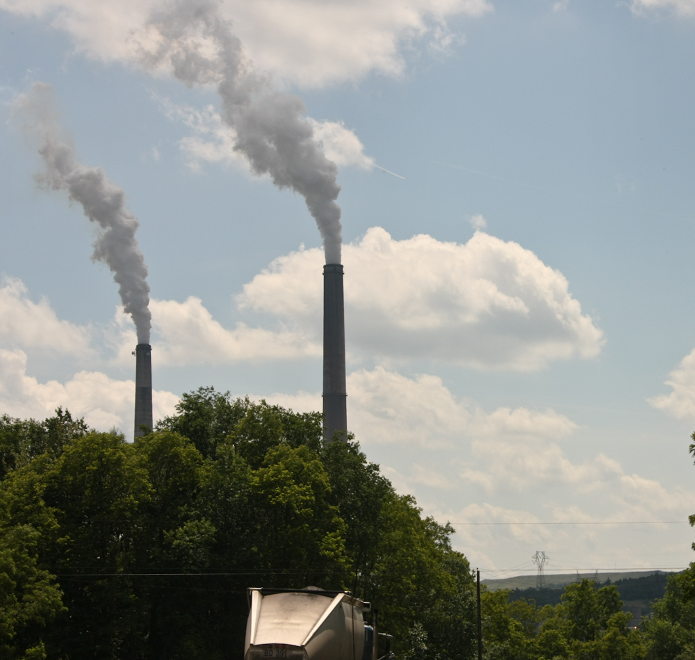
A
few miles down the road we discovered the real reason for the
large power lines. On the top of the ridge was a huge
coal-fired power plant. The truck in the lower portion of
the photo above is a coal truck.
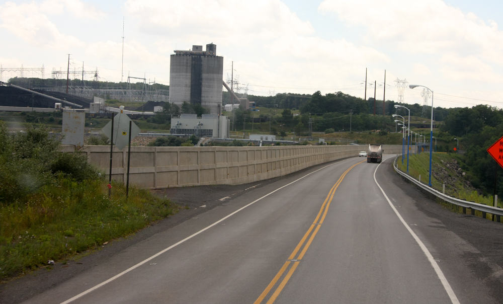
The
concrete wall is not to prevent access but rather part of a
dam. There is a large lake to the left of the wall.
Note the coal pile in the left of the photo above.
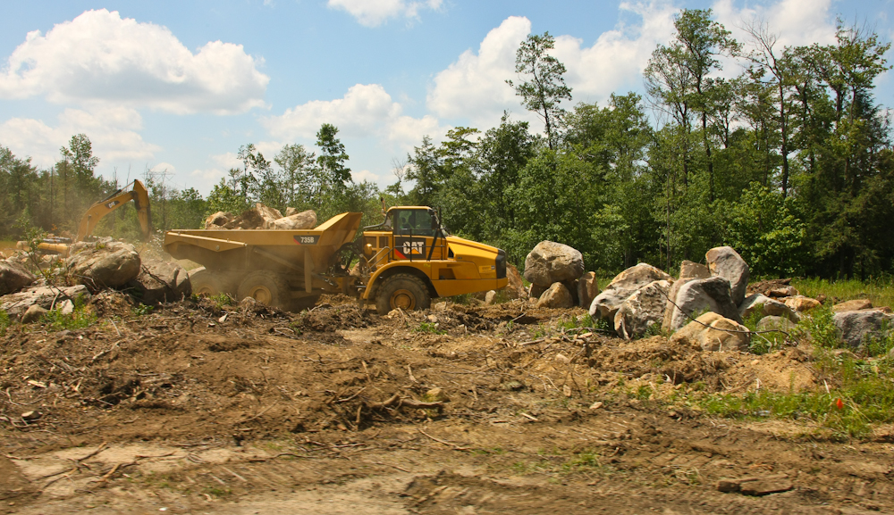
On
the top of the ridge there were many large earthmovers
transporting boulders.
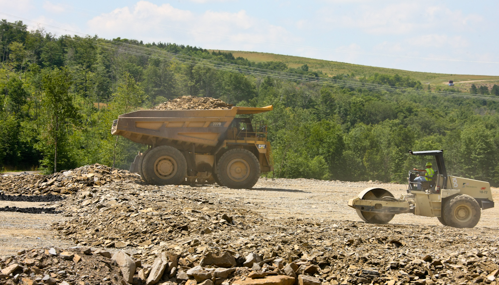
Further
on we saw this team building road bed from the spoils of the road
cut.
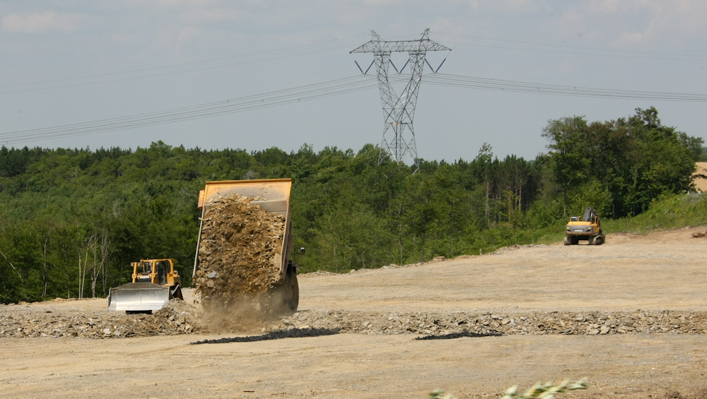
The
bulldozer spreads the rubble and the packer gets it flat.
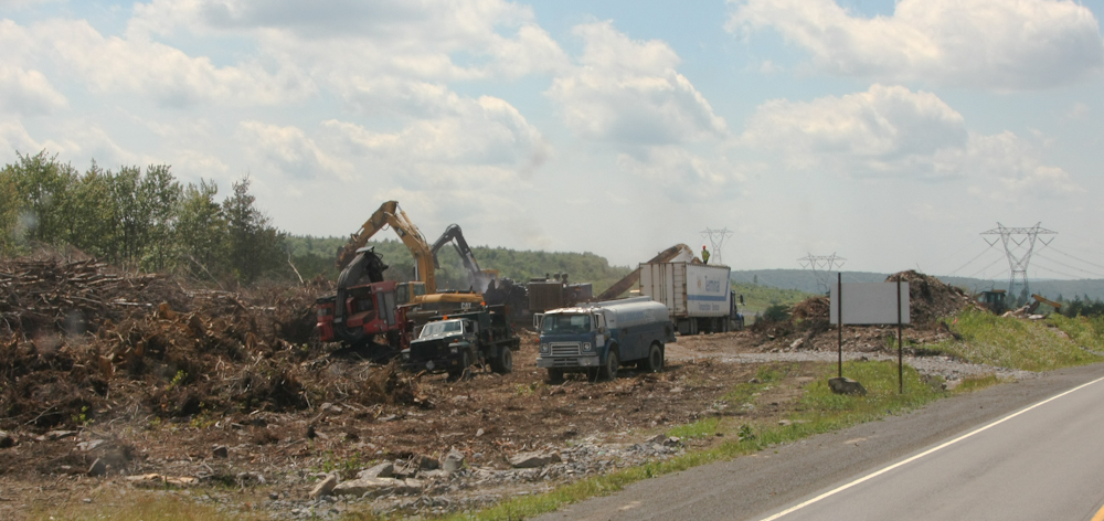
On
the south side of the roadway was a team of guys converting slash
into wood chips. Many miles of forest had been cut to make
way for the road and the trees had to go somewhere. The
trac-hoes had grippers and were loading the slash into the
chipping machine. The 18-wheeler is on the output side of
the conveyer belt taking the chips for processing.
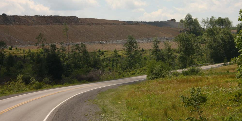
Only
a few miles down the road we came upon several large coal mines
that were used to supply the power plant. Note the large
earthmover on the crest of the ridge.
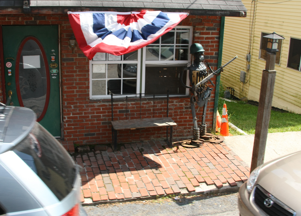
We
turned south and passed through a small town called Davis and
spotted this "tin soldier".
We
headed south to Canaan State Resort Park. In addition to
golf, a hotel, restaurant, a ski area and hiking they also had a
camping area. We got one of the few remaining sites for the
4th of July holiday and had a good night. At the park, we
talked to some semi-locals that were camping off their
motorcycles. They had been there several days and were just
"marking time". They were caught in the storm and showed us
some awesome photos of trees that crashed on their bikes and
narrowly avoided crushing one of the riders. They were
marking time because the damage the storm caused to the electrical
grid was preventing operation of gas pumps making gasoline
unavailable. They were pretty sure they could not get home
on the gas they had in their tanks. And they were pretty
certain, based on news reports, that their path home was impacted,
so they decided to just hang out. Next morning, we got the
photo above as we departed the park. PLENTY of mowed grass.
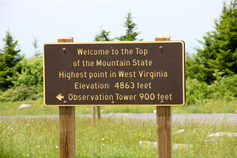
From
Canaan we headed to the top of the tallest mountain in the state,
Spruce Knob. The road was mixed dirt and asphalt and it was
not too steep. Best of all, there were no trees blocking the
path.
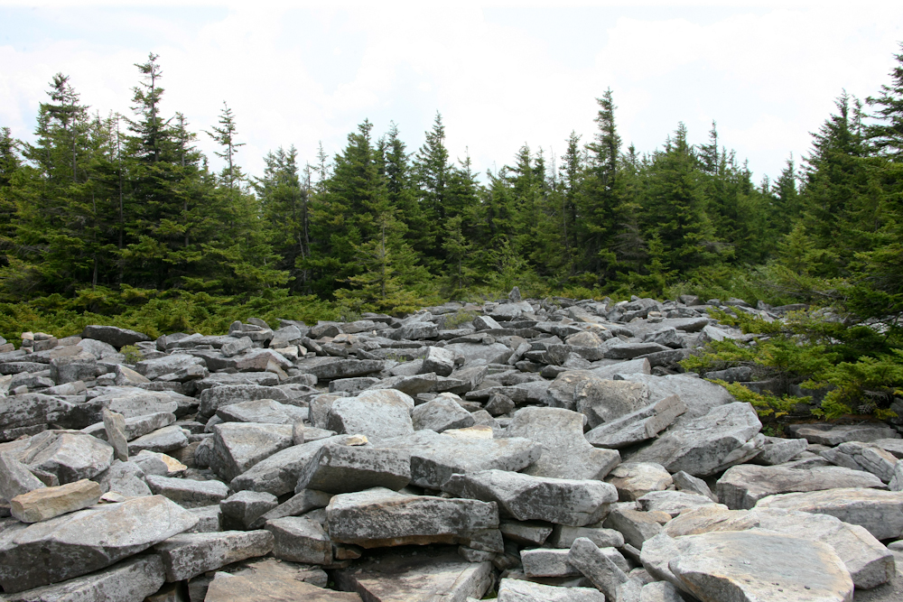
We
hiked to the observation tower and passed large fields of
boulders.
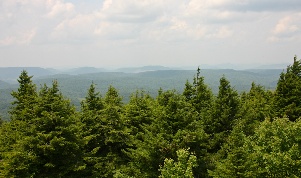
The view from the top was OK, but not breathtaking. Plus, being overcast, it obscured visibility. Pale in comparison to the west.
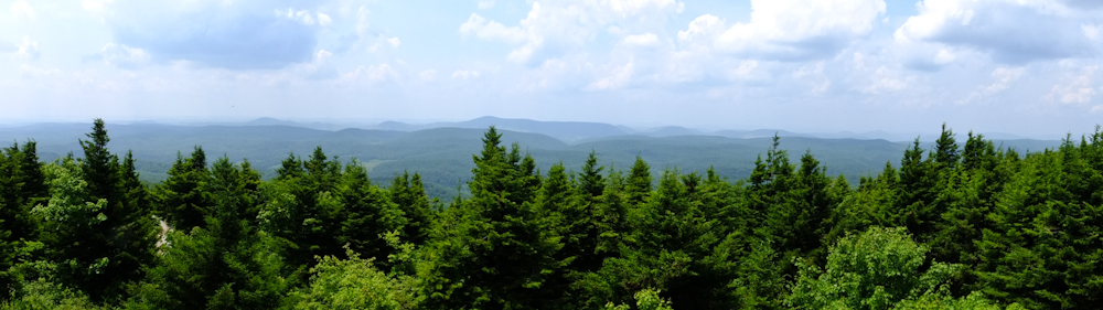
My
little Fuji X10 did an acceptable panorama of the view from the
observation tower.
From
Spruce Knob we headed down the mountain and then south toward the
National Radio Astronomy Observatory in Green Bank, WV.
Along the way, we passed debris that was still being cleaned from
the storm a few days before. Indeed, the locals still had no
power and the local RV park was shut down for lack of power and
water service.
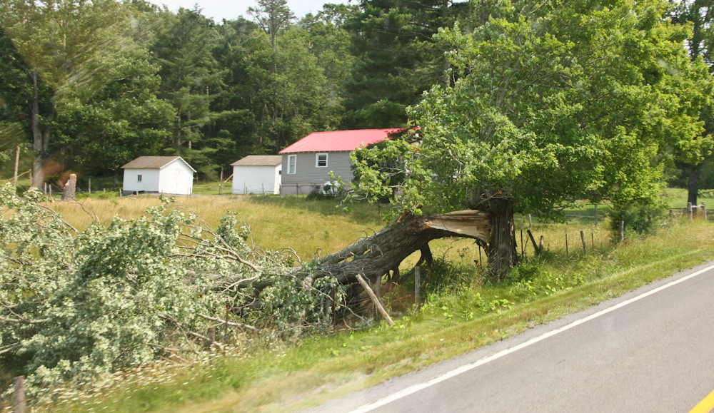
An
example of some of the damage. If the power or phone lines
had run next to that tree it would have been down as well.
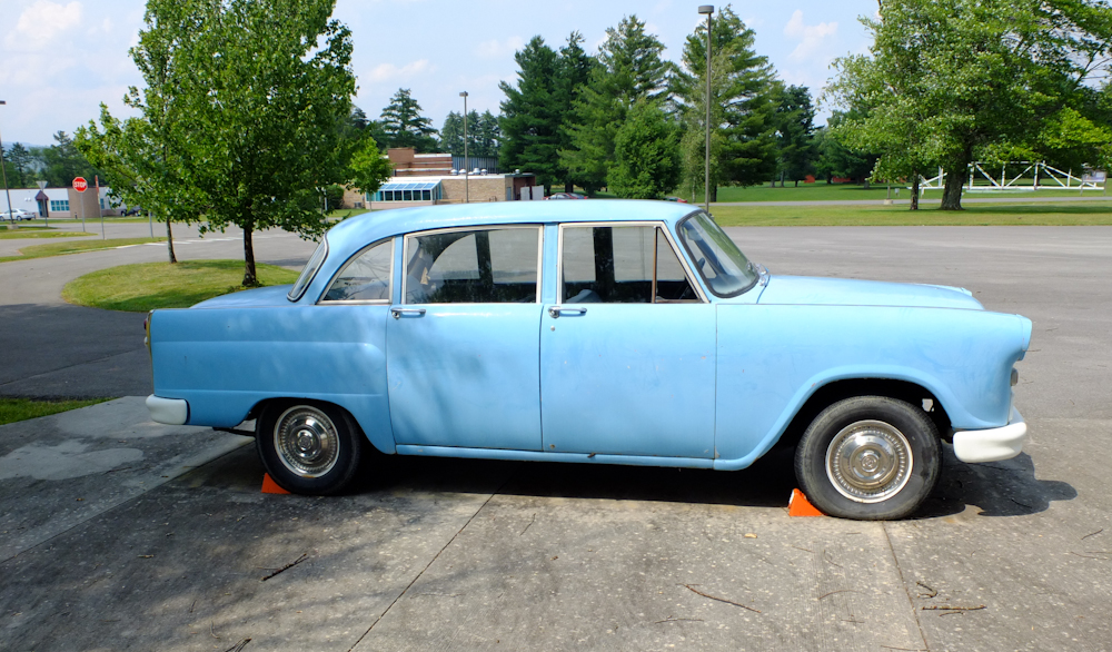
We
arrived at the National Radio Astronomy Observatory and I spotted
this vintage Checker Marathon sedan. These used to be the
only car that could stand up to being in taxi service in
NYC. This one is ex-Navy and was used as a staff car and I
was told that it is quite rare. The car is rare because it
is one of the few that were diesel. NRAO only allows diesel
vehicles on it's grounds due to radio frequency interference (RFI)
caused by the ignition systems of gasoline powered vehicles.
This car is still is use ferrying scientist to and from the
equipment.
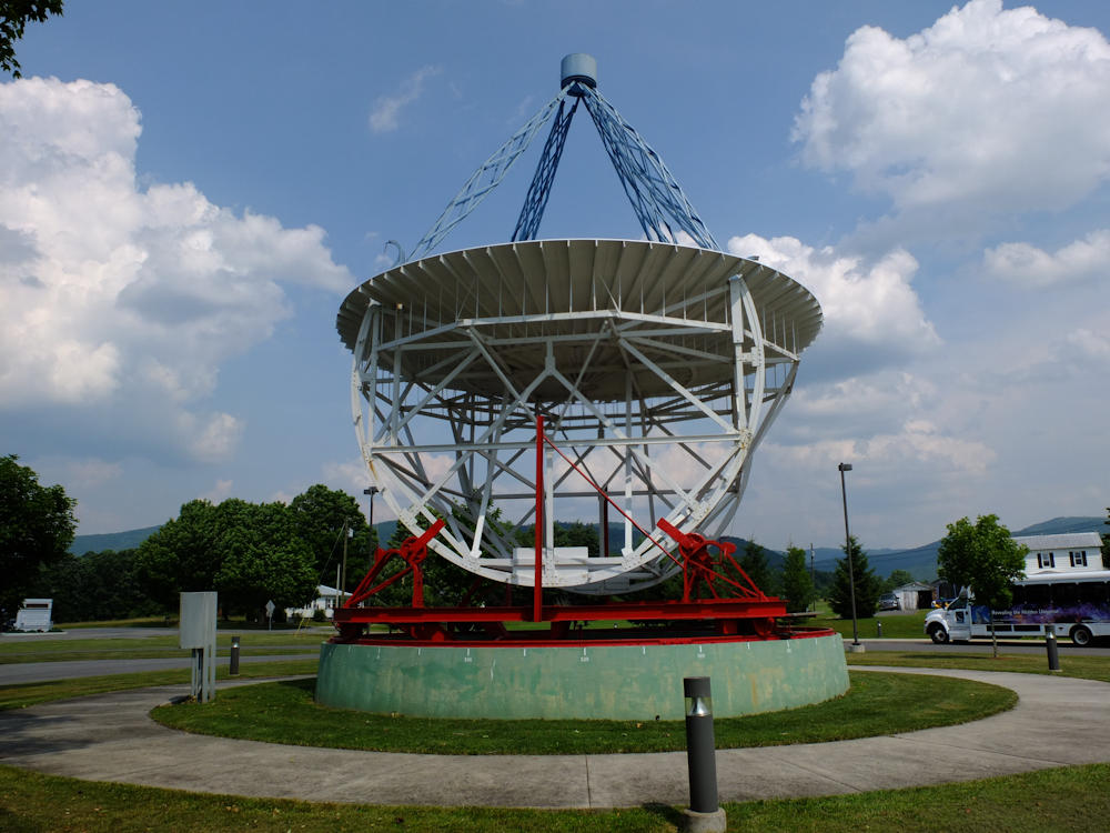
In
the parking area of the visitor's center was this home-made dish
that started the whole scientific investigation.
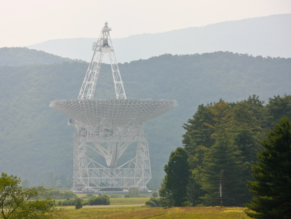
Sadly,
because of RFI caused by digital cameras, they were prohibited on
the grounds and the only photos I got of the dishes at NRAO were
from a distance. The dish above is the biggest dish at the
facility and is claimed to be the biggest and most sensitive
instrument of its kind on the planet. The surface of the
dish is adaptive and can change the focal point of the dish to
match deformations resulting from stresses as the dish is
tilted. The reflective surface of the dish is over 2 acres
and the whole device weighs over 17 million pounds. The
guide told us the gain on this antenna is 60 dB, but that seems
low to me. To be sure, 60 dB corresponds to a gain factor of
10^6 (one million), but with that much area it still seems
small. They have a new generation of detector being tested
that is 16 pixels (as opposed to 1 pixel normally used).
With the high pointing accuracy of 1 arc-second maps were produced
by measuring each pixel and then repositioning the dish for the
next pixel. Repeat until done. The new detector is
more sensitive and is cooled by liquid helium to nearly absolute
zero. And it will finish the job 16x faster.
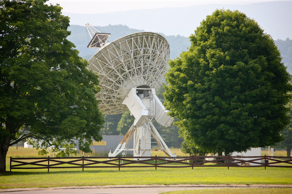
This
is one of the older dishes that has been re-purposed as a solar
radio observatory. The dish is used to look for solar flares
and other events that may be a potential terrestrial hazard.
We attempted to
stay close to NRAO but the power outages in the are close most of
the stores, gas stations and RV parks. We headed south to a
primitive camp in the state forest.
| Previous Adventure | ||
| Trip Home Page |
Photos and Text Copyright Bill Caid 2012, all rights
reserved.
For your enjoyment only, not for commercial use.