We
spent the night beside the Gila River. Next morning, we
broke camp and headed into Clifton, AZ to see what was
there. From Clifton, we headed into New Mexico. We
spent the next night at the "City of Rocks" state park. From
there, we crossed most of New Mexico headed toward the Sacramento
Mountains and from there into the Guadalupe Range just north of
the Texas border.
The photos below are what we saw.
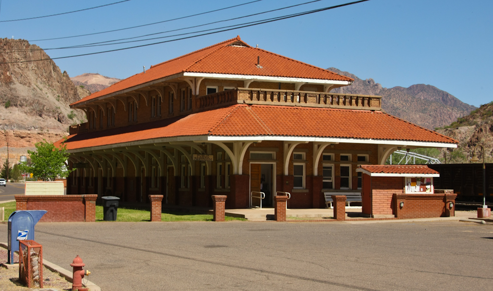
There
is not much in Clifton. Basically, it is a burned-out hulk
of a town that passed it's prime in the early 1900s and has been
supplanted by the bigger mine in nearby Morenci. The
railroad station above is a testament to earlier glory.
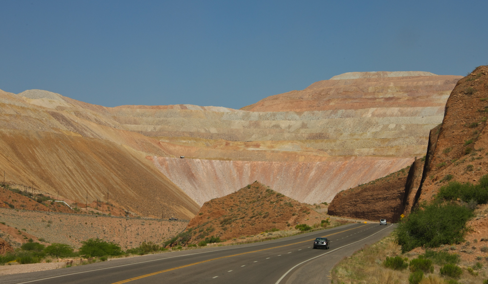
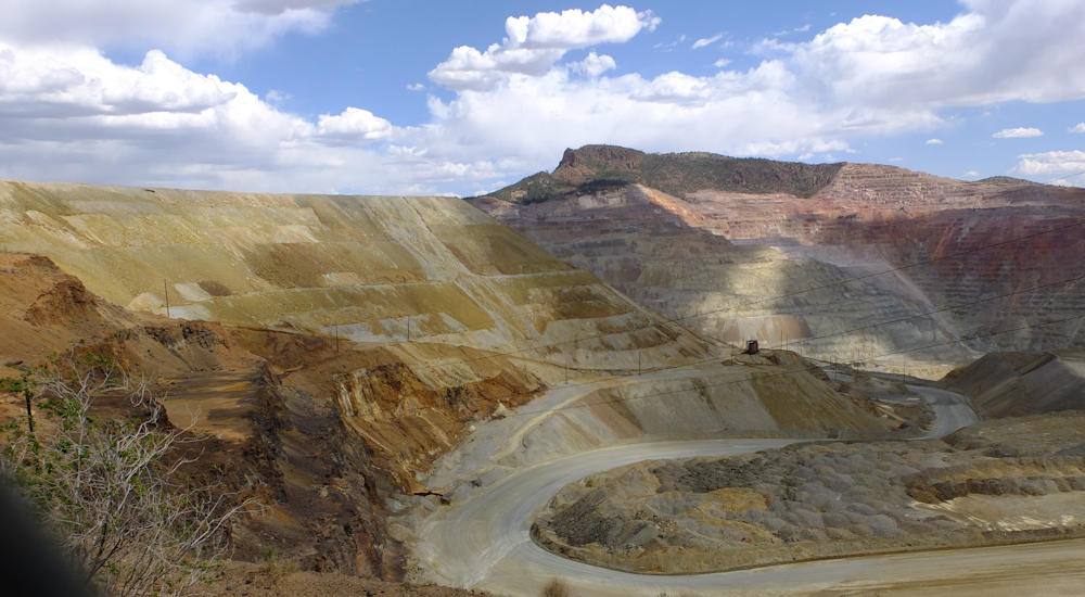
Approaching
the Freeport McMoRan pit at Morenci, you get a good feel for the
amount of material that has been moved over the years. The
dark dot on the hill is a HUGE earth-mover truck.
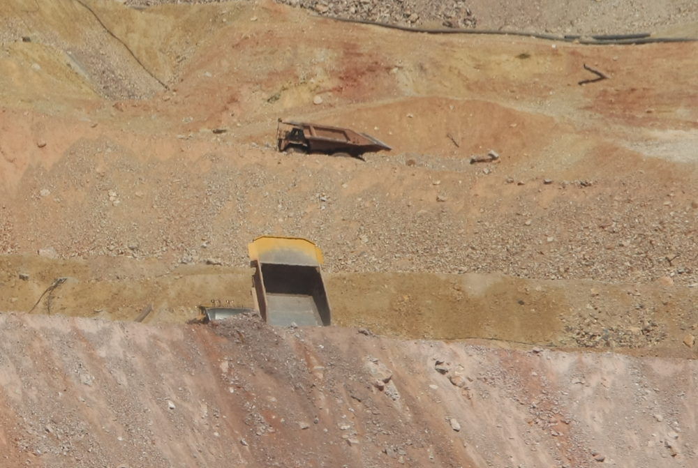
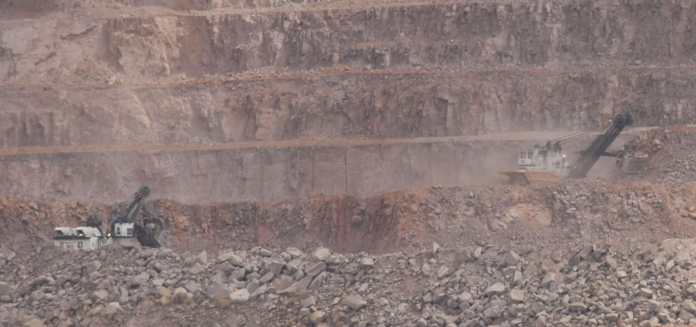
When
we got closer, we got a shot of the trucks doing their
thing. They dump the overburden near the edge and a dozer,
visible on the left, pushes the spoil over the edge. They
don't let the trucks get too close to the edge for fear of a
collapse and/or backing over the edge.
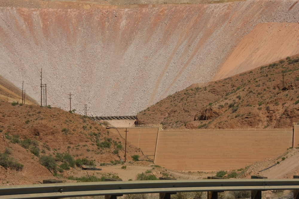
Because
of the high angle of repose of the dumped material, and the fact
that it is loose, the mine had to construct a series of check dams
at the base to stop mud slides that are likely during heavy
rains. Note the first dam is made of old (huge) truck tires.
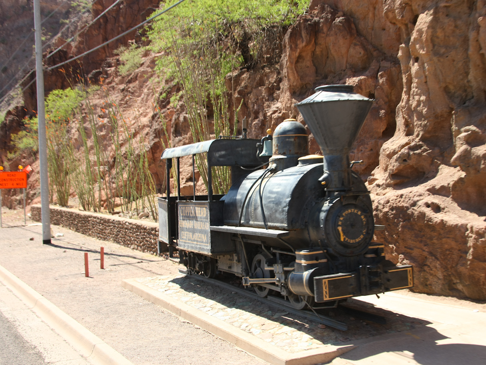
We
headed back through Clifton and got a view of one of the old steam
engines that serviced the mines.
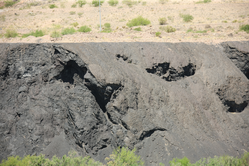
Back
in the day, Clifton had a smelter for the copper. They
dumped the slag right next to the town.

We
headed over the mountains into New Mexico and the road was quite
steep. At a turnout we got a nice view of some of the
awesome cliffs on the opposite side of the canyon.
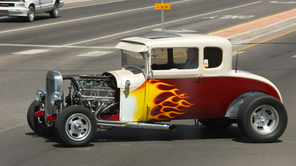
We
continued on to Silver City for lunch and at one of the
intersections, we spotted this fine ride.
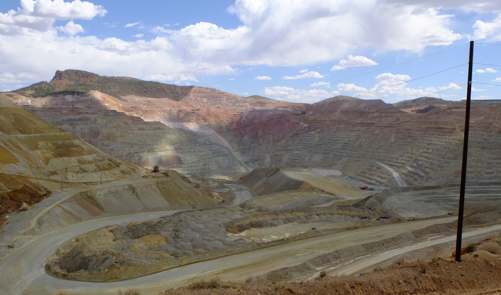
After
lunch, we headed east past the Santa Rita mine. This mine,
also owned by Freeport McMoRan, is one of the larger mines on the
planet and has been worked since the time of the Spanish
conquistadors.
Note
the colors in the overburden pile.
From
the overlook point, we could see the large shovels loading
trucks. Note the truck next to the shovel on the right.
He is backing into position to get loaded.
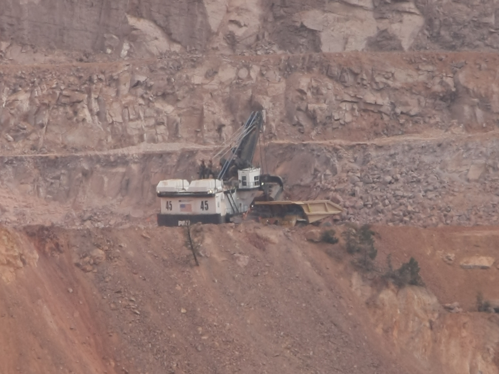
This
equipment is indescribably huge.
From
Santa Rita, it was a short hop to City of Rocks. We drove up
to a view point and got a nice view of the weather that was
brewing north of our position.
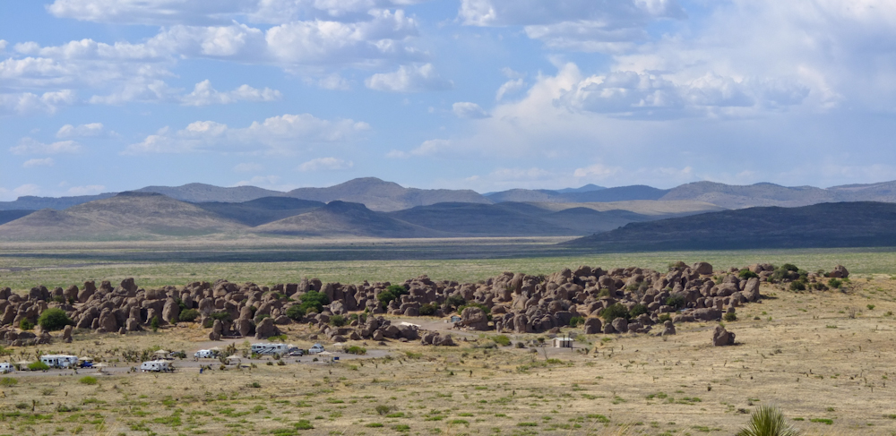
City
of Rocks is an odd place. The boulders just jut out of an
otherwise flat plain. There were camping sites interspersed
in the rocks as well as the trailer sites in the foreground.
Since we need no services to be comfortable, we chose a secluded
spot among the rocks and settled in for a nice night. The
weather was cool, so we slept well.
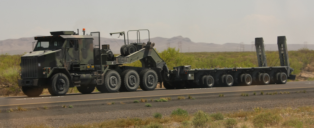
We
headed south from City of Rocks to I-10 and encountered a convoy
of these tank carriers. There were 30-40 trucks in the
convoy and I assumed they were coming from Ft. Bliss but their
destination was not clear. These units are huge and they
have dual massive winches on the rear of the tractor.
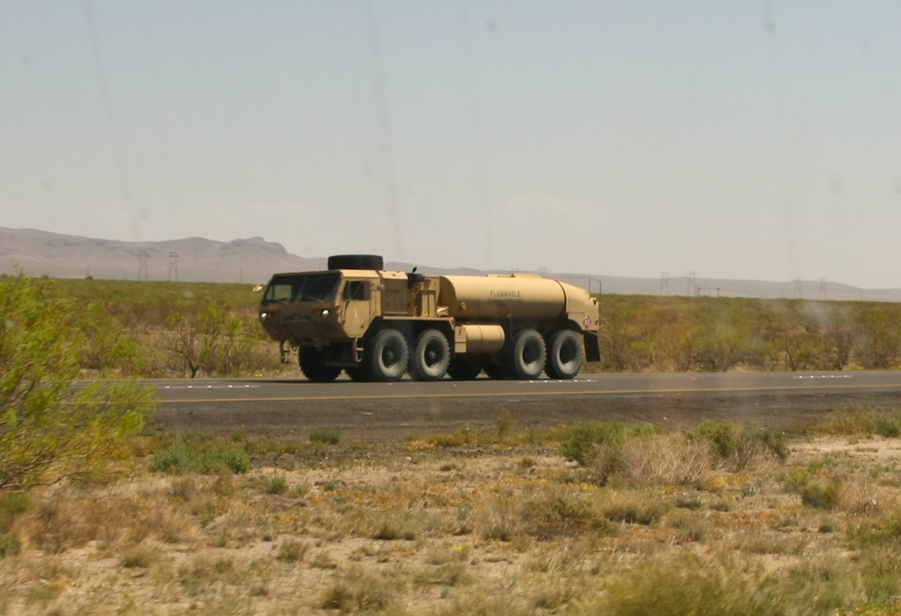
The
convoy was followed by a fuel bowser. This truck, even
compared to Thor is huge, but is puny compared to the tank
carriers.
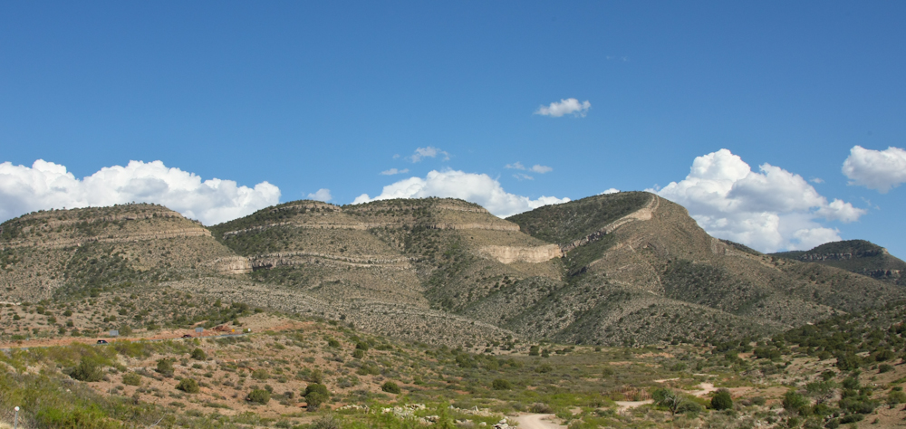
We
restocked in Las Cruces and then headed north to Alamogordo, then
east into the Sacramento Mountains. Note the folding in the
bedding on the west flank of the range.
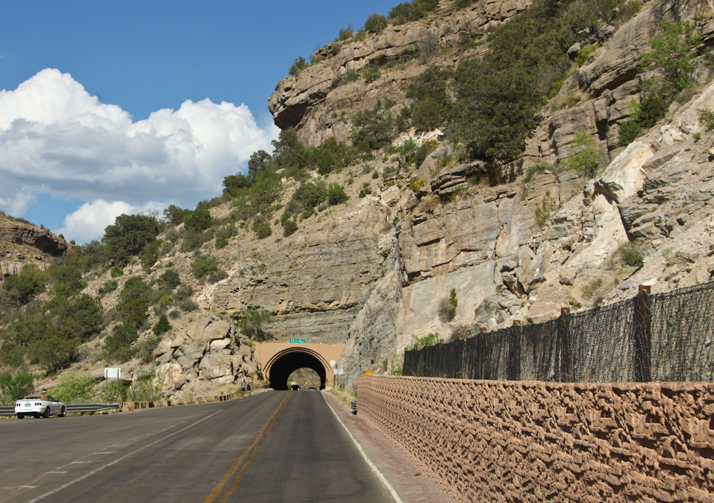
The
road was steep; more than 6% and we had to go through this tunnel.
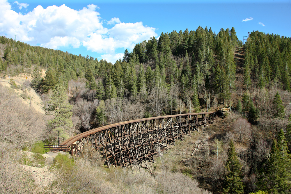
In
the old days, the Sacramento Mountains provided timber for the
railroads. This railroad trestle was built to deliver the
timber to the flat lands below.
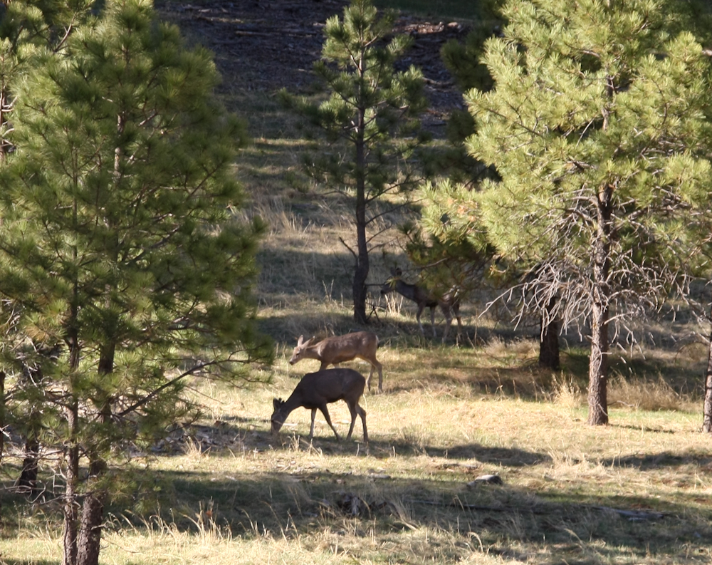
We
had to go to a number of USFS campsites before we found one that
was open. Along the way, we spotted these deer feeding in
the open area. There were 5 in the herd. Our campsite
was at 9,000 feet and needless to say it got cool at night.
But, the wind was calm.
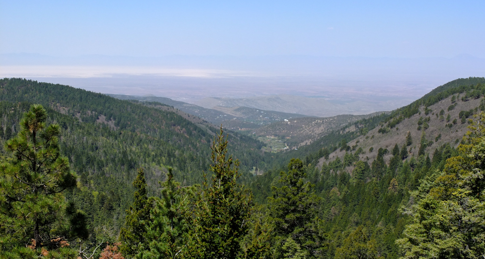
Next
morning, we broke camp and headed south along the rim of the
Sacramento Range. Looking to the east we could see the
Tularosa Basin and the White Sands gypsum dunes (upper left of the
photo above).
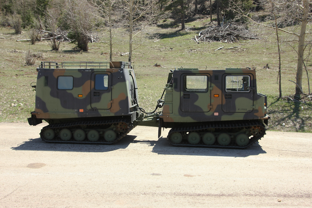
Enroute
to Sunspot, we passed this Haglund snow tractor on the side of the
road.
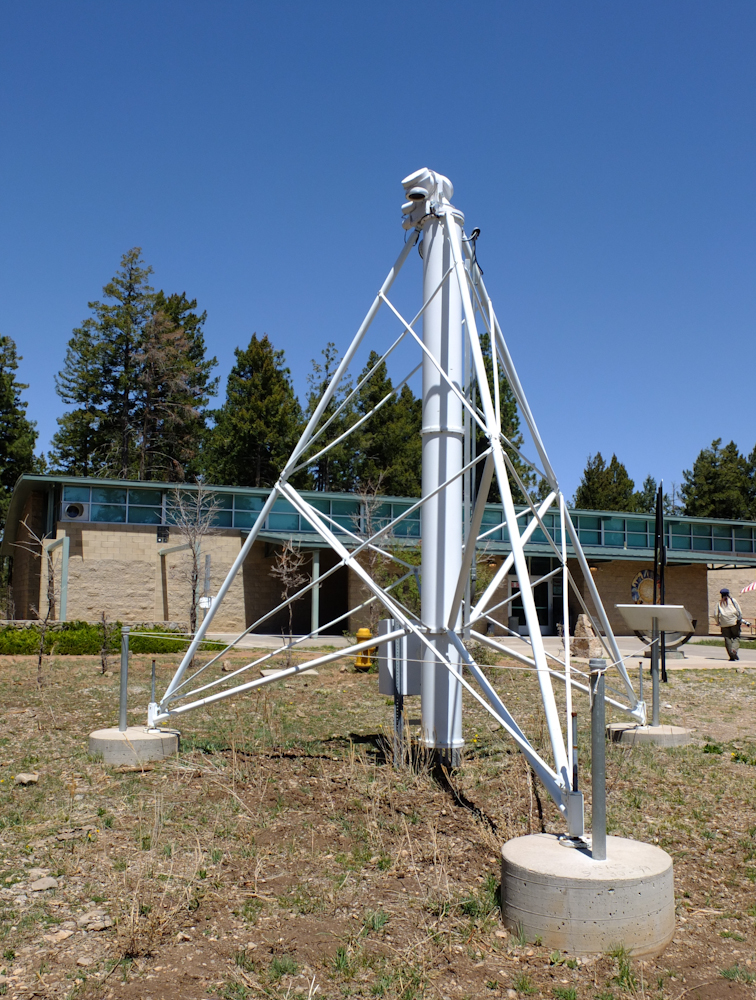
The
photo above shows a solar telescope that was deployed at the South
Pole.
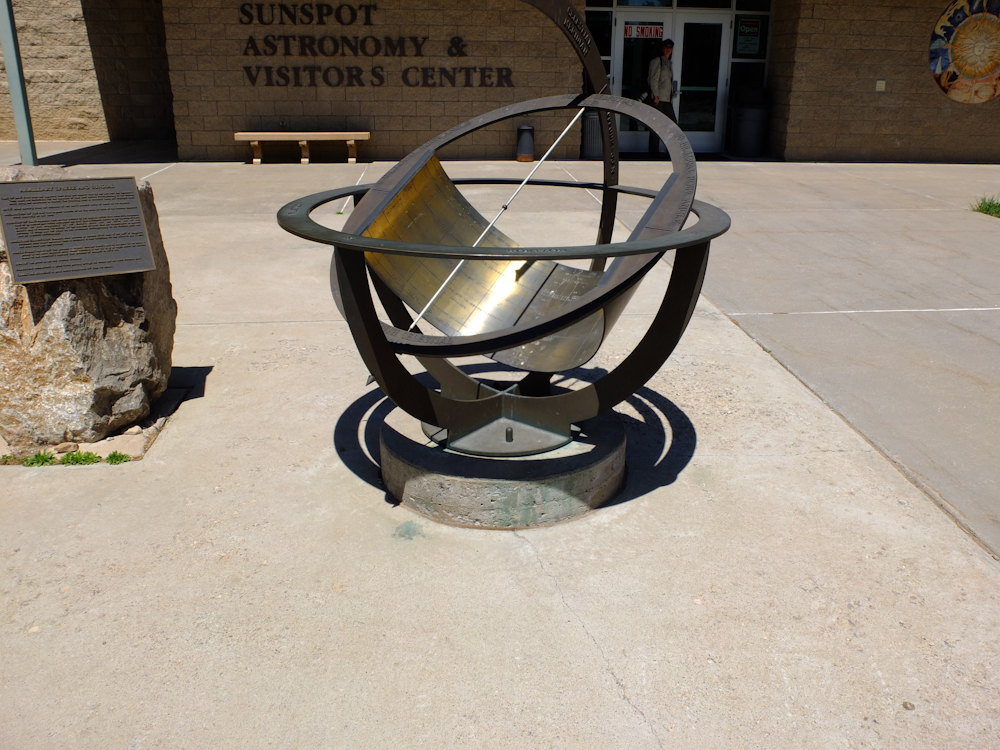
The
visitor center wanted cash to go in, so having already paid and
paid through my taxes, I told them to kiss off and we headed out
on foot. The device above is a solar clock.
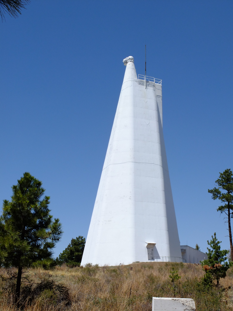
The
first building we encountered had a solar telescope in
operation. This booger was too tall to get in one photo.
The
upper end of the 'scope has the pointing mirror that reflects the
sun into the analysis chamber.
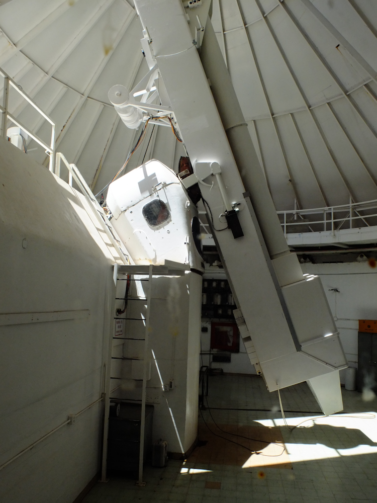
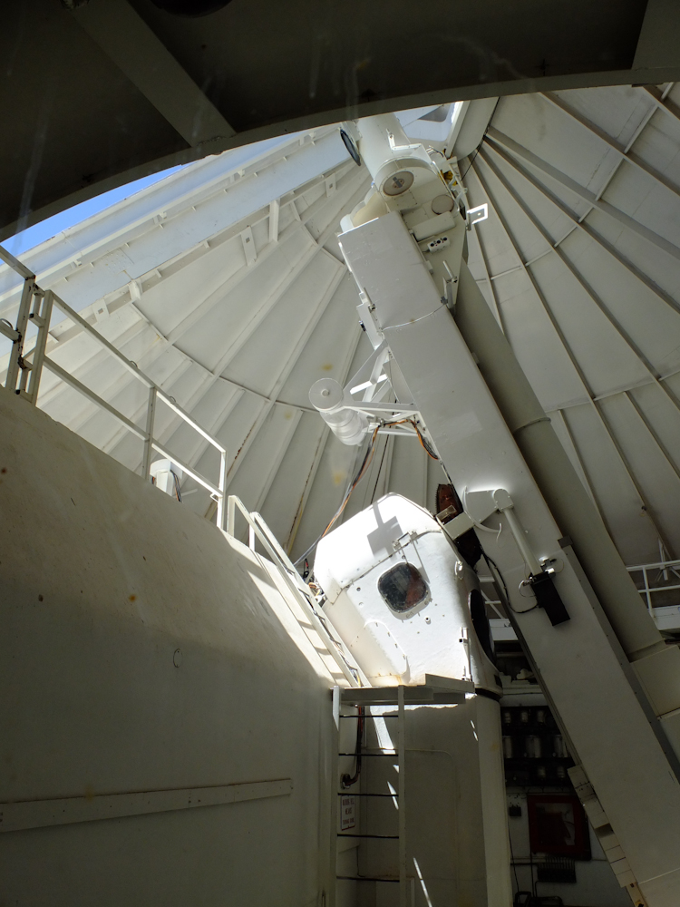
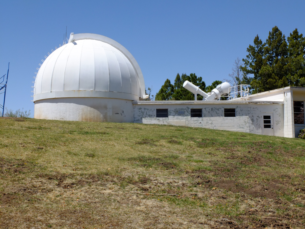
This
instrument is the big bad boy at the Sunspot installation.
Built in the middle 1960s, most of the device is below ground
level. The pit that contains the balance of the optical path
is about 260 feet BELOW the foundation. The above ground
part is about 100 feet. The whole device runs on a floating
mercury bearing assembly. The optical path is "evacuated" (a
vacuum) to prevent distortion from the heat of the sun.
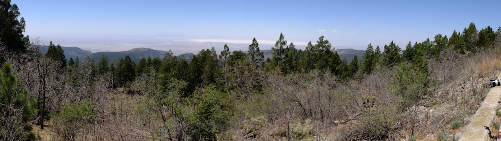
This
is a panorama from my Fuji X10 of the valley to the west of
Sunspot, NM. Click here to see
the full size image. When the image is displayed, you
can use the browser to zoom in further. Use the "Back"
button in the browser to return to this page. The Tularosa
Basin, the valley to the west, includes the White Sands gypsum
dunes as well as the White Sands Missile Range. WSMR is the
home of Trinity Site, the location of the first atomic bomb
explosion.
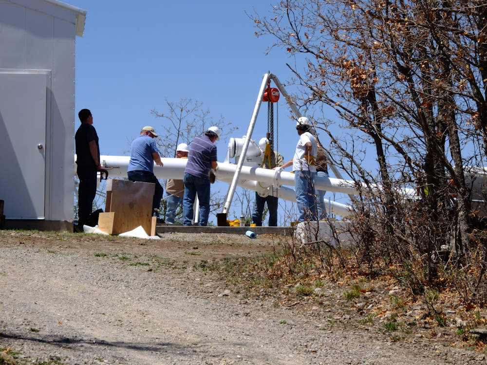
As
we were walking around, we spotted this crew modding some of the
existing infrastructure to accommodate new instruments.
This
facility is used for instrument development and calibration.
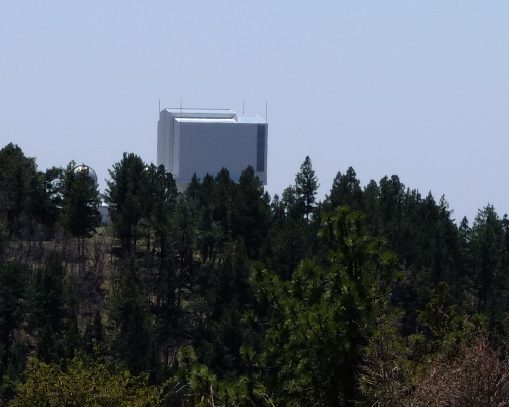
From
the upper view point, we could see the Apache telescope facility
to the south.
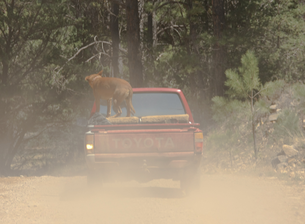
From
Sunspot, we headed south into Timberon and got "positionally
uncertain", so we stopped to check our maps. A local fellow
stopped to assist us, but in reality wanted to check out
Thor. He was a nice fellow and led us to the correct
turnoff. He carries his dog outside and I am not so hot on
that arrangement. I had a hound fall out of my pickup some
years back at about 45 mph. Lucky for him, he hit the only
part of his body that could not be damaged -- his head. To
say he was thick-headed would be an understatement.
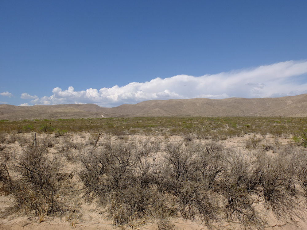
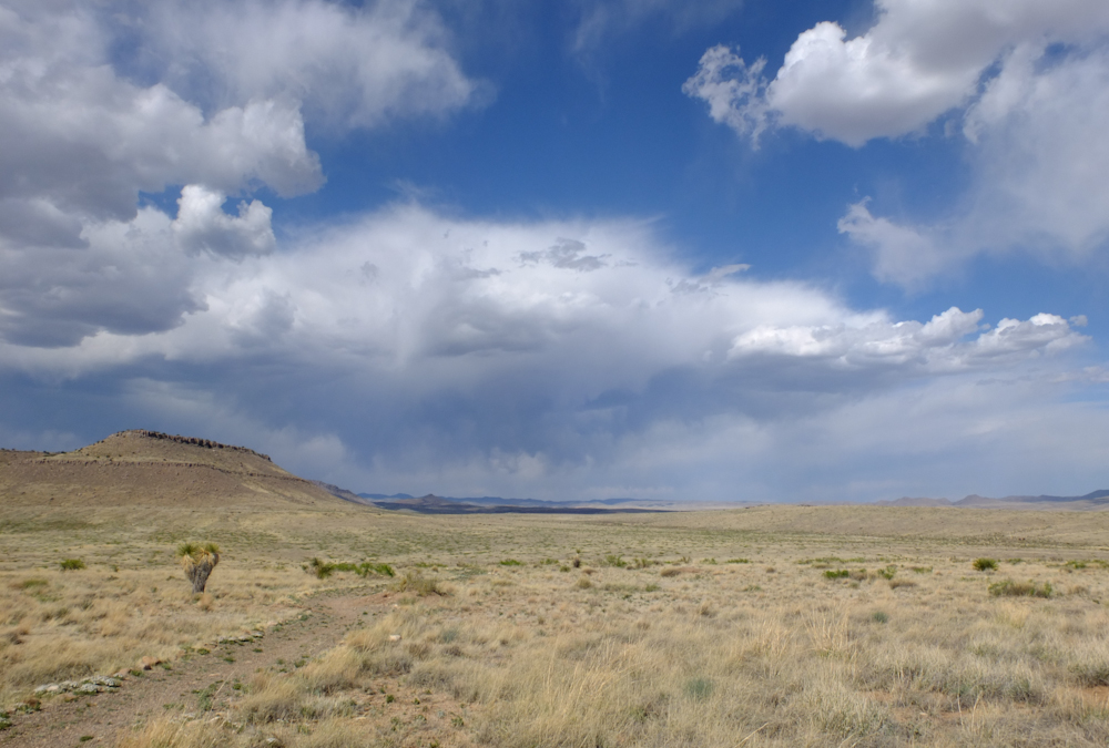
From
Timberon, NM we traveled many, many miles on dirt roads across the
Ft. Bliss range and into the hills beyond. The terrain is
harsh and dry. There is minimal vegetation due to the
minimal rainfall.
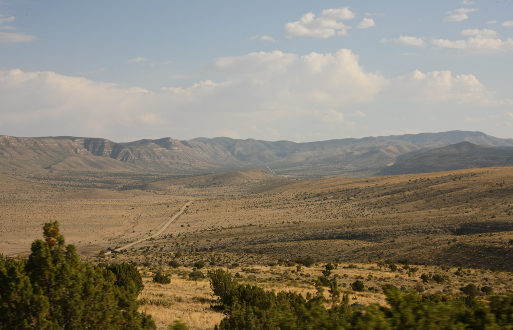
We
traveled perhaps 75 miles of dirt to get to the Guadalupe
Mountains.
| Previous Adventure | ||
| Trip Home Page |
Photos and Text Copyright Bill Caid 2012, all rights
reserved.
For your enjoyment only, not for commercial use.