Trip Report: 20070926
Our plan was to travel from Montrose, CO to Alamosa, CO and see the Black Canyon of the Gunnison River along the way. The Black Canyon is about half as deep as the Grand Canyon, but much more narrow proportionally. As such, the visual impression is striking and very stunning.
The photos below are what we saw.
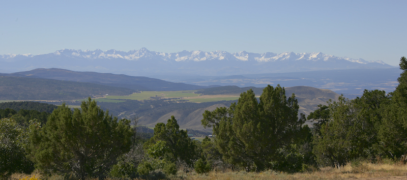
Ascending the mountain that encompasses the Black Canyon, we got an awesome view of the San Juan range to the south. The snow that was the result of the rains a few days previous are clearly visible.
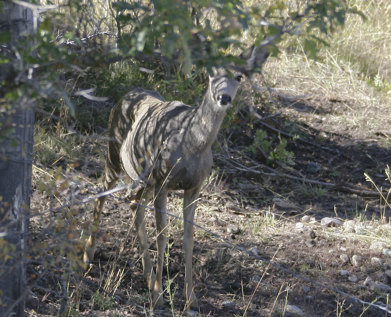
Near the entrance to the canyon, we spotted this mule dear doe grazing along the road.
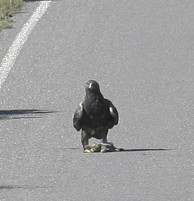
Inside the park we spotted this hawk chowing down on some road kill. Since the hawk was a long way away, I could not tell what it was, but it carried it away when it spotted us. This shot was taken at the maximum zoom of the camera lens (300mm) and then heavily cropped resulting in an effective focal length of perhaps 1200mm.
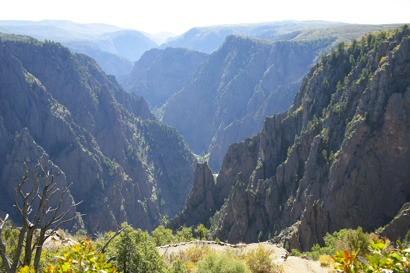
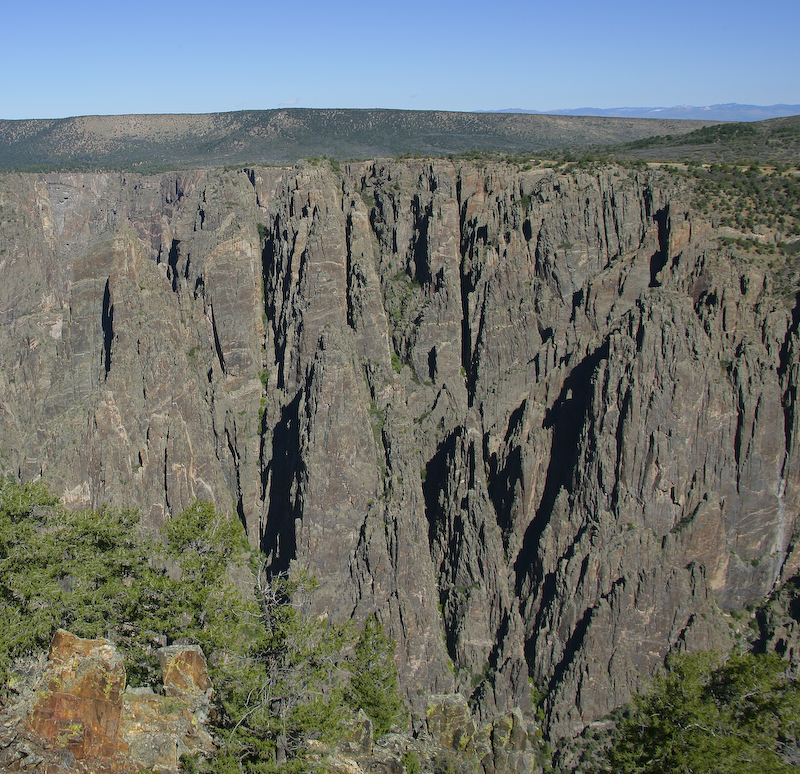
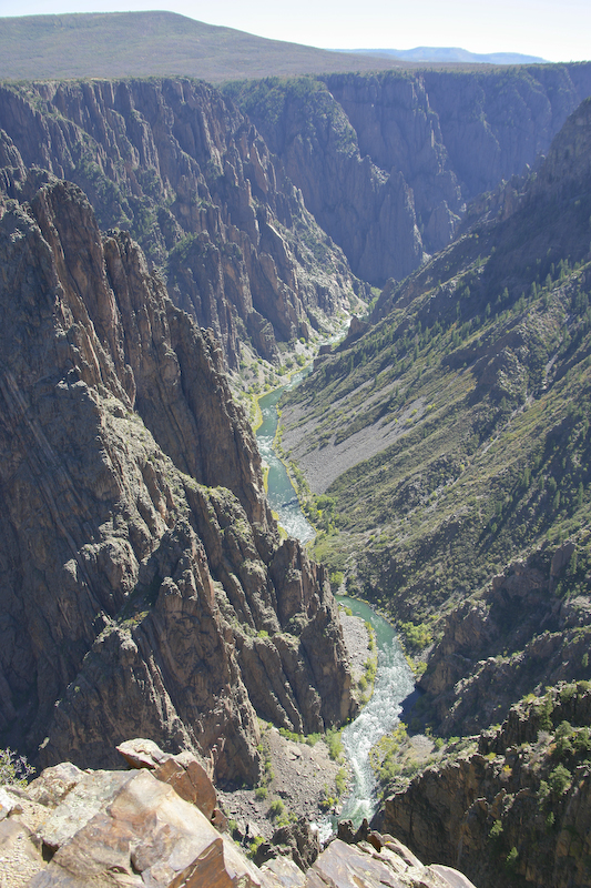
The first view of the canyon was looking east into the sun (thus the haze) but still stunning.
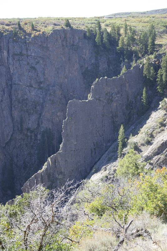
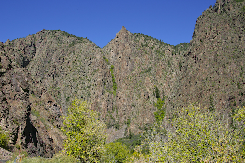
One of the interesting features of the geology of the area is the creation of large fissures and flakes. This is one of the larger flakes.
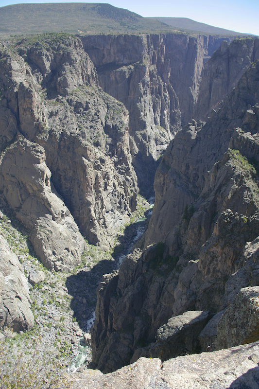
The water is several thousand feet below the rim and the river has a very steep grade resulting in high erosive power and steep cliffs.
Another large flake where the thickness is now apparent.
This is a view directly across the canyon. Note the fractal nature of the side canyons.
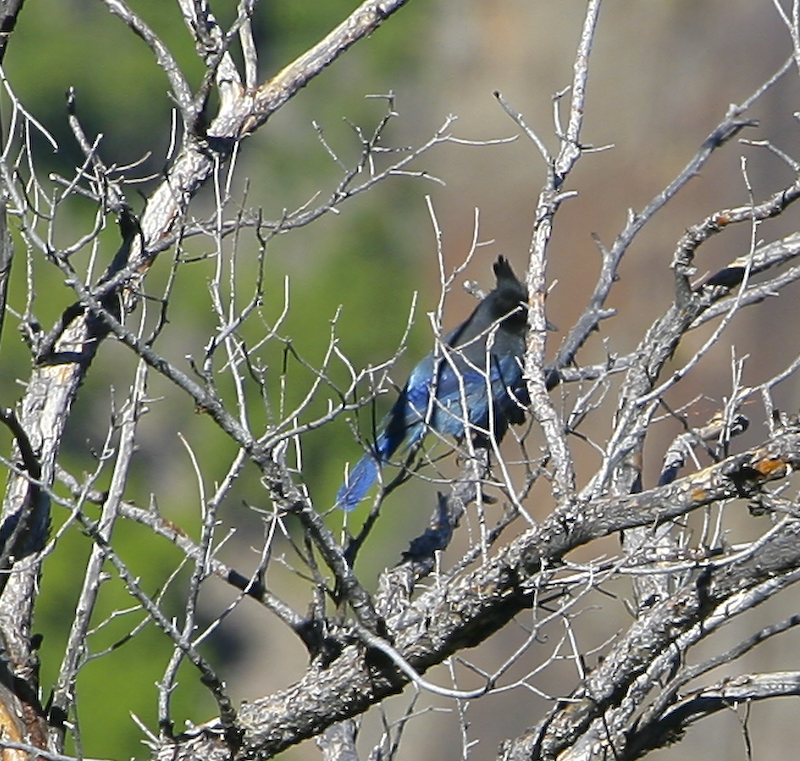
Another critter, this one being a blue jay. This photo was also produced with the" max zoom, then crop" trick.
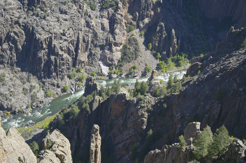
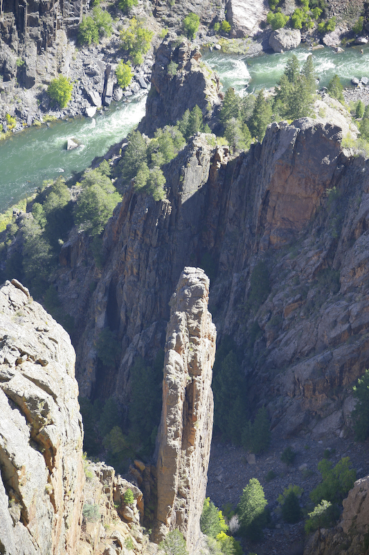
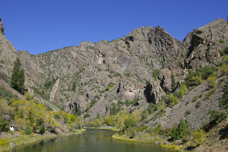
From several of the overlook points the Gunnison River was clearly visible at the bottom of the canyon.
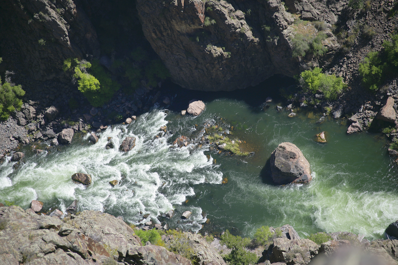
Here one of the rapids is clearly visible. Note the clear green color of the water as contrasted to the turbid yellow-brown of the Animas River several days previous. This is due to the presence of Crystal Dam just upstream from our position. The dam causes silt and sediment to drop out of the water.
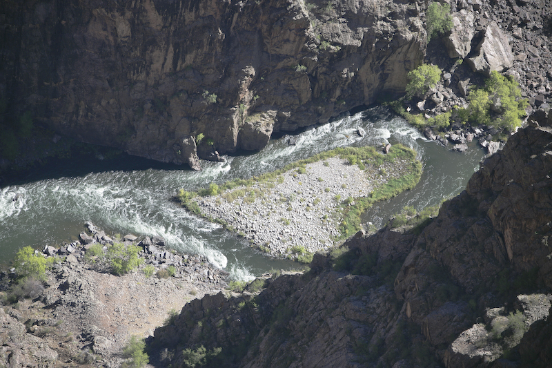
This heart shaped island was visible from one of the overlook points.
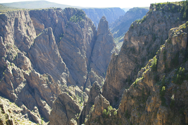
As we traveled west, the overlook points allowed a more direct view of the canyon. Notice the colored intrusions in the canyon walls.
This shot was taken from the Chasm View overlook.
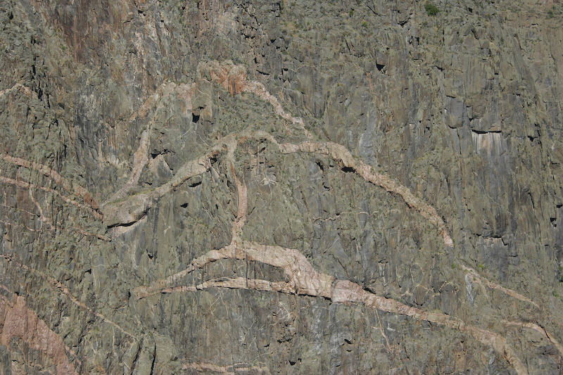
A close up view of the intrusions in the canyon wall. These are made when molten rock pushes up from below into cracks in the overlying strata and then solidify.
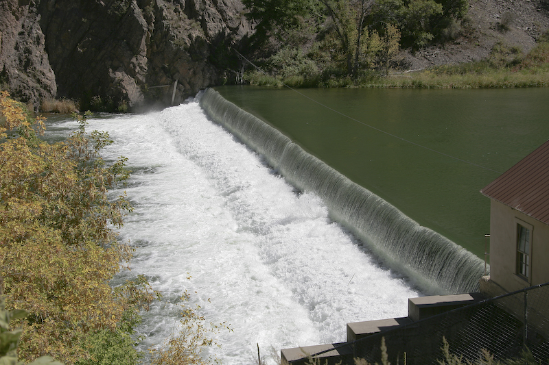
We then headed to the eastern part of the park, descending a road with a 16% grade to the bottom of the gorge. There was a small check dam there to hold back enough of the river to cause some of it to divert into the Gunnison Tunnel. This tunnel is 6 miles long and cuts through the mountain, emerging on the south side to provide water to the Montrose Valley.
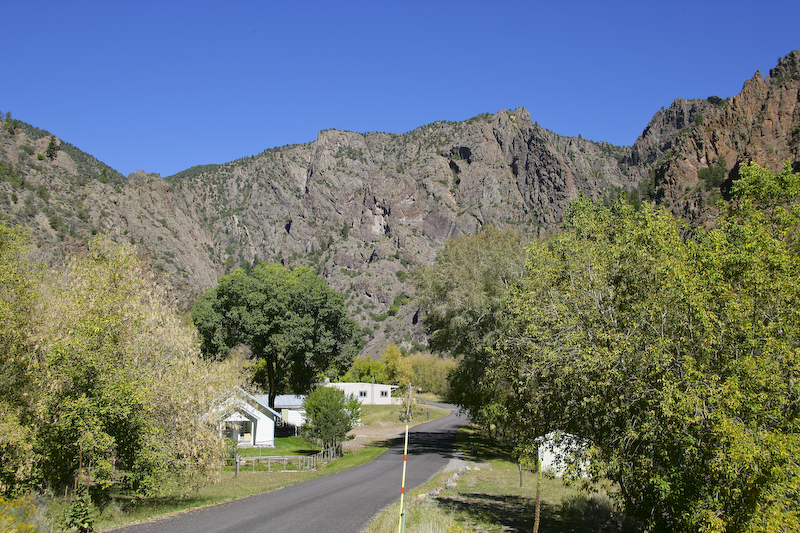
Just downstream from the check dam is a nice camp ground and a fly fishing area.
While not visible in this 800x800 pixel photo, there are fishermen on the banks of the river.
Just upstream from the check dam is Crystal Dam which is part of the Colorado River Storage Project. This is a "real" dam built in the late 1970s and produces 31 megawatts of electric power. Since 9/11 the area is now off limits so I could not get photos.
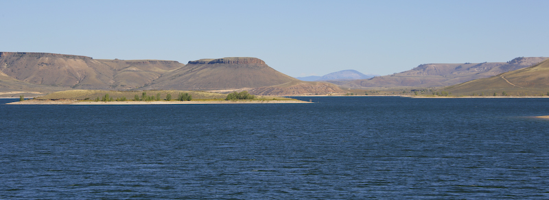
After Black Canyon, we headed east toward Gunnison. Along the way we passed Blue Mesa Reservoir. This is one of several on the Gunnison River.
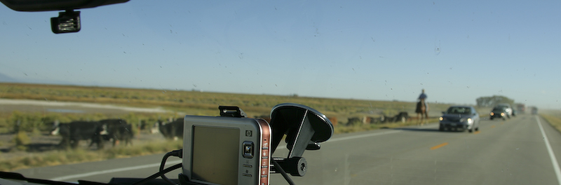
Here is something you don't see every day, even living in the west. While a bad photo taken through the windshield, we passed a real cattle drive. They were holding up traffic on US 285 as they were driving the cattle along the shoulder of the highway from one pasture to another. Gladly, the cars and trucks were going slow, but there were only inches between the cattle and the vehicles. They were stirring up tons of dust.
This was a good day. The Black Canyon was more intense than I expected and the views were spectacular. That said, I would see the canyon in the afternoon next time so the sun would be at your back.
Sand Dune National Park and Wolf Creek Pass.
Back to the Road Trip Home Page