When
we finished the tour at Scotty's Castle, we headed north to see
Ubehebe Crater and the Racetrack. From there, the plan was
to head to Hunter Mountain and find a place to camp.
The photos below are what we saw.
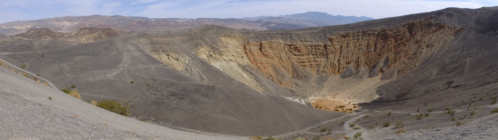
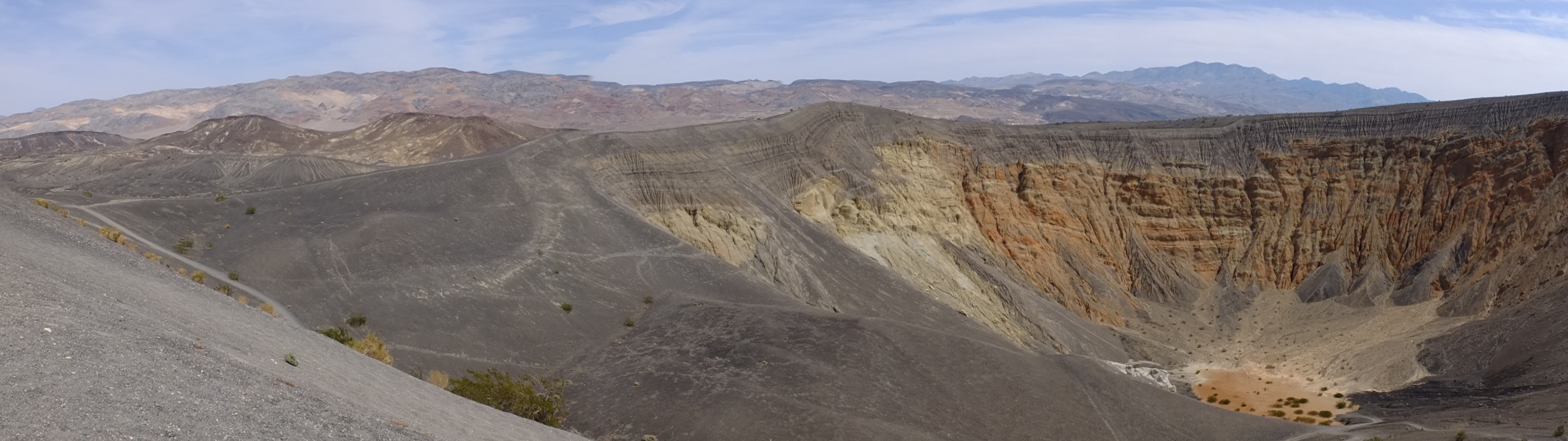
A
panorama shot of Ubehebe Crater. This was the best I could
do due to the 40+ mph winds at the lip of the crater. Click here to see the full-sized photo.
Ubehebe Crater is what is called a Marr Crater and was formed when
a pluton of molten magma rose through the ground until it hit the
water table. The steam created caused a massive explosion
and threw out millions of tons of ejecta.
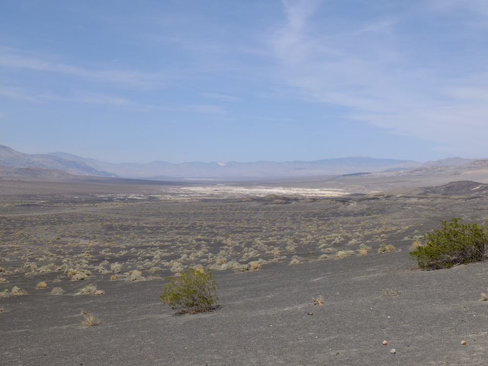
From
the lip of the crater, we had a commanding view of the lowlands to
the north.
We
left Ubehebe and followed 27 miles of heavily wash-boarded dirt
road to the Racetrack playa. Along the way, we got great
views of the warping and folding exposed in the surrounding
mountains.
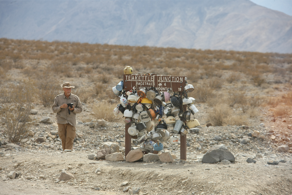
When
we hit Teakettle Junction, we left several of the trucks there and
car-pooled in the others. For whatever reason, travelers
that come this way have been bringing teakettles and hanging them
on the sign. The road from Teakettle to the Racetrack was awful
and it was very slow going.
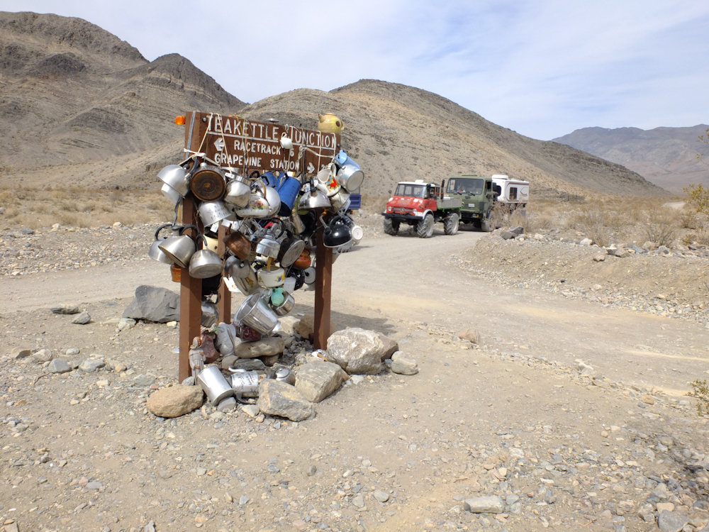
Matt
and I left our rigs at the junction. Upon our return, the
trucks had caused a traffic jam of curious onlookers wondering
about the odd trucks.
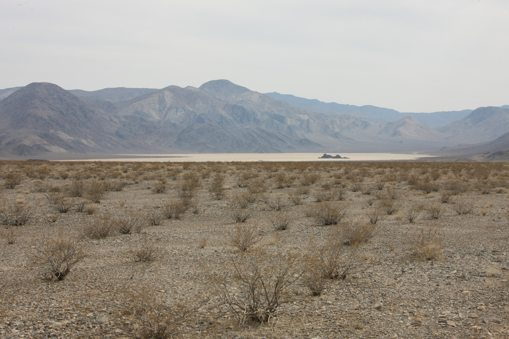
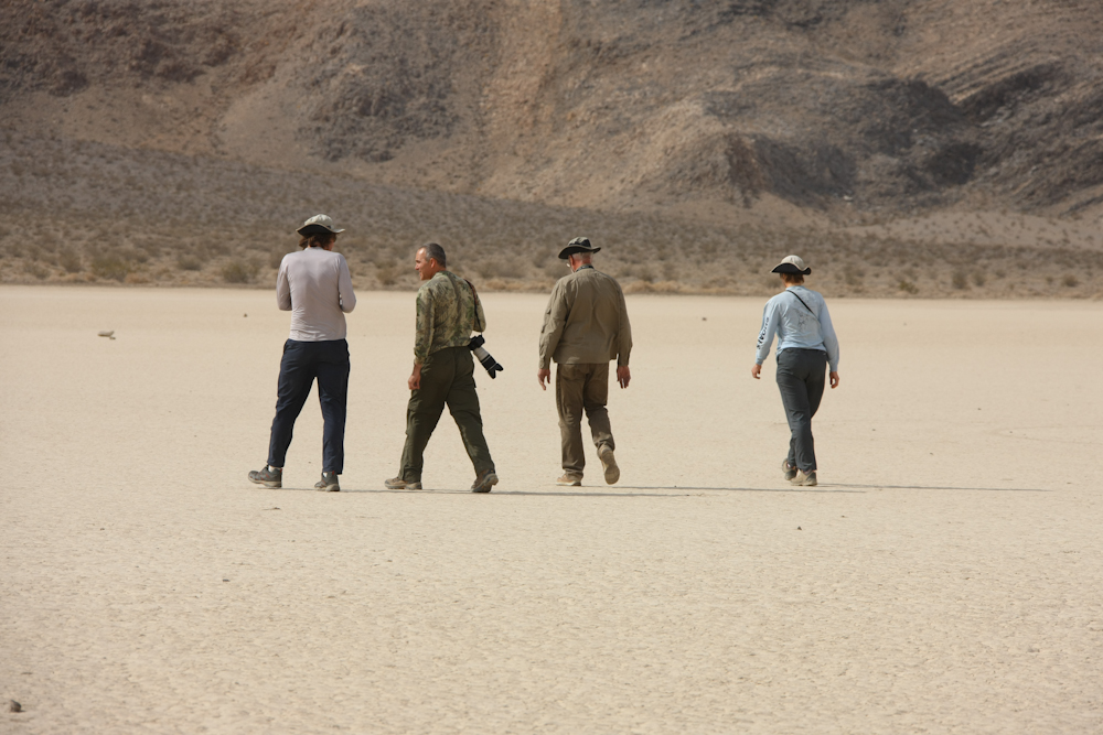
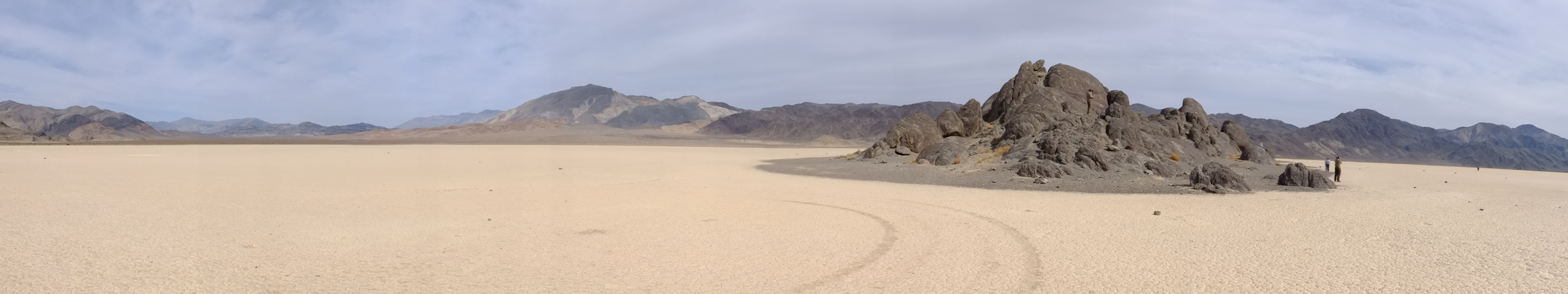
Our
first view of the Racetrack playa. The Racetrack got its
name from rocks that moved on the surface of the dry lake due to
the high winds. Indeed, the winds were howling when we were
there.
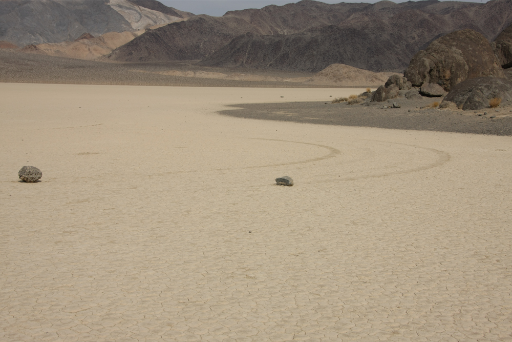
Here
is a shot of a couple of traveling rocks. Note the
tracks. When the surface of the playa gets sufficiently wet,
the clay in the mud acts as a lubricant allowing the force of the
winds to move the rocks.
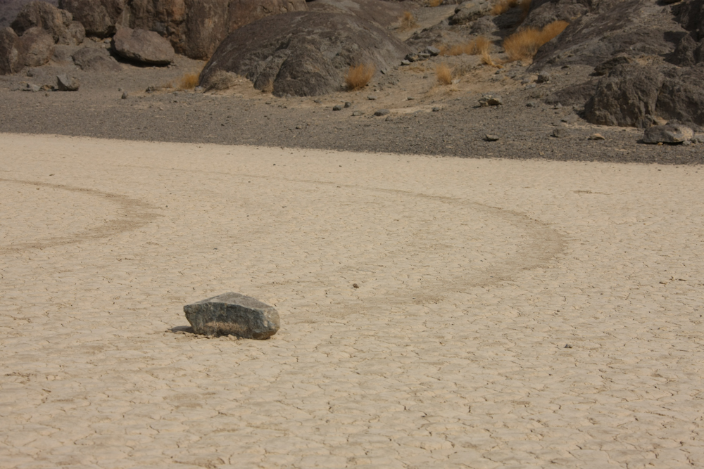
I
am guessing that the flat bottom rocks are the only ones that move
well (or much).

A
panorama of the Racetrack playa.
Click here to see the full-sized image.
The
team saw what there was to see and then headed back to the trucks
for the punishing drive back to Teakettle Junction.
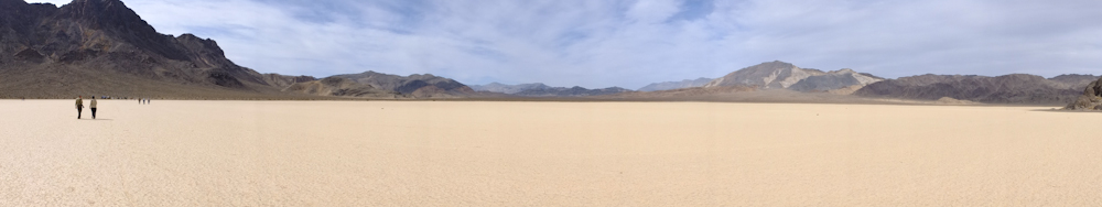
Another
panorama
of the Racetrack playa. Click
here to see a full-size image.

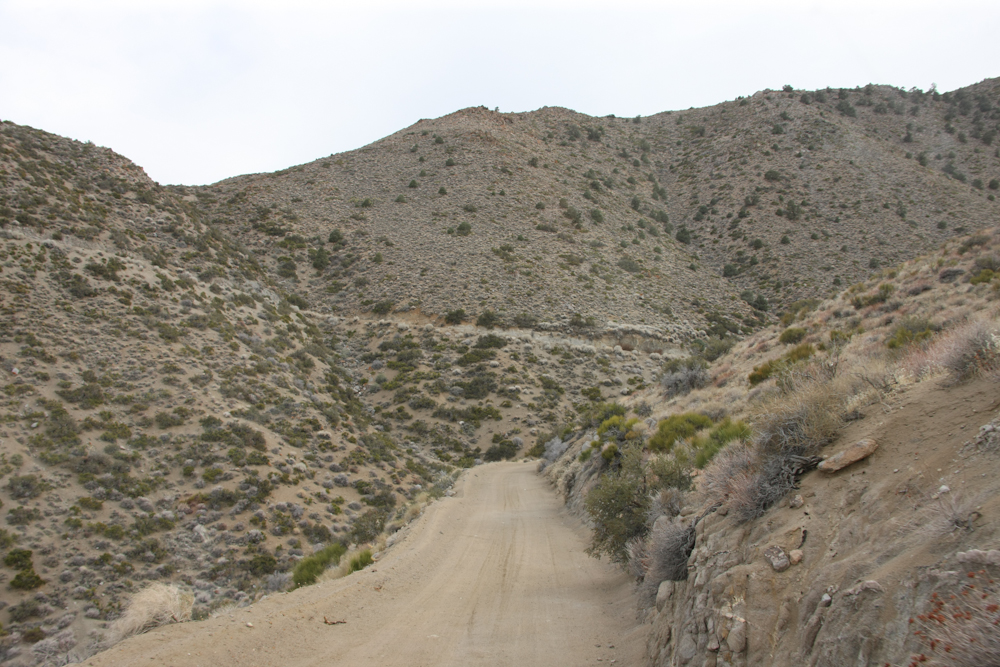
From
Teakettle Junction, we headed for Hunter Mountain. The road
was in much better shape since it was much less used. The
washboards are the result of excessive tire pressure and high
speed travel. On the Hunter Mountain trail, we encountered a
recently wet silt bed that had some reasonable ruts. These
were no challenge to our trucks, of course.
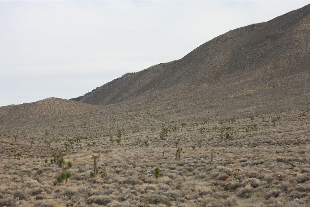
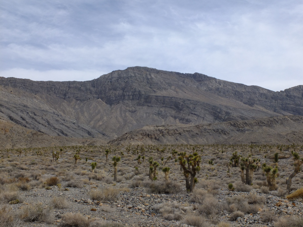
The
Hunter Mountain trail goes through the high desert. Note the
Joshua Trees. Some areas were quite dense with the trees.
The
trail was narrow and became quite steep. We went over the
mountain range and the grades required lower gears.
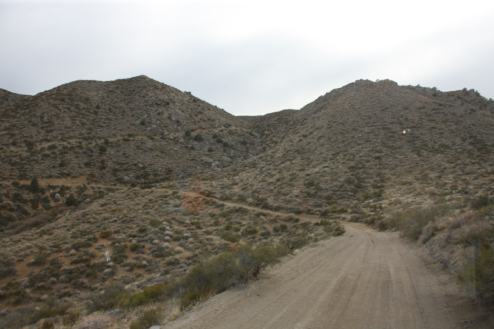
Note the switchbacks on the far hill. There were some tight turns and the hills were bleeding rocks onto the trail making careful driving a must.
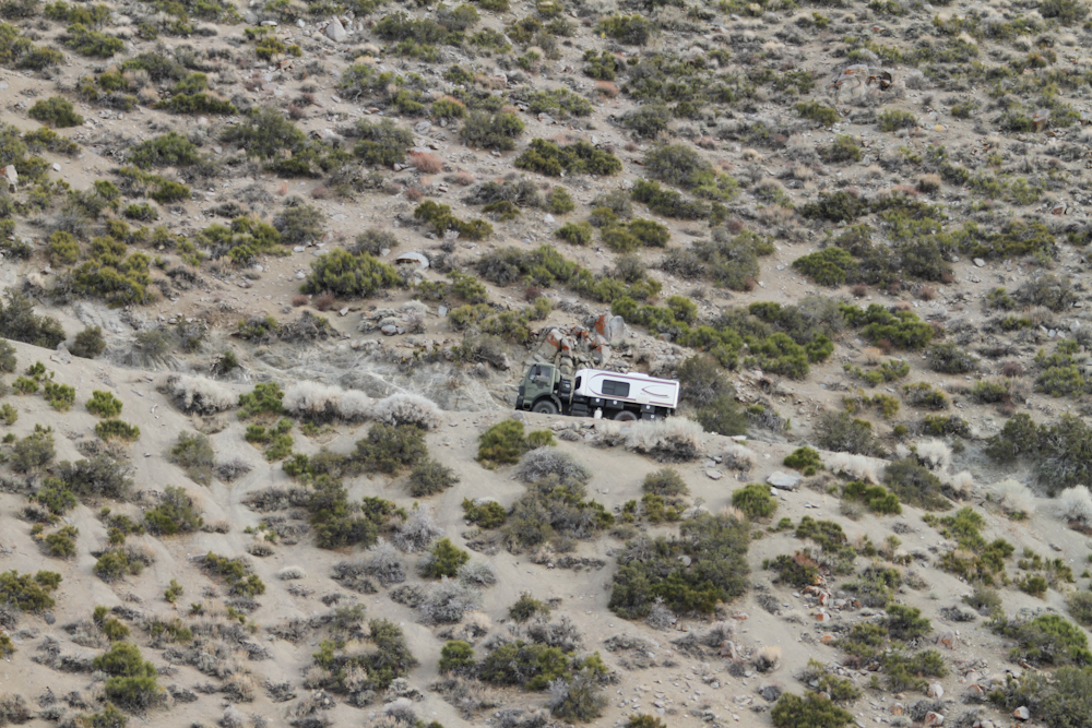
Roberto
got this shot of Thor going up a steep section of the trail.
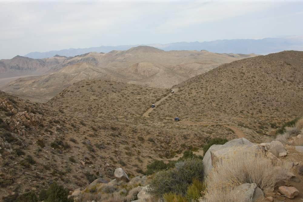
We
were in the lead and as we got to an overlook point, we could see
the balance of the group below us.
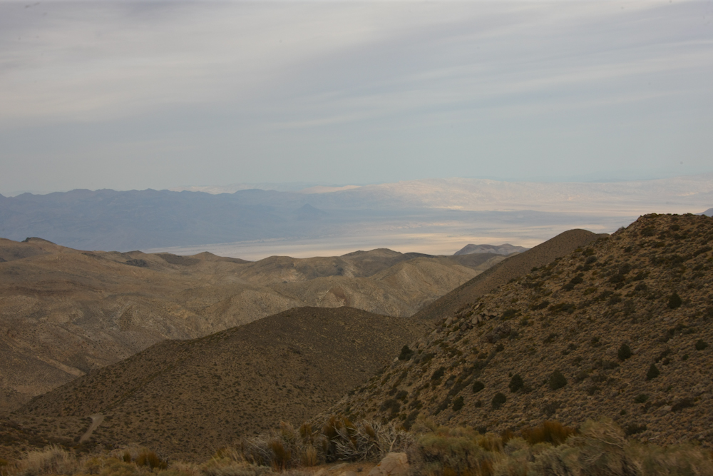
From
one of the crests, we had a view to the east that included Death
Valley.
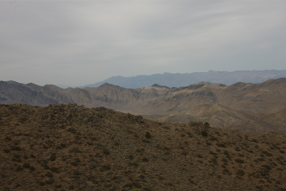
The
mountains in the area were riddled with small mines, all
abandoned. Note the colors in the middle range.
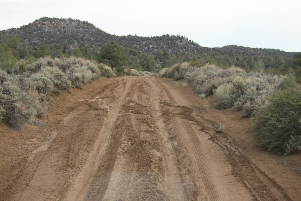
The
recent rains in the area made the trail muddy and provided a
challenge for some vehicles. We were lucky in that the muddy
spots were mostly dry by the time we got there. But, the
trails in the mud tell the story.
We
hit the turnoff to Hunter Mountain Cabin, so we decided to check
it out. It was getting late and we were searching in earnest
for a campsite. We almost got to the cabin, but there was
low hanging brush that was too low for Thor (without dozing the
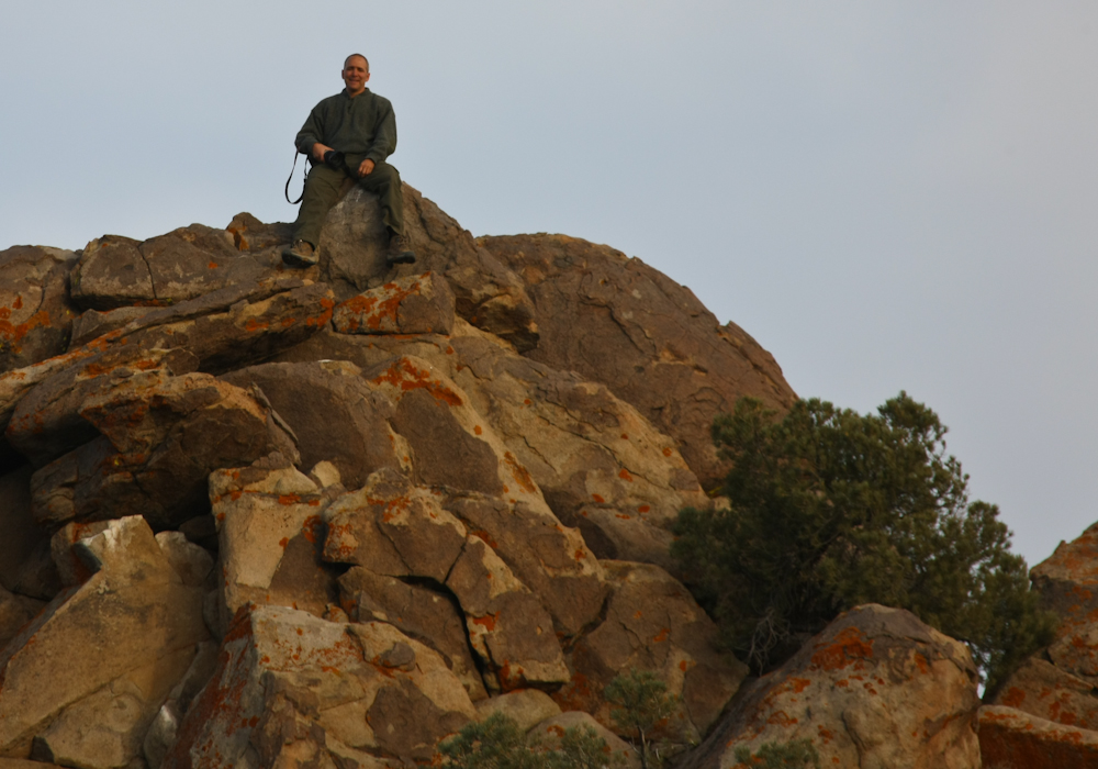
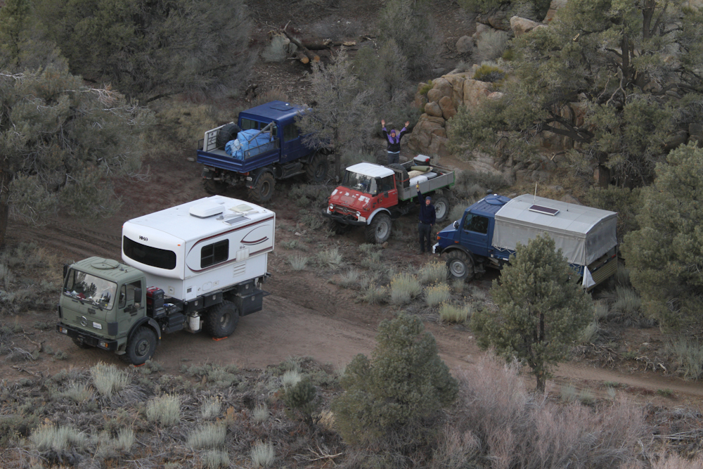
trees), so we found a flat area and began to setup camp.
Roberto headed up to the rock outcropping to take some photos.
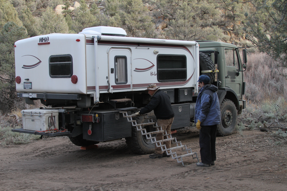
The
ground at our camp was not that level, but with some leveling
blocks, it was good enough. Above, we install the stairs and
get ready to lift the top.
Our
camp from Roberto's overlook on the peak.
| Previous Adventure | ||
| Trip Home Page |
Photos
and Text Copyright Bill Caid 2012, all rights reserved.
For your enjoyment only, not for commercial use.